Punta Mirauda

Last updated
Punta Mirauda
Punta Mirauda da Punta Agugion.png
The summit from Punta Agugion in a foggy day
Highest point
Elevation 2,157 m (7,077 ft) [1]
Prominence 77 m (253 ft) [2] [1]
Coordinates 44°13′13″N7°37′29″E / 44.2203298°N 7.6246360°E / 44.2203298; 7.6246360 Coordinates: 44°13′13″N7°37′29″E / 44.2203298°N 7.6246360°E / 44.2203298; 7.6246360
Geography
Alps location map.png
Red triangle with thick white border.svg
Punta Mirauda
Location in the Alps
Location Piemonte, Italy
Parent range Ligurian Alps
Climbing
First ascent ancestral
Easiest route hiking

The Punta Mirauda is a mountain of the Ligurian Alps located in Piedmont (NW Italy).

Contents

Toponymy

Mirauda is a regional name used in Piedmont for the green whip snake. [3]

Geography

Punta Mirauda in the shade behind the Punta Agugion Agugion e Mirauda dal Monte Vecchio.png
Punta Mirauda in the shade behind the Punta Agugion

The mountain stands on the ridge dividing the valleys of Vermenagna and Pesio. Southwards of the summit the water divide lowers with Colla Vaccarile (2.050 m) after which stand the Monte Jurin and the Cima della Fascia. In the opposite direction, after Il Colletto (2.080 m), [4] the ridge goes on with the Bric Costa Rossa and the Bisalta. From the Punta Mirauda starts a third ridge which, heading SW, divides the Vallone Sottana from the Valle Almellina, two tributaries of the main Vermenagna Valley. A last ridge heads E towards the centre of the Pesio valley, linking Punta Mirauda with the Labiaia Mirauda (1.971 m), a mountain that overlooks Pian della Gorre. [5] The prominence of Punta Mirauda is 77 m, its key col being the Colletto (2.080 m). The summit of the mountain is flanked by a subsummit named Punta Agugion (2.133 m [4] ). [6]

SOIUSA classification

According to the SOIUSA (International Standardized Mountain Subdivision of the Alps) the mountain can be classified in the following way: [7]

Geology

The mountain stands in a karstic area. A huge network of natural tunnels, which collects underground water reaching the acquifer through many fractures and ponors, takes its name from Punta Mirauda. [8]

Access to the summit

The Punta Mirauda can be reached from Limone Piemonte (Casali Barat village) with an easy hiking itinerary, [9] or from the Pesio valley, starting in this case from Pian delle Gorre. [10]

The mountain is also a classic, but quite engaging, ski mountaineering destination. [11]

Conservation

The eastern slopes of the mountain, facing the Pesio Valley, are part of the Natural Park of Marguareis, a nature reserve established by Regione Piemonte.

Related Research Articles

<span class="mw-page-title-main">Monte Frontè</span> Mountain in Italy

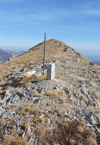
Monte Frontè is a mountain in Liguria, northern Italy, part of the Alps. It is located in the province of province of Imperia. It lies at an altitude of 2,152 metres. After Monte Saccarello it is the second highest peak in the Ligurian region.

<span class="mw-page-title-main">Monte Saccarello</span> Mountain in Italy

Monte Saccarello (Italian) or Mont Saccarel (French) is a mountain located on the French-Italian border between Liguria, Piedmont and Provence-Alpes-Côte d'Azur.

<span class="mw-page-title-main">Punta Marguareis</span> Mountain in Italy

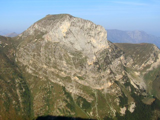
The Punta Marguareis (It) or Pointe Marguareis (Fr) is a mountain in the Ligurian Alps, on the boundary between Italy and France; It is the highest peak of the Ligurian Alps.

<span class="mw-page-title-main">Punta Sulè</span> Mountain in Italy

Punta Sulè is a 3,384 m a.s.l.mountain of the Graian Alps, located in Italy.

<span class="mw-page-title-main">Punta Tempesta</span> Mountain in Italy

Punta Tempesta is a 2,679 m a.s.l. mountain of the Cottian Alps, located in Italy.

<span class="mw-page-title-main">Cima di Pertegà</span> Mountain in Italy

Cima di Pertegà (Italian) or Cime de la Pertègue (French) is a mountain located on the French-Italian border between Piemonte and Provence-Alpes-Côte d'Azur.

<span class="mw-page-title-main">Cime de Capoves</span> Mountain in Italy

The Cime de Capoves (French) or Cima Capoves (Italian) is a mountain of the Ligurian Alps located in the French region of Provence-Alpes-Côte d'Azur, close to the French-Italian border.

<span class="mw-page-title-main">Monte Monega</span> Mountain in Italy

Monte Monega is a 1,882-metre (6,175 ft) mountain of the Ligurian Alps, in Italy.

<span class="mw-page-title-main">Carmo di Brocchi</span> Mountain in Italy

Carmo di Brocchi is a 1,610-metre (5,282 ft) mountain of the Ligurian Alps, in Italy.

<span class="mw-page-title-main">Monte Bertrand</span> Mountain in Italy

Monte Bertrand (Italian) or Mont Bertrand (French) is a mountain located on the French-Italian border between Piemonte and Provence-Alpes-Côte d'Azur.

<span class="mw-page-title-main">Cime de Missun</span> Mountain in Italy

The Cime de Mussun (French) or Cima Missun (Italian) is a mountain of the Ligurian Alps.

<span class="mw-page-title-main">Monte Civrari</span> Mountain in Italy

The Monte Civrari is a mountain of the Graian Alps, with an elevation of 2,302 m.

<span class="mw-page-title-main">Bric Costa Rossa</span> Mountain in Italy

The Bric Costa Rossa is a mountain of the Ligurian Alps located in Piedmont.

<span class="mw-page-title-main">Cima della Fascia</span> Mountain in Italy

The Cima della Fascia is a mountain of the Ligurian Alps located in Piedmont.

<span class="mw-page-title-main">Monte Mongioie</span> Mountain in Italy

The Monte Mongioie is a mountain of the Ligurian Alps located in Piedmont.

<span class="mw-page-title-main">Monte Antoroto</span> Mountain in Italy

The Monte Antoroto is a mountain of the Ligurian Alps located in Piedmont.

<span class="mw-page-title-main">Cima delle Saline</span> Mountain in Italy

The Cima delle Saline is a mountain of the Ligurian Alps located in Piedmont.

<span class="mw-page-title-main">Monte I Gemelli</span> Mountain in Italy

The Monte I Gemelli is an Alpine mountain located between Aosta Valley and Piedmont.

<span class="mw-page-title-main">Cima Cars</span> Mountain in Italy

The Cima Cars is a mountain of the Ligurian Alps located in Piedmont.

<span class="mw-page-title-main">Monte Fantino</span> Mountain in Italy

The Monte Fantino is a mountain of the Ligurian Alps located in Piedmont.

References

  1. 1 2 Fraternali & 1:25.000 map nr.16.
  2. Key col: Colletto (2.080 m)
  3. In Italian biacco; see AA.VV. (2007). Miscellanea di studi storici sulle Valli di Lanzo in memoria di Ines Poggetto (in Italian). Vol. 1. Società storica delle Valli di Lanzo. p. 195. Retrieved 2021-03-18.
  4. 1 2 IGM & Tavoletta IGM 1:25.000.
  5. CAI-TCI & Alpi liguri, page 274.
  6. L'Appenninista. "Punta Miràuda 2155 m" (in Italian). Retrieved 2020-06-08.
  7. Marazzi, Sergio (2005). Atlante Orografico delle Alpi. SOIUSA (in Italian). Priuli & Verlucca. p. 64. ISBN   978-88-8068-273-8.
  8. Farneti, Gianni (2011). "Alta Valle Pesio e Tanaro". 1000 oasi e parchi naturali da vedere in Italia (in Italian). Rizzoli. p. 28. ISBN   9788858653739 . Retrieved 2020-06-08.
  9. mariateresa58 (29 May 2006). "Tetti Barat (Limone) - Capanna Chiara - Vallone del Cros - Punta Mirauda" (in Italian). gulliver.it. Retrieved 2020-06-08.
  10. Elio Dutto (9 June 2015). "Escursione alla Colla Vaccarile (2050 m) e alla Punta Mirauda (2157 m) – Valle Pesio" (in Italian). cuneotrekking.com. Retrieved 2020-06-08.
  11. ciatpitois! (2 March 2009). "Mirauda (Punta) da Limone Piemonte" (in Italian). gulliver.it. Retrieved 2020-06-08.

Bibliography

Maps

Commons-logo.svg Media related to Punta Mirauda at Wikimedia Commons