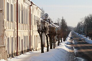
Opochka is a town and the administrative center of Opochetsky District in Pskov Oblast, Russia, located on the Velikaya River, 130 kilometers (81 mi) south of Pskov, the administrative center of the oblast. Population: 11,603 (2010 Census); 13,964 (2002 Census); 16,190 (1989 Soviet census).; 9,902.
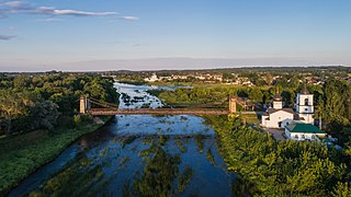
Ostrov is a town and the administrative center of Ostrovsky District in Pskov Oblast, Russia, located on the Velikaya River, 55 kilometers (34 mi) south of Pskov, the administrative center of the oblast. Population: 21,668 (2010 Census); 25,078 (2002 Census); 29,060 (1989 Soviet census); 27,000 (1974).
Nevel is a town and the administrative center of Nevelsky District in Pskov Oblast, Russia, located on Lake Nevel 242 kilometers (150 mi) southeast of Pskov, the administrative center of the oblast. Population: 16,324 (2010 Census); 18,545 (2002 Census); 22,472 (1989 Soviet census).
Novorzhev is a town and the administrative center of Novorzhevsky District in Pskov Oblast, Russia, located on the Sorot River 144 kilometers (89 mi) southeast of Pskov, the administrative center of the oblast. Population: 3,695 (2010 Census); 4,125 (2002 Census); 5,050 (1989 Soviet census).

Pustoshka is a town and the administrative center of Pustoshkinsky District in Pskov Oblast, Russia, located on the Krupeya River, 191 kilometers (119 mi) southeast of Pskov, the administrative center of the oblast. Population: 4,619 (2010 Census); 5,509 (2002 Census); 6,332 (1989 Soviet census).
Strugi Krasnye is an urban locality and the administrative center of Strugo-Krasnensky District of Pskov Oblast, Russia, located 87 kilometers (54 mi) northeast of Pskov. Municipally, it is incorporated as Strugi Krasnye Urban Settlement, the only urban settlement in the district. Population: 8,447 (2010 Census); 8,762 (2002 Census); 7,067 (1989 Soviet census).

Bezhanitsy is an urban locality and the administrative center of Bezhanitsky District of Pskov Oblast, Russia. It is one of the two urban-type settlements in the district. Population: 4,333 (2010 Census); 4,846 (2002 Census); 6,789 (1989 Soviet census).
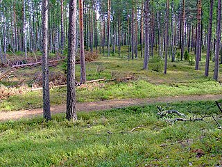
Bezhanitsky District is an administrative and municipal district (raion), one of the twenty-four in Pskov Oblast, Russia. It is located in the central and eastern parts of the oblast and borders with Dedovichsky District in the north, Poddorsky and Kholmsky Districts of Novgorod Oblast in the east, Loknyansky District in the south, Novosokolnichesky, Pustoshkinsky, and Opochetsky Districts in the southwest, and with Novorzhevsky District in the west. The area of the district is 3,535 square kilometers (1,365 sq mi). Its administrative center is the urban locality of Bezhanitsy. Population: 13,264 (2010 Census); 17,547 ; 22,784 (1989 Soviet census). The population of Bezhanitsy accounts for 32.7% of the district's total population.

Dnovsky District is an administrative and municipal district (raion), one of the twenty-four in Pskov Oblast, Russia. It is located in the east of the oblast and borders with Soletsky District of Novgorod Oblast in the northeast, Volotovsky District, also of Novgorod Oblast, in the east, Dedovichsky District in the south, and with Porkhovsky District in the west. The area of the district is 1,194 square kilometers (461 sq mi). Its administrative center is the town of Dno. Population: 13,341 (2010 Census); 16,048 ; 20,110 (1989 Soviet census). The population of Dno accounts for 67.9% of the district's total population.

Krasnogorodsky District is an administrative and municipal district (raion), one of the twenty-four in Pskov Oblast, Russia. It is located in the west of the oblast and borders with Ostrovsky District in the north, Pushkinogorsky District in the northeast, Opochetsky District in the southeast, Sebezhsky District in the south, Cibla and Kārsava municipalities of Latvia in the southwest, and with Pytalovsky District in the west. The area of the district is 1,320.42 square kilometers (509.82 sq mi). Its administrative center is the urban locality of Krasnogorodsk. Population: 7,328 (2010 Census); 9,800 ; 11,886 (1989 Soviet census). The population of Krasnogorodsk accounts for 52.8% of the district's total population.

Loknyansky District is an administrative and municipal district (raion), one of the twenty-four in Pskov Oblast, Russia. It is located in the east of the oblast and borders with Kholmsky District of Novgorod Oblast in the northeast, Toropetsky District of Tver Oblast in the southeast, Velikoluksky District in the south, Novosokolnichesky District in the southwest, and with Bezhanitsky District in the northwest. The area of the district is 2,412 square kilometers (931 sq mi). Its administrative center is the urban locality of Loknya. Population: 9,535 (2010 Census); 13,268 ; 16,782 (1989 Soviet census). The population of Loknya accounts for 40.6% of the district's total population.

Novorzhevsky District is an administrative and municipal district (raion), one of the twenty-four in Pskov Oblast, Russia. It is located in the center of the oblast and borders with Porkhovsky District in the north, Dedovichsky District in the northeast, Bezhanitsky District in the east, Opochetsky District in the south, Pushkinogorsky District in the west, and with Ostrovsky District in the northwest. The area of the district is 1,683 square kilometers (650 sq mi). Its administrative center is the town of Novorzhev. Population: 9,334 (2010 Census); 12,217 ; 15,477 (1989 Soviet census). The population of Novorzhev accounts for 39.6% of the district's total population.

Novosokolnichesky District is an administrative and municipal district (raion), one of the twenty-four in Pskov Oblast, Russia. It is located in the south of the oblast and borders with Loknyansky District in the north, Velikoluksky District in the east, Nevelsky District in the south, Pustoshkinsky District in the west, and with Bezhanitsky District in the northwest. The area of the district is 1,616.0 square kilometers (623.9 sq mi). Its administrative center is the town of Novosokolniki. Population: 14,776 (2010 Census); 19,389 ; 21,319 (1989 Soviet census). The population of Novosokolniki accounts for 54.9% of the district's total population.

Opochetsky District is an administrative and municipal district (raion), one of the twenty-four in Pskov Oblast, Russia. It is located in the southwest of the oblast and borders with Pushkinogorsky District in the north, Novorzhevsky District in the northeast, Bezhanitsky District in the east, Pustoshkinsky District in the southeast, Sebezhsky District in the south, and with Krasnogorodsky District in the west. The area of the district is 2,028.9 square kilometers (783.4 sq mi). Its administrative center is the town of Opochka. Population: 18,673 (2010 Census); 23,973 ; 28,877 (1989 Soviet census). The population of Opochka accounts for 62.1% of the district's total population.

Plyussky District is an administrative and municipal district (raion), one of the twenty-four in Pskov Oblast, Russia. It is located in the northeast of the oblast and borders with Slantsevsky District of Leningrad Oblast in the north, Luzhsky District of Leningrad Oblast in the northeast, Shimsky District of Novgorod Oblast in the east, Strugo-Krasnensky District in the south, and with Gdovsky District in the west. The area of the district is 2,767 square kilometers (1,068 sq mi). Its administrative center is the urban locality of Plyussa. Population: 9,187 (2010 Census); 11,610 ; 13,988 (1989 Soviet census). The population of Plyussa accounts for 37.6% of the district's total population.

Pushkinogorsky District is an administrative and municipal district (raion), one of the twenty-four in Pskov Oblast, Russia. It is located in the center of the oblast and borders with Ostrovsky District in the north, Novorzhevsky District in the east, Opochetsky District in the south, and with Krasnogorodsky District in the west. The area of the district is 1,059 square kilometers (409 sq mi). Its administrative center is the urban locality of Pushkinskiye Gory. Population: 9,253 (2010 Census); 11,694 ; 13,566 (1989 Soviet census). The population of Pushkinskiye Gory accounts for 56.4% of the district's total population.
Pustoshkinsky District is an administrative and municipal district (raion), one of the twenty-four in Pskov Oblast, Russia. It is located in the south of the oblast and borders with Bezhanitsky District in the north, Novosokolnichesky District in the east, Nevelsky District in the south, Sebezhsky District in the west, and with Opochetsky District in the northwest. The area of the district is 1,870 square kilometers (720 sq mi). Its administrative center is the town of Pustoshka. Population: 9,379 (2010 Census); 12,071 ; 14,063 (1989 Soviet census). The population of Pustoshka accounts for 49.2% of the district's total population.

Krasnogorodsk is an urban locality and the administrative center of Krasnogorodsky District of Pskov Oblast, Russia, located on the Sinyaya River south of Pskov. Municipally, it is incorporated as Krasnogorodsk Urban Settlement, the only urban settlement in the district. Population: 3,870 (2010 Census); 4,694 (2002 Census); 5,295 (1989 Soviet census).
Krasny Luch is an urban locality in Bezhanitsky District of Pskov Oblast, Russia. Municipally, it is a part of Polistovskoye Rural Settlement. Population: 1,020 (2010 Census); 1,494 (2002 Census); 2,105 (1989 Soviet census).
Loknya is an urban locality and the administrative center of Loknyansky District of Pskov Oblast, Russia. Municipally, it is incorporated as Loknya Urban Settlement, the only urban settlement in the district. Population: 3,872 (2010 Census); 4,898 (2002 Census); 6,061 (1989 Soviet census).