Administratively, Pskov Oblast is divided into two cities and towns of oblast significance and twenty-four districts.
Nevel is a town and the administrative center of Nevelsky District in Pskov Oblast, Russia, located on Lake Nevel 242 kilometers (150 mi) southeast of Pskov, the administrative center of the oblast. Population: 16,324 (2010 Census); 18,545 (2002 Census); 22,472 (1989 Soviet census).
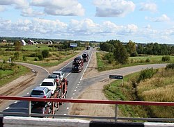
Novosokolniki is a town and the administrative center of Novosokolnichesky District in Pskov Oblast, Russia, located on the Maly Udray River at the junction of the St. Petersburg–Kyiv and Moscow–Riga railways, 287 kilometers (178 mi) southeast of Pskov, the administrative center of the oblast. Population: 8,119 (2010 Census); 9,757 (2002 Census); 10,689 (1989 Soviet census).

Pustoshka is a town and the administrative center of Pustoshkinsky District in Pskov Oblast, Russia, located on the Krupeya River, 191 kilometers (119 mi) southeast of Pskov, the administrative center of the oblast. Population: 4,619 (2010 Census); 5,509 (2002 Census); 6,332 (1989 Soviet census).

Bezhanitsy is an urban locality and the administrative center of Bezhanitsky District of Pskov Oblast, Russia. It is one of the two urban-type settlements in the district. Population: 4,333 (2010 Census); 4,846 (2002 Census); 6,789 (1989 Soviet census).
Bezhanitsky District is an administrative and municipal district (raion), one of the twenty-four in Pskov Oblast, Russia. It is located in the central and eastern parts of the oblast and borders with Dedovichsky District in the north, Poddorsky and Kholmsky Districts of Novgorod Oblast in the east, Loknyansky District in the south, Novosokolnichesky, Pustoshkinsky, and Opochetsky Districts in the southwest, and with Novorzhevsky District in the west. The area of the district is 3,535 square kilometers (1,365 sq mi). Its administrative center is the urban locality of Bezhanitsy. Population: 13,264 (2010 Census); 17,547 ; 22,784 (1989 Soviet census). The population of Bezhanitsy accounts for 32.7% of the district's total population.
Kholmsky District is an administrative and municipal district (raion), one of the twenty-one in Novgorod Oblast, Russia. It is located in the south of the oblast and borders with Poddorsky District in the north, Maryovsky District in the east, Andreapolsky District of Tver Oblast in the southeast, Toropetsky District of Tver Oblast in the south, Loknyansky District of Pskov Oblast in the southwest, and with Bezhanitsky District of Pskov Oblast in the northwest. The area of the district is 2,178.69 square kilometers (841.20 sq mi). Its administrative center is the town of Kholm. Population: 6,177 (2010 Census); 7,712 ; 9,174 (1989 Soviet census). The population of Kholm accounts for 62.0% of the district's total population.

Kunyinsky District is an administrative and municipal district (raion), one of the twenty-four in Pskov Oblast, Russia. It is located in the southeast of the oblast and borders with Toropetsky District of Tver Oblast in the north, Zapadnodvinsky District of Tver Oblast in the east, Velizhsky District of Smolensk Oblast in the south, Usvyatsky District in the southwest, and Velikoluksky District in the northwest. The area of the district is 2,621.4 square kilometers (1,012.1 sq mi). Its administrative center is the urban locality of Kunya. Population: 10,277 (2010 Census); 12,928 ; 17,698 (1989 Soviet census). The population of Kunya accounts for 30.4% of the district's total population.

Loknyansky District is an administrative and municipal district (raion), one of the twenty-four in Pskov Oblast, Russia. It is located in the east of the oblast and borders with Kholmsky District of Novgorod Oblast in the northeast, Toropetsky District of Tver Oblast in the southeast, Velikoluksky District in the south, Novosokolnichesky District in the southwest, and with Bezhanitsky District in the northwest. The area of the district is 2,412 square kilometers (931 sq mi). Its administrative center is the urban locality of Loknya. Population: 9,535 (2010 Census); 13,268 ; 16,782 (1989 Soviet census). The population of Loknya accounts for 40.6% of the district's total population.

Nevelsky District is an administrative and municipal district (raion), one of the twenty-four in Pskov Oblast, Russia. It is located in the south of the oblast and borders with Novosokolnichesky District in the north, Velikoluksky District in the east, Usvyatsky District in the southeast, Haradok, Polotsk, and Rasony Districts of Vitebsk Region of Belarus in the south, Sebezhsky District in the west, and with Pustoshkinsky District in the northwest. The area of the district is 2,689.9 square kilometers (1,038.6 sq mi). Its administrative center is the town of Nevel. Population: 26,657 (2010 Census); 31,419 ; 38,951 (1989 Soviet census). The population of Nevel accounts for 61.2% of the district's total population.

Novorzhevsky District is an administrative and municipal district (raion), one of the twenty-four in Pskov Oblast, Russia. It is located in the center of the oblast and borders with Porkhovsky District in the north, Dedovichsky District in the northeast, Bezhanitsky District in the east, Opochetsky District in the south, Pushkinogorsky District in the west, and with Ostrovsky District in the northwest. The area of the district is 1,683 square kilometers (650 sq mi). Its administrative center is the town of Novorzhev. Population: 9,334 (2010 Census); 12,217 ; 15,477 (1989 Soviet census). The population of Novorzhev accounts for 39.6% of the district's total population.

Novosokolnichesky District is an administrative and municipal district (raion), one of the twenty-four in Pskov Oblast, Russia. It is located in the south of the oblast and borders with Loknyansky District in the north, Velikoluksky District in the east, Nevelsky District in the south, Pustoshkinsky District in the west, and with Bezhanitsky District in the northwest. The area of the district is 1,616.0 square kilometers (623.9 sq mi). Its administrative center is the town of Novosokolniki. Population: 14,776 (2010 Census); 19,389 ; 21,319 (1989 Soviet census). The population of Novosokolniki accounts for 54.9% of the district's total population.

Opochetsky District is an administrative and municipal district (raion), one of the twenty-four in Pskov Oblast, Russia. It is located in the southwest of the oblast and borders with Pushkinogorsky District in the north, Novorzhevsky District in the northeast, Bezhanitsky District in the east, Pustoshkinsky District in the southeast, Sebezhsky District in the south, and with Krasnogorodsky District in the west. The area of the district is 2,028.9 square kilometers (783.4 sq mi). Its administrative center is the town of Opochka. Population: 18,673 (2010 Census); 23,973 ; 28,877 (1989 Soviet census). The population of Opochka accounts for 62.1% of the district's total population.
Pustoshkinsky District is an administrative and municipal district (raion), one of the twenty-four in Pskov Oblast, Russia. It is located in the south of the oblast and borders with Bezhanitsky District in the north, Novosokolnichesky District in the east, Nevelsky District in the south, Sebezhsky District in the west, and with Opochetsky District in the northwest. The area of the district is 1,870 square kilometers (720 sq mi). Its administrative center is the town of Pustoshka. Population: 9,379 (2010 Census); 12,071 ; 14,063 (1989 Soviet census). The population of Pustoshka accounts for 49.2% of the district's total population.

Sebezhsky District is an administrative and municipal district (raion), one of the twenty-four in Pskov Oblast, Russia. It is located in the southwest of the oblast and borders Rasony and Verkhnyadzvinsk Districts of Vitebsk Oblast, Belarus to the south; Zilupe, Ludza, and Cibla municipalities of Latvia to the west; Krasnogorodsky and Opochetsky Districts to the north; and Pustoshkinsky and Nevelsky Districts to the east. The area of the district is 3,100 square kilometers (1,200 sq mi). Its administrative center is the town of Sebezh.
Usvyatsky District is an administrative and municipal district (raion), one of the twenty-four in Pskov Oblast, Russia. It is located in the south of the oblast and borders with Velikoluksky District in the north, Kunyinsky District in the east, Velizhsky District of Smolensk Oblast in the southeast, Vitebsk and Haradok Districts of Belarus in the southwest, and Nevelsky District in the west. The area of the district is 1,100 square kilometers (420 sq mi). Its administrative center is the urban locality of Usvyaty. Population: 5,598 (2010 Census); 6,360 ; 7,905 (1989 Soviet census). The population of Usvyaty accounts for 52.9% of the district's total population.

Toropetsky District is an administrative and municipal district (raion), one of the thirty-six in Tver Oblast, Russia. It is located in the west of the oblast and borders with Kholmsky District of Novgorod Oblast in the north, Andreapolsky District in the east, Zapadnodvinsky District in the south, Kunyinsky District of Pskov Oblast in the southwest, Velikoluksky District of Pskov Oblast in the west, and with Loknyansky District of Pskov Oblast in the northwest. The area of the district is 3,373 square kilometers (1,302 sq mi). Its administrative center is the town of Toropets. Population: 20,526 ; 25,235 (2002 Census); 31,228 (1989 Soviet census). The population of Toropets accounts for 63.4% of the district's total population.
Loknya is an urban locality and the administrative center of Loknyansky District of Pskov Oblast, Russia. Municipally, it is incorporated as Loknya Urban Settlement, the only urban settlement in the district. Population: 3,872 (2010 Census); 4,898 (2002 Census); 6,061 (1989 Soviet census).

Usvyaty is an urban locality and the administrative center of Usvyatsky District of Pskov Oblast, Russia. It is located on the right bank of the Usvyacha River, between Lake Uzmen and Lake Usvyaty, two biggest lakes in the area. Municipally, it is incorporated as Usvyaty Urban Settlement, the only urban settlement in the district. Population: 2,961 (2010 Census); 3,148 (2002 Census); 3,638 (1989 Soviet census).
Kunya is an urban locality and the administrative center of Kunyinsky District of Pskov Oblast, Russia. Municipally, it is incorporated as Kunya Urban Settlement, the only urban settlement in the district. Population: 3,127 (2010 Census); 3,527 (2002 Census); 4,023 (1989 Soviet census).