Pushkinogorsky District

Last updated
Pushkinogorsky District
Пушкиногорский район(Russian)
Location of Pushkinogorsky District (Pskov Oblast).svg
Location of Pushkinogorsky District in Pskov Oblast
Coordinates: 57°01′N28°55′E / 57.017°N 28.917°E / 57.017; 28.917 Coordinates: 57°01′N28°55′E / 57.017°N 28.917°E / 57.017; 28.917
Coat of Arms of Pushkinogorsky rayon (Pskov oblast).png
Coat of arms
Location
Country Russia
Federal subject Pskov Oblast [1]
Administrative structure (as of December 2014)
Administrative center work settlement of  Pushkinskiye Gory [2]
Inhabited localities: [2]
Urban-type settlements [3] 1
Rural localities 326
Municipal structure (as of December 2014)
Municipally incorporated asPushkinogorsky Municipal District [2]
Municipal divisions: [2]
Urban settlements1
Rural settlements3
Statistics
Area 1,059 km2 (409 sq mi) [4]
Population (2010 Census) 9,253 inhabitants [5]
 Urban56.4%
 Rural43.6%
Density 8.74/km2 (22.6/sq mi) [6]
Time zone MSK (UTC+03:00) [7]
Official website
Pushkinogorsky District on WikiCommons

Pushkinogorsky District (Russian : Пушкиного́рский райо́н) is an administrative [1] and municipal [2] district (raion), one of the twenty-four in Pskov Oblast, Russia. It is located in the center of the oblast and borders with Ostrovsky District in the north, Novorzhevsky District in the east, Opochetsky District in the south, and with Krasnogorodsky District in the west. The area of the district is 1,059 square kilometers (409 sq mi). [4] Its administrative center is the urban locality (a work settlement) of Pushkinskiye Gory. [2] Population: 9,253(2010 Census); [5] 11,694 (2002 Census); [8] 13,566(1989 Census). [9] The population of Pushkinskiye Gory accounts for 56.4% of the district's total population. [5]

Russian language East Slavic language

Russian is an East Slavic language, which is official in the Russian Federation, Belarus, Kazakhstan and Kyrgyzstan, as well as being widely used throughout Eastern Europe, the Baltic states, the Caucasus and Central Asia. It was the de facto language of the Soviet Union until its dissolution on 25 December 1991. Although nearly three decades have passed since the breakup of the Soviet Union, Russian is used in official capacity or in public life in all the post-Soviet nation-states, as well as in Israel and Mongolia.

A raion is a type of administrative unit of several post-Soviet states. The term is from the French "rayon", which is both a type of a subnational entity and a division of a city, and is commonly translated in English as "district".

Administratively, Pskov Oblast is divided into two cities and towns of oblast significance and twenty-four districts.

Contents

Geography

The Velikaya River in the village of Selikhnovo Velikaya in Selikhnovo.jpg
The Velikaya River in the village of Selikhnovo

The whole of the district lies in the basin of the Velikaya River, and thus of the Narva River. The Velikaya crosses the district from south to north dividing it into two approximately equal parts. The biggest tributaries of the Velikaya within the limits of the district are the Issa River (left) and the Sorot River (right). There are many lakes in the district, the biggest of which are Lakes Velye (shared with Krasnogorodsky District), Kuchane, and Beloguli.

Drainage basin Area of land where precipitation collects and drains off into a common outlet

A drainage basin is any area of land where precipitation collects and drains off into a common outlet, such as into a river, bay, or other body of water. The drainage basin includes all the surface water from rain runoff, snowmelt, and nearby streams that run downslope towards the shared outlet, as well as the groundwater underneath the earth's surface. Drainage basins connect into other drainage basins at lower elevations in a hierarchical pattern, with smaller sub-drainage basins, which in turn drain into another common outlet.

Velikaya River river in Russia, a tributary of Lake Pskovskoe

The Velikaya is a river in Novosokolnichesky, Pustoshkinsky, Sebezhsky, Opochetsky, Pushkinogorsky, Ostrovsky, Palkinsky, and Pskovsky Districts of Pskov Oblast, as well as in the city of Pskov in Russia. It is a major tributary of Lake Peipus and belongs to the basin of the Narva River. It is 430 kilometres (270 mi) long, and the area of its basin 25,200 square kilometres (9,700 sq mi). The name of the river means literally "Grand" or "Great" in Russian. The towns of Opochka, Ostrov and Pskov are located on the banks of the Velikaya. The principal tributaries of the Velikaya are the Alolya River (right), the Issa River (left), the Sorot River (right), the Sinyaya River (left), the Utroya River (left), the Kukhva River (left), the Cheryokha River (right), and the Pskova River (right).

Narva River river between Estonia and Russia

The Narva or Narova is a river flowing into the Baltic Sea, the largest river in Estonia by discharge. Draining Lake Peipsi, the river forms the border of Estonia and Russia and flows through the towns of Narva/Ivangorod and Narva-Jõesuu into Narva Bay. Though the river is only 77 kilometres (48 mi) long, in terms of volume discharged it is the second largest river flowing into the Gulf of Finland. The river gives its name to the Narva culture and the city of Narva.

The western and the northwestern parts of the district, and especially the part west of the Velikaya, are flat; the rest is hilly. Swamps occupy considerable areas in the district, especially in the west. There are peat deposits. [10]

Peat accumulation of partially decayed vegetation

Peat, also known as turf, is an accumulation of partially decayed vegetation or organic matter. It is unique to natural areas called peatlands, bogs, mires, moors, or muskegs. The peatland ecosystem is the most efficient carbon sink on the planet, because peatland plants capture CO2 naturally released from the peat, maintaining an equilibrium. In natural peatlands, the "annual rate of biomass production is greater than the rate of decomposition", but it takes "thousands of years for peatlands to develop the deposits of 1.5 to 2.3 m [4.9 to 7.5 ft], which is the average depth of the boreal [northern] peatlands". Sphagnum moss, also called peat moss, is one of the most common components in peat, although many other plants can contribute. The biological features of Sphagnum mosses act to create a habitat aiding peat formation, a phenomenon termed 'habitat manipulation'. Soils consisting primarily of peat are known as histosols. Peat forms in wetland conditions, where flooding or stagnant water obstructs the flow of oxygen from the atmosphere, slowing the rate of decomposition.

History

The area has been populated since at least the 10th century and was subordinate to Pskov. The fortress of Voronich was founded in 1349 and was one of the most important fortifications protecting Pskov from the south. In the beginning of the 16th century, the area together with the rest of the Pskov lands was transferred to the Grand Duchy of Moscow. Voronich was destroyed during the Livonian War in the end of the 16th century. [11]

Pskov City in Pskov Oblast, Russia

Pskov is a city and the administrative center of Pskov Oblast, Russia, located about 20 kilometers (12 mi) east from the Estonian border, on the Velikaya River. Population: 203,279 (2010 Census); 202,780 (2002 Census); 203,789 (1989 Census).

Grand Duchy of Moscow country which existed in 1283–1547

The Grand Duchy of Moscow, Muscovite Rus' or Grand Principality of Moscow was a Rus' principality of the Late Middle Ages centered around Moscow, and the predecessor state of the Tsardom of Russia in the early modern period.

Livonian War 16th century war in Eastern Europe

The Livonian War (1558–1583) was fought for control of Old Livonia, when the Tsardom of Russia faced a varying coalition of Denmark–Norway, the Kingdom of Sweden, and the Union of the Grand Duchy of Lithuania and the Kingdom of Poland.

In the course of the administrative reform carried out in 1708 by Peter the Great, the area was included into Ingermanland Governorate (known since 1710 as Saint Petersburg Governorate). In 1727, separate Novgorod Governorate was split off, and in 1772, Pskov Governorate (which between 1777 and 1796 existed as Pskov Viceroyalty) was established. The area was a part of Opochetsky Uyezd of Pskov Governorate.

The administrative division reform of 1708 was carried out by Russian Tsar Peter the Great in an attempt to improve the manageability of the vast territory of Russia. Prior to the reform, the country was subdivided into uyezds and volosts, and in the 17th century the number of the uyezds was 166.

Peter the Great Tsar and 1st Emperor, founder of the Russian Empire

Peter the Great, Peter I or Peter Alexeyevich ruled the Tsardom of Russia and later the Russian Empire from 7 May [O.S. 27 April] 1682 until his death in 1725, jointly ruling before 1696 with his elder half-brother, Ivan V. Through a number of successful wars, he expanded the Tsardom into a much larger empire that became a major European power and also laid the groundwork for the Russian navy after capturing ports at Azov and the Baltic Sea. He led a cultural revolution that replaced some of the traditionalist and medieval social and political systems with ones that were modern, scientific, Westernised and based on the Enlightenment. Peter's reforms made a lasting impact on Russia, and many institutions of Russian government trace their origins to his reign. He is also known for founding and developing the city of Saint Petersburg, which remained the capital of Russia until 1917.

Saint Petersburg Governorate governorate of the Russian Empire

Saint Petersburg Governorate, or Government of Saint Petersburg, was an administrative division of the Tsardom of Russia, the Russian Empire, and the Russian SFSR, which existed during 1708–1927.

On August 1, 1927, the uyezds were abolished, and Pushkinsky District was established, with the administrative center in the selo of Pushkinskiye Gory. It included parts of former Opochetsky Uyezd. The governorates were abolished as well, and the district became a part of Pskov Okrug of Leningrad Oblast. On July 23, 1930, the okrugs were also abolished and the districts were directly subordinated to the oblast. On January 1, 1932, parts of abolished Krasnogorodsky District were merged into Pushkinsky District. On January 29, 1935, the district was transferred to Kalinin Oblast and on February 5 of the same year, Pushkinsky District became a part of Velikiye Luki Okrug of Kalinin Oblast, one of the okrugs abutting the state boundaries of the Soviet Union. On March 5, 1935, Krasnogorodsky District was re-established. On May 11, 1937, the district was transferred to Opochka Okrug and renamed Pushkinogorsky District. On February 5, 1941, the okrug was abolished. Between July 1941 and July 1944, Pushkinogorsky District was occupied by German troops. On August 23, 1944, the district was transferred to newly established Pskov Oblast. On February  29, 1960, Pushkinskiye Gory was granted urban-type settlement status. [12]

Leningrad Oblast First-level administrative division of Russia

Leningrad Oblast is a federal subject of Russia. It was established on August 1, 1927, although it was not until 1946 that the oblast's borders had been mostly settled in their present position. The oblast was named after the city of Leningrad. Unlike the city, the oblast retains the name of Leningrad.

Tver Oblast First-level administrative division of Russia

Tver Oblast is a federal subject of Russia. Its administrative center is the city of Tver. From 1935 to 1990, it was known as Kalinin Oblast, named after Mikhail Kalinin. Population: 1,353,392.

Soviet Union 1922–1991 country in Europe and Asia

The Soviet Union, officially the Union of Soviet Socialist Republics (USSR), was a socialist state in Eurasia that existed from 1922 to 1991. Nominally a union of multiple national Soviet republics, its government and economy were highly centralized. The country was a one-party state, governed by the Communist Party with Moscow as its capital in its largest republic, the Russian Soviet Federative Socialist Republic. Other major urban centres were Leningrad, Kiev, Minsk, Alma-Ata, and Novosibirsk. It spanned over 10,000 kilometres east to west across 11 time zones, and over 7,200 kilometres north to south. It had five climate zones: tundra, taiga, steppes, desert and mountains.

On February 1, 1963, the district was abolished and split between Novorzhevsky and Opochetsky District as a part of abortive Khrushchev's administrative reform. On December 30, 1966, it was re-established. [12]

Economy

Industry

In the district, there are enterprises of food and timber industry. [13]

Agriculture

The main specializations of agriculture in the district are cattle breeding with meat and milk production, egg production, as well as crops, potatoes, and vegetables growing. [14]

Transportation

Pushkinskiye Gory is located on the highway between Novgorodka and Novorzhev. In Novgorodka, it has access to the M20 highway which connects St. Petersburg and Vitebsk via Pskov. The M20 highway crosses the western part of the district from north to south. There are also local roads.

Culture and recreation

Pyotr Gannibal estate in the village of Petrovskoye Petrovskoe. Dom-muzei P.A. Gannibala.JPG
Pyotr Gannibal estate in the village of Petrovskoye

The district contains thirty-two cultural heritage monuments of federal significance and additionally forty-two objects classified as cultural and historical heritage of local significance. [15] The majority of the federally protected monuments are grouped in and around the Mikhaylovskoye Museum Reserve, a large museum complex located in Pushkinskiye Gory and the surrounding villages. The complex is devoted to Alexander Pushkin, a Russian 19th century national poet, who owned an estate in the village of Mikhaylovskoye and spent there considerable periods of his life. He was buried in Svyatogorsky Monastery in what is currently Pushkinskiye Gory. Other monuments are archeological sites.

Related Research Articles

Opochka Town in Pskov Oblast, Russia

Opochka is a town and the administrative center of Opochetsky District in Pskov Oblast, Russia, located on the Velikaya River, 130 kilometers (81 mi) south of Pskov, the administrative center of the oblast. Population: 11,603 (2010 Census); 13,964 (2002 Census); 16,190 (1989 Census).

Ostrov, Ostrovsky District, Pskov Oblast Town in Pskov Oblast, Russia

Ostrov is a town and the administrative center of Ostrovsky District in Pskov Oblast, Russia, located on the Velikaya River, 55 kilometers (34 mi) south of Pskov, the administrative center of the oblast. Population: 21,668 (2010 Census); 25,078 (2002 Census); 29,060 (1989 Census); 27,000 (1974).

Dno Town in Pskov Oblast, Russia

Dno is a town and the administrative center of Dnovsky District in Pskov Oblast, Russia, located at the intersection of the Pskov–Bologoye and St. Petersburg–Kiev railways, 113 kilometers (70 mi) east of Pskov, the administrative center of the oblast. Population: 9,061 (2010 Census); 10,049 (2002 Census); 12,406 (1989 Census).

Novorzhev Town in Pskov Oblast, Russia

Novorzhev is a town and the administrative center of Novorzhevsky District in Pskov Oblast, Russia, located on the Sorot River 144 kilometers (89 mi) southeast of Pskov, the administrative center of the oblast. Population: 3,695 (2010 Census); 4,125 (2002 Census); 5,050 (1989 Census).

Strugi Krasnye Work settlement in Pskov Oblast, Russia

Strugi Krasnye is an urban locality and the administrative center of Strugo-Krasnensky District of Pskov Oblast, Russia, located 87 kilometers (54 mi) northeast of Pskov. Municipally, it is incorporated as Strugi Krasnye Urban Settlement, the only urban settlement in the district. Population: 8,447 (2010 Census); 8,762 (2002 Census); 7,067 (1989 Census).

Bezhanitsy Work settlement in Pskov Oblast, Russia

Bezhanitsy is an urban locality and the administrative center of Bezhanitsky District of Pskov Oblast, Russia. It is one of the two urban-type settlements in the district. Population: 4,333 (2010 Census); 4,846 (2002 Census); 6,789 (1989 Census).
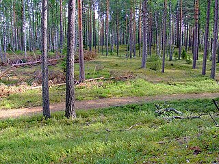
Bezhanitsky District District in Pskov Oblast, Russia

Bezhanitsky District is an administrative and municipal district (raion), one of the twenty-four in Pskov Oblast, Russia. It is located in the central and eastern parts of the oblast and borders with Dedovichsky District in the north, Poddorsky and Kholmsky Districts of Novgorod Oblast in the east, Loknyansky District in the south, Novosokolnichesky, Pustoshkinsky, and Opochetsky Districts in the southwest, and with Novorzhevsky District in the west. The area of the district is 3,535 square kilometers (1,365 sq mi). Its administrative center is the urban locality of Bezhanitsy. Population: 13,264 (2010 Census); 17,547 ; 22,784 (1989 Census). The population of Bezhanitsy accounts for 32.7% of the district's total population.

Dedovichsky District District in Pskov Oblast, Russia

Dedovichsky District is an administrative and municipal district (raion), one of the twenty-four in Pskov Oblast, Russia. It is located in the east of the oblast and borders with Dnovsky District in the north, Volotovsky District of Novgorod Oblast in the northeast, Poddorsky District, also of Novgorod Oblast, in the east, Bezhanitsky District in the south, Novorzhevsky District in the southwest, and with Porkhovsky District in the west. The area of the district is 2,188 square kilometers (845 sq mi). Its administrative center is the urban locality of Dedovichi. Population: 14,692 (2010 Census); 17,881 ; 18,948 (1989 Census). The population of Dedovichi accounts for 59.9% of the district's total population.

Krasnogorodsky District District in Pskov Oblast, Russia

Krasnogorodsky District is an administrative and municipal district (raion), one of the twenty-four in Pskov Oblast, Russia. It is located in the west of the oblast and borders with Ostrovsky District in the north, Pushkinogorsky District in the northeast, Opochetsky District in the southeast, Sebezhsky District in the south, Cibla and Kārsava municipalities of Latvia in the southwest, and with Pytalovsky District in the west. The area of the district is 1,320.42 square kilometers (509.82 sq mi). Its administrative center is the urban locality of Krasnogorodsk. Population: 7,328 (2010 Census); 9,800 ; 11,886 (1989 Census). The population of Krasnogorodsk accounts for 52.8% of the district's total population.

Loknyansky District District in Pskov Oblast, Russia

Loknyansky District is an administrative and municipal district (raion), one of the twenty-four in Pskov Oblast, Russia. It is located in the east of the oblast and borders with Kholmsky District of Novgorod Oblast in the northeast, Toropetsky District of Tver Oblast in the southeast, Velikoluksky District in the south, Novosokolnichesky District in the southwest, and with Bezhanitsky District in the northwest. The area of the district is 2,412 square kilometers (931 sq mi). Its administrative center is the urban locality of Loknya. Population: 9,535 (2010 Census); 13,268 ; 16,782 (1989 Census). The population of Loknya accounts for 40.6% of the district's total population.

Novorzhevsky District District in Pskov Oblast, Russia

Novorzhevsky District is an administrative and municipal district (raion), one of the twenty-four in Pskov Oblast, Russia. It is located in the center of the oblast and borders with Porkhovsky District in the north, Dedovichsky District in the northeast, Bezhanitsky District in the east, Opochetsky District in the south, Pushkinogorsky District in the west, and with Ostrovsky District in the northwest. The area of the district is 1,683 square kilometers (650 sq mi). Its administrative center is the town of Novorzhev. Population: 9,334 (2010 Census); 12,217 ; 15,477 (1989 Census). The population of Novorzhev accounts for 39.6% of the district's total population.

Novosokolnichesky District District in Pskov Oblast, Russia

Novosokolnichesky District is an administrative and municipal district (raion), one of the twenty-four in Pskov Oblast, Russia. It is located in the south of the oblast and borders with Loknyansky District in the north, Velikoluksky District in the east, Nevelsky District in the south, Pustoshkinsky District in the west, and with Bezhanitsky District in the northwest. The area of the district is 1,616.0 square kilometers (623.9 sq mi). Its administrative center is the town of Novosokolniki. Population: 14,776 (2010 Census); 19,389 ; 21,319 (1989 Census). The population of Novosokolniki accounts for 54.9% of the district's total population.

Opochetsky District District in Pskov Oblast, Russia

Opochetsky District is an administrative and municipal district (raion), one of the twenty-four in Pskov Oblast, Russia. It is located in the southwest of the oblast and borders with Pushkinogorsky District in the north, Novorzhevsky District in the northeast, Bezhanitsky District in the east, Pustoshkinsky District in the southeast, Sebezhsky District in the south, and with Krasnogorodsky District in the west. The area of the district is 2,028.9 square kilometers (783.4 sq mi). Its administrative center is the town of Opochka. Population: 18,673 (2010 Census); 23,973 ; 28,877 (1989 Census). The population of Opochka accounts for 62.1% of the district's total population.

Ostrovsky District, Pskov Oblast District in Pskov Oblast, Russia

Ostrovsky District is an administrative and municipal district (raion), one of the twenty-four in Pskov Oblast, Russia. It is located in the west of the oblast and borders with Pskovsky District in the north, Porkhovsky District in the northeast, Novorzhevsky District in the southeast, Pushkinogorsky and Krasnogorodsky Districts in the south, Pytalovsky District in the west, and with Palkinsky District in the northwest. The area of the district is 2,400 square kilometers (930 sq mi). Its administrative center is the town of Ostrov. Population: 31,096 (2010 Census); 36,685 ; 14,199 (1989 Census). The population of Ostrov accounts for 69.7% of the district's total population.

Palkinsky District District in Pskov Oblast, Russia

Palkinsky District is an administrative and municipal district (raion), one of the twenty-four in Pskov Oblast, Russia. It is located in the west of the oblast and borders with Pskovsky District in the northwest, Ostrovsky District in the southeast, Pytalovsky District in the south, Viļaka and Alūksne Municipalities of Latvia in the southwest, and with Pechorsky District in the northwest. The area of the district is 1,191.2 square kilometers (459.9 sq mi). Its administrative center is the urban locality of Palkino. Population: 8,826 (2010 Census); 10,520 ; 12,392 (1989 Census). The population of Palkino accounts for 33.1% of the district's total population.
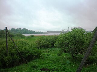
Pustoshkinsky District District in Pskov Oblast, Russia

Pustoshkinsky District is an administrative and municipal district (raion), one of the twenty-four in Pskov Oblast, Russia. It is located in the south of the oblast and borders with Bezhanitsky District in the north, Novosokolnichesky District in the east, Nevelsky District in the south, Sebezhsky District in the west, and with Opochetsky District in the northwest. The area of the district is 1,870 square kilometers (720 sq mi). Its administrative center is the town of Pustoshka. Population: 9,379 (2010 Census); 12,071 ; 14,063 (1989 Census). The population of Pustoshka accounts for 49.2% of the district's total population.

Sebezhsky District is an administrative and municipal district (raion), one of the twenty-four in Pskov Oblast, Russia. It is located in the southwest of the oblast and borders with Rasony and Verkhnyadzvinsk Districts of Vitebsk Oblast of Belarus in the south, Zilupe, Ludza, and Cibla municipalities of Latvia in the west, Krasnogorodsky and Opochetsky Districts in the north, and with Pustoshkinsky and Nevelsky Districts in the east. The area of the district is 3,100 square kilometers (1,200 sq mi). Its administrative center is the town of Sebezh. Population: 21,674 (2010 Census); 25,473 ; 26,926 (1989 Census). The population of Sebezh accounts for 29.4% of the district's total population.

Velikoluksky District District in Pskov Oblast, Russia

Velikoluksky District is an administrative and municipal district (raion), one of the twenty-four in Pskov Oblast, Russia. It is located in the southeast of the oblast and borders with Loknyansky District in the north, Toropetsky District of Tver Oblast in the northeast, Kunyinsky District in the east, Usvyatsky District in the south, Nevelsky District in the southwest, and with Novosokolnichesky District in the west. The area of the district is 2,960 square kilometers (1,140 sq mi). Its administrative center is the town of Velikiye Luki. Population: 22,121 (2010 Census); 24,035 ; 31,911 (1989 Census).

Krasnogorodsk Work settlement in Pskov Oblast, Russia

Krasnogorodsk is an urban locality and the administrative center of Krasnogorodsky District of Pskov Oblast, Russia, located on the Sinyaya River south of Pskov. Municipally, it is incorporated as Krasnogorodsk Urban Settlement, the only urban settlement in the district. Population: 3,870 (2010 Census); 4,694 (2002 Census); 5,295 (1989 Census).

Pushkinskiye Gory Work settlement in Pskov Oblast, Russia

Pushkinskiye Gory is an urban locality and the administrative center of Pushkinogorsky District of Pskov Oblast, Russia. Municipally, it is incorporated as Pushkinogorye Urban Settlement, the only urban settlement in the district. Population: 5,222 (2010 Census); 6,089 (2002 Census); 7,067 (1989 Census).

References

Notes

  1. 1 2 Law #833-oz
  2. 1 2 3 4 5 6 Law #420-oz
  3. The count of urban-type settlements may include the work settlements, the resort settlements, the suburban (dacha) settlements, as well as urban-type settlements proper.
  4. 1 2 О районе (in Russian). Портал муниципальных образований Псковской области. Retrieved July 19, 2012.
  5. 1 2 3 Russian Federal State Statistics Service (2011). "Всероссийская перепись населения 2010 года. Том 1" [2010 All-Russian Population Census, vol. 1]. Всероссийская перепись населения 2010 года (2010 All-Russia Population Census) (in Russian). Federal State Statistics Service . Retrieved June 29, 2012.
  6. The value of density was calculated automatically by dividing the 2010 Census population by the area specified in the infobox. Please note that this value is only approximate as the area specified in the infobox does not necessarily correspond to the area of the entity proper or is reported for the same year as the population.
  7. Правительство Российской Федерации. Федеральный закон №107-ФЗ от 3 июня 2011 г. «Об исчислении времени», в ред. Федерального закона №271-ФЗ от 03 июля 2016 г. «О внесении изменений в Федеральный закон "Об исчислении времени"». Вступил в силу по истечении шестидесяти дней после дня официального опубликования (6 августа 2011 г.). Опубликован: "Российская газета", №120, 6 июня 2011 г. (Government of the Russian Federation. Federal Law #107-FZ of June 31, 2011 On Calculating Time , as amended by the Federal Law #271-FZ of July 03, 2016 On Amending Federal Law "On Calculating Time". Effective as of after sixty days following the day of the official publication.).
  8. Russian Federal State Statistics Service (May 21, 2004). "Численность населения России, субъектов Российской Федерации в составе федеральных округов, районов, городских поселений, сельских населённых пунктов – районных центров и сельских населённых пунктов с населением 3 тысячи и более человек" [Population of Russia, Its Federal Districts, Federal Subjects, Districts, Urban Localities, Rural Localities—Administrative Centers, and Rural Localities with Population of Over 3,000](XLS). Всероссийская перепись населения 2002 года [All-Russia Population Census of 2002] (in Russian). Retrieved August 9, 2014.
  9. Demoscope Weekly (1989). "Всесоюзная перепись населения 1989 г. Численность наличного населения союзных и автономных республик, автономных областей и округов, краёв, областей, районов, городских поселений и сёл-райцентров" [All Union Population Census of 1989: Present Population of Union and Autonomous Republics, Autonomous Oblasts and Okrugs, Krais, Oblasts, Districts, Urban Settlements, and Villages Serving as District Administrative Centers]. Всесоюзная перепись населения 1989 года [All-Union Population Census of 1989] (in Russian). Институт демографии Национального исследовательского университета: Высшая школа экономики [Institute of Demography at the National Research University: Higher School of Economics]. Retrieved August 9, 2014.
  10. Рельеф Пушкиногорского района (in Russian). Портал муниципальных образований Псковской области. Retrieved July 19, 2012.
  11. История (in Russian). Портал муниципальных образований Псковской области. Retrieved July 22, 2012.
  12. 1 2 Герасимёнок, Т. Е.; Н. В. Коломыцева, И. С. Пожидаев, С. М. Фёдоров, К. И. Карпов (2002). Территориальное деление Псковской области (in Russian). Pskov. ISBN   5-94542-031-X.
  13. Экономика (in Russian). Портал муниципальных образований Псковской области. Retrieved July 21, 2012.
  14. Сельское хозяйство (in Russian). Портал муниципальных образований Псковской области. Retrieved July 21, 2012.
  15. Памятники истории и культуры народов Российской Федерации (in Russian). Russian Ministry of Culture. Retrieved 2 June 2016.

Sources