No. 100 Group was a special duties group within RAF Bomber Command. The group was formed on 11 November 1943 to consolidate the increasingly complex business of electronic warfare and countermeasures in one organisation. The group was responsible for the development, operational trial and use of electronic warfare and countermeasures equipment. It was based at RAF stations in East Anglia, chiefly Norfolk.

RAF Andover is a former Royal Flying Corps and Royal Air Force station in England, 2 miles (3.2 km) west of Andover, Hampshire. As well as RFC and RAF units, units of the Aviation Section, U.S. Signal Corps, Royal Canadian Air Force, United States Army Air Forces, and the Air Transport Auxiliary were also stationed at the airfield.

Royal Air Force Gaydon or more simply RAF Gaydon is a former Royal Air Force station located 5.2 miles (8.4 km) east of Wellesbourne, Warwickshire and 10.8 miles (17.4 km) north west of Banbury, Oxfordshire, England.
Royal Air Force Foulsham, more commonly known as RAF Foulsham is a former Royal Air Force station, a military airfield, located 15 miles North-West of Norwich, in the English county of Norfolk, East Anglia, from 1942 to 1945.

Royal Air Force East Kirkby or more simply RAF East Kirkby is a former Royal Air Force station near the village of East Kirkby, south of Horncastle in Lincolnshire, just off the A155. The airfield is now home to the Lincolnshire Aviation Heritage Centre.

Royal Air Force Croft or more simply RAF Croft is a former Royal Air Force satellite station located 4.6 miles (7.4 km) south of Darlington, County Durham, England and 8 miles (13 km) north-east of Richmond, North Yorkshire. The site is also known locally as Croft Aerodrome or Neasham. Constructed at the same time as many other airfields, it was originally named RAF Dalton-on-Tees after the nearby village Dalton-on-Tees. However, it was quickly renamed RAF Croft after initial confusion with the also newly opened RAF Dalton near Thirsk, just 25 miles away.

Royal Air Force Horsham St Faith or more simply RAF Horsham St Faith is a former Royal Air Force station near Norwich, Norfolk, England which was operational from 1939 to 1963. It was then developed as Norwich International Airport.

Royal Air Force Bodney or more simply RAF Bodney is a former Royal Air Force Station located 4.5 miles (7.2 km) west of Watton, Norfolk, England.
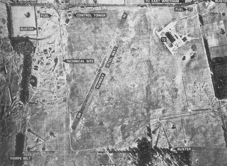
Royal Air Force East Wretham or more simply RAF East Wretham is a former Royal Air Force station located 6 miles (9.7 km) northeast of Thetford, Norfolk, England.
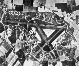
Royal Air Force Attlebridge, or simply RAF Attlebridge, is a former Royal Air Force station located near Attlebridge and 8 miles (13 km) northwest of Norwich, Norfolk, England.

Royal Air Force Fulbeck or more simply RAF Fulbeck is a former Royal Air Force station located 6.3 miles (10.1 km) east of Newark-on-Trent, Nottinghamshire and 10.9 miles (17.5 km) west of Sleaford, Lincolnshire, England.

Royal Air Force Balderton or more simply RAF Balderton was a former Royal Air Force satellite station located 2.0 miles (3.2 km) south of Newark-on-Trent, sandwiched between the now extinct Great Northern Railway (GNR) Bottesford-Newark line and the A1 road in Nottinghamshire, England.
Royal Air Force Dalton or more simply RAF Dalton is a former Royal Air Force satellite station located near to Dalton, North Yorkshire, England.

Royal Air Force High Ercall or more simply RAF High Ercall is a former Royal Air Force sector station situated near the village of High Ercall, 7 miles (11 km) northeast of Shrewsbury, Shropshire, England.
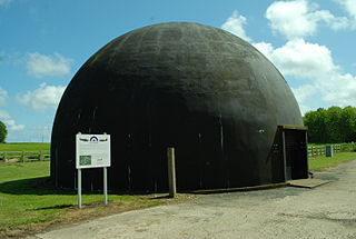
Royal Air Force Langham or more simply RAF Langham is a former Royal Air Force station, located at Langham, 27.2 miles (43.8 km) northwest of Norwich in the English county of Norfolk. It operated between 1940 and 1961. The airfield was the most northerly of the wartime RAF airfields in Norfolk and its position, just 3.3 miles (5.3 km) from the North Sea at Blakeney, made it a suitable site for RAF Coastal Command aircraft.
Royal Air Force Downham Market, or more simply RAF Downham Market, was a Royal Air Force station in the west of the county of Norfolk, England which operated during the second half of the Second World War.
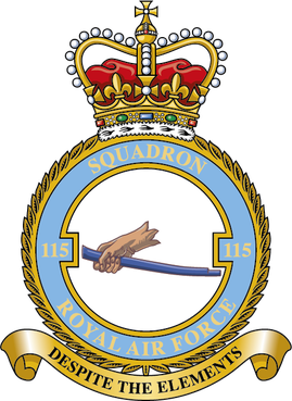
Number 115 Squadron is a Royal Air Force squadron operating the Grob Tutor T1, training QFIs for the RAF's Elementary Flying Training (EFT) squadrons and the University Air Squadrons, as well as undertaking evaluation and standardisation duties.

Royal Air Force Methwold or more simply RAF Methwold is a former Royal Air Force station located 2.1 miles (3.4 km) north east of Feltwell, Norfolk and 10.9 miles (17.5 km) north west of Thetford, Norfolk, England.

Royal Air Force Cheddington or more simply RAF Cheddington is a former Royal Air Force station located 1 mile (1.6 km) south-west of Cheddington, Buckinghamshire, England. The airfield was closed in 1952.

Royal Air Force Lichfield or more simply RAF Lichfield is a former Royal Air Force station located in Fradley, 2 miles (3.2 km) north east of Lichfield, Staffordshire, England. The airfield was the busiest airfield in Staffordshire during the Second World War. The airfield supported its own units as well as providing safe haven for many more. It was a control point for all aviation traffic that passed through the Birmingham area during the war and saw more aircraft movements than any other Staffordshire airfield.


