
The Red Rock Canyon National Conservation Area in Clark County, Nevada, United States, is an area managed by the Bureau of Land Management as part of its National Landscape Conservation System, and protected as a National Conservation Area. It is about 15 miles (24 km) west of Las Vegas. More than three million people visit the area each year.

The Titan is a 6,112-foot-elevation (1,863-meter) pillar in Grand County, Utah, United States.

Mount Kinesava is a 7,285-foot (2,220 m) sandstone mountain summit located in Zion National Park, in Washington County of southwest Utah, United States.

Mount Moroni is a 5,690-foot (1,730 m) elevation Navajo Sandstone summit located at the Court of the Patriarchs in Zion National Park, in Washington County of southwest Utah, United States.
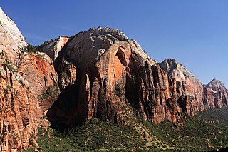
Red Arch Mountain is a 5,930-foot (1,810 m) elevation Navajo Sandstone summit located in Zion National Park, in Washington County of southwest Utah, United States.
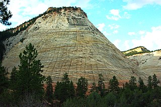
Checkerboard Mesa is an iconic 6,520+ ft elevation Navajo Sandstone summit located in Zion National Park, in Kane County of southwest Utah, United States. Checkerboard Mesa is situated immediately southwest of the park's east entrance, towering 900 feet above the Zion – Mount Carmel Highway. Its nearest neighbor is Crazy Quilt Mesa, one-half mile immediately west, and separated by Checkerboard Mesa Canyon. This canyon holds pools of rainwater which provide a vital source of water for resident bighorn sheep. This peak was originally named Checkerboard Mountain by the park's third superintendent, Preston P. Patraw. The landform's toponym was officially adopted in 1935 by the U.S. Board on Geographic Names. The descriptive name stems from the cliff's distinctive multitudinous check lines in cross-bedded white sandstone which give the impression of a checkerboard. The horizontal lines are caused by cross-bedding, a remnant of ancient sand dunes. The vertical and sub-vertical lines formed by the contraction and expansion of the sandstone caused by temperature changes, freezing and thawing cycles, in combination with wetting and drying. Precipitation runoff from this mountain drains into tributaries of the Virgin River.
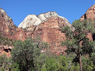
Castle Dome is a 7,054-foot (2,150 m) elevation Navajo Sandstone summit located in Zion National Park, in Washington County of southwest Utah, United States. Castle Dome is situated northwest of Zion Lodge, towering 2,800 feet (850 m) above the lodge and the floor of Zion Canyon. It is set on the west side of the North Fork Virgin River which drains precipitation runoff from this mountain. It is wedged between Behunin Canyon and Heaps Canyon, with the popular Emerald Pools set at the southeast foot of this mountain. Its neighbors include Mount Majestic, Cathedral Mountain, The Great White Throne, Red Arch Mountain, Mountain of the Sun, and Lady Mountain. This feature's name was officially adopted in 1934 by the U.S. Board on Geographic Names.
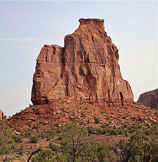
Independence Monument is a 5,739-foot-elevation sandstone pillar located in Colorado National Monument, in Mesa County of western Colorado, United States. This iconic 450-foot-high landmark is situated one mile southeast of the monument's visitor center, and 9 miles (14 km) west of the community of Grand Junction, where it towers above the floor of Monument Canyon and Wedding Canyon. It is a popular climbing destination, and can be seen from Rim Rock Drive.
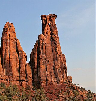
Kissing Couple is a 5,815-foot-elevation (1,772-meter) sandstone pillar located in Colorado National Monument, in Mesa County of western Colorado, United States. This iconic 400-foot-high tower is situated on the west side of Monument Canyon, 1.5 mile southeast of the monument's visitor center, and nine miles (14 km) west of the community of Grand Junction. It is also a half-mile south-southeast of another popular climbing destination, Independence Monument, and both can be seen from viewpoints along Rim Rock Drive. It is so named because it resembles an embracing couple. This geographical feature's name was officially adopted in 1982 by the United States Board on Geographic Names. Older USGS maps have the feature's name misplaced by about one-half mile to the southeast. The first ascent of the summit was made May 4, 1960, by Layton Kor, Harvey Carter, and John Auld via the five pitch, class 5.11a route named Long Dong Wall. The first free ascent was made in 1977 by Andy Petefish, Tom Stubbs, and Jim Pearson. Some climbers alternatively refer to Kissing Couple as "Bell Tower."

Pipe Organ is a 5,731-foot-elevation (1,747-meter) sandstone pillar located in Colorado National Monument, in Mesa County of western Colorado, United States. This 400+ foot tower is situated in Wedding Canyon, less than one-half mile east of the monument's visitor center, and 9 miles (14 km) west of the community of Grand Junction. It is also immediately northwest of another popular climbing destination, Independence Monument, and both can be seen from viewpoints along Rim Rock Drive. The first ascent of the summit was made January 31, 1961, by John Auld, Gary Ziegler, Jim Dyson, and John Kuglin. Pipe Organ has a subsidiary summit unofficially named Organ Pipe Spire on the east aspect, which the National Park Service refers to as Praying Hands. This 325-foot-high subsidiary peak was originally named Squall Spire in 1976 by Harvey T. Carter of the first ascent party.
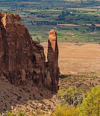
Sentinel Spire is a 5,500-foot-elevation (1,676-meter) sandstone pillar located in Colorado National Monument, in Mesa County of western Colorado, United States. This 200-foot freestanding tower is situated in Wedding Canyon, one-half mile east of the monument's visitor center, and 9 miles (14 km) west of the community of Grand Junction. It is also immediately south of Window Rock, and north of another climbing destination, Pipe Organ, both of which can be seen from viewpoints along Rim Rock Drive. The first ascent of the summit was made May 3, 1960, by Layton Kor, Harvey Carter, and John Auld via the class 5.10 route, Fast Draw. This was the day before the climbers also made the first ascent of nearby Kissing Couple. The first solo ascent was made by Ron Olevsky in March 1976, and the first free ascent was made by Andy Petefish and John Christenson in 1978. Some climbers refer to Sentinel Spire as Watusi Spear.

Grand View Spire is a 5,821-foot-elevation (1,774-meter) sandstone pillar located in Colorado National Monument, in Mesa County of western Colorado, United States. This 400-foot tower is situated on the west side of Monument Canyon, one mile southeast of the monument's visitor center, and 9 miles (14 km) west of the community of Grand Junction. It is also 0.32 mile immediately south of Independence Monument, and 0.27 mile northwest of another climbing destination, Kissing Couple. Its unofficial name relates to its position at the tip of Grand View Overlook, one of several scenic viewpoints along Rim Rock Drive.

Kingfisher Tower is a 6,794-foot-elevation (2,071-meter) pillar in Grand County, Utah, United States.

Argon Tower is a 4,750-foot-elevation (1,448-meter) pillar in Grand County, Utah. It is located within Arches National Park and like many of the rock formations in the park, Argon Tower is composed of Entrada Sandstone. The tower is 260 feet tall, and topographic relief is significant as the summit rises 450 feet vertically above the Park Avenue Trail in 400 feet laterally. Precipitation runoff from Argon Tower drains to the nearby Colorado River via Courthouse Wash. This landform was shown briefly in the opening scene credits of the 1989 American action-adventure film Indiana Jones and the Last Crusade.

Tower of Babel is a 4,655-foot-elevation (1,419-meter) summit in Grand County, Utah. It is located within Arches National Park and like many of the rock formations in the park, it is composed of Entrada Sandstone. The tower is 500 feet tall, and topographic relief is significant as the summit rises 500 feet vertically above the main park road in approximately 200 feet laterally. Precipitation runoff from Tower of Babel drains to the nearby Colorado River via Courthouse Wash. This landform's descriptive toponym has been officially adopted by the United States Board on Geographic Names. This landform was shown briefly in the opening scene of the 1989 American action-adventure film Indiana Jones and the Last Crusade.

Echo Tower is a 5,784-foot-elevation (1,763-meter) pillar in Grand County, Utah, United States.

The Oracle is a 6,060-foot-elevation (1,847-meter) pillar in Grand County, Utah, United States.

Family Butte is a 7,405-foot-elevation (2,257-meter) summit in Emery County, Utah, United States.

Mount Watkins is an 8,497-foot-elevation mountain summit in the Sierra Nevada mountain range, in Mariposa County, California, United States.

Turtlehead Mountain is a 6,323-foot-elevation (1,927-meter) summit in Clark County, Nevada, United States.


