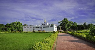
Lumbinī is a Buddhist pilgrimage site in the Rupandehi District of Lumbini Province in Nepal. It is the place where, according to Buddhist tradition, queen Maya gave birth to Siddhartha Gautama at around 623 BCE. Gautama, who, according to Buddhist tradition, achieved Enlightenment some time around 528 BCE, became Shakyamuni Buddha and founded Buddhism. Lumbini is one of many magnets for pilgrimage that sprang up in places pivotal to the life of the Buddha.
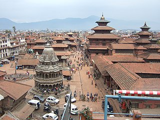
Lalitpur Metropolitan City is a metropolitan city and fourth most populous city of Nepal with 299,843 inhabitants living in 49,044 households per the 2021 census. It is located in the south-central part of Kathmandu Valley, a large valley in the high plateaus in central Nepal, at an altitude of 1,400 metres.

The Kathmandu Valley, also known as the Nepal Valley or Nepa Valley, National Capital Area, is a bowl-shaped valley located in the Himalayan mountains of Nepal. It lies at the crossroads of ancient civilizations of the Indian subcontinent and the broader Asian continent, and has at least 130 important monuments, including several pilgrimage sites for Hindus and Buddhists. There are seven World Heritage Sites within the valley.
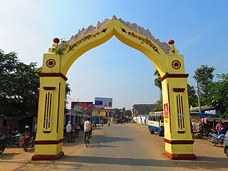
Kapilvastu, formerly known by name of Taulihawa, is a municipality and administrative center of Kapilvastu District in Lumbini Province of southern Nepal. The municipality is located roughly 25 kilometres (16 mi) to the south-west of Lumbini, a UNESCO World Heritage Site and the birthplace of Gautama Buddha.
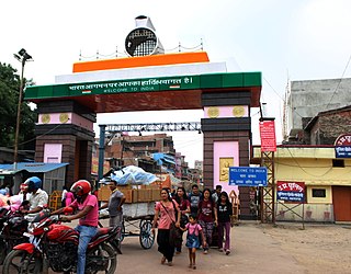
Maharajganj district is one of the 75 districts of Uttar Pradesh state in northern India, and the town of Maharajganj is the district headquarters. District is a part Gorakhpur division. It is located in Terai region of Himalayas, bordering Nepal in North. Gandak, Rapti, Rohin are some major river flowing through the district.
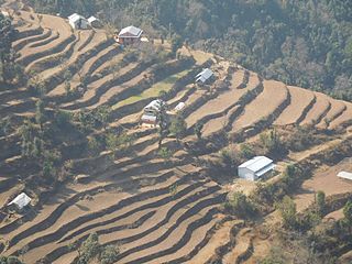
Dailekh District a part of Karnali Province, is one of the 77 districts of Nepal. The district, with Dailekh as its district headquarters, covers an area of 1,502 km2 (580 sq mi) and had a population of 225,201 in 2001 and 261,770 in 2011.

Kapilvastu District, often Kapilbastu, is one of the districts of Lumbini Province, Nepal. The district, with Kapilbastu municipality as its district headquarters, covers an area of 1,738 square kilometres (671 sq mi) and in 2001 had a population of 481,976, which increased to 571,936 in 2011 and later according 2021 census it further increased to 686,739 Kapilvastu district has 3 number of seats for central whereas 6 seats for state level elections.

Nawalparasi District, part of which belongs to Gandaki Province and part to Lumbini Province, was one of the 75 districts of Nepal before being divided into Parasi District and Nawalpur District in 2015.

Rupandehi District, a part of Lumbini Province, is one of the seventy-seven districts of Nepal and covers an area of 1,360 km2 (530 sq mi). The district headquarter is Bhairahawa. As per the national census 2011, the population of Rupandehi was 880,196.
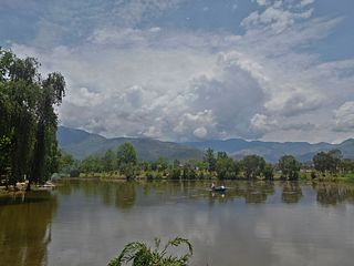
Surkhet District is a district in Karnali Province of mid-western Nepal. Surkhet is one of the ten districts of Karnali located about 600 kilometres (373 mi) west of the national capital Kathmandu. The district's area is 2,489 square kilometres (961 sq mi). It had 288,527 population in 2001 and 350,804 in 2011 which male comprised 169,461 and female 181,381. Its district headquarters, Birendranagar, is the capital of Karnali Province. It is serving as a business hub and document center for Karnali province. According to population, development, road links, landforms, climate, many peoples are migrating here. After becoming province capital developmental activities are boosted and are in peak level. All the governmental works are carried here. Birendranagar is beautiful valley surrounded by hills having moderate climate.

Butwal, officially Butwal Sub-Metropolitan City ,previously known as Khasyauli, is a sub-metropolitan city and economic hub in Lumbini Province in West Nepal. Butwal has a city population of 195,054 as per the 2021 AD Nepal census.

Mahendranagar, officially known as Bhimdattanagar, is a municipality in Kanchanpur District of Sudurpashchim Province, Nepal. The city and the municipality were named Mahendranagar in honour of the late King Mahendra of Nepal. After becoming a republic in 2008, the Mahendranagar municipality name was changed to Bhimdatta municipality in honour of the revolutionary farmer leader Bhimdatta Panta. It is surrounded by Bedkot Municipality in the east, Dadeldhura District in the north, Shuklaphanta National Park in the south and Uttarakhand, India in the west.
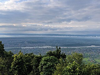
Bharatpur is a city in south central Nepal. It is the third most populous city of Nepal after Kathmandu and Pokhara with 369,377 inhabitants in 2021. It is also the second largest metropolitan city in Nepal by area. It is the district headquarter of the Chitwan District.
Sunwal City, officially the Sunwal Municipal City, is the urbanized and the most populous city of Parasi District with 72,621 native inhabitants living in 18,689 households in 2021 and 0.11 million people in its urban agglomeration. It is located in the Lumbini Province at an altitude of 131 metres.
Ramagrama stupa is a stupa located in Ramgram Municipality, in the Parasi District of Nepal. This Buddhist pilgrimage site containing relics of Gautama Buddha was constructed between the Mauryan and Gupta periods, according to research by Nepal’s Department of Archaeology.

Kushinagar is a town in the Kushinagar district in Uttar Pradesh, India. Located 53 kilometres east of Gorakhpur on National Highway 27, Kushinagar is an important and popular Buddhist pilgrimage site, where Buddhists believe Gautama Buddha attained parinirvana.

Lumbini Sanskritik is a municipality situated in Rupandehi District of Lumbini Province in Nepal. Lumbini, the Buddhist pilgrimage site where Buddha was born lies in the center of this municipality.

Lumbini Province is a province in western Nepal. The country's third largest province in terms of area as well as population, Lumbini is home to the World Heritage Site of Lumbini, where according to the Buddhist tradition, the founder of Buddhism, Gautama Buddha was born.

Nawalparasi (West of Bardaghat Susta) district or Nawalparasi West, as known commonly (Nepali: नवलपरासी (बर्दघाट सुस्ता पश्चिम) वा नवलपरासी पश्चिम ), also frequently referred to as just Parasi District, is a district located in Lumbini Province of Nepal. It is 1 out of 12 districts of Lumbini Province. The headquarter of the district is located in Ramgram.


