Belper is a town and civil parish in the local government district of Amber Valley in Derbyshire, England, located about 7 miles (11 km) north of Derby on the River Derwent. As well as Belper itself, the parish also includes the village of Milford and the hamlets of Bargate, Blackbrook and Makeney. As of the 2011 Census, the parish had a population of 21,823. Originally a centre for the nail-making industry since the Middle Ages, Belper expanded during the early Industrial Revolution to become one of the first mill towns with the establishment of several textile mills; as such, it forms part of the Derwent Valley Mills World Heritage Site.

Jedediah Strutt or Jedidiah Strutt – as he spelled it – was a hosier and cotton spinner from Belper, England.

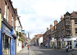
Clay Cross is a town and a civil parish in the North East Derbyshire district of Derbyshire, England. It is a former industrial and mining town, about 5 miles (8.0 km) south of Chesterfield. It is directly on the A61. Surrounding settlements include North Wingfield, Tupton, Pilsley and Ashover.
Crich is a village in the English county of Derbyshire. The population at the 2001 Census was 2,821, increasing to 2,898 at the 2011 Census. It has the National Tramway Museum inside the Crich Tramway Village and, at the summit of Crich Hill above, a memorial tower for those of the Sherwood Foresters regiment who died in battle, particularly in World War I.

Eckington is a village and civil parish in North East Derbyshire, England. It is 7 miles (11 km) northeast of Chesterfield and 9 miles (14 km) southeast of Sheffield city centre, on the border with South Yorkshire. It lies on the B6052 and B6056 roads close to the A6135 for Sheffield and Junction 30 of the M1. It had a 2001 population of 11,152, increasing to 11,855 at the 2011 Census.

Findern is a village and civil parish in the District of South Derbyshire, approximately 5–6 miles (9.7 km) south of Derby. The population of the civil parish was 1,669 at the 2011 Census.

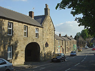
Ashover is a village and civil parish in the English county of Derbyshire. It is in the North East Derbyshire district of the county. The population of the civil parish taken at the 2011 Census was 1,905, increasing to 1,959 for the 2021 census. It sits in a valley, not far from the town of Matlock and the Peak District national park.

Godstone is a village and civil parish in the Tandridge District of Surrey, England. It is 6 miles (9.7 km) east of Reigate, 3 miles (4.8 km) west of Oxted, 22 miles (35 km) east of Guildford and 18 miles (29 km) south of London. Close to the North Downs and Blindley Heath. The Greensand Way and the North Downs Way both pass through Godstone.

Bulkeley is a village and former civil parish, now in the parish of Bulkeley and Ridley, in the unitary authority area of Cheshire East and the ceremonial county of Cheshire, England. The village is on the A534 road, 9 miles (14 km) west of Nantwich. In the 2011 census it had a population of 239.
Wessington is a village and civil parish in the English county of Derbyshire. The population of the civil parish at the 2011 census was 576. It is in the North East Derbyshire district of the county. It is near to the towns of Matlock, Alfreton and the village of Brackenfield. Situated 740 ft above sea level.

Draycott and Church Wilne is a civil parish within the Borough of Erewash, which is in the county of Derbyshire, England. Partially built up and otherwise rural, its population was 3,090 residents in the 2011 census. The parish is 100 miles (160 km) north west of London, 5+1⁄2 miles (8.9 km) south east of the county city of Derby, and 3 miles (4.8 km) west of the nearest market town of Long Eaton. It shares a boundary with the parishes of Breaston, Elvaston, Hopwell, Ockbrook and Borrowash, Risley and Shardlow and Great Wilne.
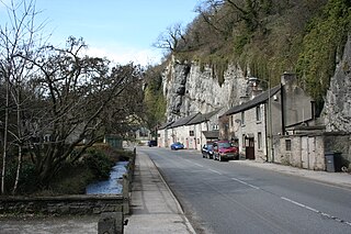
Stoney Middleton is a village and civil parish in the Derbyshire Dales district of Derbyshire, England. It is in the White Peak area of the Peak District southeast of Eyam and northwest of Calver, on the A623 road at the foot of the limestone valley of Middleton Dale. The population at the 2011 Census was 470.
Faddiley is a small village and civil parish in the unitary authority of Cheshire East and the ceremonial county of Cheshire, England. The village is located 4 miles to the west of Nantwich. The parish also includes the small settlements of Larden Green and Woodhey or Woodhey Green, with a total population of just over 150, measured at 163 during the 2011 Census. Nearby villages include Brindley, Burland, Chorley, Haughton and Ravensmoor.

Hunsterson is a hamlet and former civil parish, now in the parish of Doddington and District, in the unitary authority area of Cheshire East and the ceremonial county of Cheshire, England. The hamlet is located 2¾ miles to the north east of Audlem and 6 miles to the south of Crewe. The parish also included the settlements of Brown Moss, Four Lane End, Foxes Bank and Whittaker's Green. In 2011 the parish had a population of 163. Nearby villages include Audlem, Buerton, Hatherton and Hankelow.

Peckforton is a scattered settlement and civil parish in the unitary authority of Cheshire East and the ceremonial county of Cheshire, England. The settlement is located 6.5 miles (10.5 km) to the north east of Malpas and 7.5 miles (12.1 km) to the west of Nantwich. The civil parish covers 1,754 acres (710 ha), with an estimated total population of 150 in 2006. The area is predominantly agricultural. Nearby villages include Bulkeley to the south, Beeston to the north, Higher Burwardsley to the west, Spurstow to the east and Bunbury to the north east.

Steventon is a village and civil parish in Oxfordshire, England, about 4 miles (6.4 km) south of Abingdon and a similar distance west of Didcot. It lies within the boundaries of the historic county of Berkshire. The 2011 Census recorded the parish population as 1,485.

Hart's Green is a hamlet in the civil parish of Lawshall in the Babergh District in the county of Suffolk, England. It is located between Stanningfield and Hanningfield Green and is just over a mile off the A134 between Bury St Edmunds and Sudbury. The road that serves Hart's Green is known as Donkey Lane.

Holymoorside and Walton is a civil parish within the North East Derbyshire district, which is in the county of Derbyshire, England. Named for its main settlements, with a mix of a number of villages and hamlets amongst a large rural area, it had a population of 2,138 residents in 2021. The parish is 130 miles (210 km) north west of London, 20 miles (32 km) north of the county city of Derby, and 2 miles (3.2 km) south west of the nearest market town of Chesterfield. It is adjacent with the Peak District national park to the west, and shares a border with the district of Chesterfield, along with the parishes of Ashover, Beeley, Brampton as well as Wingerworth. The parish paradoxically does not include the majority of the nearby built-up suburb of Walton, Chesterfield which is now within an adjacent unparished area of the borough.
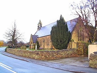
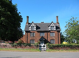
Ashover is a civil parish in the North East Derbyshire district of Derbyshire, England. The parish contains 83 listed buildings that are recorded in the National Heritage List for England. Of these, one is listed at Grade I, the highest of the three grades, and the others are at Grade II, the lowest grade. The parish is almost entirely rural, and contains the village of Ashover and smaller settlements, including Milltown and Ashover Hay. Most of the listed buildings are farmhouses and farmbuildings, houses, cottages, and associated structures. The other listed buildings include a church and items in the churchyard, chapels, public houses, a footbridge and a road bridge, a former watermill and a windmill, a pinfold, the chimney of a former engine house, a former school, and a telephone kiosk.
