Rivers of Lake County, California

Last updated
Topography of Lake County Lake County, California topography.png
Topography of Lake County
Map all coordinates using: OpenStreetMap  
Download coordinates as: KML

Rivers and creeks in Lake County, California are listed below by river basin and alphabetically. Unless otherwise stated, the information is taken from the Geographic Names Information System maintained by the United States Geological Survey. Coordinates, elevations and lengths from this source are approximate.

Contents

General

Surface water of Lake County Lake County, California surface water.png
Surface water of Lake County

Lake County covers about 1,261 square miles (3,270 km2) in the California Coastal Range. The rugged topography includes hills, mountains and valleys. The largest waterbody is Clear Lake, at an elevation of about 1,320 feet (400 m) above sea level. The three main drainages are Eel River, Cache Creek and Putah Creek, each of which have their headwaters in the county. Eel River drains the north of the county and flows west into Mendocino County. The center of the county drains into Clear Lake, which drains into Cache Creek, which flows east into Yolo County. The south of the county drains into Putah Creek, which flows south into Napa County. [1] Eel River empties into the Pacific, while Cache Creek and Putah Creek flow into the Sacramento River valley.

Lake County has warm, dry summers, and cool, moist winters. In the summer, a continual tropical air mass typically creates high daytime temperatures and cool evening temperatures. In winter, a marine air mass typically keeps temperatures above 20 °F (−7 °C). Average monthly temperatures range from about 43°F during December through January to about 73°F during July through August. [2] There are greater levels of precipitation at higher elevations and in the north and southwest of the county. [3] Almost 90% of precipitation falls in winter, and there is very little rain from May to September. [4]

Geological changes

Clear Lake formed about 600,000 years ago as the land in the region began to subside when the Clear Lake Volcanic Field erupted. Its basin continues to move downward, while sedimentation keeps it shallow. [5] The Clear Lake basin lies between the watersheds of the Sacramento River and the Russian River. When it was formed it drained east into the Sacramento Valley. [6]

About 200,000 years ago the Clear Lake Volcanic Field blocked the lake's outlet. [6] The lake rose until it found a new outlet, draining west through the Blue Lakes into Cold Creek and the Russian River. [7] Clear Lake was almost 300 feet (91 m) higher than it is today, and Scotts Creek flowed into the lake from the west near where Lakeport is today. It formed a large delta there, which deposited the Lakeport ridge. [5]

At some time in the last 10,000 years a landslide at the west end of the Blue Lakes blocked Clear Lake's outlet to the Russian River watershed. The lake rose again, and created its present outlet via Cache Creek to the Sacramento River. [8] Cache Creek began eroding upstream to Clear Lake, and when it reached the lake the outflow along Cache Creek quickly eroded a channel through soft sediments. The lake dropped almost 300 feet (91 m) as a result. [5]

Basins

Eel River

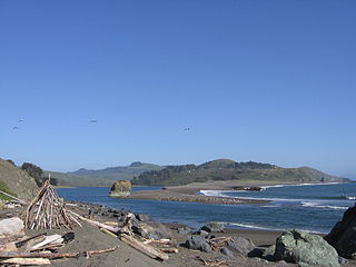
Eel River flows through the northern part of the County and drains through Lake Pillsbury into Mendocino County. [9] The Eel River’s drainage includes Corbin Creek, Anderson Creek, Cold Creek and Bear Creek. The drainage includes the highest point in Lake County, Snow Mountain. The Pacific Gas and Electric Company created Lake Pillsbury on the Eel River as part of its Potter Valley Project, which diverts water downstream on the Eel River to generate power, and releases the water into the East Fork Russian River. Diverted flows supplement Russian River water supplies in Mendocino and Sonoma Counties. Lake Pillsbury captures about one percent of the Eel River flow. [10]

StreamGNIS idParentMouthLength
CoordsElev ftElev mmikm
all values are approximate
Eel River 251974 Pacific Ocean 40°38′29″N124°18′44″W / 40.64139°N 124.31222°W / 40.64139; -124.31222 (Eel River) 00196315
←←Middle Creek (Black Butte River) 263500 Black Butte River 39°35′42″N122°51′31″W / 39.59500°N 122.85861°W / 39.59500; -122.85861 (MiddleCreek) 3,4021,0373.55.6
←Elk Creek 259846 Middle Fork Eel River 39°40′35″N123°08′02″W / 39.67639°N 123.13389°W / 39.67639; -123.13389 (Elk Creek) 1,1383471626
←←Lookout Creek 227634 Elk Creek 39°31′37″N123°00′14″W / 39.52694°N 123.00389°W / 39.52694; -123.00389 (Lookout Creek) 2,43174134.8
←←Sulphur Springs Creek 235736 Elk Creek 39°33′27″N123°01′56″W / 39.55750°N 123.03222°W / 39.55750; -123.03222 (Sulphur Springs Creek) 1,7855444.57.2
←←Crocker Creek 221836 Elk Creek 39°33′36″N123°02′10″W / 39.56000°N 123.03611°W / 39.56000; -123.03611 (Crocker Creek) 1,755535
←←Forks Creek 223687 Elk Creek 39°34′26″N123°02′46″W / 39.57389°N 123.04611°W / 39.57389; -123.04611 1,562476
←←Bear Creek (Elk Creek) 218824 Elk Creek 39°34′44″N123°02′45″W / 39.57889°N 123.04583°W / 39.57889; -123.04583 1,51946358.0
←←Little Thatcher Creek 227389 Elk Creek 39°36′45″N123°05′33″W / 39.61250°N 123.09250°W / 39.61250; -123.09250 1,335407
←←Sanhedrin Creek 232532 Elk Creek 39°36′43″N123°05′52″W / 39.61194°N 123.09778°W / 39.61194; -123.09778 1,322403
←←←Bennett Creek 219041 Sanhedrin Creek 39°36′11″N123°05′27″W / 39.60306°N 123.09083°W / 39.60306; -123.09083 1,394425
Trout Creek (Eel River) 268433 Eel River 39°32′18″N122°51′32″W / 39.53833°N 122.85889°W / 39.53833; -122.85889 2,78284846.4
Horse Creek 261480 Eel River 39°31′29″N122°51′05″W / 39.52472°N 122.85139°W / 39.52472; -122.85139 2,6948213.255.23
Corbin Creek 258714 Eel River 39°31′43″N122°51′01″W / 39.52861°N 122.85028°W / 39.52861; -122.85028 2,684818
←Dutch Oven Creek E 259637 Corbin Creek 39°32′50″N122°44′36″W / 39.54722°N 122.74333°W / 39.54722; -122.74333 3,218981
←Five Spring Creek 260179 Corbin Creek 39°32′59″N122°46′44″W / 39.54972°N 122.77889°W / 39.54972; -122.77889 3,0649347.512.1
←Wescott Creek 268857 Corbin Creek 39°33′18″N122°46′03″W / 39.55500°N 122.76750°W / 39.55500; -122.76750 3,054931
←Dutch Oven Creek W 222774 Corbin Creek 39°32′32″N122°47′47″W / 39.54222°N 122.79639°W / 39.54222; -122.79639 2,9268922.253.62}
Anderson Creek (Eel River) 256236 Eel River 39°30′32″N122°50′45″W / 39.50889°N 122.84583°W / 39.50889; -122.84583 2,572784
Rattlesnake Creek (Eel River) 267161 Eel River 39°29′37″N122°51′21″W / 39.49361°N 122.85583°W / 39.49361; -122.85583 2,4937605.58.9
←Little Round Mountain Creek 266925 Rattlesnake Creek (Eel River) 39°29′39″N122°51′50″W / 39.49417°N 122.86389°W / 39.49417; -122.86389 2,61879823.2
Cold Creek (Eel River) 258532 Eel River 39°28′17″N122°49′59″W / 39.47139°N 122.83306°W / 39.47139; -122.83306 2,47475469.7
Skeleton Creek 266231 Eel River 39°26′07″N122°51′24″W / 39.43528°N 122.85667°W / 39.43528; -122.85667 2,06462934.8
Copper Butte Creek 258698 Eel River 39°25′46″N122°51′12″W / 39.42944°N 122.85333°W / 39.42944; -122.85333 2,0246173.255.23
Berry Creek 256844 Eel River 39°25′30″N122°51′23″W / 39.42500°N 122.85639°W / 39.42500; -122.85639 1,9555961.52.4
Grapevine Creek (Eel River) 260776 Eel River 39°24′45″N122°51′54″W / 39.41250°N 122.86500°W / 39.41250; -122.86500 1,8965787.512.1
Hummingbird Creek 261621 Eel River 39°24′35″N122°52′02″W / 39.40972°N 122.86722°W / 39.40972; -122.86722 1,8965783.255.23
Rice Fork 267180 Eel River (Lake Pillsbury) 39°23′00″N122°55′52″W / 39.38333°N 122.93111°W / 39.38333; -122.93111 1,831558
←Salt Creek 265761 Rice Fork 39°17′20″N122°49′12″W / 39.28889°N 122.82000°W / 39.28889; -122.82000 2,2776943.255.23
←French Creek 260379 Rice Fork 39°17′27″N122°50′05″W / 39.29083°N 122.83472°W / 39.29083; -122.83472 2,17266246.4
←←Rock Creek 265486 French Creek 39°17′07″N122°50′15″W / 39.28528°N 122.83750°W / 39.28528; -122.83750 2,21867646.4
←Little Soda Creek 262728 Rice Fork 39°18′44″N122°51′55″W / 39.31222°N 122.86528°W / 39.31222; -122.86528 2,06763046.4
←Parramore Creek 264534 Rice Fork 39°18′51″N122°52′01″W / 39.31417°N 122.86694°W / 39.31417; -122.86694 2,0576274.57.2
←Bear Creek (Rice Fork) 256631 Rice Fork 39°19′30″N122°52′15″W / 39.32500°N 122.87083°W / 39.32500; -122.87083 2,0316197.512.1
←←Blue Slides Creek 257281 Bear Creek (Rice Fork) 39°19′13″N122°50′52″W / 39.32028°N 122.84778°W / 39.32028; -122.84778 2,15965846.4
←Bevans Creek 256858 Rice Fork 39°20′32″N122°53′02″W / 39.34222°N 122.88389°W / 39.34222; -122.88389 1,9916073.55.6
←Salt Glade Creek 265777 Rice Fork 39°20′55″N122°53′21″W / 39.34861°N 122.88917°W / 39.34861; -122.88917 1,95959711.6
←Rice Creek 267179 Rice Fork 39°21′19″N122°53′08″W / 39.35528°N 122.88556°W / 39.35528; -122.88556 1,9555967.512.1
←←Barker Creek 256517 Rice Creek 39°22′00″N122°48′59″W / 39.36667°N 122.81639°W / 39.36667; -122.81639 3,5011,06723.2
←←Dry Creek (Rice Creek) 259543 Rice Creek 39°20′41″N122°51′41″W / 39.34472°N 122.86139°W / 39.34472; -122.86139 2,1266482.253.62
←←McLeod Creek 263403 Rice Creek 39°20′56″N122°52′11″W / 39.34889°N 122.86972°W / 39.34889; -122.86972 2,0676301.52.4
←Packsaddle Creek 264441 Rice Fork 39°22′56″N122°56′12″W / 39.38222°N 122.93667°W / 39.38222; -122.93667 1,88057046.4
←Deer Creek 259218 Rice Fork 39°22′38″N122°54′39″W / 39.37722°N 122.91083°W / 39.37722; -122.91083 1,863568711
←Willow Creek (Rice Fork) 269147 Rice Fork 39°22′37″N122°55′02″W / 39.37694°N 122.91722°W / 39.37694; -122.91722 1,85056058.0
Smokehouse Creek 267275 Eel River (Lake Pillsbury) 39°26′38″N122°57′52″W / 39.44389°N 122.96444°W / 39.44389; -122.96444 1,831558914
←Boardman Creek 257305 Smokehouse Creek 39°29′34″N122°58′19″W / 39.49278°N 122.97194°W / 39.49278; -122.97194 2,3067032.54.0
Salmon Creek 232278 Eel River (Lake Pillsbury) 39°26′38″N122°58′00″W / 39.44389°N 122.96667°W / 39.44389; -122.96667 1,8245562.54.0
←Fuller Creek 260443 Salmon Creek 39°28′40″N122°58′46″W / 39.47778°N 122.97944°W / 39.47778; -122.97944 1,97260134.8
←Mill Creek (Salmon Creek) 263604 Salmon Creek 39°28′36″N122°58′41″W / 39.47667°N 122.97806°W / 39.47667; -122.97806 1,9625986.2510.06
Squaw Valley Creek 235326 Eel River (Lake Pillsbury) 39°26′12″N122°56′06″W / 39.43667°N 122.93500°W / 39.43667; -122.93500 1,8245563.255.23
Salt Spring Creek 232336 Eel River (Lake Pillsbury) 39°25′15″N122°54′56″W / 39.42083°N 122.91556°W / 39.42083; -122.91556 1,8635682.253.62
Thistle Glade Creek 268225 Eel River 39°23′46″N122°52′52″W / 39.39611°N 122.88111°W / 39.39611; -122.88111 1,8475635.58.9
Soda Creek (Eel River) 234825 Eel River 39°24′38″N122°58′44″W / 39.41056°N 122.97889°W / 39.41056; -122.97889 1,7095212.54.0
←Welch Creek 268847 Soda Creek (Eel River) 39°26′21″N122°59′08″W / 39.43917°N 122.98556°W / 39.43917; -122.98556 1,83756034.8
←Panther Creek (Soda Creek) 264478 Soda Creek (Eel River) 39°26′21″N122°59′08″W / 39.43917°N 122.98556°W / 39.43917; -122.98556 1,8375605.258.45
←←Cedar Creek 220761 Panther Creek (Soda Creek) 39°26′30″N123°03′01″W / 39.44167°N 123.05028°W / 39.44167; -123.05028 3,0359251.52.4
Benmore Creek (Eel River) 256825 Eel River 39°24′17″N122°59′38″W / 39.40472°N 122.99389°W / 39.40472; -122.99389 1,69951834.8
Dashiell Creek 222032 Eel River 39°23′48″N123°02′10″W / 39.39667°N 123.03611°W / 39.39667; -123.03611 1,57848123.2
Bucknell Creek 233564 Eel River 39°22′37″N123°03′05″W / 39.37694°N 123.05139°W / 39.37694; -123.05139 1,5524738.513.7
Alder Creek (Eel River) 218090 Eel River 39°23′11″N123°02′35″W / 39.38639°N 123.04306°W / 39.38639; -123.04306 1,54947223.2
Mill Creek (Eel River) 228671 Eel River 39°23′05″N123°06′55″W / 39.38472°N 123.11528°W / 39.38472; -123.11528 1,49645646.4

Clear Lake

Clear Lake is the largest freshwater lake wholly within the state of California. The lake has an average depth of about 26 feet (7.9 m). Many important tributary streams drain into Clear Lake, including Kelsey Creek, Adobe Creek, Scotts Creek and Middle Creek. The streams flow over permeable geologic formations and percolate into the subsurface as groundwater recharge. [9]

StreamGNIS idParentMouthLength
CoordsElev ftElev mmikm
all values are approximate
Thurston Creek 236332 Clear Lake (Thurston Lake) [lower-alpha 1] 38°56′09″N122°41′34″W / 38.93583°N 122.69278°W / 38.93583; -122.69278 1,440440914
Manning Creek 228024 Clear Lake 39°00′00″N122°54′21″W / 39.00000°N 122.90583°W / 39.00000; -122.90583 1,3784206.2510.06
←Thompson Creek (Manning Creek) 236266 Manning Creek 39°00′24″N122°53′48″W / 39.00667°N 122.89667°W / 39.00667; -122.89667 1,3454102.54.0
Forbes Creek 223663 Clear Lake 39°02′27″N122°54′47″W / 39.04083°N 122.91306°W / 39.04083; -122.91306 1,3324064.256.84
Molesworth Creek 228903 Clear Lake 38°56′17″N122°38′09″W / 38.93806°N 122.63583°W / 38.93806; -122.63583 1,3324062.54.0
Schindler Creek 265909 Clear Lake 39°01′22″N122°40′01″W / 39.02278°N 122.66694°W / 39.02278; -122.66694 1,332406
Kelsey Creek 262116 Clear Lake 39°01′14″N122°48′58″W / 39.02056°N 122.81611°W / 39.02056; -122.81611 1,3294052235
←Jones Creek 226332 Kelsey Creek 38°49′16″N122°43′04″W / 38.82111°N 122.71778°W / 38.82111; -122.71778 2,5297711.52.4
←Houghton Creek 225685 Kelsey Creek 38°49′27″N122°43′18″W / 38.82417°N 122.72167°W / 38.82417; -122.72167 2,4877581.52.4
←Rush Creek 232020 Kelsey Creek 38°50′15″N122°44′31″W / 38.83750°N 122.74194°W / 38.83750; -122.74194 2,36572111.6
←Alder Creek (Kelsey Creek) 218088 Kelsey Creek 38°51′07″N122°45′26″W / 38.85194°N 122.75722°W / 38.85194; -122.75722 2,30370246.4
←←Lee Creek 226991 Alder Creek (Kelsey Creek) 38°49′51″N122°45′33″W / 38.83083°N 122.75917°W / 38.83083; -122.75917 2,58278723.2
←Sulphur Creek 235710 Kelsey Creek 38°51′22″N122°45′45″W / 38.85611°N 122.76250°W / 38.85611; -122.76250 2,27769423.2
←High Valley Creek 225284 Kelsey Creek 38°52′08″N122°47′36″W / 38.86889°N 122.79333°W / 38.86889; -122.79333 2,2186764.57.2
←Sweetwater Creek 235896 Kelsey Creek 38°54′19″N122°51′10″W / 38.90528°N 122.85278°W / 38.90528; -122.85278 1,5354684.256.84
←Widow Creek 237728 Kelsey Creek 38°54′30″N122°51′28″W / 38.90833°N 122.85778°W / 38.90833; -122.85778 1,5264651.52.4
←Cole Creek 258583 Kelsey Creek 39°01′04″N122°48′55″W / 39.01778°N 122.81528°W / 39.01778; -122.81528 1,3324061.52.4
←←McIntire Creek 228380 Cole Creek 38°56′34″N122°48′59″W / 38.94278°N 122.81639°W / 38.94278; -122.81639 1,64750246.4
Rumsey Slough 232013 Clear Lake 39°01′26″N122°53′26″W / 39.02389°N 122.89056°W / 39.02389; -122.89056 1,3294051.52.4
←Thompson Creek (Rumsey Slough) 236260 Rumsey Slough 39°01′07″N122°53′35″W / 39.01861°N 122.89306°W / 39.01861; -122.89306 1,3324061.252.01
Adobe Creek 256126 Clear Lake 39°01′43″N122°52′41″W / 39.02861°N 122.87806°W / 39.02861; -122.87806 1,3254041118
←Highland Creek 225288 Adobe Creek 38°57′07″N122°53′39″W / 38.95194°N 122.89417°W / 38.95194; -122.89417 1,411430711
Lyons Creek 227867 Clear Lake 39°06′21″N122°53′44″W / 39.10583°N 122.89556°W / 39.10583; -122.89556 1,3254043.55.6
McGaugh Slough 263349 Clear Lake 39°01′37″N122°51′50″W / 39.02694°N 122.86389°W / 39.02694; -122.86389 1,3254044.256.84
←Hill Creek 225316 McGaugh Creek 38°59′34″N122°51′44″W / 38.99278°N 122.86222°W / 38.99278; -122.86222 1,3554133.55.6
Morrison Creek 263845 Clear Lake 39°05′45″N122°48′15″W / 39.09583°N 122.80417°W / 39.09583; -122.80417 1,3254042.253.62
Old Kelsey Creek 1766141 Clear Lake 39°01′10″N122°48′16″W / 39.01944°N 122.80444°W / 39.01944; -122.80444 1,325404
Rodman Slough 267193 Clear Lake 39°07′35″N122°53′55″W / 39.12639°N 122.89861°W / 39.12639; -122.89861 1,3254042.54.0
Scotts Creek 234664 Rodman Slough 39°09′45″N122°57′14″W / 39.16250°N 122.95389°W / 39.16250; -122.95389 1,3354073048
←←Black Oak Springs Creek 219393 Scotts Creek 39°08′07″N123°02′25″W / 39.13528°N 123.04028°W / 39.13528; -123.04028 2,0376212.54.0
←←Lyons Valley Creek 227871 Scotts Creek 39°06′57″N123°02′52″W / 39.11583°N 123.04778°W / 39.11583; -123.04778 1,9756021.52.4
←←Willow Creek (Scotts Creek) 237881 Scotts Creek 39°06′09″N123°02′35″W / 39.10250°N 123.04306°W / 39.10250; -123.04306 1,82755746.4
←←←Panther Creek (Willow Creek) 230298 Willow Creek (Scotts Creek) 39°05′21″N123°03′27″W / 39.08917°N 123.05750°W / 39.08917; -123.05750 2,0806302.54.0
←←South Fork Scotts Creek 235050 Scotts Creek 39°02′30″N122°58′57″W / 39.04167°N 122.98250°W / 39.04167; -122.98250 1,483452711
←←←Benmore Creek (South Fork Scotts Creek) 254604 South Fork Scotts Creek 39°01′21″N122°58′55″W / 39.02250°N 122.98194°W / 39.02250; -122.98194 1,522464
←←Pool Creek 230926 Scotts Creek 39°05′27″N122°57′56″W / 39.09083°N 122.96556°W / 39.09083; -122.96556 1,440440
←←Hendricks Creek 225171 Scotts Creek 39°06′02″N122°57′47″W / 39.10056°N 122.96306°W / 39.10056; -122.96306 1,3984265.258.45
←←Dorr Creek 266656 Scotts Creek 39°06′42″N122°58′38″W / 39.11167°N 122.97722°W / 39.11167; -122.97722 1,3814212.253.62
←←Cooper Creek 233711 Scotts Creek (Tule Lake) 39°10′07″N122°57′35″W / 39.16861°N 122.95972°W / 39.16861; -122.95972 1,33940869.7
←←←Dayle Creek 233760 Cooper Creek 39°10′31″N122°57′56″W / 39.17528°N 122.96556°W / 39.17528; -122.96556 1,34240946.4
←Robinson Creek 234576 Rodman Slough 39°08′41″N122°54′28″W / 39.14472°N 122.90778°W / 39.14472; -122.90778 1,33240646.4
Middle Creek (Rodman Slough) 234282 Rodman Slough 39°08′54″N122°54′45″W / 39.14833°N 122.91250°W / 39.14833; -122.91250 1,3294058.513.7
←←Basin Creek 256573 Middle Creek (Rodman Slough) 39°35′34″N122°51′33″W / 39.59278°N 122.85917°W / 39.59278; -122.85917 3,4481,05111.6
←←West Fork Middle Creek 268908 Middle Creek (Rodman Slough) 39°15′04″N122°57′04″W / 39.25111°N 122.95111°W / 39.25111; -122.95111 1,4804506.510.5
←←←Bear Creek (West Fork Middle Creek) 266426 West Fork Middle Creek 39°16′14″N122°58′33″W / 39.27056°N 122.97583°W / 39.27056; -122.97583 1,5984872.54.0
←←East Fork Middle Creek 266680 Middle Creek (Rodman Slough) 39°15′03″N122°57′04″W / 39.25083°N 122.95111°W / 39.25083; -122.95111 1,476450914
←←Chair Creek 233652 Middle Creek (Rodman Slough) 39°14′15″N122°56′43″W / 39.23750°N 122.94528°W / 39.23750; -122.94528 1,45044023.2
←←Salt Flat Creek 234616 Middle Creek (Rodman Slough) 39°13′36″N122°56′31″W / 39.22667°N 122.94194°W / 39.22667; -122.94194 1,44444023.2
←←Kirkpatrick Creek 234111 Middle Creek (Rodman Slough) 39°13′10″N122°56′08″W / 39.21944°N 122.93556°W / 39.21944; -122.93556 1,430440
←←Clover Creek 233692 Middle Creek (Rodman Slough) 39°09′34″N122°54′48″W / 39.15944°N 122.91333°W / 39.15944; -122.91333 1,342409813
←←←Gilbert Creek 260558 Clover Creek 39°09′22″N122°51′28″W / 39.15611°N 122.85778°W / 39.15611; -122.85778 1,4604505.258.45
←←←Alley Creek 233407 Clover Creek 39°10′41″N122°53′47″W / 39.17806°N 122.89639°W / 39.17806; -122.89639 1,3654166.2510.06
←←←←Poge Creek 234489 Alley Creek 39°11′01″N122°53′34″W / 39.18361°N 122.89278°W / 39.18361; -122.89278 1,36841734.8

Cache Creek

Cache Creek drains Clear Lake and flows eastward into Yolo County, then into the Sacramento River. [9] Cache Creek has two major reaches in Lake County: the north fork and the main branch. The north fork drains an area north of the Clear Lake watershed through Indian Valley Reservoir, and includes Long Valley Creek, Wolf Creek, and Bartlett Creek. The main branch drains Clear Lake and flows eastward into Yolo County. Kelsey Creek, Adobe Creek, Scott’s Creek, and Middle Creek drain through Clear Lake to the main stem of Cache Creek. [12]

Clear Lake and the Indian Valley Reservoir heavily influence the flow characteristics of Cache Creek. Unmanaged flows above the Indian Valley Reservoir on Cache Creek show a strong response to rainfall and low base flows. In contrast, managed flows on Cache Creek below the Indian Valley Reservoir and Clear Lake show a reduced influence of precipitation and increased base flows. [12]

StreamGNIS idParentMouthLength
CoordsElev ftElev mmikm
all values are approximate
Cache Creek 233595 Sacramento River 38°40′39″N121°41′09″W / 38.67751°N 121.6857°W / 38.67751; -121.6857 267.95893
Clear Lake 258441 Cache Creek 38°56′10″N122°38′35″W / 38.93621°N 122.64294°W / 38.93621; -122.64294 1,325404
Hospital Creek 261547 Cache Creek 39°11′33″N122°41′09″W / 39.19250°N 122.68583°W / 39.19250; -122.68583 1,7555352.253.62
Copsey Creek 221548 Cache Creek 38°55′19″N122°35′40″W / 38.92194°N 122.59444°W / 38.92194; -122.59444 1,325404813
←Sweet Springs Creek 235890 Copsey Creek 38°51′22″N122°38′02″W / 38.85611°N 122.63389°W / 38.85611; -122.63389 1,5394691.252.01
←Harris Creek 224962 Copsey Creek 38°51′31″N122°37′38″W / 38.85861°N 122.62722°W / 38.85861; -122.62722 1,52246434.8
←Clayton Creek 221182 Copsey Creek 38°53′59″N122°35′55″W / 38.89972°N 122.59861°W / 38.89972; -122.59861 1,3654161.52.4
Herndon Creek 225207 Cache Creek 38°55′24″N122°35′33″W / 38.92333°N 122.59250°W / 38.92333; -122.59250 1,3254043.55.6
Seigler Canyon Creek 253836 Cache Creek 38°55′32″N122°36′45″W / 38.92556°N 122.61250°W / 38.92556; -122.61250 1,325404813
←Perini Creek 230526 Seigler Canyon Creek 38°54′12″N122°38′20″W / 38.90333°N 122.63889°W / 38.90333; -122.63889 1,45044023.2
Dry Creek (Cache Creek) 222609 Cache Creek 38°56′25″N122°33′49″W / 38.94028°N 122.56361°W / 38.94028; -122.56361 1,2533823.55.6
Davis Creek 222045 Cache Creek 38°54′19″N122°22′34″W / 38.90528°N 122.37611°W / 38.90528; -122.37611 1,043318
North Fork Cache Creek 234369 Cache Creek 38°58′52″N122°30′12″W / 38.98111°N 122.50333°W / 38.98111; -122.50333 9452883658
←Rattlesnake Creek (North Fork Cache Creek) 265197 North Fork Cache Creek 39°14′41″N122°48′22″W / 39.24472°N 122.80611°W / 39.24472; -122.80611 2,3237082.54.0
←Alder Creek (North Fork Cache Creek) 256155 North Fork Cache Creek 39°14′36″N122°48′06″W / 39.24333°N 122.80167°W / 39.24333; -122.80167 2,30070023.2
←Wild Bill Creek 269072 North Fork Cache Creek 39°14′07″N122°46′46″W / 39.23528°N 122.77944°W / 39.23528; -122.77944 2,2086732.253.62
←Wyman Creek 269324 North Fork Cache Creek 39°13′06″N122°43′53″W / 39.21833°N 122.73139°W / 39.21833; -122.73139 2,0016102.54.0
←←Root Creek 265562 Wyman Creek 39°13′15″N122°43′41″W / 39.22083°N 122.72806°W / 39.22083; -122.72806 2,1656602.54.0
←Twin Valley Creek 255173 North Fork Cache Creek 39°13′17″N122°44′04″W / 39.22139°N 122.73444°W / 39.22139; -122.73444 1,9956085.258.45
←Soap Creek 267352 North Fork Cache Creek 39°11′57″N122°42′34″W / 39.19917°N 122.70944°W / 39.19917; -122.70944 1,8905802.54.0
←Ladybug Creek 262265 North Fork Cache Creek 39°11′59″N122°42′31″W / 39.19972°N 122.70861°W / 39.19972; -122.70861 1,8445622.54.0
←Kilpepper Creek 266882 North Fork Cache Creek
(Indian Valley Reservoir)
39°10′03″N122°30′25″W / 39.16750°N 122.50694°W / 39.16750; -122.50694 1,726526
←Grapevine Creek (North Fork Cache Creek) 260775 North Fork Cache Creek 39°11′01″N122°40′28″W / 39.18361°N 122.67444°W / 39.18361; -122.67444 1,70351923.2
Bartlett Creek 256527 North Fork Cache Creek 39°10′01″N122°38′24″W / 39.16694°N 122.64000°W / 39.16694; -122.64000 1,6314976.510.5
←←North Fork Bartlett Creek 234368 Bartlett Creek 39°10′36″N122°44′07″W / 39.17667°N 122.73528°W / 39.17667; -122.73528 2,13365034.8
←←South Fork Bartlett Creek 267423 Bartlett Creek 39°10′36″N122°44′07″W / 39.17667°N 122.73528°W / 39.17667; -122.73528 2,1336502.54.0
←Spanish Creek 267546 North Fork Cache Creek 39°10′10″N122°36′54″W / 39.16944°N 122.61500°W / 39.16944; -122.61500 1,5294661.52.4
←←East Fork Spanish Creek 259751 Spanish Creek 39°11′13″N122°36′42″W / 39.18694°N 122.61167°W / 39.18694; -122.61167 1,7655382.54.0
←←West Fork Spanish Creek 268917 Spanish Creek 39°11′16″N122°36′41″W / 39.18778°N 122.61139°W / 39.18778; -122.61139 1,69951834.8
←Stanton Creek 267675 North Fork Cache Creek 39°09′58″N122°32′14″W / 39.16611°N 122.53722°W / 39.16611; -122.53722 1,4734495.58.9
←Long Valley Creek 227620 North Fork Cache Creek 39°02′54″N122°34′41″W / 39.04833°N 122.57806°W / 39.04833; -122.57806 1,1483501423
←←South Fork Valley Creek 267473 Long Valley Creek 39°06′06″N122°41′41″W / 39.10167°N 122.69472°W / 39.10167; -122.69472 1,33240658.0
←Wolf Creek 269265 North Fork Cache Creek 39°04′09″N122°35′01″W / 39.06917°N 122.58361°W / 39.06917; -122.58361 1,1293445.58.9
←←North Fork Wolf Creek 264221 Wolf Creek 39°07′35″N122°38′49″W / 39.12639°N 122.64694°W / 39.12639; -122.64694 2,08063034.8
←←South Fork Wolf Creek 267520 Wolf Creek 39°07′35″N122°38′49″W / 39.12639°N 122.64694°W / 39.12639; -122.64694 2,08063034.8
←Hog Hollow Creek 261398 North Fork Cache Creek 39°01′32″N122°34′27″W / 39.02556°N 122.57417°W / 39.02556; -122.57417 1,0603202.253.62
←Sweet Hollow Creek 268022 North Fork Cache Creek 39°01′06″N122°33′59″W / 39.01833°N 122.56639°W / 39.01833; -122.56639 1,040320
←Phipps Creek 230602 North Fork Cache Creek 38°59′58″N122°33′20″W / 38.99944°N 122.55556°W / 38.99944; -122.55556 1,0203102.253.62
←Indian Creek 261730 North Fork Cache Creek 38°59′51″N122°33′08″W / 38.99750°N 122.55222°W / 38.99750; -122.55222 1,0103105.58.9
←Grizzly Creek (North Fork Cache Creek) 266783 North Fork Cache Creek 38°59′19″N122°32′24″W / 38.98861°N 122.54000°W / 38.98861; -122.54000 994303
←Middle Creek (North Fork Cache Creek) 263504 North Fork Cache Creek 38°59′19″N122°32′24″W / 38.98861°N 122.54000°W / 38.98861; -122.54000 9943033.255.23
←Perkins Creek 230529 North Fork Cache Creek 38°59′04″N122°31′16″W / 38.98444°N 122.52111°W / 38.98444; -122.52111 96829558.0
Trout Creek (Cache Creek) 236564 Cache Creek 38°57′03″N122°27′16″W / 38.95083°N 122.45444°W / 38.95083; -122.45444 93828623.2
Rocky Creek 231763 Cache Creek 38°58′46″N122°28′35″W / 38.97944°N 122.47639°W / 38.97944; -122.47639 9192808.513.7
←Chandans Creek 220903 Rocky Creek 38°53′30″N122°27′52″W / 38.89167°N 122.46444°W / 38.89167; -122.46444 2,40273234.8
Brushy Creek 219944 Cache Creek 38°57′38″N122°27′26″W / 38.96056°N 122.45722°W / 38.96056; -122.45722 87926834.8

Putah Creek

Putah Creek drains the southwestern portion of Lake County, draining into Lake Berryessa in Napa County. [9] Putah Creek’s drainage includes Harbin Creek, Big Canyon Creek, St. Helena Creek and Soda Creek. The drainage also includes Collayomi Valley, Long Valley and the Coyote Valley. The Putah Creek drainage mostly consists of direct rainfall runoff with a very little snowmelt and base flow. The Putah Creek basin in Lake County has no reservoirs to provide surface storage and regulate flows. [13]

StreamGNIS idParentMouthLength
CoordsElev ftElev mmikm
all values are approximate
Putah Creek 234522 Sacramento River 38°31′48″N121°45′37″W / 38.53006°N 121.7602°W / 38.53006; -121.7602 4313
Anderson Creek (Putah Creek) 218250 Putah Creek 38°46′28″N122°41′20″W / 38.77444°N 122.68889°W / 38.77444; -122.68889 1,3164014.57.2
←Gunning Creek 224743 Anderson Creek (Putah Creek) 38°46′52″N122°42′36″W / 38.78111°N 122.71000°W / 38.78111; -122.71000 1,67651123.2
←Bear Canyon Creek 218796 Anderson Creek (Putah Creek) 38°46′38″N122°40′50″W / 38.77722°N 122.68056°W / 38.77722; -122.68056 1,29939623.2
Dry Creek (Putah Creek) 222625 Putah Creek 38°45′37″N122°36′55″W / 38.76028°N 122.61528°W / 38.76028; -122.61528 1,07932969.7
←Appletree Creek 218323 Dry Creek (Putah Creek) 38°44′11″N122°41′00″W / 38.73639°N 122.68333°W / 38.73639; -122.68333 1,9555961.252.01
←South Fork Dry Creek 234997 Dry Creek (Putah Creek) 38°43′47″N122°39′59″W / 38.72972°N 122.66639°W / 38.72972; -122.66639 1,30239723.2
←Meyers Creek 228559 Dry Creek (Putah Creek) 38°44′37″N122°39′03″W / 38.74361°N 122.65083°W / 38.74361; -122.65083 1,260380
←Kroll Creek 226688 Dry Creek (Putah Creek) 38°43′59″N122°39′08″W / 38.73306°N 122.65222°W / 38.73306; -122.65222 1,2243731.52.4
←Herman Creek 225201 Dry Creek (Putah Creek) 38°43′48″N122°39′32″W / 38.73000°N 122.65889°W / 38.73000; -122.65889 1,21737123.2
←Black Rock Creek 219404 Dry Creek (Putah Creek) 38°43′48″N122°39′27″W / 38.73000°N 122.65750°W / 38.73000; -122.65750 1,2143701.52.4
←Hoodoo Creek 225530 Dry Creek (Putah Creek) 38°44′49″N122°37′51″W / 38.74694°N 122.63083°W / 38.74694; -122.63083 1,1193412.54.0
Saint Helena Creek 232162 Putah Creek 38°46′00″N122°36′17″W / 38.76667°N 122.60472°W / 38.76667; -122.60472 1,066325914
←Troutdale Creek 236573 Saint Helena Creek 38°40′01″N122°35′19″W / 38.66694°N 122.58861°W / 38.66694; -122.58861 1,5984872.54.0
←Grizzly Creek (Saint Helena Creek) 224629 Saint Helena Creek 38°41′32″N122°35′51″W / 38.69222°N 122.59750°W / 38.69222; -122.59750 1,3844221.52.4
←Bradford Creek 219757 Saint Helena Creek 38°42′07″N122°36′01″W / 38.70194°N 122.60028°W / 38.70194; -122.60028 1,31640123.2
←Hoffman Creek 225383 Saint Helena Creek 38°41′48″N122°35′49″W / 38.69667°N 122.59694°W / 38.69667; -122.59694 1,2993961.52.4
←Wilkinson Creek 237832 Saint Helena Creek 38°42′52″N122°36′36″W / 38.71444°N 122.61000°W / 38.71444; -122.61000 1,22037023.2
←Saint Marys Creek 232215 Saint Helena Creek 38°43′27″N122°36′52″W / 38.72417°N 122.61444°W / 38.72417; -122.61444 1,1843612.54.0
Big Canyon Creek 219152 Putah Creek 38°48′22″N122°36′52″W / 38.80611°N 122.61444°W / 38.80611; -122.61444 1,040320813
←Mill Creek (Big Canyon Creek) 228668 Big Canyon Creek 38°51′02″N122°42′02″W / 38.85056°N 122.70056°W / 38.85056; -122.70056 2,1196461.52.4
←Spikenard Creek 235198 Big Canyon Creek 38°50′59″N122°40′31″W / 38.84972°N 122.67528°W / 38.84972; -122.67528 1,64050023.2
←Bad Creek 218510 Big Canyon Creek 38°50′55″N122°40′00″W / 38.84861°N 122.66667°W / 38.84861; -122.66667 1,56847811.6
←Malo Creek 227987 Big Canyon Creek 38°49′54″N122°38′41″W / 38.83167°N 122.64472°W / 38.83167; -122.64472 1,27039023.2
Harbin Creek 224913 Putah Creek 38°47′10″N122°36′23″W / 38.78611°N 122.60639°W / 38.78611; -122.60639 1,04032058.0
Gallagher Creek 224012 Putah Creek 38°47′43″N122°33′22″W / 38.79528°N 122.55611°W / 38.79528; -122.55611 96529423.2
Coyote Creek 221730 Putah Creek 38°47′03″N122°32′32″W / 38.78417°N 122.54222°W / 38.78417; -122.54222 93828669.7
Crazy Creek 221811 Putah Creek 38°46′34″N122°31′23″W / 38.77611°N 122.52306°W / 38.77611; -122.52306 9252826.2510.06
Soda Creek (Putah Creek) 253908 Putah Creek 38°47′46″N122°29′17″W / 38.79611°N 122.48806°W / 38.79611; -122.48806 7782371016
←Asbill Creek 254578 Soda Creek (Putah Creek) 38°51′56″N122°31′11″W / 38.86556°N 122.51972°W / 38.86556; -122.51972 1,0833304.57.2
←Palmer Creek 230267 Soda Creek (Putah Creek) 38°51′32″N122°30′51″W / 38.85889°N 122.51417°W / 38.85889; -122.51417 1,06032034.8
←Gunther Creek 224745 Soda Creek (Putah Creek) 38°48′14″N122°29′31″W / 38.80389°N 122.49194°W / 38.80389; -122.49194 86926523.2
Bucksnort Creek 255073 Putah Creek 38°46′49″N122°27′16″W / 38.78028°N 122.45444°W / 38.78028; -122.45444 663202
←Cassidy Creek 220682 Bucksnort Creek 38°43′12″N122°32′23″W / 38.72000°N 122.53972°W / 38.72000; -122.53972 1,0633242.54.0
Butcherknife Creek 220274 Putah Creek 38°46′13″N122°25′48″W / 38.77028°N 122.43000°W / 38.77028; -122.43000 63319323.2
Hunting Creek 225798 Putah Creek 38°46′06″N122°24′58″W / 38.76833°N 122.41611°W / 38.76833; -122.41611 6171881.252.01
←Jericho Creek 226208 Hunting Creek 38°47′56″N122°24′16″W / 38.79889°N 122.40444°W / 38.79889; -122.40444 876267711
←←Hole Creek 225441 Jericho Creek 38°50′20″N122°25′49″W / 38.83889°N 122.43028°W / 38.83889; -122.43028 1,2143703.55.6
←John Thomas Creek 226282 Hunting Creek 38°47′27″N122°24′30″W / 38.79083°N 122.40833°W / 38.79083; -122.40833 8532602.54.0
Butts Creek 233590 Putah Creek 38°42′15″N122°22′54″W / 38.70417°N 122.38167°W / 38.70417; -122.38167 443135813
Pope Creek 234501 Putah Creek 38°37′22″N122°15′56″W / 38.62278°N 122.26556°W / 38.62278; -122.26556 4431351727

Russian River

A few of the streams in Lake County are in the watershed of the Russian River to the west.

StreamGNIS idParentMouthLength
CoordsElev ftElev mmikm
all values are approximate
Cold Creek (East Fork Russian River) 221320 East Fork Russian River 39°14′51″N123°07′44″W / 39.24750°N 123.12889°W / 39.24750; -123.12889 8332548.513.7
←McDowell Creek 228352 Dooley Creek 38°59′03″N123°00′04″W / 38.98417°N 123.00111°W / 38.98417; -123.00111 1,821555711
←McClure Creek 228303 Mill Creek 39°08′01″N123°10′40″W / 39.13361°N 123.17778°W / 39.13361; -123.17778 594181711
←North Fork Mill Creek 254984 Mill Creek 39°07′53″N123°09′24″W / 39.13139°N 123.15667°W / 39.13139; -123.15667 64619758.0
Coleman Creek 221365 Russian River 38°55′18″N123°02′47″W / 38.92167°N 123.04639°W / 38.92167; -123.04639 594181813
←←Wildhorse Creek 237815 Squaw Creek 38°50′21″N122°50′31″W / 38.83917°N 122.84194°W / 38.83917; -122.84194 1,5524732.253.62
←Vasser Creek 237036 Coleman Creek 38°56′30″N123°02′40″W / 38.94167°N 123.04444°W / 38.94167; -123.04444 80124458.0

Stony Creek

Stony Creek is a tributary of the Sacramento River that drains a small part of northeast Lake County

StreamGNIS idParentMouthLength
CoordsElev ftElev mmikm
all values are approximate
Bear Wallow Creek 218903 Middle Fork Stony Creek 39°24′48″N122°42′42″W / 39.41333°N 122.71167°W / 39.41333; -122.71167 3,3731,02834.8
Middle Fork Stony Creek 228603 Stony Creek 39°22′40″N122°39′07″W / 39.37778°N 122.65194°W / 39.37778; -122.65194 1,480450

Alphabetical list

StreamGNIS idParentMouthLength
CoordsElev ftElev mmikm
all values are approximate
Adobe Creek 256126 Clear Lake 39°01′43″N122°52′41″W / 39.02861°N 122.87806°W / 39.02861; -122.87806 1,3254041118
Alder Creek (Eel River) 218090 Eel River 39°23′11″N123°02′35″W / 39.38639°N 123.04306°W / 39.38639; -123.04306 1,54947223.2
Alder Creek (Kelsey Creek) 218088 Kelsey Creek 38°51′07″N122°45′26″W / 38.85194°N 122.75722°W / 38.85194; -122.75722 2,30370246.4
Alder Creek (North Fork Cache Creek) 256155 North Fork Cache Creek 39°14′36″N122°48′06″W / 39.24333°N 122.80167°W / 39.24333; -122.80167 2,30070023.2
Alley Creek 233407 Clover Creek 39°10′41″N122°53′47″W / 39.17806°N 122.89639°W / 39.17806; -122.89639 1,3654166.2510.06
Anderson Creek (Dry Creek) 218250 Putah Creek 38°46′28″N122°41′20″W / 38.77444°N 122.68889°W / 38.77444; -122.68889 1,3164014.57.2
Anderson Creek (Eel River) 256236 Eel River 39°30′32″N122°50′45″W / 39.50889°N 122.84583°W / 39.50889; -122.84583 2,572784
Appletree Creek 218323 Dry Creek 38°44′11″N122°41′00″W / 38.73639°N 122.68333°W / 38.73639; -122.68333 1,9555961.252.01
Asbill Creek 254578 Soda Creek 38°51′56″N122°31′11″W / 38.86556°N 122.51972°W / 38.86556; -122.51972 1,0833304.57.2
Bad Creek 218510 Big Canyon Creek 38°50′55″N122°40′00″W / 38.84861°N 122.66667°W / 38.84861; -122.66667 1,56847811.6
Barker Creek 256517 Rice Creek 39°22′00″N122°48′59″W / 39.36667°N 122.81639°W / 39.36667; -122.81639 3,5011,06723.2
Bartlett Creek 256527 North Fork Cache Creek 39°10′01″N122°38′24″W / 39.16694°N 122.64000°W / 39.16694; -122.64000 1,6314976.510.5
Basin Creek 256573 Middle Creek 39°35′34″N122°51′33″W / 39.59278°N 122.85917°W / 39.59278; -122.85917 3,4481,05111.6
Bear Canyon Creek 218796 Anderson Creek 38°46′38″N122°40′50″W / 38.77722°N 122.68056°W / 38.77722; -122.68056 1,29939623.2
Bear Creek (Elk Creek) 218824 Elk Creek 39°34′44″N123°02′45″W / 39.57889°N 123.04583°W / 39.57889; -123.04583 1,51946358.0
Bear Creek (Rice Fork) 256631 Rice Fork 39°19′30″N122°52′15″W / 39.32500°N 122.87083°W / 39.32500; -122.87083 2,0316197.512.1
Bear Creek (West Fork Middle Creek) 266426 West Fork Middle Creek 39°16′14″N122°58′33″W / 39.27056°N 122.97583°W / 39.27056; -122.97583 1,5984872.54.0
Bear Wallow Creek 218903 Middle Fork Stony Creek 39°24′48″N122°42′42″W / 39.41333°N 122.71167°W / 39.41333; -122.71167 3,3731,02834.8
Benmore Creek (Eel River) 256825 Eel River 39°24′17″N122°59′38″W / 39.40472°N 122.99389°W / 39.40472; -122.99389 1,69951834.8
Benmore Creek (South Fork Scotts Creek) 254604 South Fork Scotts Creek 39°01′21″N122°58′55″W / 39.02250°N 122.98194°W / 39.02250; -122.98194 1,522464
Bennett Creek 219041 Sanhedrin Creek 39°36′11″N123°05′27″W / 39.60306°N 123.09083°W / 39.60306; -123.09083 1,394425
Berry Creek 256844 Eel River 39°25′30″N122°51′23″W / 39.42500°N 122.85639°W / 39.42500; -122.85639 1,9555961.52.4
Bevans Creek 256858 Rice Fork 39°20′32″N122°53′02″W / 39.34222°N 122.88389°W / 39.34222; -122.88389 1,9916073.55.6
Big Canyon Creek 219152 Putah Creek 38°48′22″N122°36′52″W / 38.80611°N 122.61444°W / 38.80611; -122.61444 1,040320813
Black Oak Springs Creek 219393 Scotts Creek 39°08′07″N123°02′25″W / 39.13528°N 123.04028°W / 39.13528; -123.04028 2,0376212.54.0
Black Rock Creek 219404 Dry Creek 38°43′48″N122°39′27″W / 38.73000°N 122.65750°W / 38.73000; -122.65750 1,2143701.52.4
Blue Slides Creek 257281 Bear Creek 39°19′13″N122°50′52″W / 39.32028°N 122.84778°W / 39.32028; -122.84778 2,15965846.4
Boardman Creek 257305 Smokehouse Creek 39°29′34″N122°58′19″W / 39.49278°N 122.97194°W / 39.49278; -122.97194 2,3067032.54.0
Bradford Creek 219757 Saint Helena Creek 38°42′07″N122°36′01″W / 38.70194°N 122.60028°W / 38.70194; -122.60028 1,31640123.2
Brushy Creek 219944 Cache Creek 38°57′38″N122°27′26″W / 38.96056°N 122.45722°W / 38.96056; -122.45722 87926834.8
Bucknell Creek 233564 Eel River 39°22′37″N123°03′05″W / 39.37694°N 123.05139°W / 39.37694; -123.05139 1,5524738.513.7
Bucksnort Creek 255073 Putah Creek 38°46′49″N122°27′16″W / 38.78028°N 122.45444°W / 38.78028; -122.45444 663202
Butcherknife Creek 220274 Putah Creek 38°46′13″N122°25′48″W / 38.77028°N 122.43000°W / 38.77028; -122.43000 63319323.2
Butts Creek 233590 Putah Creek 38°42′15″N122°22′54″W / 38.70417°N 122.38167°W / 38.70417; -122.38167 443135813
Cache Creek 233595 Rodman Slough 38°40′39″N121°41′09″W / 38.67751°N 121.6857°W / 38.67751; -121.6857 267.95893
Cassidy Creek 220682 Bucksnort Creek 38°43′12″N122°32′23″W / 38.72000°N 122.53972°W / 38.72000; -122.53972 1,0633242.54.0
Cedar Creek 220761 Panther Creek 39°26′30″N123°03′01″W / 39.44167°N 123.05028°W / 39.44167; -123.05028 3,0359251.52.4
Chair Creek 233652 Middle Creek 39°14′15″N122°56′43″W / 39.23750°N 122.94528°W / 39.23750; -122.94528 1,45044023.2
Chandans Creek 220903 Rocky Creek 38°53′30″N122°27′52″W / 38.89167°N 122.46444°W / 38.89167; -122.46444 2,40273234.8
Clayton Creek 221182 Copsey Creek 38°53′59″N122°35′55″W / 38.89972°N 122.59861°W / 38.89972; -122.59861 1,3654161.52.4
Clover Creek 233692 Middle Creek 39°09′34″N122°54′48″W / 39.15944°N 122.91333°W / 39.15944; -122.91333 1,342409813
Cold Creek (East Fork Russian River) 221320 East Fork Russian River 39°14′51″N123°07′44″W / 39.24750°N 123.12889°W / 39.24750; -123.12889 8332548.513.7
Cold Creek (Eel River) 258532 Eel River 39°28′17″N122°49′59″W / 39.47139°N 122.83306°W / 39.47139; -122.83306 2,47475469.7
Cole Creek 258583 Kelsey Creek 39°01′04″N122°48′55″W / 39.01778°N 122.81528°W / 39.01778; -122.81528 1,3324061.52.4
Coleman Creek 221365 Pieta Creek 38°55′18″N123°02′47″W / 38.92167°N 123.04639°W / 38.92167; -123.04639 594181813
Cooper Creek 233711 Tule Lake 39°10′07″N122°57′35″W / 39.16861°N 122.95972°W / 39.16861; -122.95972 1,33940869.7
Copper Butte Creek 258698 Eel River 39°25′46″N122°51′12″W / 39.42944°N 122.85333°W / 39.42944; -122.85333 2,0246173.255.23
Copsey Creek 221548 Cache Creek 38°55′19″N122°35′40″W / 38.92194°N 122.59444°W / 38.92194; -122.59444 1,325404813
Corbin Creek 258714 Eel River 39°31′43″N122°51′01″W / 39.52861°N 122.85028°W / 39.52861; -122.85028 2,684818
Coyote Creek 221730 Putah Creek 38°47′03″N122°32′32″W / 38.78417°N 122.54222°W / 38.78417; -122.54222 93828669.7
Crazy Creek 221811 Putah Creek 38°46′34″N122°31′23″W / 38.77611°N 122.52306°W / 38.77611; -122.52306 9252826.2510.06
Crocker Creek 221836 Elk Creek 39°33′36″N123°02′10″W / 39.56000°N 123.03611°W / 39.56000; -123.03611 1,755535
Dashiell Creek 222032 Eel River 39°23′48″N123°02′10″W / 39.39667°N 123.03611°W / 39.39667; -123.03611 1,57848123.2
Davis Creek 222045 Cache Creek 38°54′19″N122°22′34″W / 38.90528°N 122.37611°W / 38.90528; -122.37611 1,043318
Dayle Creek 233760 Cooper Creek 39°10′31″N122°57′56″W / 39.17528°N 122.96556°W / 39.17528; -122.96556 1,34240946.4
Deer Creek 259218 Rice Fork 39°22′38″N122°54′39″W / 39.37722°N 122.91083°W / 39.37722; -122.91083 1,863568711
Dorr Creek 266656 Scotts Creek 39°06′42″N122°58′38″W / 39.11167°N 122.97722°W / 39.11167; -122.97722 1,3814212.253.62
Dry Creek (Cache Creek) 222609 Cache Creek 38°56′25″N122°33′49″W / 38.94028°N 122.56361°W / 38.94028; -122.56361 1,2533823.55.6
Dry Creek (Putah Creek) 222625 Putah Creek 38°45′37″N122°36′55″W / 38.76028°N 122.61528°W / 38.76028; -122.61528 1,07932969.7
Dry Creek (Rice Creek) 259543 Rice Creek 39°20′41″N122°51′41″W / 39.34472°N 122.86139°W / 39.34472; -122.86139 2,1266482.253.62
Dutch Oven Creek E 259637 Corbin Creek 39°32′50″N122°44′36″W / 39.54722°N 122.74333°W / 39.54722; -122.74333 3,218981
Dutch Oven Creek W 222774 Corbin Creek 39°32′32″N122°47′47″W / 39.54222°N 122.79639°W / 39.54222; -122.79639 2,9268922.253.62
East Fork Middle Creek 266680 Middle Creek 39°15′03″N122°57′04″W / 39.25083°N 122.95111°W / 39.25083; -122.95111 1,476450914
East Fork Spanish Creek 259751 Spanish Creek 39°11′13″N122°36′42″W / 39.18694°N 122.61167°W / 39.18694; -122.61167 1,7655382.54.0
Eel River 251974 Pacific Ocean 40°38′29″N124°18′44″W / 40.64139°N 124.31222°W / 40.64139; -124.31222 00196315
Elk Creek 259846 Middle Fork Eel River 39°40′35″N123°08′02″W / 39.67639°N 123.13389°W / 39.67639; -123.13389 1,1383471626
Five Spring Creek 260179 Corbin Creek 39°32′59″N122°46′44″W / 39.54972°N 122.77889°W / 39.54972; -122.77889 3,0649347.512.1
Forbes Creek 223663 Clear Lake 39°02′27″N122°54′47″W / 39.04083°N 122.91306°W / 39.04083; -122.91306 1,3324064.256.84
{Forks Creek 223687 Elk Creek 39°34′26″N123°02′46″W / 39.57389°N 123.04611°W / 39.57389; -123.04611 1,562476
French Creek 260379 Rice Fork 39°17′27″N122°50′05″W / 39.29083°N 122.83472°W / 39.29083; -122.83472 2,17266246.4
Fuller Creek 260443 Salmon Creek 39°28′40″N122°58′46″W / 39.47778°N 122.97944°W / 39.47778; -122.97944 1,97260134.8
Gallagher Creek 224012 Putah Creek 38°47′43″N122°33′22″W / 38.79528°N 122.55611°W / 38.79528; -122.55611 96529423.2
Gilbert Creek 260558 Clover Creek 39°09′22″N122°51′28″W / 39.15611°N 122.85778°W / 39.15611; -122.85778 1,4604505.258.45
Grapevine Creek (Eel River) 260776 Eel River 39°24′45″N122°51′54″W / 39.41250°N 122.86500°W / 39.41250; -122.86500 1,8965787.512.1
Grapevine Creek (North Fork Cache Creek) 260775 North Fork Cache Creek 39°11′01″N122°40′28″W / 39.18361°N 122.67444°W / 39.18361; -122.67444 1,70351923.2
Grizzly Creek (North Fork Cache Creek) 266783 North Fork Cache Creek 38°59′19″N122°32′24″W / 38.98861°N 122.54000°W / 38.98861; -122.54000 994303
Grizzly Creek (Saint Helena Creek) 224629 Saint Helena Creek 38°41′32″N122°35′51″W / 38.69222°N 122.59750°W / 38.69222; -122.59750 1,3844221.52.4
Gunning Creek 224743 Anderson Creek 38°46′52″N122°42′36″W / 38.78111°N 122.71000°W / 38.78111; -122.71000 1,67651123.2
Gunther Creek 224745 Soda Creek 38°48′14″N122°29′31″W / 38.80389°N 122.49194°W / 38.80389; -122.49194 86926523.2
Harbin Creek 224913 Putah Creek 38°47′10″N122°36′23″W / 38.78611°N 122.60639°W / 38.78611; -122.60639 1,04032058.0
Harris Creek 224962 Copsey Creek 38°51′31″N122°37′38″W / 38.85861°N 122.62722°W / 38.85861; -122.62722 1,52246434.8
Hendricks Creek 225171 Scotts Creek 39°06′02″N122°57′47″W / 39.10056°N 122.96306°W / 39.10056; -122.96306 1,3984265.258.45
Herman Creek 225201 Dry Lake 38°43′48″N122°39′32″W / 38.73000°N 122.65889°W / 38.73000; -122.65889 1,21737123.2
Herndon Creek 225207 Cache Creek 38°55′24″N122°35′33″W / 38.92333°N 122.59250°W / 38.92333; -122.59250 1,3254043.55.6
High Valley Creek 225284 Kelsey Creek 38°52′08″N122°47′36″W / 38.86889°N 122.79333°W / 38.86889; -122.79333 2,2186764.57.2
Highland Creek 225288 Adobe Creek 38°57′07″N122°53′39″W / 38.95194°N 122.89417°W / 38.95194; -122.89417 1,411430711
Hill Creek 225316 McGaugh Creek 38°59′34″N122°51′44″W / 38.99278°N 122.86222°W / 38.99278; -122.86222 1,3554133.55.6
Hoffman Creek 225383 Saint Helena Creek 38°41′48″N122°35′49″W / 38.69667°N 122.59694°W / 38.69667; -122.59694 1,2993961.52.4
Hog Hollow Creek 261398 North Fork Cache Creek 39°01′32″N122°34′27″W / 39.02556°N 122.57417°W / 39.02556; -122.57417 1,0603202.253.62
Hole Creek 225441 Jericho Creek 38°50′20″N122°25′49″W / 38.83889°N 122.43028°W / 38.83889; -122.43028 1,2143703.55.6
Hoodoo Creek 225530 Dry Creek 38°44′49″N122°37′51″W / 38.74694°N 122.63083°W / 38.74694; -122.63083 1,1193412.54.0
Horse Creek 261480 Eel River 39°31′29″N122°51′05″W / 39.52472°N 122.85139°W / 39.52472; -122.85139 2,6948213.255.23
Hospital Creek 261547 Cache Creek 39°11′33″N122°41′09″W / 39.19250°N 122.68583°W / 39.19250; -122.68583 1,7555352.253.62
Houghton Creek 225685 Kelsey Creek 38°49′27″N122°43′18″W / 38.82417°N 122.72167°W / 38.82417; -122.72167 2,4877581.52.4
Hummingbird Creek 261621 Eel River 39°24′35″N122°52′02″W / 39.40972°N 122.86722°W / 39.40972; -122.86722 1,8965783.255.23
Hunting Creek 225798 Putah Creek 38°46′06″N122°24′58″W / 38.76833°N 122.41611°W / 38.76833; -122.41611 6171881.252.01
Indian Creek 261730 North Fork Cache Creek 38°59′51″N122°33′08″W / 38.99750°N 122.55222°W / 38.99750; -122.55222 1,0103105.58.9
Jericho Creek 226208 Hunting Creek 38°47′56″N122°24′16″W / 38.79889°N 122.40444°W / 38.79889; -122.40444 876267711
John Thomas Creek 226282 Hunting Creek 38°47′27″N122°24′30″W / 38.79083°N 122.40833°W / 38.79083; -122.40833 8532602.54.0
Jones Creek 226332 Kelsey Creek 38°49′16″N122°43′04″W / 38.82111°N 122.71778°W / 38.82111; -122.71778 2,5297711.52.4
Kelsey Creek 262116 Clear Lake 39°01′14″N122°48′58″W / 39.02056°N 122.81611°W / 39.02056; -122.81611 1,3294052235
Kilpepper Creek 266882 Indian Valley Reservoir 39°10′03″N122°30′25″W / 39.16750°N 122.50694°W / 39.16750; -122.50694 1,726526
Kirkpatrick Creek 234111 Middle Creek 39°13′10″N122°56′08″W / 39.21944°N 122.93556°W / 39.21944; -122.93556 1,430440
Kroll Creek 226688 Dry Creek 38°43′59″N122°39′08″W / 38.73306°N 122.65222°W / 38.73306; -122.65222 1,2243731.52.4
Ladybug Creek 262265 North Fork Cache Creek 39°11′59″N122°42′31″W / 39.19972°N 122.70861°W / 39.19972; -122.70861 1,8445622.54.0
Lee Creek 226991 Alder Creek 38°49′51″N122°45′33″W / 38.83083°N 122.75917°W / 38.83083; -122.75917 2,58278723.2
Little Round Mountain Creek 266925 Rattlesnake Creek 39°29′39″N122°51′50″W / 39.49417°N 122.86389°W / 39.49417; -122.86389 2,61879823.2
Little Soda Creek 262728 Rice Fork 39°18′44″N122°51′55″W / 39.31222°N 122.86528°W / 39.31222; -122.86528 2,06763046.4
Little Thatcher Creek 227389 Elk Creek 39°36′45″N123°05′33″W / 39.61250°N 123.09250°W / 39.61250; -123.09250 1,335407
Long Valley Creek 227620 North Fork Cache Creek 39°02′54″N122°34′41″W / 39.04833°N 122.57806°W / 39.04833; -122.57806 1,1483501423
Lookout Creek 227634 Elk Creek 39°31′37″N123°00′14″W / 39.52694°N 123.00389°W / 39.52694; -123.00389 2,43174134.8
Lyons Creek 227867 Clear Lake 39°06′21″N122°53′44″W / 39.10583°N 122.89556°W / 39.10583; -122.89556 1,3254043.55.6
Lyons Valley Creek 227871 Scotts Creek 39°06′57″N123°02′52″W / 39.11583°N 123.04778°W / 39.11583; -123.04778 1,9756021.52.4
Malo Creek 227987 Big Canyon Creek 38°49′54″N122°38′41″W / 38.83167°N 122.64472°W / 38.83167; -122.64472 1,27039023.2
Manning Creek 228024 Clear Lake 39°00′00″N122°54′21″W / 39.00000°N 122.90583°W / 39.00000; -122.90583 1,3784206.2510.06
McClure Creek 228303 Mill Creek 39°08′01″N123°10′40″W / 39.13361°N 123.17778°W / 39.13361; -123.17778 594181711
McDowell Creek 228352 Dooley Creek 38°59′03″N123°00′04″W / 38.98417°N 123.00111°W / 38.98417; -123.00111 1,821555711
McGaugh Slough 263349 Clear Lake 39°01′37″N122°51′50″W / 39.02694°N 122.86389°W / 39.02694; -122.86389 1,3254044.256.84
McIntire Creek 228380 Cole Creek 38°56′34″N122°48′59″W / 38.94278°N 122.81639°W / 38.94278; -122.81639 1,64750246.4
McLeod Creek 263403 Rice Creek 39°20′56″N122°52′11″W / 39.34889°N 122.86972°W / 39.34889; -122.86972 2,0676301.52.4
Meyers Creek 228559 Dry Creek 38°44′37″N122°39′03″W / 38.74361°N 122.65083°W / 38.74361; -122.65083 1,260380
Middle Creek (Black Butte River) 263500 Black Butte River 39°35′42″N122°51′31″W / 39.59500°N 122.85861°W / 39.59500; -122.85861 3,4021,0373.55.6
Middle Creek (North Fork Cache Creek) 263504 North Fork Cache Creek 38°59′19″N122°32′24″W / 38.98861°N 122.54000°W / 38.98861; -122.54000 9943033.255.23
Middle Creek (Rodman Slough) 234282 Rodman Slough 39°08′54″N122°54′45″W / 39.14833°N 122.91250°W / 39.14833; -122.91250 1,3294058.513.7
Middle Fork Stony Creek 228603 Stony Creek 39°22′40″N122°39′07″W / 39.37778°N 122.65194°W / 39.37778; -122.65194 1,480450
Mill Creek (Big Canyon Creek) 228668 Big Canyon Creek 38°51′02″N122°42′02″W / 38.85056°N 122.70056°W / 38.85056; -122.70056 2,1196461.52.4
Mill Creek (Eel River) 228671 Eel River 39°23′05″N123°06′55″W / 39.38472°N 123.11528°W / 39.38472; -123.11528 1,49645646.4
Mill Creek (Salmon Creek) 263604 Salmon Creek 39°28′36″N122°58′41″W / 39.47667°N 122.97806°W / 39.47667; -122.97806 1,9625986.2510.06
Molesworth Creek 228903 Clear Lake 38°56′17″N122°38′09″W / 38.93806°N 122.63583°W / 38.93806; -122.63583 1,3324062.54.0
Morrison Creek 263845 Clear Lake 39°05′45″N122°48′15″W / 39.09583°N 122.80417°W / 39.09583; -122.80417 1,3254042.253.62
North Fork Bartlett Creek 234368 Bartlett Creek 39°10′36″N122°44′07″W / 39.17667°N 122.73528°W / 39.17667; -122.73528 2,13365034.8
North Fork Cache Creek 234369 Cache Creek 38°58′52″N122°30′12″W / 38.98111°N 122.50333°W / 38.98111; -122.50333 9452883658
North Fork Mill Creek 254984 Mill Creek 39°07′53″N123°09′24″W / 39.13139°N 123.15667°W / 39.13139; -123.15667 64619758.0
North Fork Wolf Creek 264221 Wolf Creek 39°07′35″N122°38′49″W / 39.12639°N 122.64694°W / 39.12639; -122.64694 2,08063034.8
Old Kelsey Creek 1766141 Clear Lake 39°01′10″N122°48′16″W / 39.01944°N 122.80444°W / 39.01944; -122.80444 1,325404
Packsaddle Creek 264441 Rice Fork 39°22′56″N122°56′12″W / 39.38222°N 122.93667°W / 39.38222; -122.93667 1,88057046.4
Palmer Creek 230267 Soda Creek 38°51′32″N122°30′51″W / 38.85889°N 122.51417°W / 38.85889; -122.51417 1,06032034.8
Panther Creek (Soda Creek) 264478 Soda Creek 39°26′21″N122°59′08″W / 39.43917°N 122.98556°W / 39.43917; -122.98556 1,8375605.258.45
Panther Creek (Willow Creek) 230298 Willow Creek 39°05′21″N123°03′27″W / 39.08917°N 123.05750°W / 39.08917; -123.05750 2,0806302.54.0
Parramore Creek 264534 Rice Fork 39°18′51″N122°52′01″W / 39.31417°N 122.86694°W / 39.31417; -122.86694 2,0576274.57.2
Perini Creek 230526 Seigler Canyon Creek 38°54′12″N122°38′20″W / 38.90333°N 122.63889°W / 38.90333; -122.63889 1,45044023.2
Perkins Creek 230529 North Fork Cache Creek 38°59′04″N122°31′16″W / 38.98444°N 122.52111°W / 38.98444; -122.52111 96829558.0
Phipps Creek 230602 North Fork Cache Creek 38°59′58″N122°33′20″W / 38.99944°N 122.55556°W / 38.99944; -122.55556 1,0203102.253.62
Poge Creek 234489 Alley Creek 39°11′01″N122°53′34″W / 39.18361°N 122.89278°W / 39.18361; -122.89278 1,36841734.8
Pool Creek 230926 Scotts Creek 39°05′27″N122°57′56″W / 39.09083°N 122.96556°W / 39.09083; -122.96556 1,440440
Pope Creek 234501 Putah Creek 38°37′22″N122°15′56″W / 38.62278°N 122.26556°W / 38.62278; -122.26556 4431351727
Putah Creek 234522 Sacramento River 38°31′48″N121°45′37″W / 38.53006°N 121.7602°W / 38.53006; -121.7602 4313
Rattlesnake Creek (Eel River) 267161 Eel River 39°29′37″N122°51′21″W / 39.49361°N 122.85583°W / 39.49361; -122.85583 2,4937605.58.9
Rattlesnake Creek (North Fork Cache Creek) 265197 North Fork Cache Creek 39°14′41″N122°48′22″W / 39.24472°N 122.80611°W / 39.24472; -122.80611 2,3237082.54.0
Rice Creek 267179 Rice Fork 39°21′19″N122°53′08″W / 39.35528°N 122.88556°W / 39.35528; -122.88556 1,9555967.512.1
Rice Fork 267180 Lake Pillsbury 39°23′00″N122°55′52″W / 39.38333°N 122.93111°W / 39.38333; -122.93111 1,831558
Robinson Creek 234576 Rodman Slough 39°08′41″N122°54′28″W / 39.14472°N 122.90778°W / 39.14472; -122.90778 1,33240646.4
Rock Creek 265486 French Creek 39°17′07″N122°50′15″W / 39.28528°N 122.83750°W / 39.28528; -122.83750 2,21867646.4
Rocky Creek 231763 Cache Creek 38°58′46″N122°28′35″W / 38.97944°N 122.47639°W / 38.97944; -122.47639 9192808.513.7
Rodman Slough 267193 Clear Lake 39°07′35″N122°53′55″W / 39.12639°N 122.89861°W / 39.12639; -122.89861 1,3254042.54.0
Root Creek 265562 Wyman Creek 39°13′15″N122°43′41″W / 39.22083°N 122.72806°W / 39.22083; -122.72806 2,1656602.54.0
Rumsey Slough 232013 Clear Lake 39°01′26″N122°53′26″W / 39.02389°N 122.89056°W / 39.02389; -122.89056 1,3294051.52.4
Rush Creek 232020 Kelsey Creek 38°50′15″N122°44′31″W / 38.83750°N 122.74194°W / 38.83750; -122.74194 2,36572111.6
Saint Helena Creek 232162 Putah Creek 38°46′00″N122°36′17″W / 38.76667°N 122.60472°W / 38.76667; -122.60472 1,066325914
Saint Marys Creek 232215 Saint Helena Creek 38°43′27″N122°36′52″W / 38.72417°N 122.61444°W / 38.72417; -122.61444 1,1843612.54.0
Salmon Creek 232278 Lake Pillsbury 39°26′38″N122°58′00″W / 39.44389°N 122.96667°W / 39.44389; -122.96667 1,8245562.54.0
Salt Creek 265761 Rice Fork 39°17′20″N122°49′12″W / 39.28889°N 122.82000°W / 39.28889; -122.82000 2,2776943.255.23
Salt Flat Creek 234616 Middle Creek 39°13′36″N122°56′31″W / 39.22667°N 122.94194°W / 39.22667; -122.94194 1,44444023.2
Salt Glade Creek 265777 Rice Fork 39°20′55″N122°53′21″W / 39.34861°N 122.88917°W / 39.34861; -122.88917 1,95959711.6
Salt Spring Creek 232336 Lake Pillsbury 39°25′15″N122°54′56″W / 39.42083°N 122.91556°W / 39.42083; -122.91556 1,8635682.253.62
Sanhedrin Creek 232532 Elk Creek 39°36′43″N123°05′52″W / 39.61194°N 123.09778°W / 39.61194; -123.09778 1,322403
Schindler Creek 265909 Clear Lake 39°01′22″N122°40′01″W / 39.02278°N 122.66694°W / 39.02278; -122.66694 1,332406
Scotts Creek 234664 Rodman Slough 39°09′45″N122°57′14″W / 39.16250°N 122.95389°W / 39.16250; -122.95389 1,3354073048
Seigler Canyon Creek 253836 Cache Creek 38°55′32″N122°36′45″W / 38.92556°N 122.61250°W / 38.92556; -122.61250 1,325404813
Skeleton Creek 266231 Eel River 39°26′07″N122°51′24″W / 39.43528°N 122.85667°W / 39.43528; -122.85667 2,06462934.8
Smokehouse Creek 267275 Lake Pillsbury 39°26′38″N122°57′52″W / 39.44389°N 122.96444°W / 39.44389; -122.96444 1,831558914
Soap Creek 267352 North Fork Cache Creek 39°11′57″N122°42′34″W / 39.19917°N 122.70944°W / 39.19917; -122.70944 1,8905802.54.0
Soda Creek (Eel River) 234825 Eel River 39°24′38″N122°58′44″W / 39.41056°N 122.97889°W / 39.41056; -122.97889 1,7095212.54.0
Soda Creek (Putah Creek) 253908 Putah Creek 38°47′46″N122°29′17″W / 38.79611°N 122.48806°W / 38.79611; -122.48806 7782371016
South Fork Bartlett Creek 267423 Bartlett Creek 39°10′36″N122°44′07″W / 39.17667°N 122.73528°W / 39.17667; -122.73528 2,1336502.54.0
South Fork Dry Creek 234997 Dry Creek 38°43′47″N122°39′59″W / 38.72972°N 122.66639°W / 38.72972; -122.66639 1,30239723.2
South Fork Scotts Creek 235050 Scotts Creek 39°02′30″N122°58′57″W / 39.04167°N 122.98250°W / 39.04167; -122.98250 1,483452711
South Fork Valley Creek 267473 Long Valley Creek 39°06′06″N122°41′41″W / 39.10167°N 122.69472°W / 39.10167; -122.69472 1,33240658.0
South Fork Wolf Creek 267520 Wolf Creek 39°07′35″N122°38′49″W / 39.12639°N 122.64694°W / 39.12639; -122.64694 2,08063034.8
Spanish Creek 267546 North Fork Cache Creek 39°10′10″N122°36′54″W / 39.16944°N 122.61500°W / 39.16944; -122.61500 1,5294661.52.4
Spikenard Creek 235198 Big Canyon Creek 38°50′59″N122°40′31″W / 38.84972°N 122.67528°W / 38.84972; -122.67528 1,64050023.2
Squaw Valley Creek 235326 Lake Pillsbury 39°26′12″N122°56′06″W / 39.43667°N 122.93500°W / 39.43667; -122.93500 1,8245563.255.23
Stanton Creek 267675 North Fork Cache Creek 39°09′58″N122°32′14″W / 39.16611°N 122.53722°W / 39.16611; -122.53722 1,4734495.58.9
Sulphur Creek 235710 Kelsey Creek 38°51′22″N122°45′45″W / 38.85611°N 122.76250°W / 38.85611; -122.76250 2,27769423.2
Sulphur Springs Creek 235736 Elk Creek 39°33′27″N123°01′56″W / 39.55750°N 123.03222°W / 39.55750; -123.03222 1,7855444.57.2
Sweet Hollow Creek 268022 North Fork Cache Creek 39°01′06″N122°33′59″W / 39.01833°N 122.56639°W / 39.01833; -122.56639 1,040320
Sweet Springs Creek 235890 Copsey Creek 38°51′22″N122°38′02″W / 38.85611°N 122.63389°W / 38.85611; -122.63389 1,5394691.252.01
Sweetwater Creek 235896 Kelsey Creek 38°54′19″N122°51′10″W / 38.90528°N 122.85278°W / 38.90528; -122.85278 1,5354684.256.84
Thistle Glade Creek 268225 Eel River 39°23′46″N122°52′52″W / 39.39611°N 122.88111°W / 39.39611; -122.88111 1,8475635.58.9
Thompson Creek (Manning Creek) 236266 Manning Creek 39°00′24″N122°53′48″W / 39.00667°N 122.89667°W / 39.00667; -122.89667 1,3454102.54.0
Thompson Creek (Rumsey Slough) 236260 Rumsey Slough 39°01′07″N122°53′35″W / 39.01861°N 122.89306°W / 39.01861; -122.89306 1,3324061.252.01
Thurston Creek 236332 Thurston Lake 38°56′09″N122°41′34″W / 38.93583°N 122.69278°W / 38.93583; -122.69278 1,440440914
Trout Creek (Cache Creek) 236564 Cache Creek 38°57′03″N122°27′16″W / 38.95083°N 122.45444°W / 38.95083; -122.45444 93828623.2
Trout Creek (Eel River) 268433 Eel River 39°32′18″N122°51′32″W / 39.53833°N 122.85889°W / 39.53833; -122.85889 2,78284846.4
Troutdale Creek 236573 Saint Helena Creek 38°40′01″N122°35′19″W / 38.66694°N 122.58861°W / 38.66694; -122.58861 1,5984872.54.0
win Valley Creek 255173 North Fork Cache Creek 39°13′17″N122°44′04″W / 39.22139°N 122.73444°W / 39.22139; -122.73444 1,9956085.258.45
Vasser Creek 237036 Coleman Creek 38°56′30″N123°02′40″W / 38.94167°N 123.04444°W / 38.94167; -123.04444 80124458.0
Welch Creek 268847 Soda Creek 39°26′21″N122°59′08″W / 39.43917°N 122.98556°W / 39.43917; -122.98556 1,83756034.8
Wescott Creek 268857 Corbin Creek 39°33′18″N122°46′03″W / 39.55500°N 122.76750°W / 39.55500; -122.76750 3,054931
West Fork Middle Creek 268908 Middle Creek 39°15′04″N122°57′04″W / 39.25111°N 122.95111°W / 39.25111; -122.95111 1,4804506.510.5
West Fork Spanish Creek 268917 Spanish Creek 39°11′16″N122°36′41″W / 39.18778°N 122.61139°W / 39.18778; -122.61139 1,69951834.8
Widow Creek 237728 Kelsey Creek 38°54′30″N122°51′28″W / 38.90833°N 122.85778°W / 38.90833; -122.85778 1,5264651.52.4
Wild Bill Creek 269072 North Fork Cache Creek 39°14′07″N122°46′46″W / 39.23528°N 122.77944°W / 39.23528; -122.77944 2,2086732.253.62
Wildhorse Creek 237815 Squaw Creek 38°50′21″N122°50′31″W / 38.83917°N 122.84194°W / 38.83917; -122.84194 1,5524732.253.62
Wilkinson Creek 237832 Saint Helena Creek 38°42′52″N122°36′36″W / 38.71444°N 122.61000°W / 38.71444; -122.61000 1,22037023.2
Willow Creek (Rive Fork) 269147 Rice Fork 39°22′37″N122°55′02″W / 39.37694°N 122.91722°W / 39.37694; -122.91722 1,85056058.0
Willow Creek (Scotts Creek) 237881 Scotts Creek 39°06′09″N123°02′35″W / 39.10250°N 123.04306°W / 39.10250; -123.04306 1,82755746.4
Wolf Creek 269265 North Fork Cache Creek 39°04′09″N122°35′01″W / 39.06917°N 122.58361°W / 39.06917; -122.58361 1,1293445.58.9
Wyman Creek 269324 North Fork Cache Creek 39°13′06″N122°43′53″W / 39.21833°N 122.73139°W / 39.21833; -122.73139 2,0016102.54.0

Notes on source

Unless otherwise stated, the information above is derived from an extract from the GNIS database of features of class "stream" in Lake County, California. Some anomalies have been corrected:

Notes

  1. Thurston Lake is a small body of saline water with no outlet, probably in a volcanic crater. It is near the southwest corner of Clear Lake, and is treated here is part of the Clear Lake basin. [11]
  2. There must be a story behind the two Dutch Oven Creeks. A July 2009 report on steelhead / rainbow trout resources of the Eel River watershed prepared for the California State Coastal Conservancy noted that there were two and described them both. The first has a stream length of about 2.3 miles (3.7 km) and enters Corbin Creek from the south about 3.8 miles (6.1 km) upstream from the Eel River confluence. [14] The second has a stream length of about 2.6 miles (4.2 km) and enters Corbin Creek from the south about 7.9 miles (12.7 km) upstream from the Eel River confluence. [15]

Citations

  1. Lake County Water Inventory and Analysis, p. 2-1.
  2. Lake County Water Inventory and Analysis, p. 2-2.
  3. Lake County Water Inventory and Analysis, p. 2-3.
  4. Lake County Water Inventory and Analysis, p. 2-4.
  5. 1 2 3 Lundquist 2010, p. 10.
  6. 1 2 Lundquist 2010b, p. 11.
  7. Lundquist 2010b, pp. 11–12.
  8. Lundquist 2010b, p. 12.
  9. 1 2 3 4 Lake County Water Inventory and Analysis, p. 2-5.
  10. Lake County Water Inventory and Analysis, p. 2-6.
  11. Hittell 1882, p. 130.
  12. 1 2 Lake County Water Inventory and Analysis, p. 2-8.
  13. Lake County Water Inventory and Analysis, p. 2-7.
  14. Becker & Reining 2009, p. 311.
  15. Becker & Reining 2009, p. 312.

Sources

Related Research Articles

<span class="mw-page-title-main">Feather River</span> River in California, United States

The Feather River is the principal tributary of the Sacramento River, in the Sacramento Valley of Northern California. The river's main stem is about 73 miles (117 km) long. Its length to its most distant headwater tributary is just over 210 miles (340 km). The main stem Feather River begins in Lake Oroville, where its four long tributary forks join—the South Fork, Middle Fork, North Fork, and West Branch Feather Rivers. These and other tributaries drain part of the northern Sierra Nevada, and the extreme southern Cascades, as well as a small portion of the Sacramento Valley. The total drainage basin is about 6,200 square miles (16,000 km2), with approximately 3,604 square miles (9,330 km2) above Lake Oroville.

<span class="mw-page-title-main">Eel River (California)</span> River in northern California, United States

The Eel River is a major river, about 196 miles (315 km) long, of northwestern California. The river and its tributaries form the third largest watershed entirely in California, draining a rugged area of 3,684 square miles (9,540 km2) in five counties. The river flows generally northward through the Coast Ranges west of the Sacramento Valley, emptying into the Pacific Ocean about 10 miles (16 km) downstream from Fortuna and just south of Humboldt Bay. The river provides groundwater recharge, recreation, and industrial, agricultural and municipal water supply.

Tinker's Creek, in Cuyahoga, Summit and Portage counties, is the largest tributary of the Cuyahoga River, providing about a third of its flow into Lake Erie.

<span class="mw-page-title-main">Cache Creek (Sacramento River tributary)</span> Stream from Lake to Yolo Counties, CA

Cache Creek is an 87-mile-long (140 km) stream in Lake, Colusa and Yolo counties, California.

<span class="mw-page-title-main">Putah Creek</span> River in California

Putah Creek is a major stream in Northern California, a tributary of the Yolo Bypass, and ultimately, the Sacramento River. The 85-mile-long (137 km) creek has its headwaters in the Mayacamas Mountains, a part of the Coast Range, and flows east through two dams. First, Monticello Dam forms Lake Berryessa, below which Putah Creek forms the border of Yolo and Solano Counties, and then flows to the Putah Diversion Dam and Lake Solano. After several drought years in the late 1980s, the majority of Putah Creek went dry, prompting a landmark lawsuit that resulted in the signing of the Putah Creek Accord in 2000. The Accord established releases from the dams to maintain stream flows in Putah Creek, with natural flow regimes which spike in winter/spring and ebb in summer/fall. The restoration of natural flow regimes has resulted in a doubling of riparian bird species and a return of spawning native steelhead trout and Chinook salmon, as well as protecting the livelihood of farmers on the lower watershed.

<span class="mw-page-title-main">Russian River (California)</span> River in California

The Russian River is a southward-flowing river that drains 1,485 sq mi (3,850 km2) of Sonoma and Mendocino counties in Northern California. With an annual average discharge of approximately 1,600,000 acre feet (2.0 km3), it is the second-largest river flowing through the nine-county Greater San Francisco Bay Area, with a mainstem 115 mi (185 km) long.

<span class="mw-page-title-main">Black Creek (Nescopeck Creek tributary)</span>

Black Creek is a long source tributary of Nescopeck Creek so part of the Susquehanna River drainage basin. It is also the second & longer stream of the same name recognized by the USGS GNIS system in Luzerne County, Pennsylvania, in the United States—compared to the Black Creek beyond the ridgeline of the drainage divide, so in the Lehigh River valley and Carbon County. The headwaters of both Black Creeks in Luzerne county are only a few miles apart, and both valleys were traversed by the Lausanne-Nescopeck Turnpike in the first half of the 19th-century.

<span class="mw-page-title-main">Mehoopany Creek</span>

Mehoopany Creek is a tributary of the Susquehanna River in Sullivan and Wyoming counties, Pennsylvania, in the United States. It is approximately 26.8 miles (43.1 km) long. In Sullivan County the creek flows through Colley Township and in Wyoming County it flows through Forkston Township and Mehoopany Township. The stream's watershed has an area of 123 square miles (320 km2). Its major tributaries include Stony Brook and North Fork Mehoopany Creek.

<span class="mw-page-title-main">Cobb Mountain</span> Mountain in California

Cobb Mountain is the tallest mountain in the Mayacamas Mountains of California.

<span class="mw-page-title-main">East Fork Russian River</span> River in California, United States

East Fork Russian River is a 15 mi (24 km) long tributary of the Russian River in Mendocino County, California artificially connected to the Eel River via an interbasin diversion at the Potter Valley Project hydroelectric facility. It forms in the north of Potter Valley, flows south through this valley, then southwest through a mountain pass to Lake Mendocino, an artificial reservoir that empties into Russian River. At one time Clear Lake to the east drained through Cold Creek then along the lower part of East Fork Russian River through Coyote Valley to the Russian River proper. A few hundred years ago a massive landslide blocked this channel, and Clear Lake found a new outlet to the Sacramento River.

<span class="mw-page-title-main">Spring Creek Dam</span> Dam in Shasta County, California

Spring Creek Debris Dam is an earthfill dam on Spring Creek, a tributary of the Sacramento River, in Shasta County in the U.S. state of California. Completed in 1963, the dam, maintained by the U.S. Bureau of Reclamation, serves primarily to collect severe acid mine drainage stemming from the Iron Mountain Mine. The dam forms the Spring Creek Reservoir, less than 1 mile (1.6 km) long. Spring Creek and South Fork Spring Creek flow into the reservoir from a 16-square-mile (41 km2) watershed. The dam is directly upstream from the city of Keswick, California and the Keswick Reservoir. The operation is part of the Trinity River Division of the Central Valley Project.

<span class="mw-page-title-main">South Fork Eel River</span> River in north-central California

The South Fork Eel River is the largest tributary of the Eel River in north-central California in the United States. The river flows 105 miles (169 km) north from Laytonville to Dyerville/Founders' Grove where it joins the Eel River. The South Fork drains a long and narrow portion of the Coast Range of California in parts of Mendocino and Humboldt counties. U.S. Route 101 follows the river for much of its length.

<span class="mw-page-title-main">Rice Fork</span> Place in California, United States

The Rice Fork is a 22.7-mile-long (36.5 km) tributary of the Eel River in Lake County, California. The Rice Fork begins on the upper northwest side of Goat Mountain, on the Colusa-Lake County line, at an elevation of over 6,000 feet (1,800 m). It quickly descends the steep western slope of the mountain, then bends northward, and flows northwesterly down a narrow winding steep walled canyon for about 18 miles (29 km), crossing two forest roads and adding many tributaries, ending its journey at the southern tip of Lake Pillsbury, at a varied elevation around 1,800 feet (550 m), depending on the lake level. Before the construction of Scott Dam in the 1920s, which formed Lake Pillsbury, the Rice Fork ran directly into the Eel River. It is one of Lake County's longest streams.

<span class="mw-page-title-main">Buttermilk Creek (Susquehanna River tributary)</span> River

Buttermilk Creek is a tributary of the Susquehanna River in Lackawanna County and Wyoming County, in Pennsylvania, in the United States. It is approximately 6.8 miles (10.9 km) long and flows through Newton Township in Lackawanna County and Falls Township in Wyoming County. The watershed of the creek has an area of 26.1 square miles (68 km2). The creek is a perennial stream and is not designated as an impaired waterbody. Major geographical features in its watershed include the Buttermilk Falls in its lower reaches, as well as Fords Lake and Lake Winola.

<span class="mw-page-title-main">Cottonwood Creek (Sacramento River tributary)</span> River in California, United States

Cottonwood Creek is a major stream and tributary of the Sacramento River in Northern California. About 68 miles (109 km) long measured to its uppermost tributaries, the creek drains a large rural area bounded by the crest of the Coast Ranges, traversing the northwestern Sacramento Valley before emptying into the Sacramento River near the town of Cottonwood. For its entire length, it defines the boundary of Shasta and Tehama counties. Because Cottonwood Creek is the largest undammed tributary of the Sacramento River, it is known for its Chinook salmon and steelhead runs.

Big Canyon Creek is a creek in Lake County, California. It is a tributary of Putah Creek.

<span class="mw-page-title-main">Scotts Creek (California)</span> River in California, United States

Scotts Creek is a stream in Lake County, California, the largest tributary of Clear Lake. It rises to the south of Cow Mountain in the Mayacamas Mountains, then flows southeast towards Clear Lake, running through the fertile Scotts Valley and the seasonal Tule Lake before joining Middle Creek and flowing into the lake via Rodman Slough.

<span class="mw-page-title-main">Cold Creek (Russian River tributary)</span> River in California, United States

Cold Creek is a river of Mendocino County, California, a tributary of East Fork Russian River. In the past it may have connected Clear Lake to the Russian River before this route was blocked by a large landslide and Clear Lake began to drain into the Sacramento River watershed.

<span class="mw-page-title-main">Blue Lakes (California)</span> Lakes in Lake County, California, US

The Blue Lakes are a string of two or three lakes in Lake County, California, set in a deep canyon. At one time they seem to have been in the Russian River watershed, but a recent geological upheaval cut them off from that basin and they now drain via Scotts Creek into Clear Lake in the Sacramento River basin. In the 19th and early 20th centuries there were several resorts around the lakes. Their waters have been highly altered by human activity and most of their native fish are lost, but they have a healthy population of largemouth bass.

<span class="mw-page-title-main">Middle Creek (Lake County, California)</span> River in California, United States

Middle Creek is a creek that drains through Rodman Slough into Clear Lake in Lake County, California. It supplies 21% of the streamflow to Clear Lake. The watershed vegetation has been drastically modified by European settlers through sheep and cattle grazing, logging and farming in the valley floors. The creek once flowed through extensive wetlands at its mouth, but these were mainly drained to create farmland, apart from Rodman Slough on the west side. There are now projects to restore the drained land to its original condition.