Stark County is a county located in the U.S. state of Ohio. As of the 2020 census, the population was 374,853. Its county seat is Canton. The county was created in 1808 and organized the next year. It is named for John Stark, an officer in the American Revolutionary War.

Green is a city in southeastern Summit County, Ohio, United States. The population was 27,475 at the 2020 census. It is a suburban community between Akron and Canton and is part of the Akron metropolitan area.

Homeworth is an unincorporated community and census-designated place in southwestern Knox Township, Columbiana County, Ohio, United States. The population was 492 as of the 2020 census. It is part of the Salem micropolitan area, about 16.5 miles (26.6 km) east of Canton, and has a post office with the ZIP code 44634.

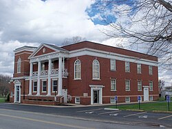
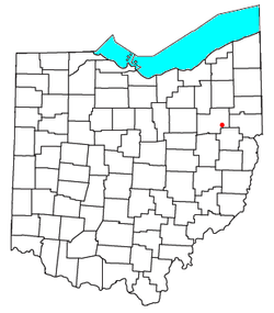
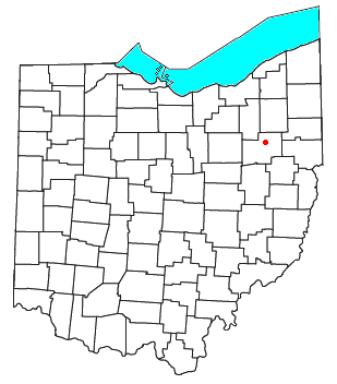
Paris Township is one of the seventeen townships of Stark County, Ohio, United States. The 2020 census found 5,743 people in the township.
Brown Township is one of the fourteen townships of Carroll County, Ohio, United States. As of the 2020 census the township had a population of 7,214.
Buffalo is an unincorporated community and census-designated place in eastern Valley Township, Guernsey County, Ohio, United States. As of the 2020 census it had a population of 373. It has a post office with the ZIP code 43722. It lies along State Route 313.

Kilbourne is a census-designated place in eastern Brown Township, Delaware County, Ohio, United States. As of the 2020 census it had a population of 127. The community has a post office with the ZIP code of 43032. It lies along State Route 521.

Oceola is a census-designated place (CDP) in central Tod Township, Crawford County, Ohio, United States. As of the 2020 census its population was 156. It has a post office with the ZIP code 44860. It is located along the road that was U.S. Route 30 until being upgraded to a freeway.

Glencoe is a census-designated place in southern Richland Township, Belmont County, Ohio, United States. As of the 2020 census it had a population of 264. It has a post office with the ZIP code 43928.
Ridgeville Corners is an unincorporated community and census-designated place (CDP) in southern Ridgeville Township, Henry County, Ohio, United States. It has a post office with the ZIP code 43555. The population was 416 at the 2020 census.

Damascus is an unincorporated community and census-designated place in southern Mahoning and northern Columbiana counties in the U.S. state of Ohio. As of the 2020 census, it had a population of 418. The community lies at the intersection of U.S. Route 62 and State Routes 173 and 534.

East Rochester is an unincorporated community and census-designated place (CDP) in southern West Township, Columbiana County, Ohio, United States. The population was 224 as of the 2020 census. It lies along U.S. Route 30, and has a post office with the ZIP code 44625. It is a part of the Salem micropolitan area, about 20 miles (32 km) east of Canton.

New Marshfield is a census-designated place in central Waterloo Township, Athens County, Ohio, United States. The population was 316 at the 2020 census. It has a post office with the ZIP code 45766. It is located along State Route 56 west of the county seat of Athens.

North Lawrence is a census-designated place in southwestern Lawrence Township, Stark County, Ohio, United States. It has a post office with the ZIP code 44666. The community is part of the Canton–Massillon Metropolitan Statistical Area. The population was 212 at the 2020 census.
Middlebranch is a census-designated place in northeastern Plain Township, Stark County, Ohio, United States. It is located about 7 miles Northeast of Canton. It has a post office with the ZIP code 44652. The community is part of the Canton–Massillon Metropolitan Statistical Area. The population was 2,117 at the 2020 census. Trains from the Wheeling and Lake Erie Railway often run through the area carrying loads of scrap metal bound for other Ohio cities.

Maximo is an unincorporated community in northwestern Washington Township, Stark County, Ohio, United States. It has a post office with the ZIP code 44650. The community is part of the Canton–Massillon Metropolitan Statistical Area.

McDermott is a census-designated place in western Rush Township, Scioto County, Ohio, United States. As of the 2020 census it had a population of 308. It has a post office with the ZIP code 45652.

Eureka is an unincorporated community and census-designated place (CDP) in Clinton County in the U.S. state of Michigan. The population of the CDP was 233 at the 2020 census. The community is located within Greenbush Township.

North Industry is a census-designated place in southern Canton Township, Stark County, Ohio, United States, along the Nimishillen Creek. Its altitude is 1,001 feet (305 m). The community is part of the Canton–Massillon Metropolitan Statistical Area. The population was 1,528 at the 2020 census.

The Canton–Massillon metropolitan statistical area, as defined by the United States Census Bureau, is an area consisting of two counties in Northeast Ohio, anchored by the cities of Canton and Massillon. As of the 2010 census, the MSA had a population of 404,422. The MSA is also part of the Cleveland–Akron–Canton, OH Combined Statistical Area, which had a population of 3,515,646 in 2010, making it the largest CSA in Ohio.