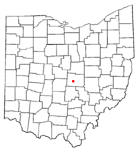
Beechwood Trails is a census-designated place (CDP) in Harrison Township, Licking County, Ohio, United States. The population was 3,276 at the 2020 census.

Granville South is a census-designated place (CDP) in Licking County, Ohio, United States. The population was 1,420 at the 2020 census.

Harbor Hills is a census-designated place (CDP) in southern Licking County, Ohio, United States. The population was 1,565 at the 2020 census.

Eaton Estates is an unincorporated community and census-designated place (CDP) in Lorain County, Ohio, United States. The population was 1,155 at the 2020 census.

Oakwood is an unincorporated area and census-designated place (CDP) in Lawrence County, Pennsylvania, United States. The population was 2,270 at the 2010 census.

Brown Township is one of the fourteen townships of Carroll County, Ohio, United States. As of the 2020 census the township had a population of 7,214.

New Haven is an unincorporated community and census-designated place (CDP) in central New Haven Township, Huron County, Ohio, United States. As of the 2020 census the population was 356. It has a post office with the ZIP code 44850. It lies at the intersection of U.S. Route 224 with State Routes 61 and 598.
Frizzleburg is an unincorporated community and census-designated place (CDP) in Lawrence County, Pennsylvania, United States. The population was 602 at the 2010 census.
Kanauga is an unincorporated community and census-designated place (CDP) in Gallia County, Ohio, United States. As of the 2020 census it had a population of 185.

Pottery Addition is a census-designated place (CDP) in Jefferson County, Ohio, United States. Its population was 258 as of the 2020 census. The community is located along the Ohio River and is served by Ohio State Route 7.

New Boston is a census-designated place (CDP) comprising the main village in the town of New Boston, Hillsborough County, New Hampshire, United States. As of the 2020 census, the population of the CDP was 326, out of 6,108 in the entire town.
Saybrook-on-the-Lake is an unincorporated community and census-designated place (CDP) on the shore of Lake Erie in Ashtabula County, Ohio, United States. It was first listed as a CDP prior to the 2020 census.
Pekin is an unincorporated community and census-designated place (CDP) in Carroll County, Ohio, United States. It was first listed as a CDP prior to the 2020 census.

Salem Heights is an unincorporated community and census-designated place (CDP) in Columbiana County, Ohio, United States. It was first listed as a CDP prior to the 2020 census, in which its population was 336. Salem Heights sits on the 1,275-foot (389 m) Blackburn Hill, separated from the city of Salem by the valley of the Middle Fork of the Little Beaver Creek. It is part of the Salem micropolitan area.
Miller is an unincorporated community and census-designated place (CDP) in Lawrence County, Ohio, United States, along the Ohio River. It was first listed as a CDP prior to the 2020 census.

East Alliance is an unincorporated community and census-designated place (CDP) in Mahoning County, Ohio, United States. It was first listed as a CDP prior to the 2020 census.
Lincoln Heights is an unincorporated area and census-designated place (CDP) in Richland County, Ohio, United States. It was first listed as a CDP prior to the 2020 census.
Wilkshire Hills is an unincorporated community and census-designated place (CDP) in Tuscarawas County, Ohio, United States. It was first listed as a CDP in the 2020 census.
Castleton Four Corners is a census-designated place (CDP) in the town of Castleton, Rutland County, Vermont, United States. It consists of the unincorporated villages of Castleton Corners and Hydeville. As of the 2020 census, the CDP had a population of 699, out of 4,458 in the entire town.
West Dunbar is an unincorporated community and census-designated place (CDP) in Kanawha County, West Virginia, United States. As of the 2020 census, it had a population of 617.


