Uniontown, Ohio

Last updated
Uniontown, Ohio
CDP
Uniontown 6-18-24 thumbnail IMG 0523.jpg
OHMap-doton-Uniontown.png
Location of Uniontown, Ohio
Detailed map of Uniontown, Ohio.png
Detailed map of Uniontown
Coordinates: 40°57′48″N81°24′22″W / 40.96333°N 81.40611°W / 40.96333; -81.40611
Country United States
State Ohio
County Stark
Summit
Township Lake
Area
[1]
  Total4.20 sq mi (10.89 km2)
  Land4.18 sq mi (10.83 km2)
  Water0.02 sq mi (0.06 km2)
Elevation
[2]
1,132 ft (345 m)
Population
 (2020)
  Total7,173
  Density1,715.21/sq mi (662.21/km2)
Time zone UTC-5 (Eastern (EST))
  Summer (DST) UTC-4 (EDT)
ZIP code
44685
Area code 330
FIPS code 39-78736 [3]
GNIS feature ID2393262 [2]

Uniontown is a census-designated place (CDP) in Stark County, Ohio, United States. The population was 7,173 at the 2020 census.

Contents

The Industrial Excess Landfill, now a superfund site, is located south of Uniontown. [4]

Uniontown is part of the Canton-Massillon, OH Metropolitan Statistical Area.

History

Uniontown was platted in 1816. [5] Two stagecoach lines which met near the original town site caused the name "Union" to be selected. [6] By the 1830s, Uniontown had a church, schoolhouse, tannery, tavern, and two stores. [7] A post office called Uniontown has been in operation since 1920. [8]

Superfund Site

A pit from prior sand and gravel mining was turned into a landfill in 1966, the so called Industrial Excess Landfill (IEL), which accepted solid and liquid waste of Akron's rubber industry as well as black shale and coal ash, military waste, and various other industrial wastes including plutonium, according to former landfill owner Charles Kittinger. The 30 acre landfill closed in 1980 and left soil and groundwater contamination behind, with recurring plumes of toxic vapors for years to come. [9] In 1983, concerned citizens raised the issue of health effects from IEL's contamination. [10] EPA listed IEL as a Superfund site in 1984. They determined that a toxic plume moved in a radial pattern away from the site in all directions. A soil vapor intrusion control system was installed in areas where residents could not be evacuated. In 1989, EPA hired Tetra Tech to conduct cleanup efforts. [10] In 2004, EPA considering the clean-up finished and shut down monitoring wells. [9]

Geography

Uniontown is located along the Tuscarawas River. [11]

According to the United States Census Bureau, the CDP has a total area of 2.5 square miles (6.5 km2), of which 2.5 square miles (6.5 km2) is land and 0.04 square miles (0.10 km2) (0.79%) is water.

Demographics

Historical population
CensusPop.Note
2020 7,173
U.S. Decennial Census [12]

Uniontown is part of the Canton-Massillon, OH Metropolitan Statistical Area. At the 2000 census there were 2,802 people, 1,141 households, and 861 families in the CDP. The population density was 1,122.5 inhabitants per square mile (433.4/km2). There were 1,171 housing units at an average density of 469.1 per square mile (181.1/km2). The racial makeup of the CDP was 98.14% White, 0.32% African American, 0.14% Native American, 0.54% Asian, 0.14% from other races, and 0.71% from two or more races. Hispanic or Latino of any race were 0.50%. [3]

Of the 1,141 households 26.2% had children under the age of 18 living with them, 65.7% were married couples living together, 7.4% had a female householder with no husband present, and 24.5% were non-families. 21.5% of households were one person and 10.2% were one person aged 65 or older. The average household size was 2.46 and the average family size was 2.86.

The age distribution was 20.9% under the age of 18, 5.9% from 18 to 24, 24.6% from 25 to 44, 30.3% from 45 to 64, and 18.3% 65 or older. The median age was 44 years. For every 100 females there were 90.4 males. For every 100 females age 18 and over, there were 88.5 males.

The median household income was $47,206 and the median family income was $60,510. Males had a median income of $45,212 versus $28,625 for females. The per capita income for the CDP was $23,108. About 0.8% of families and 2.7% of the population were below the poverty line, including none of those under age 18 and 4.2% of those age 65 or over.

Education

Uniontown has a public library, a branch of Stark County District Library. [13]

Related Research Articles

<span class="mw-page-title-main">Stark County, Ohio</span> County in Ohio, United States

Stark County is a county located in the northeastern part of U.S. state of Ohio. As of the 2020 census, the population was 374,853. Its county seat is Canton. The county was created in 1808 and organized the next year. It is named for John Stark, an officer in the American Revolutionary War.

<span class="mw-page-title-main">Uniontown, Alabama</span> City in Alabama, United States

Uniontown is a city in Perry County, Alabama, in west-central Alabama. As of the 2020 census, the population of the city is 2,107, up 18.7% over 2010. Of the 573 cities in Alabama, Uniontown is the 207th most populous.
<span class="mw-page-title-main">Emelle, Alabama</span> Town in Alabama, United States

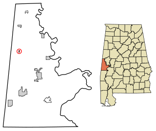
Emelle is a town in Sumter County, Alabama, United States. It was named after the daughters of the man who donated the land for the town. The town was started in the 19th century but not incorporated until 1981. The daughters of the man who donated were named Emma Dial and Ella Dial, so he combined the two names to create Emelle. Emelle was famous for its great cotton. The first mayor of Emelle was James Dailey. He served two terms. The current mayor is Roy Willingham Sr. The population was 32 at the 2020 census.
<span class="mw-page-title-main">Highfield-Cascade, Maryland</span> CDP in Maryland, United States

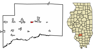
Highfield-Cascade is a census-designated place (CDP) in Washington County, Maryland, United States. The CDP is, however, more commonly referred to as just Cascade, MD. The official CDP name encompasses two closely-spaced unincorporated communities, Highfield and Cascade. The population of the CDP was 1,141 at the 2000 census.

<span class="mw-page-title-main">Oshtemo Township, Michigan</span> Charter township in Michigan, United States

Oshtemo Charter Township is a charter township of Kalamazoo County in the U.S. state of Michigan. The 2020 census recorded a population of 23,747, up from 21,705 at the 2010 census. The township was organized in 1839.

<span class="mw-page-title-main">Fort Shawnee, Ohio</span> CDP in Ohio, United States

Fort Shawnee is census-designated place (CDP) in Allen County, Ohio, United States. The population was 6,263 at the 2020 census. It is included in the Lima, Ohio Metropolitan Statistical Area. Fort Shawnee is adjacent to the city of Lima and the village of Cridersville in Auglaize County. In 2012, village residents voted to disincorporate the village. According to the United States Census Bureau, the village had a total area of 7.25 square miles (18.78 km2), of which 7.21 square miles (18.67 km2) is land and 0.04 square miles (0.10 km2) is water.

<span class="mw-page-title-main">Mack North, Ohio</span> Former CDP in Ohio, United States

Mack North was a census-designated place (CDP) in Hamilton County, Ohio, United States. The population was 3,529 at the 2000 census. For the 2010 census, it became part of the Mack CDP.
<span class="mw-page-title-main">Greentown, Ohio</span> Census-designated place in Ohio, United States

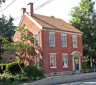
Greentown is a census-designated place in northern Stark County, Ohio, United States. The population was 3,382 at the 2020 census. It is part of the Canton–Massillon metropolitan area.

<span class="mw-page-title-main">Hartville, Ohio</span> Village in Ohio, United States

Hartville is a village in northern Stark County, Ohio, United States. The population was 3,329 at the 2020 census. It is part of the Canton–Massillon metropolitan area. Hartville lies halfway between Akron and Canton at the intersection of State Routes 43 and 619.

<span class="mw-page-title-main">Limaville, Ohio</span> Census-designated place in Ohio, United States

Limaville is a census-designated place (CDP) and former village in Stark County, Ohio, United States. The population was 151 at the 2020 census. It is part of the Canton–Massillon Metropolitan Statistical Area.

<span class="mw-page-title-main">Meyers Lake, Ohio</span> Village in Ohio, United States

Meyers Lake is a village in central Stark County, Ohio, United States. The population was 724 at the 2020 census. It is part of the Canton–Massillon metropolitan area.
<span class="mw-page-title-main">Perry Heights, Ohio</span> Census-designated place in Ohio, United States

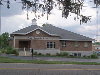
Perry Heights is a census-designated place in Stark County, Ohio, United States. The population was 8,391 at the 2020 census. It is part of the Canton–Massillon metropolitan area.

<span class="mw-page-title-main">Union Township, Adams County, Pennsylvania</span> Township in Pennsylvania, United States

Union Township is a township in Adams County, Pennsylvania, United States. The population was 3,148 at the 2010 census.

<span class="mw-page-title-main">East Uniontown, Pennsylvania</span> Census-designated place in Pennsylvania, United States

East Uniontown is a census-designated place (CDP) in Fayette County, Pennsylvania, United States. The population was 2,419 at the 2010 census, down from 2,760 at the 2000 census.
<span class="mw-page-title-main">Hopwood, Pennsylvania</span> Census-designated place in Pennsylvania, United States

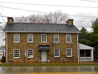
Hopwood is a census-designated place (CDP) in Fayette County, Pennsylvania, United States. The population was 2,090 at the 2010 census, up from 2,006 at the 2000 census. It is located in North Union and South Union townships. The village was named after John Hopwood.

Walterhill, also known as Walter Hill, is a census-designated place (CDP) in Rutherford County, Tennessee. The population was 401 at the 2010 census.

<span class="mw-page-title-main">Erlands Point-Kitsap Lake, Washington</span> Former CDP in Washington, United States

Erlands Point-Kitsap Lake is an unincorporated area and former census-designated place (CDP) in Kitsap County, Washington, United States. The population was 2,935 at the 2010 census. For the 2020 census, the area was split into two CDPs, Erlands Point and Kitsap Lake.

<span class="mw-page-title-main">Evansville, Wyoming</span> Town in Wyoming, United States

Evansville is a town in Natrona County, Wyoming, United States. It is part of the Casper, Wyoming Metropolitan Statistical Area. The population was 2,746 at the 2020 census.
<span class="mw-page-title-main">Hooven, Ohio</span> Census-designated place in Ohio, United States

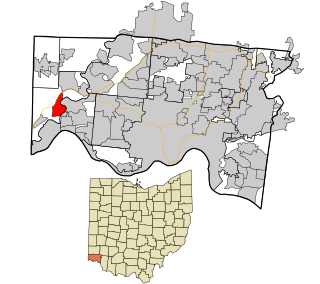
Hooven is a census-designated place (CDP) in southeastern Whitewater Township, Hamilton County, Ohio, United States. The population was 464 at the 2020 census.

<span class="mw-page-title-main">Casmalia, California</span> Census-designated place in California, United States

Casmalia is a census-designated place (CDP) in Santa Barbara County, California located just outside the borders of Vandenberg Air Force Base about 5 miles (8.0 km) southwest of Santa Maria. The ZIP Code is 93429, and the community is inside area code 805. The population was 138 at the 2010 census.

References

  1. "ArcGIS REST Services Directory". United States Census Bureau. Retrieved September 20, 2022.
  2. 1 2 U.S. Geological Survey Geographic Names Information System: Uniontown, Ohio
  3. 1 2 "U.S. Census website". United States Census Bureau . Retrieved 2008-01-31.
  4. "Superfund Record of Decision" (PDF). United States Environmental Protection Agency Ohio. 1989-07-17. Archived from the original (PDF) on 2017-02-16. Retrieved 2020-08-23.
  5. Lehman, John H. (1916). A Standard History of Stark County, Ohio: An Authentic Narrative of the Past, with Particular Attention to the Modern Era in the Commercial, Industrial, Civic and Social Development. Lewis Publishing Company. p. 80.
  6. Overman, William Daniel (1958). Ohio Town Names. Akron, OH: Atlantic Press. p. 136.
  7. Kilbourn, John (1833). The Ohio Gazetteer, or, a Topographical Dictionary. Scott and Wright. pp.  455 . Retrieved 12 December 2013.
  8. "Stark County". Jim Forte Postal History. Retrieved 21 January 2016.
  9. 1 2 Cooley, Patrick; clevel; .com (2017-01-26). "The 16 most toxic sites in Ohio, according to the EPA". Cleveland.com, Advanced Local Media. Retrieved 2020-08-23.
  10. 1 2 Burns, Karpani (2020-08-20). "2020 hindsight brings corrupted radiation testing into focus at the EPA – Part 1". San Francisco Bay View. Retrieved 2020-08-23.
  11. DeLorme (1991). Ohio Atlas & Gazetteer. Yarmouth, Maine: DeLorme. ISBN   0-89933-233-1.
  12. "Census of Population and Housing". Census.gov. Retrieved June 4, 2016.
  13. "Locations". Stark County District Library. Retrieved 3 March 2018.