Rodemer, Kentucky

Last updated
Rodemer
USA Kentucky location map.svg
Red pog.svg
Rodemer
Location within the state of Kentucky
Usa edcp location map.svg
Red pog.svg
Rodemer
Rodemer (the United States)
Coordinates: 36°43′09″N86°13′46″W / 36.71917°N 86.22944°W / 36.71917; -86.22944 Coordinates: 36°43′09″N86°13′46″W / 36.71917°N 86.22944°W / 36.71917; -86.22944
Country Flag of the United States.svg United States
State Flag of Kentucky.svg  Kentucky
County Allen
Elevation
761 ft (232 m)
Time zone UTC-5 (Central (CST))
  Summer (DST) UTC-4 (CDT)
ZIP codes
42164
GNIS feature ID508962 [1]

Rodemer is a rural unincorporated community in central Allen County, Kentucky, United States. [1] [2]

Unincorporated area Region of land not governed by own local government

In law, an unincorporated area is a region of land that is not governed by a local municipal corporation; similarly an unincorporated community is a settlement that is not governed by its own local municipal corporation, but rather is administered as part of larger administrative divisions, such as a township, parish, borough, county, city, canton, state, province or country. Occasionally, municipalities dissolve or disincorporate, which may happen if they become fiscally insolvent, and services become the responsibility of a higher administration. Widespread unincorporated communities and areas are a distinguishing feature of the United States and Canada. In most other countries of the world, there are either no unincorporated areas at all, or these are very rare; typically remote, outlying, sparsely populated or uninhabited areas.
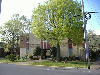
Allen County, Kentucky county in Kentucky, United States

Allen County is a county located in the U.S. state of Kentucky. As of the 2010 census, the population was 19,956. Its county seat is Scottsville. The county is named for Colonel John Allen, a state senator and soldier who was killed leading the 1st Regiment of Kentucky Rifleman at the Battle of Frenchtown, Michigan during the War of 1812. Allen County is a prohibition or completely dry county. It was formed in 1815 from parts of Barren and Warren counties.

Related Research Articles

Simpson County, Kentucky county in Kentucky, United States

Simpson County is a county located in the Pennyroyal Plateau region the U.S. state of Kentucky. As of the 2010 census, the population was 17,327. Its county seat is Franklin.

Scottsville, Kentucky City in Kentucky, United States

Scottsville is a home rule-class city in Allen County, Kentucky, in the United States. It is the seat of its county. The population was 4,226 during the 2010 U.S. Census.

Allen, Kentucky City in Kentucky, United States

Allen is a home rule-class city in Floyd County, Kentucky, in the United States. The population was 193 at the 2010 census, up from 150 at the 2000 census.

Henry Dixon Allen U.S. Representative

Henry Dixon Allen was a U.S. Representative from Kentucky.

United States District Court for the Western District of Kentucky

The United States District Court for the Western District of Kentucky is the federal district court for the western part of the state of Kentucky.

1912 United States presidential election in Kentucky

The 1912 United States presidential election in Kentucky took place on November 5, 1912, as part of the 1912 United States presidential election. Kentucky voters chose thirteen representatives, or electors, to the Electoral College, who voted for president and vice president.

Allen Springs, Kentucky Unincorporated community in Kentucky, United States

Allen Springs is a rural unincorporated community in northwest Allen County, Kentucky, United States. The community is located near the terminus of Kentucky Route 240 at US Route 231.

Butlersville, Kentucky Unincorporated community in Kentucky, United States

Butlersville is a rural unincorporated community in northwest Allen County, Kentucky, United States.

Cedar Springs, Kentucky Unincorporated community in Kentucky, United States

Cedar Springs is a rural unincorporated community in northeast Allen County, Kentucky, United States. The community is located near the intersection of U.S. Route 31E and Kentucky Route 252.

Chapel Hill, Kentucky Unincorporated community in Kentucky, United States

Chapel Hill is a rural unincorporated community in southwest Allen County, Kentucky, United States.

Clare, Kentucky Unincorporated community in Kentucky, United States

Clare is a rural unincorporated community in southwest Allen County, Kentucky, United States.

Forest Springs, Kentucky Unincorporated community in Kentucky, United States

Forest Springs is a rural unincorporated community in southern Allen County, Kentucky, United States.

Maynard, Kentucky Unincorporated community in Kentucky, United States

Maynard is a rural unincorporated community in eastern Allen County, Kentucky, United States.

McElroy Ford, Kentucky Unincorporated community in Kentucky, United States

McElroy Ford is a rural unincorporated community in western Allen County, Kentucky, United States.

Meador, Kentucky Unincorporated community in Kentucky, United States

Meador is a rural unincorporated community in northern Allen County, Kentucky, United States. The community is located near the intersection of Kentucky Route 101 and Kentucky Route 1533.

Mount Aerial, Kentucky Unincorporated community in Kentucky, United States

Mount Aerial is a rural unincorporated community in eastern Allen County, Kentucky, United States.

Mount Zion, Kentucky Unincorporated community in Kentucky, United States

Mount Zion is a rural unincorporated community in southeastern Allen County, Kentucky, United States.

Raley Ford, Kentucky Unincorporated community in Kentucky, United States

Raley Ford is a rural unincorporated community in northwest Allen County, Kentucky, United States.

Trammel, Kentucky Unincorporated community in Kentucky, United States

Trammel is a rural unincorporated community in western Allen County, Kentucky, United States.

References

  1. 1 2 "Rodemer". Geographic Names Information System . United States Geological Survey.
  2. "Rodemer Populated Place Profile / Allen County, Kentucky Data". kentucky.hometownlocator.com. Retrieved February 22, 2019.