Adolphus, Kentucky

Last updated
Adolphus, Kentucky
Adolphus kentucky post office 2009.jpg
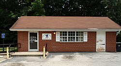
Post office in Adolphus, Kentucky
USA Kentucky location map.svg
Red pog.svg
Adolphus, Kentucky
Coordinates: 36°39′6″N86°15′41″W / 36.65167°N 86.26139°W / 36.65167; -86.26139 Coordinates: 36°39′6″N86°15′41″W / 36.65167°N 86.26139°W / 36.65167; -86.26139
Country United States
State Kentucky
County Allen
Elevation
640 ft (200 m)
Time zone UTC-6 (Central (CST))
  Summer (DST) UTC-5 (CDT)
ZIP codes
42120
Area code(s) 270
GNIS feature ID485782 [1]

Adolphus is an unincorporated community in southern Allen County, Kentucky, United States. The community is due south of Scottsville. The community is primarily a rural area on farmland.

Contents

History

A post office called Adolphus has been in operation since 1888. [2] The community has the name of Adolphus Alexander, a railroad attorney. [3]

Climate

The climate in this area is characterized by hot, humid summers and generally mild to cool winters. According to the Köppen Climate Classification system, Adolphus has a humid subtropical climate, abbreviated "Cfa" on climate maps. [4]

Related Research Articles

Oneida, Kentucky Census-designated place in Kentucky, United States

Oneida is an unincorporated community and census-designated place (CDP) in Clay County, Kentucky, United States. Its population was 410 at the 2010 census. It is the home of Oneida Baptist Institute, World Animal Foundation and Monkey Hollow Wildlife Sanctuary. Goose Creek and the Red Bird River confluence to form the South Fork of the Kentucky River a few hundred yards from the center of the town.

Summer Shade, Kentucky Unincorporated community & census-designated place in Kentucky, United States

Summer Shade is a small unincorporated community and census-designated place (CDP) in Metcalfe County, Kentucky, United States. Originally the area was known as Sartain Precinct and later as Glover's Creek; W.M. Riggs, the postmaster, changed the name to Summer Shade in 1872. The rural-dominated area is home to the Kingsford Charcoal factory. This plant is the largest briquette factory in the world. The community is part of the Glasgow Micropolitan Statistical Area. State highway 90, connecting Glasgow to the Dale Hollow Lake area, runs through Summer Shade. There was one school in Summer Shade that is formerly known as Summer Shade Elementary School. It went from grades K-6. Now students go to Metcalfe County Elementary. One of the foremost doctors in south-central Kentucky and the state during the twentieth century was Dr. C.C. Howard, who was born in Summer Shade. He worked to establish tuberculosis hospitals throughout Kentucky and to improve medical care in the rural areas of the state.

Heidelberg, Kentucky Unincorporated community in Kentucky, United States

Heidelberg is an unincorporated community in Lee County, Kentucky, United States. It lies along Route 399 southwest of the city of Beattyville, the county seat of Lee County. Its elevation is 718 feet (219 m), and it is located at (37.5553639|-83.7788073). Although it is unincorporated, it has a post office, with the ZIP code of 41333. Said post office was established in 1904, and is said to be named for the hometown of an early German-American settler. Heidelberg is also home to the modern Native American enthusiast and skilled craftsmen Marcus Abner.

Greenwich, Kansas Unincorporated community in Kansas, United States

Greenwich is an unincorporated community in Sedgwick County, Kansas, United States. It is located northeast of 53rd St North and Greenwich Rd.

Borderland, West Virginia Unincorporated community in West Virginia, United States

Borderland is an unincorporated community in Mingo County, West Virginia, United States. Borderland is located along the Tug Fork and U.S. Routes 52 and 119 3 miles (4.8 km) northwest of Williamson. Borderland had a post office, which opened on March 6, 1905, and closed on June 20, 2009.

West Paducah, Kentucky Unincorporated community in Kentucky, United States

West Paducah is an unincorporated community in McCracken County, Kentucky, United States. Its elevation is 361 feet.

Gray Hawk, Kentucky Unincorporated community in Kentucky, United States

Gray Hawk is an unincorporated community located in Jackson County, Kentucky, United States. A post office was established in the community in 1853.

Keene, Kentucky City in Kentucky, United States

Keene is a home rule-class city located in Jessamine County, Kentucky, in the United States. It is home to the Keene Springs Hotel. The U.S. Census Bureau does not record Keene as a city and does not publish a population figure for the community.

Burdine, Kentucky Unincorporated community in Kentucky, United States

Burdine is an unincorporated community and coal town in Letcher County, Kentucky, United States. Their post office operated in Burdine from 1907 to 1911.

Fedscreek, Kentucky Unincorporated community in Kentucky, United States

Fedscreek is an unincorporated community and coal town in Pike County, Kentucky, United States.

Freeburn, Kentucky Unincorporated community & census-designated place in Kentucky, United States

Freeburn is a census-designated place, unincorporated community and coal town in Pike County, Kentucky, United States.

Stanley, Kentucky Unincorporated community in Kentucky, United States

Stanley is an unincorporated community in Daviess County, Kentucky, United States. Its zip code was 42375, but its post office closed in 1997.

Meta, Kentucky Unincorporated community in Kentucky, United States

Meta is an unincorporated community in Pike County, Kentucky. Meta is located at the junction of Kentucky Route 1426 and Kentucky Route 2169 7.7 miles (12.4 km) northeast of Pikeville. The community had a post office from 1896 to 1959.

Raccoon, Kentucky Unincorporated community in Kentucky, United States

Raccoon is an unincorporated community located in Pike County, Kentucky, United States.

Dunmor, Kentucky census-designated place in Kentucky, United States

Dunmor is a census-designated place in Muhlenberg County, Kentucky, United States. It lies on the south side of the county, adjacent to Logan County.

Stephensport, Kentucky Unincorporated community in Kentucky, United States

Stephensport is an unincorporated community in Breckinridge County, Kentucky, United States. Stephensport is located on the Ohio River along Kentucky Route 144, 9.8 miles (15.8 km) north-northwest of Hardinsburg. Stephensport has a post office with ZIP code 40170, which opened on December 12, 1825.

Waynesburg, Kentucky Unincorporated community in Kentucky, United States

Waynesburg is an unincorporated community in Lincoln County, Kentucky, United States. Waynesburg is located along U.S. Route 27, Kentucky Route 328 and the Norfolk Southern Railway 3.8 miles (6.1 km) north of Eubank. Waynesburg has a post office with ZIP code 40489.

Dundee, Kentucky Unincorporated community in Kentucky, United States

Dundee is an unincorporated community in Ohio County, Kentucky, United States. Dundee is located on Kentucky Route 69, 10.5 miles (16.9 km) northeast of Hartford.

Skyline, Kentucky Unincorporated community in Kentucky, United States

Skyline is an unincorporated community located in Letcher County, Kentucky, United States. Its post office is closed.

Jeremiah, Kentucky Unincorporated community in Kentucky, United States

Jeremiah is an unincorporated community located in Letcher County, Kentucky, United States.

References

  1. "Adolphus". Geographic Names Information System . United States Geological Survey.
  2. "Allen County". Jim Forte Postal History. Retrieved 17 January 2016.
  3. Rennick, Robert M. (28 August 2013). Kentucky Place Names. University Press of Kentucky. p. 37. ISBN   978-0-8131-4401-6.
  4. Climate Summary for Adolphus, Kentucky