
The Nelson River is a river of north-central North America, in the Canadian province of Manitoba. The river drains Lake Winnipeg and runs 644 kilometres (400 mi) before it ends in Hudson Bay. Its full length is 2,575 kilometres (1,600 mi), it has mean discharge of 2,370 cubic metres per second (84,000 cu ft/s), and has a drainage basin of 1,072,300 square kilometres (414,000 sq mi), of which 180,000 square kilometres (69,000 sq mi) is in the United States.
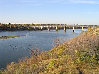
The Saskatchewan River is a major river in Canada. It stretches about 550 kilometres (340 mi) from where it is formed by the joining of the North Saskatchewan River and South Saskatchewan River just east of Prince Albert, Saskatchewan, to Lake Winnipeg. It flows roughly eastward across Saskatchewan and Manitoba to empty into Lake Winnipeg. Through its tributaries the North Saskatchewan and South Saskatchewan, its watershed encompasses much of the prairie regions of Canada, stretching westward to the Rocky Mountains in Alberta and north-western Montana in the United States.

The Assiniboine River is a 1,070-kilometre (660 mi) river that runs through the prairies of Western Canada in Saskatchewan and Manitoba. It is a tributary of the Red River. The Assiniboine is a typical meandering river with a single main channel embanked within a flat, shallow valley in some places and a steep valley in others. Its main tributaries are the Qu'Appelle, Souris, and Whitesand Rivers. For early history and exploration see Assiniboine River fur trade.

The Churchill River is a major river in Alberta, Saskatchewan and Manitoba, Canada. From the head of the Churchill Lake it is 1,609 kilometres (1,000 mi) long. It was named after John Churchill, 1st Duke of Marlborough and governor of the Hudson's Bay Company from 1685 to 1691. The Cree name for the river is Missinipi, meaning "big waters". The Denesuline name for the river is des nëdhë́, meaning "Great River".
The Mink River is a river in the Hudson Bay drainage basin in Census Division No. 22 - Thompson-North Central, Northern Region, Manitoba, Canada. It is about 14.7 kilometres (9.1 mi) long and begins at Aswapiswanan Lake at an elevation of 186 metres (610 ft). The river takes in one significant tributary, an unnamed river from the Colen Lakes, from the left at 54°29′57″N95°13′06″W before emptying into Touchwood Lake at an elevation of 184 metres (604 ft). The Mink River's waters eventually flow into Gods Lake, and via the Gods River and the Hayes River into Hudson Bay.
The Whitefish River is a river in Census Division 21 in the Northern Region of Manitoba, Canada. It is in the Hudson Bay and Nelson River drainage basins and is a left tributary of the Saskatchewan River.

The Whitefish River is a river in Census division No. 18 in northern Saskatchewan, Canada. It is in the Hudson Bay and Churchill River drainage basins.

Minago River is a river in the Hudson Bay drainage basin in Northern Manitoba, Canada. It flows in a northeasterly direction from Moon Lake into the western end of Cross Lake on the Nelson River.
Swift Creek is a river in the Hudson Bay drainage basin in Northern Manitoba, Canada. It runs from an unnamed lake to the Nelson River, which it enters as a left tributary. The river flows under the Hudson Bay Railway, between the flag stops of Charlebois to the north and Amery to the south, just past its source; and under Manitoba Provincial Road 290 just before its mouth.
Limestone Lake is a lake in Northern Manitoba, Canada. It is in the Hudson Bay drainage basin and is the source of the Limestone River.
The Broad River is a river in the Hudson Bay drainage basin in Census division 23 in Northern Manitoba, Canada. Its flows from an unnamed lake to Hudson Bay.
The Black Duck River is a river in the provinces of Manitoba and Ontario, Canada. Flowing northeast from Hosea Lake in Kenora District in Northwestern Ontario, the river criss-crosses the Manitoba-Ontario border before reaching to its mouth at Hudson Bay in the Northern Region of Manitoba just west of Manitoba's easternmost point where the inter-provincial border meets the bay.
Goose Creek is a river in the Hudson Bay drainage basin in Northern Manitoba, Canada. It runs from an unnamed lake to the Nelson River, which it enters as a left tributary. The river flows under the Hudson Bay Railway, between the flag stops of Weir River to the north and Charlebois to the south, close to its source; and under Manitoba Provincial Road 290 just before its mouth.

Lake Athapapuskow is a glacial lake in Manitoba and Saskatchewan, Canada, located 15 km (9.3 mi) southeast of Flin Flon, Manitoba. The lake is in the Hudson Bay drainage basin and is the source of the Goose River.
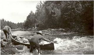
Goose River is a river in the Hudson Bay drainage basin in the Northern Region of Manitoba and Division No. 18 in Saskatchewan, Canada, approximately 19 kilometres (12 mi) south-east of Bakers Narrows.

The Cochrane River is a river in Canadian provinces of Manitoba and Saskatchewan. Located in the boreal forest of the Canadian Shield, it flows from Wellbelove Bay on the northern end of Wollaston Lake in north-eastern Saskatchewan to the north-east end of Reindeer Lake in Manitoba. The river has a drainage basin of 28,400 square kilometres (11,000 sq mi) and is part of the Churchill River drainage basin.
The Deer River is a river in Census division 23 in Northern Manitoba, Canada. It is in the Hudson Bay drainage basin and is a right tributary of the Dog River.
The Dog River is a river in Census division 23 in Northern Manitoba, Canada. It is in the Hudson Bay drainage basin and is a right tributary of the Churchill River.
Carroll Lake is an irregularly-shaped lake in the province of Manitoba, and in the Unorganized Part of Kenora District in Northwestern province of Ontario, Canada. It is in the Hudson Bay drainage basin, and, with the exception of portions of two small bays in the west, lies mostly in Ontario. The Ontario portion of the lake is within Woodland Caribou Provincial Park, and the small Manitoba portions within Atikaki Provincial Wilderness Park.
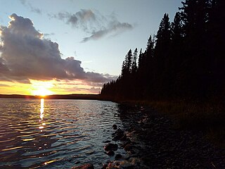
Porcupine Hills Provincial Park is the newest provincial park in the Canadian Province of Saskatchewan. It was created in 2018 through the amalgamation of five pre-existing provincial recreation sites south-east of the town of Hudson Bay. The park is in the Porcupine Provincial Forest in the Porcupine Hills, which is a geographical feature in eastern Saskatchewan and western Manitoba. The hills are part of a range of hills called the Manitoba Escarpment.


