Related Research Articles

Dry Well Creek is a stream in Harney County, Oregon, United States in the Harney Basin of Eastern Oregon. Its mouth is at an elevation of 5,000 feet (1,500 m). It is among streams in the drainage basin of Malheur Lake, a Great Basin water body with no outlet.

The Bitterroot River is a northward flowing 84-mile (135 km) river running through the Bitterroot Valley, from the confluence of its West and East forks near Conner in southern Ravalli County to its confluence with the Clark Fork River near Missoula in Missoula County, in western Montana. The Clark Fork River is tributary to the Columbia River and ultimately, the Pacific Ocean. The Bitterroot River is a Blue Ribbon trout fishery with a healthy population of native westslope cutthroat trout and bull trout. It is the third most fly fished river in Montana behind the Madison and Big Horn Rivers.

The Red Deer River is a river in Alberta and a small portion of Saskatchewan, Canada. It is a major tributary of the South Saskatchewan River and is part of the larger Saskatchewan-Nelson system that empties into Hudson Bay.
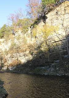
The Root River flows for 80 miles (130 km) through the Driftless Area of southeastern Minnesota and is a tributary of the Upper Mississippi River. The Root River is formed by three branches, the North, South and Middle branches of the Root River and the South Fork Root River. It is an excellent river for canoeing and fishing. The gentle to moderate flowing river drops an average of 3.4 ft/mile from Chatfield, Minnesota, to its pour point in the Mississippi River into Navigation Pool 7 just south of La Crosse, Wisconsin and east of Hokah, Minnesota.

Slate Run is a 7.3-mile-long (11.7 km) tributary of Pine Creek in Tioga and Lycoming counties, Pennsylvania in the United States.

The Thornapple River is an 88.1-mile-long (141.8 km) tributary of Michigan's longest river, the Grand River. The Thornapple rises in Eaton County, Michigan and drains a primarily rural farming area in Central Michigan. It joins the Grand in Ada, Michigan, 10 miles (16 km) east of Grand Rapids.

The Park River, sometimes called the Hog River, is a tributary of the Connecticut River in the city of Hartford, Connecticut. Between 1940 and the 1980s, the 2.3-mile (3.7 km) river was buried by the Army Corps of Engineers to prevent the spring floods regularly caused by increased surface runoff from urban development.

The Whitewater River is a 16.6-mile-long (26.7 km) tributary of the Upper Mississippi River which flows through the Driftless Area of Minnesota, reaching its mouth in Wabasha County at the community of Weaver opposite Buffalo, Wisconsin. The nearest towns are Altura, Saint Charles, and Elba. The region hosts endangered native dry oak savannas, semiforested areas that seem to have been dependent on fire for their well-being.

Hay Creek is a small trout stream in southeastern Minnesota. It has its headwaters west of Goodhue and empties into the Mississippi River just to the north of Red Wing. It runs 25.1 miles (40.4 km). Hay Creek was named for the hay meadows near its banks. A railroad once ran along Hay Creek from the claybanks near Goodhue to the pottery and stoneware factories in Red Wing, which also made use of the water from the creek. The railroad was torn up in 1937, but traces such as trestle pilings remain.
Pine Creek is a 23.7-mile-long (38.1 km) tributary of the Mississippi River in Winona and Houston counties, Minnesota, United States. Pine Creek joins the Mississippi southeast of La Crescent, Minnesota, directly across from La Crosse, Wisconsin.

The Potlatch River is in the state of Idaho in the United States. About 56 miles (90 km) long, it is the lowermost major tributary to the Clearwater River, a tributary of the Snake River that is in turn a tributary of the Columbia River. Once surrounded by arid grasslands of the Columbia Plateau adjacent to the western foothills of the Rocky Mountains, the Potlatch today is used mainly for agriculture and irrigation purposes.
Money Creek is a stream in Houston and Winona counties, in the U.S. state of Minnesota. It is a tributary of the Root River. Money Creek was so named when a passerby's money blew into the creek and was lost.
Camp Creek is a stream in Fillmore County, in the U.S. state of Minnesota. It is a tributary of the South Branch Root River. Camp Creek was named from the fact pioneer settlers camped upon its banks.
Crooked Creek is a stream in Houston County, in the U.S. state of Minnesota. Crooked Creek was so named on account of its irregular course.
Badger Creek is a stream in Houston County, in the U.S. state of Minnesota. It is a tributary of the South Fork Root River, which it meets east of Houston, Minnesota. Badger Creek was named for the badgers once common in the area.
The Raven River or South Raven River is a major tributary of the Red Deer River located in Central-Western Alberta, Canada. The river is located in both the Clearwater County and Red Deer County.

The North Raven River or Stauffer Creek is a major tributary of the Raven River located in western Central Alberta, Canada. It is located in the Red Deer River system. The river is a popular place for anglers.
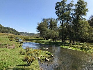
Pine Creek is a stream in Fillmore and Winona counties, in the U.S. state of Minnesota. It is a tributary of the Rush Creek, which is a tributary of the Root River. It joins the Rush Creek in the extreme north of Rushford, Minnesota. Tributaries of Pine Creek are Cooledge Creek and Hemmingway Creek.
References
- ↑ U.S. Geological Survey Geographic Names Information System: Rush Creek (Root River tributary)
- ↑ Upham, Warren (1920). Minnesota Geographic Names: Their Origin and Historic Significance. Minnesota Historical Society. p. 194.
- ↑ "44 photos: A look back at deadly 2007 flooding in the La Crosse and Winona areas". LaCross Tribune. Retrieved March 21, 2021.
- ↑ "Winona County". MN DNR. Retrieved March 20, 2021.
- ↑ "Rush Creek Project". Minnesota Trout Unlimited. Retrieved March 21, 2021.