
The Little Minnesota River is a 71.4-mile-long (114.9 km) headwaters tributary of the Minnesota River in northeastern South Dakota and west-central Minnesota in the United States. Via the Minnesota River, it is part of the Mississippi River watershed.

The Rock River is a tributary of the Big Sioux River, about 144 miles (232 km) long, in southwestern Minnesota and northwestern Iowa in the United States. Via the Big Sioux and Missouri rivers, it is part of the watershed of the Mississippi River. The river's name comes from a prominent rocky outcrop about 175 feet high of reddish-gray Sioux Quartzite, about 3 miles (5 km) north of Luverne. The outcrop of quartzite is contained in Minnesota's Blue Mounds State Park.
The Little Rock River is a tributary of the Rock River, 74.5 miles (119.9 km) long, in southwestern Minnesota and northwestern Iowa in the United States. Via the Rock, Big Sioux and Missouri rivers, it is part of the watershed of the Mississippi River.

The Whitewater River is a 16.6-mile-long (26.7 km) tributary of the Upper Mississippi River which flows through the Driftless Area of Minnesota, reaching its mouth in Wabasha County at the community of Weaver opposite Buffalo, Wisconsin. The nearest towns are Altura, Saint Charles, and Elba. The region hosts endangered native dry oak savannas, semiforested areas that seem to have been dependent on fire for their well-being.
Plum Creek is a 35.4-mile-long (57.0 km) stream near the city of Walnut Grove, Minnesota. It passes to the northwest of the town, flowing northeasterly to the Cottonwood River, with its waters then flowing to the Minnesota River and eventually the Mississippi River. Plum Creek lends its name to a regional library network.
Ashley Creek is a 28.3-mile-long (45.5 km) tributary of the Sauk River in central Minnesota, United States, joining the Sauk just north of Sauk Centre. It is part of the Mississippi River watershed.
Buffalo Creek is an 84.3-mile-long (135.7 km) river in central Minnesota. It is a tributary of the South Fork of the Crow River, which is a tributary of the Mississippi River.
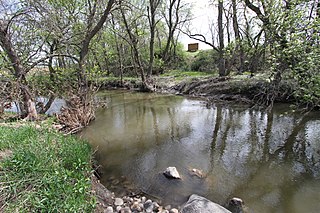
Crooked Creek is a 9.9-mile-long (15.9 km) tributary of the Mississippi River in northwestern Minnesota.
Elm Creek is an 89.5-mile-long (144.0 km) tributary of the Blue Earth River in southern Minnesota. It rises in northeastern Jackson County and flows eastwardly through Martin County into northeastern Faribault County, where it joins the Blue Earth River near the city of Winnebago. Via the Blue Earth and Minnesota rivers, it is part of the Mississippi River watershed.
Jack Creek is a 64-mile-long (103 km) stream in southern Minnesota in the United States. It is a tributary of Heron Lake, the outlet of which flows to the Des Moines River.
Lime Creek is a 19.8-mile-long (31.9 km) tributary of the Winnebago River in Minnesota and Iowa. Via the Winnebago, Shell Rock, Cedar, and Iowa rivers, it is part of the Mississippi River watershed.
Okabena Creek is a 40-mile-long (64 km) waterway in southern Minnesota. It is a tributary, via the short Diversion Creek, of Heron Lake, the outlet of which flows to the Des Moines River. Okabena Creek begins in Worthington, Minnesota, connecting by a ditch to the outlet of Okabena Lake, then flows northeast past the towns of Brewster and Okabena to the Heron Lake/South Heron Lake system.
Perch Creek is a 37.3-mile-long (60.0 km) tributary of the Watonwan River in southern Minnesota, United States. Via the Watonwan, Blue Earth, and Minnesota rivers, it is part of the Mississippi River watershed.
Pine Creek is a 23.7-mile-long (38.1 km) tributary of the Mississippi River in Winona and Houston counties, Minnesota, United States. Pine Creek joins the Mississippi southeast of La Crescent, Minnesota, directly across from La Crosse, Wisconsin.
Pipestone Creek is a 53.2-mile-long (85.6 km) river in southwestern Minnesota and northeastern South Dakota.
The Portage River is an 8.8-mile-long (14.2 km) tributary of the Moose Horn River in eastern Minnesota, United States. It flows west to the Moose Horn River, joining it at Moosehead Lake next to the city of Moose Lake. By the Moose Horn River, its waters flow to the Kettle River, St. Croix River, and ultimately the Mississippi River. Just to the east of the Portage River, Nemadji Creek flows east to the Nemadji River, a tributary of Lake Superior and part of the Saint Lawrence River basin.
Shakopee Creek is a 48.6-mile-long (78.2 km) tributary of the Chippewa River of Minnesota, United States. It is part of the Minnesota River drainage basin, flowing to the Mississippi River. It rises in Kandiyohi County at the outlet of Andrew Lake, with its major headwaters being an outlet from Games Lake about 7 miles (11 km) west northwest of New London. From Andrew it flows westerly into Swift County, where it passes near Kerkhoven. The creek briefly dips southward into Chippewa County, then reenters Swift County and continues to its mouth at the Chippewa River, 8 miles (13 km) southwest of Benson.
Sleepy Eye Creek is a 51.8-mile-long (83.4 km) tributary of the Cottonwood River of Minnesota, the United States. Via the Cottonwood River, its water flows to the Minnesota River and eventually the Mississippi River.
Winnebago Creek is a 23.6-mile-long (38.0 km) tributary of the Mississippi River in southeastern Minnesota. Winnebago Creek was named after the Winnebago Indians.
