Goodhue, Minnesota

Last updated

Goodhue
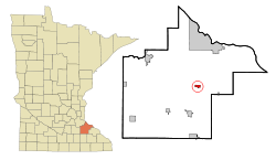
Goodhue County Minnesota Incorporated and Unincorporated areas Goodhue Highlighted.svg
Location of Goodhue, Minnesota
Coordinates: 44°24′02″N92°37′26″W / 44.40056°N 92.62389°W / 44.40056; -92.62389
Country United States
State Minnesota
County Goodhue
Area
[1]
  Total1.10 sq mi (2.85 km2)
  Land1.10 sq mi (2.85 km2)
  Water0.00 sq mi (0.00 km2)
Elevation
[2]
1,122 ft (342 m)
Population
 (2020)
  Total1,250
  Density1,136.36/sq mi (438.85/km2)
Time zone UTC−6 (Central (CST))
  Summer (DST) UTC−5 (CDT)
ZIP Code
55027
Area code 651
FIPS code 27-24398 [3]
GNIS feature ID0644219 [2]
Website www.cityofgoodhue.com

Goodhue is a city in Goodhue County, Minnesota, United States. The population was 1,176 at the 2010 census. [4]

Contents

History

James M. Goodhue. JamesMGoodhue1850.jpg
James M. Goodhue.

Goodhue was incorporated in 1889. [5] Goodhue formerly had a rail line running through the eastern edge of the incorporated area, roughly parallel to and west of State Highway 58.

The Goodhue Area Historical Society constructed a museum in the community named in honor of James M. Goodhue, [6] a newspaperman who was the first editor of the St. Paul Pioneer Press .

Since the mid-1990s, Goodhue, like many Midwestern municipalities with medium to large elevator operations, has seen its housing base and population grow.

The first significant growth in 20 years began with construction of several homes in an annexed area north of Third Avenue and west of Sixth Street known as "East side".

The Goodhue Wildcats won Class A State Championships in football in both 2003 and 2007, and the Goodhue Girls Basketball won the Class A State Championship in 2016, 2017, and 2024.

Geography

According to the United States Census Bureau, the city has a total area of 0.94 square miles (2.43 km2), all land. [7]

Minnesota State Highway 58 and County Highway 9 are two of the main routes in the community.

The Goodhue K–12 High School is located on 510 3rd Avenue, Goodhue, MN 55027. [8]

Demographics

Historical population
CensusPop.Note
1900 241
1910 40869.3%
1920 398−2.5%
1930 46717.3%
1940 4802.8%
1950 4891.9%
1960 56615.7%
1970 539−4.8%
1980 65721.9%
1990 533−18.9%
2000 77846.0%
2010 1,17651.2%
2020 1,2506.3%
U.S. Decennial Census [9]

2010 census

As of the census [10] of 2010, there were 1,176 people, 415 households, and 307 families living in the city. The population density was 1,251.1 inhabitants per square mile (483.1/km2). There were 443 housing units at an average density of 471.3 per square mile (182.0/km2). The racial makeup of the city was 89.9% White, 0.3% African American, 0.9% Native American, 0.2% Asian, 7.7% from other races, and 1.0% from two or more races. Hispanic or Latino of any race were 12.8% of the population.

There were 415 households, of which 47.2% had children under the age of 18 living with them, 61.2% were married couples living together, 8.4% had a female householder with no husband present, 4.3% had a male householder with no wife present, and 26.0% were non-families. Of all households, 23.6% were made up of individuals, and 9.9% had someone living alone who was 65 years of age or older. The average household size was 2.83 and the average family size was 3.37.

The median age in the city was 30.6 years. 32.3% of residents were under the age of 18; 8.1% were between the ages of 18 and 24; 32.1% were from 25 to 44; 17.8% were from 45 to 64; and 9.4% were 65 years of age or older. The gender makeup of the city was 50.8% male and 49.2% female.

2000 census

As of the census [3] of 2000, there were 778 people, 293 households, and 196 families living in the city. The population density was 853.8 inhabitants per square mile (329.7/km2). There were 298 housing units at an average density of 327.0 per square mile (126.3/km2). The racial makeup of the city was 95.37% White, 0.13% Native American, 0.13% Asian, 3.34% from other races, and 1.03% from two or more races. Hispanic or Latino of any race were 5.01% of the population.

There were 293 households, out of which 35.5% had children under the age of 18 living with them, 58.0% were married couples living together, 6.1% had a female householder with no husband present, and 32.8% were non-families. Of all households, 27.3% were made up of individuals, and 13.0% had someone living alone who was 65 years of age or older. The average household size was 2.66 and the average family size was 3.28.

In the city, the population was spread out, with 29.2% under the age of 18, 9.3% from 18 to 24, 29.4% from 25 to 44, 17.6% from 45 to 64, and 14.5% who were 65 years of age or older. The median age was 32 years. For every 100 females, there were 102.6 males. For every 100 females age 18 and over, there were 104.1 males.

The median income for a household in the city was $43,250, and the median income for a family was $49,531. Males had a median income of $32,031 versus $21,765 for females. The per capita income for the city was $15,873. About 1.0% of families and 3.4% of the population were below the poverty line, including none of those under age 18 and 11.3% of those age 65 or over.
Notable people

Related Research Articles

<span class="mw-page-title-main">McGregor, Minnesota</span> City in Minnesota, United States

McGregor is a city in Aitkin County, Minnesota, United States. The population was 391 at the 2010 census.

<span class="mw-page-title-main">Hampton, Minnesota</span> City in Minnesota, United States

Hampton is a city in Dakota County, Minnesota, United States. The population was 689 at the 2010 census.

<span class="mw-page-title-main">Glenville, Minnesota</span> City in Minnesota, United States

Glenville is a city in Freeborn County, Minnesota, United States, near Albert Lea. It is along the Shell Rock River. The population was 643 at the 2010 census.

<span class="mw-page-title-main">Cannon Falls, Minnesota</span> City in Minnesota, Goodhue County, United States

Cannon Falls is a city in Goodhue County, Minnesota, United States. The population was 4,083 at the 2010 census. Located along U.S. Route 52, southeast of the Twin Cities, Cannon Falls is the home of Pachyderm Studio, where many famous musicians have recorded, including Nirvana, which recorded its 1993 album In Utero there.

Florence Township is a township in Goodhue County, Minnesota, United States. The population was 1,450 at the 2000 census. A small part of the city of Lake City extends geographically within the township, but is a separate entity. The unincorporated area of Frontenac is also located within the township.

Goodhue Township is a township in Goodhue County, Minnesota, United States. The population was 530 at the 2000 census.

Hay Creek Township is a township in Goodhue County, Minnesota, United States. The population was 862 at the 2000 census. The unincorporated community of Hay Creek is located within the township.

<span class="mw-page-title-main">Kenyon, Minnesota</span> City in Minnesota, United States

Kenyon is a city in southwestern Goodhue County, Minnesota, United States, located along the North Fork of the Zumbro River. It was founded in 1856 and named in honor of Kenyon College. It is known for the Boulevard of roses on main street, which is the namesake of the town festival "Rosefest" held every August. The population was 1,815 at the 2010 census.

<span class="mw-page-title-main">Wacouta Township, Goodhue County, Minnesota</span> Township in Minnesota, United States

Wacouta Township is a township in Goodhue County, Minnesota, United States. The population was 410 at the 2000 census.

<span class="mw-page-title-main">Wanamingo, Minnesota</span> City in Minnesota, United States

Wanamingo is a community in Goodhue County, Minnesota, United States, incorporated as a city. It lies along the North Fork of the Zumbro River. The population was 1,086 at the 2010 census.

<span class="mw-page-title-main">Welch Township, Goodhue County, Minnesota</span> Township in Minnesota, United States

Welch Township is a township in Goodhue County, Minnesota, United States. It lies about halfway between the cities of Hastings and Red Wing and 36 miles southeast of Saint Paul. The population was 697 at the 2000 census. It is centered on the small community of Welch on the Cannon River. Like many river towns in the Driftless Area, it is situated at the base of the steep bluffs of the river valley.

Zumbrota Township is a township in Goodhue County, Minnesota, United States. The population was 591 at the 2000 census.

<span class="mw-page-title-main">Isanti, Minnesota</span> City in the United States

Isanti is a city in Isanti County, Minnesota, United States. The population was 6,804 at the 2020 census. The name Isanti is composed of two Dakota words: isan ("knife") and ati ("camp"), and refers to the Santee Dakota people.

<span class="mw-page-title-main">Dover, Minnesota</span> City in Minnesota, United States

Dover is a city in Olmsted County, Minnesota, United States. The population was 735 at the 2010 census.

<span class="mw-page-title-main">Grant, Minnesota</span> City in Minnesota, United States

Grant is a city in Washington County, Minnesota, and a suburb of St. Paul. The population was 4,096 at the time of the 2010 census.

<span class="mw-page-title-main">Goodview, Minnesota</span> City in Minnesota, United States

Goodview is a city in Winona County, Minnesota, United States. The population was 4,158 at the 2020 census.

<span class="mw-page-title-main">Bellechester, Minnesota</span> City in Minnesota, United States

Bellechester is a city in Goodhue and Wabasha counties in the U.S. state of Minnesota. The population was 175 at the 2010 census. Most of Bellchester is in Goodhue County, with only a small part extending into Wabasha County.

<span class="mw-page-title-main">Dennison, Minnesota</span> City in Minnesota, United States

Dennison is a city in Goodhue and Rice counties in the U.S. state of Minnesota. The population was 212 at the 2010 census. Most of Dennison is in Goodhue County, with only a small part that extends into Rice County.

<span class="mw-page-title-main">Pine Island, Minnesota</span> City in Minnesota, United States

Pine Island is a city in Goodhue and Olmsted counties in the U.S. state of Minnesota. Most of Pine Island is in Goodhue County, but a small part extends into Olmsted County, making that portion part of the Rochester metropolitan area. As of the 2020 census, the population was 3,769.

<span class="mw-page-title-main">Minneiska, Minnesota</span> City in Minnesota, United States

Minneiska is a city in Wabasha and Winona counties in the U.S. state of Minnesota. The population was 97 at the 2020 census.

References

  1. "2020 U.S. Gazetteer Files". United States Census Bureau. Retrieved July 24, 2022.
  2. 1 2 U.S. Geological Survey Geographic Names Information System: Goodhue, Minnesota
  3. 1 2 "U.S. Census website". United States Census Bureau . Retrieved January 31, 2008.
  4. "2010 Census Redistricting Data (Public Law 94-171) Summary File". American FactFinder. United States Census Bureau . Retrieved April 27, 2011.[ dead link ]
  5. Upham, Warren (1920). Minnesota Geographic Names: Their Origin and Historic Significance. Minnesota Historical Society. p.  207.
  6. Gannett, Henry (1905). The Origin of Certain Place Names in the United States. Govt. Print. Off. pp.  139.
  7. "US Gazetteer files 2010". United States Census Bureau. Archived from the original on January 25, 2012. Retrieved November 13, 2012.
  8. "Goodhue Public Schools [homepage]". Goodhue Public Schools. Retrieved August 15, 2023.
  9. "Census of Population and Housing". Census.gov. Retrieved June 4, 2015.
  10. "U.S. Census website". United States Census Bureau . Retrieved November 13, 2012.
  11. Hevesi, Dennis (June 22, 2010). "Gerald W. Heaney, a Judge Who Ruled for the Desegregation of Public Schools, Dies at 92". The New York Times .
  12. Minnesota Legislators: Past & Present-Victor H. Schulz