Stanton Township, Goodhue County, Minnesota

Last updated
Stanton Township, Minnesota
USA Minnesota location map.svg
Red pog.svg
Stanton Township, Minnesota
Location within the state of Minnesota
Usa edcp location map.svg
Red pog.svg
Stanton Township, Minnesota
Stanton Township, Minnesota (the United States)
Coordinates: 44°29′1″N92°58′9″W / 44.48361°N 92.96917°W / 44.48361; -92.96917 Coordinates: 44°29′1″N92°58′9″W / 44.48361°N 92.96917°W / 44.48361; -92.96917
Country United States
State Minnesota
County Goodhue
Area
  Total23.9 sq mi (61.8 km2)
  Land22.7 sq mi (58.9 km2)
  Water1.1 sq mi (2.9 km2)
Elevation
902 ft (275 m)
Population
 (2010)
  Total1,130
Time zone UTC-6 (Central (CST))
  Summer (DST) UTC-5 (CDT)
ZIP code
55018
Area code 507
FIPS code 27-62428 [1]
GNIS feature ID0665695 [2]
FIPS code 27-62428 [3]

Stanton Township is a township in Goodhue County, Minnesota, United States. The population was 1,130 at the 2010 census.

Contents

Stanton Township was organized in 1858, and named for William Stanton, an early settler. [4]

Geography

Stanton Township is located in the northwest corner of Goodhue County, and immediately adjacent to Dakota County. Rice County is also nearby. The community of Stanton is located within Stanton Township. State Highway 19 (MN 19) and State Highway 56 (MN 56) are two of the main routes in the township.

According to the United States Census Bureau, the township has a total area of 23.9 square miles (61.8 km2), of which 22.7 square miles (58.8 km2) is land and 1.1 square miles (2.9 km2) (4.74%) is water.

Demographics

As of the census [3] of 2010, there were 1,130 people living in the township. The population density was 49.8 inhabitants per square mile (19.2/km2). There were 434 housing units at an average density of 19.1/sq mi (6.5/km2). The racial makeup of the township was 98.05% White, 0.09% Native American, 0.27% Asian, 0.18% African American, 0.44% from other races, and 0.97% from two or more races. Hispanic or Latino of any race were 1.59% of the population.

There were 410 households, out of which 34.6% had children under the age of 18 living with them.

In the township the population was spread out, with 24.8% under the age of 18, 6.7% from 18 to 24, 8.9% from 25 to 34, 23.3% from 35 to 49, 23.9% from 50 to 64, and 12.4% who were 65 years of age or older. For every 100 females, there were 110.0 males.

As of the census [1] of 2000, the median income for a household in the township was $60,972, and the median income for a family was $65,000. Males had a median income of $41,033 versus $27,768 for females. The per capita income for the township was $23,473. About 2.8% of families and 2.8% of the population were below the poverty line, including 2.4% of those under age 18 and 6.8% of those age 65 or over.

Related Research Articles

<span class="mw-page-title-main">Rice County, Minnesota</span> County in Minnesota, United States

Rice County is a county located in the south central portion of the U.S. state of Minnesota. As of the 2020 census, the population was 67,097. Its county seat is Faribault.

<span class="mw-page-title-main">Goodhue County, Minnesota</span> County in Minnesota, United States

Goodhue County is a county in the U.S. state of Minnesota. As of the 2020 census, the population was 47,582. Its county seat is Red Wing. Nearly all of Prairie Island Indian Community is within the county.

<span class="mw-page-title-main">Dodge County, Minnesota</span> County in Minnesota, United States

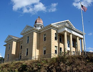
Dodge County is a county in the U.S. state of Minnesota. The population was 20,867 as of the 2020 census. Its county seat is Mantorville.

Midway Township is a township in Cottonwood County, Minnesota, United States. The population was 219 at the 2010 census. The city of Mountain Lake is located in the township.

<span class="mw-page-title-main">Randolph, Minnesota</span> City in Minnesota, United States

Randolph is a city in Dakota County, Minnesota, United States. The population was 436 at the 2010 census.

Cannon Falls Township is a township in Goodhue County, Minnesota, United States. The population was 1,236 at the 2000 census.

<span class="mw-page-title-main">Goodhue, Minnesota</span> City in Minnesota, United States

Goodhue is a city in Goodhue County, Minnesota, United States. The population was 1,176 at the 2010 census.

Goodhue Township is a township in Goodhue County, Minnesota, United States. The population was 530 at the 2000 census.

Hay Creek Township is a township in Goodhue County, Minnesota, United States. The population was 862 at the 2000 census. The unincorporated community of Hay Creek is located within the township.

<span class="mw-page-title-main">Minneola Township, Goodhue County, Minnesota</span> Township in Minnesota, United States

Minneola Township is a township in Goodhue County, Minnesota, United States. The population was 657 at the 2000 census.

Pine Island Township is a township located in Goodhue County, Minnesota, United States. As of the 2000 census, the township had a total population of 628.

Roscoe Township is a township in Goodhue County, Minnesota, United States. The population was 784 at the 2000 census.

Vasa Township is a township in Goodhue County, Minnesota, United States. The population was 872 at the 2000 census.

<span class="mw-page-title-main">Wacouta Township, Goodhue County, Minnesota</span> Township in Minnesota, United States

Wacouta Township is a township in Goodhue County, Minnesota, United States. The population was 410 at the 2000 census.

Wanamingo Township is a township in Goodhue County, Minnesota, United States. The population was 504 at the 2000 census.

Warsaw Township is a township in Goodhue County, Minnesota, United States. The population was 603 at the 2000 census.

Carpenter Township is a township in Itasca County, Minnesota, United States. The population was 179 at the 2010 census.

Culdrum Township is a township in Morrison County, Minnesota, United States. The population was 505 at the 2000 census.

Brandsvold Township is a township in Polk County, Minnesota, United States. The population was 241 at the 2000 census. It is part of the Grand Forks-ND-MN Metropolitan Statistical Area.

<span class="mw-page-title-main">Pike Township, St. Louis County, Minnesota</span> Township in Minnesota, United States

Pike Township is a township in Saint Louis County, Minnesota, United States. The population was 417 at the 2010 census.

References

  1. 1 2 "U.S. Census website". United States Census Bureau . Retrieved 2008-01-31.
  2. "US Board on Geographic Names". United States Geological Survey. 2007-10-25. Retrieved 2008-01-31.
  3. 1 2 "Interactive Population Map". United States Census Bureau . Retrieved 2015-03-19.
  4. Upham, Warren (1920). Minnesota Geographic Names: Their Origin and Historic Significance. Minnesota Historical Society. p.  208.