Belvidere Township is a township in Goodhue County, Minnesota, United States. The population was 458 at the 2000 census.
Leon Township is a township in Goodhue County, Minnesota, United States. The population was 942 at the 2000 census.
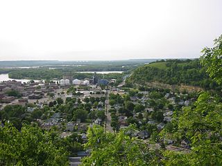
Red Wing is a city in Goodhue County, Minnesota, United States, along the upper Mississippi River. The population was 16,547 at the 2020 census. It is the county seat of Goodhue County.
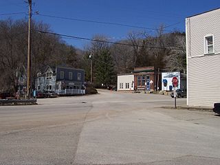
Welch is an unincorporated community in Welch Township, Goodhue County, Minnesota, United States.
Stanton is an unincorporated community in Stanton Township, Goodhue County, Minnesota, United States.
Philbrook is an unincorporated community in Todd County, Minnesota, United States. It is along Todd County Road 28 near Red Pine Road. Nearby places include Staples, Motley, Cushing, and Browerville.
Moland is an unincorporated community in Rice and Steele counties in the U.S. state of Minnesota.
Hader is an unincorporated community in Goodhue County, Minnesota, United States.
Eggleston is a neighborhood of the city of Red Wing in Goodhue County, Minnesota, United States.
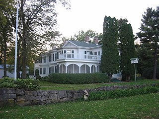
Frontenac is an unincorporated community and census-designated place (CDP) in Florence Township, Goodhue County, Minnesota, United States, on the Mississippi River. As of the 2010 census, its population was 282.
Belvidere Mills is an unincorporated community in Belvidere Township, Goodhue County, Minnesota, United States.
White Rock is an unincorporated community in Goodhue County, Minnesota, United States.
Lamoille is an unincorporated community in Richmond Township, Winona County, Minnesota, United States. Big Trout Creek and the Mississippi River meet at Lamoille.
Wastedo is an unincorporated community in Leon Township, Goodhue County, Minnesota, United States.
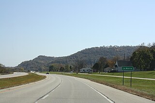
Sogn is an unincorporated community in Warsaw Township, Goodhue County, Minnesota, United States.
Hay Creek is an unincorporated community in Hay Creek Township, Goodhue County, Minnesota, United States.
Wacouta is an unincorporated community in Wacouta Township, Goodhue County, Minnesota, United States.
Claybank is an unincorporated community in Goodhue Township, Goodhue County, Minnesota, United States.
Belle Creek is an unincorporated community in Belle Creek Township, Goodhue County, Minnesota, United States.
Rossburg is an unincorporated community in Spencer Township, Aitkin County, Minnesota, United States. The community is located along 350th Avenue near the junction with Aitkin County Road 5, 360th Street. Nearby places include Aitkin, Glen, and Kimberly. State Highway 47 is nearby.


