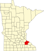
Goodhue County is a county in the U.S. state of Minnesota. As of the 2020 census, the population was 47,582. Its county seat is Red Wing. Nearly all of Prairie Island Indian Community is within the county.

Kenyon is a city in southwestern Goodhue County, Minnesota, United States, located along the North Fork of the Zumbro River. It was founded in 1856 and named in honor of Kenyon College. It is known for the Boulevard of roses on main street, which is the namesake of the town festival "Rosefest" held every August. The population was 1,815 at the 2010 census.

Clinton Township is a township in Saint Louis County, Minnesota, United States. Clinton Township was named for Clinton Markell, a prominent settler. The population was 1,015 at the 2010 census.

Fayal Township is an urban township in Saint Louis County, Minnesota, United States. The population was 1,809 at the 2010 census.

Morcom Township is a township in Saint Louis County, Minnesota, United States. The population was 94 at the 2010 census.

Solway Township is a township in Saint Louis County, Minnesota, United States. The population was 1,944 at the 2010 census. Solway Township was named after Solway Firth.

White Township is an urban township in Saint Louis County, Minnesota, United States. The population was 3,229 at the 2010 census.
Minnesota State Highway 56 (MN 56) is a 99.121-mile-long (159.520 km) highway in southeast Minnesota, which runs from its intersection with U.S. Highway 63 near the Iowa state line and Chester, Iowa, and continues north to its northern terminus at its junction with U.S. Highway 52 and State Highway 50 in Hampton.
Minnesota State Highway 246 (MN 246) is a 18.221-mile-long (29.324 km) highway in southeast Minnesota, which runs from its intersection with State Highway 3 in the city of Northfield and continues south and east to its eastern terminus at its intersection with State Highway 56 in Holden Township near Kenyon.

Markham is an unincorporated community in Colvin Township, Saint Louis County, Minnesota, United States.

Fairbanks is an unincorporated community in Fairbanks Township, Saint Louis County, Minnesota, United States; located within the Superior National Forest.

Bassett is an unincorporated community in Bassett Township, Saint Louis County, Minnesota, United States located within the Superior National Forest.

Gowan is an unincorporated community in Floodwood Township, Saint Louis County, Minnesota, United States.

Prosit is an unincorporated community in Alborn Township, Saint Louis County, Minnesota, United States.

Moland is an unincorporated community in Rice and Steele counties in the U.S. state of Minnesota.

Swan River is an unincorporated community in southeast Itasca County, Minnesota, United States.

Goodland is an unincorporated community in Goodland Township, Itasca County, Minnesota, United States.

Max is an unincorporated community in Max Township, Itasca County, Minnesota, United States; located within the Chippewa National Forest and the Leech Lake Indian Reservation.

Wirt is an unincorporated community in Wirt Township, Itasca County, Minnesota, United States; located within the Chippewa National Forest.

Jessie Lake is an unincorporated community in Lake Jessie Township, Itasca County, Minnesota, United States, located within the Chippewa National Forest. The community is located between Wirt and Talmoon; along Itasca County Road 4.


