
Morena, is a town and a district in the Indian state of northern Madhya Pradesh. The place gets its name from “mor” (peacock) and “raina”- which means a place where peacocks are found in abundance and is home to the largest number of peacocks in India.
Kurara is a town and a nagar panchayat in Hamirpur district in the Indian state of Uttar Pradesh.
Gonda district is one of the districts of Uttar Pradesh, India. The city of Gonda is the district headquarters, and also the administrative centre for the Devipatan Division. The total area of Gonda district is 4,003 km2 (1,546 sq mi).
Bilari is a city and a municipal board in Moradabad district in the state of Uttar Pradesh, India. It is connected by road as well as Indian Railways.
Bhatni Bazar is a town and a Nagar Panchayat in the Deoria district in the Indian state of Uttar Pradesh. It is the capital of the Development block Bhatni.
Charthawal is a city and a nagar panchayat in Muzaffarnagar district in the state of Uttar Pradesh, India. It acts as the administrator of 59 surrounding villages. The current chairman is Mohammed Islamuddin.
Chirgaon is a town and a municipal board in Jhansi district in the Indian state of Uttar Pradesh, India.
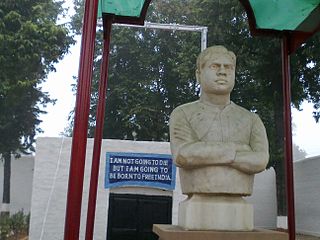
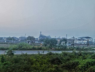
Pharenda, or Anandnagar, is a city in the Maharajganj district of the province of Uttar Pradesh in northern India. It is located approximately 44 kilometres north of Gorakhpur near the border with Nepal. District of Pharenda is Maharajganj. This is situated on the Buddhist Circuit which is built from Sarnath to Lumbini. It lies on NH-24 and near NH 29. It is about 45 km from Gorakhpur, 40 km from Siddharthnagar, 30 km from Maharajganj and 55 km from Sonauli Indo-Nepal border. This place is named after Seth Anandram Jaypuriya. There is closed sugar Mill which was started in about 1935 and closed in 1995. Near Anand Nagar there is a temple is Durga devi mandir, popularly known as Lehara Devi mandir.

Ghughuli is a town and nagar panchayat in Maharajganj district in the Indian state of Uttar Pradesh. It is near Gorakhpur and very close to the Indo-Nepal border. East of Ghughali is the Baikunthi River. The bank of the Baikunthi is used for performing last rites and the quarry is for river sand.
Kant is a town and a nagar panchayat of Shahjahanpur district in the Indian state of Uttar Pradesh.

Lodhikheda is a town and a nagar parishad in Pandhurna district in the Indian state of Madhya Pradesh. It is famous for its oranges. More than 90 per cent of farmers produce oranges. Cotton is grown in large quantities in the local area.
Obra is a town, Tehsil, and Assembly constituency of the Indian state of Uttar Pradesh. It is located in the Sonebhadra district. It has been upgraded from the stature of Nagar Panchayat, and was previously a part of the Mirzapur District. Obra is located 137 km from Varanasi at the Banks of Renu & Sone River with population of 46,574 as per the 2011 India Census. State-owned UPRVUNL and UPJVUNL have a coal-fired thermal power plant and a hydroelectric power plant in Obra, respectively. The thermal and hydroelectric power industries are the major source of employment, either directly or indirectly. Obra is not very well connected by rail. The nearest railway station is Chopan, which is about 10 kilometers from Obra, and has connectivity to other major cities of India. Recreational places in Obra include Jawahar Bal Udayan, Ambedkar Stadium, Lord Shiva's temple, Sone river banks, and Parsoi and Kharatiya villages. Restructuring of government residential colony is ongoing as new power plants are being constructed.
Sarila is a town, a former princely state and a nagar panchayat in Hamirpur district in the northern Indian state of Uttar Pradesh.
Saurikh is a nagar panchayat in Kannauj district in the Indian state of Uttar Pradesh. Its old name was Sau-Rishi.It is located near main industrial and educational hub of Dibiyapur which is around at a distance of 55 km from the town.
Faridpur is a town and a small Nagar Palika and tehsil in Bareilly district in the Indian state of Uttar Pradesh. Faridpur is known for zari work. It comes under 122 Legislative assembly. Current M.L.A. is Professor Shyam Bihari Lal and M.P. is Mr. Dharmendra Kashyap. Nagarpalika Chairman of Faridpur is Mr Sharaf Zari Wale
Dilari is a village in Moradabad district and subdistrict in the Indian state of Uttar Pradesh. It is about 18 km from Moradabad. Dilari is famous for its production and manufacturing of sugar cane and peppermint oil .It is also famous for the production of Mango, Wheat and Rice.This village have roots in history since 1734. There are many documents to prove that Dilari was settled in 1734 by Thakur Bhagwant Singh.

Gaini is a village in Aonla tehsil, Bareilly district, Uttar Pradesh, India. Gaini is located at 28.21°N 79.16°E. Gaini is 22 kilometer west from the bareilly railway junction.
Rithuakhor is a village and gram panchayat in Sahjanwa tehsil in Gorakhpur district in the Indian state of Uttar Pradesh.This village belongs to majority of janwar kshatriya caste.
Bali is a village in the Indian state of Uttar Pradesh. It is located in the Baghpat block of the Baghpat district.
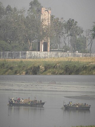
Paina is a village and Nyaya Panchayat situated along the bank of Sarayu (Ghaghra) river in the eastern part of the state of Uttar Pradesh in India. It comes under administration of Barhaj Tehsil of Deoria District and Gorakhpur Division. It is located 33 km towards South from District headquarters Deoria and 340 km from State capital Lucknow.

