Sakaraha | |
|---|---|
 | |
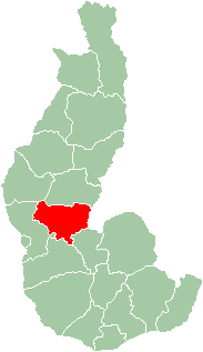 Map of former Toliara Province showing the location of Sakaraha (red). | |
| Country | Madagascar |
| Region | Atsimo-Andrefana |
Sakaraha is a district located in Atsimo-Andrefana Region, south-western Madagascar.
Sakaraha | |
|---|---|
| | |
| Map of former Toliara Province showing the location of Sakaraha (red). | |
| Country | Madagascar |
| Region | Atsimo-Andrefana |
Sakaraha is a district located in Atsimo-Andrefana Region, south-western Madagascar.
The district is further divided into 11 communes:
Sakaraha is situated along route nationale No. 7 (Tuléar-Fianarantsoa) at 134 km from Tuléar, 64 km from Andranovory and 84 km from Ilakaka. [1] Zombitse-Vohibasia National Park is located in the district, east of the town of Sakaraha. Analavelona Massif is in the western portion of the district.

Eden Township is a township in southeastern Lancaster County, Pennsylvania, United States. At the 2020 census the population was 2,248. It is part of the Solanco School District.

Pleasant Run Farms is a census-designated place (CDP) in Hamilton County, Ohio, United States. The population was 4,654 at the 2010 census.

Toliara is a city in Madagascar.

Ilakaka is a small town in Ihorombe Region in the south western part of Madagascar. In the early 1990s there were only about 40 residents in the area. After the discovery of one of Earth's largest known alluvial sapphire deposits in the valley of the Ilakaka river in 1998, the population had boomed to nearly 60,000 in 2005. Since high profits are at stake, violence is common in the town.

Sakaraha is a town and municipality in Atsimo-Andrefana Region, south-western Madagascar. It has a population of 31,183 in 2018.
Analamisampy is a town and commune in Madagascar. It belongs to the district of Toliara II, which is a part of Atsimo-Andrefana Region. The population of the commune was estimated to be approximately 23,000 in 2001 commune census.
Andranovory is a town and commune in Madagascar. It belongs to the district of Toliara II, which is a part of Atsimo-Andrefana Region. The population of the commune was estimated to be approximately 31,000 in 2001 commune census.

Miary is a town and commune in Madagascar. It belongs to the district of Toliara II, which is a part of Atsimo-Andrefana Region. The population of the commune was estimated to be approximately 6,000 in 2001 commune census.
Mikoboka is a town and commune in Madagascar. It belongs to the district of Sakaraha, which is a part of Atsimo-Andrefana Region. The population of the commune was estimated to be approximately 7,000 in 2001 commune census.
Mihavatsy is a town and commune in Madagascar. It belongs to the district of Sakaraha, which is a part of Atsimo-Andrefana Region. The population of the commune was estimated to be approximately 3,000 in 2001 commune census.
Andranolava is a town and commune in Madagascar. It belongs to the district of Sakaraha, which is a part of Atsimo-Andrefana Region. The population of the commune was estimated to be approximately 3,000 in 2001 commune census.
Ambinany is a town and commune in Madagascar. It belongs to the district of Sakaraha, which is a part of Atsimo-Andrefana Region. The population of the commune was estimated to be approximately 5,000 in 2001 commune census.
Miary Taheza is a town and commune in Madagascar. It belongs to the district of Sakaraha, which is a part of Atsimo-Andrefana Region. The population of the commune was estimated to be approximately 10,000 in 2001 commune census.
Miary Lamatihy is a town and commune in Madagascar. It belongs to the district of Sakaraha, which is a part of Atsimo-Andrefana Region. The population of the commune was estimated to be approximately 3,000 in 2001 commune census.
Harbour Round is a designated place in the Canadian province of Newfoundland and Labrador. It is east of Baie Verte.

Zombitse-Vohibasia is a national park in the Atsimo-Andrefana region of south-west Madagascar. It is 147 kilometres (91 mi) north-east of the town of Toliara, the site of the nearest airport, and the Welcome Office is at Sakaraha 10 kilometres (6.2 mi) from the park entrance. The park covers a surface of 36,308 hectares on three sites; the forest of Zombitse and the sites of Isoky Vohimena and Vohibasia. The Bara people and Mahafaly people are the main ethnic groups in the area.
Kaka Khel is a town and union council of Lakki Marwat District in Khyber Pakhtunkhwa province of Pakistan. It is located at 32°32'59N 70°47'44E and has an altitude of 307 metres.
Niewiarowo-Sochy is a village in the administrative district of Gmina Grodzisk, within Siemiatycze County, Podlaskie Voivodeship, in north-eastern Poland.
Jasieniec is a village in the administrative district of Gmina Pilica, within Zawiercie County, Silesian Voivodeship, in southern Poland. It lies approximately 11 kilometres (7 mi) north-east of Pilica, 24 km (15 mi) east of Zawiercie, and 62 km (39 mi) north-east of the regional capital Katowice.

Route nationale 7 (RN7) is a primary highway in Madagascar running 980km from the capital Antananarivo to Tulear at the south-west coast of the country. It crosses the regions of Analamanga, Vakinankaratra, Amoron'i Mania, Haute Matsiatra, Ihorombe, and Atsimo-Andrefana.
Coordinates: 22°55′0″S44°32′59″E / 22.91667°S 44.54972°E

Capital: Toliara | ||
| Ampanihy Ouest (19) - 605 |  | |
| Ankazoabo - 606 - (10) | ||
| Benenitra - 610 - (6) | ||
| Beroroha - 611 - (9) | ||
| Betioky-Atsimo -612 - (31) |
| |
| Morombe (9) - 618 | ||
| Sakaraha (12) - 620 | ||
| Toliara I (1) | ||
| Toliara II (20) (602) | ||
9 districts; 117 communes | ||
| | This Atsimo-Andrefana location article is a stub. You can help Wikipedia by expanding it. |