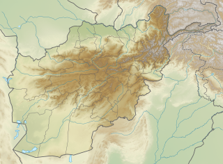
Salang mountains are found in Parwan Province and Baghlan Province in northeastern Afghanistan. [1]

These mountains lie in between the cities of Charikar in the south and Baghlan in the north.
Salang mountains are found in Parwan Province and Baghlan Province in northeastern Afghanistan. [1]
These mountains lie in between the cities of Charikar in the south and Baghlan in the north.
Baghlan is one of the thirty-four provinces of Afghanistan. It is in the north of the country. As of 2020, the province has a population of about 1,014,634.

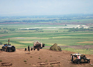
The Salang Tunnel is a 2.67-kilometre-long (1.66 mi) tunnel located at the Salang Pass in the Hindu Kush mountains, between the Parwan and Baghlan provinces of Afghanistan, about 60 miles north of the city of Kabul. Nearly 3.2 km (2 mi) above sea level, it was completed by the Soviet Union in 1964 and connects northern Afghanistan with the capital, Kabul, and southern parts of the country. The Salang Tunnel is of strategic importance and is the only pass going in a north–south direction to remain in use throughout the year, although it is often closed during the cold winters by heavy snowfall.
Baghlan is a city in northern Afghanistan, in the eponymous province, Baghlan Province. It is located three miles east of the Kunduz River, 35 miles south of Khanabad, and about 500 metres above sea level in the northern Hindu Kush.

Puli Hisar or Pul-e-Hesar is a district in Baghlan Province, Afghanistan.
Guzargahi Nur or Gozargah-e-Noor is a district in Baghlan Province, Afghanistan. It was created in 2005 from part of Khost wa Firing District.
Andarab district is located in the southern part of Baghlan Province, Afghanistan. The estimated population of Andarab in 2004 was roughly 120,642. Tajiks make up the entire population of the district. The district centre is the village of Andarab.

Baghlani Jadid is a district of Baghlan Province in northern Afghanistan. It has a population of about 119,607.

Khinjan District is located in the southern part of Baghlan province in the Hindu Kush mountains. The capital is the town of Khenjan. The main Kabul-Kunduz highway passes through the district from south to west. Ethnic Tajiks makes up around 85% of the total population while the Pashtuns, Hazara and Uzbeks, each at 5%, makes up the remaining 15% of the population.
Center for Defence Electronics Application Laboratory (DEAL) is a laboratory of the Defence Research & Development Organization (DRDO). Located in Dehradun, its primary function is research and development in the radio communication devices for defence applications. Its mission is development of Radio Communication Systems, Data links, Satellite Communication Systems, Millimeter Wave Communication systems
North Salang or Sālangi Shamāli is a village at an altitude of 3,365 meters in the Khinjan District of Baghlan Province in north-eastern Afghanistan, to the northern side of the Salang Tunnel.
Marianów is a settlement in the administrative district of Gmina Łanięta, within Kutno County, Łódź Voivodeship, in central Poland.
Ludwików is a village in the administrative district of Gmina Wola Krzysztoporska, within Piotrków County, Łódź Voivodeship, in central Poland.

Poręby Dymarskie is a village in the administrative district of Gmina Cmolas, within Kolbuszowa County, Subcarpathian Voivodeship, in south-eastern Poland. It lies approximately 5 kilometres (3 mi) north-east of Cmolas, 9 km (6 mi) north of Kolbuszowa, and 35 km (22 mi) north-west of the regional capital Rzeszów.
Górki is a village in the administrative district of Gmina Szczytniki, within Kalisz County, Greater Poland Voivodeship, in west-central Poland.
Upiłka is a village in the administrative district of Gmina Lipnica, within Bytów County, Pomeranian Voivodeship, in northern Poland. It lies approximately 8 kilometres (5 mi) south-west of Lipnica, 24 km (15 mi) south-west of Bytów, and 98 km (61 mi) south-west of the regional capital Gdańsk.
Marwica is a village in the administrative district of Gmina Rychliki, within Elbląg County, Warmian-Masurian Voivodeship, in northern Poland. It lies approximately 5 kilometres (3 mi) north of Rychliki, 12 km (7 mi) south-east of Elbląg, and 69 km (43 mi) north-west of the regional capital Olsztyn.
Gilginie is a village in the administrative district of Gmina Miłakowo, within Ostróda County, Warmian-Masurian Voivodeship, in northern Poland. It lies approximately 6 kilometres (4 mi) north-west of Miłakowo, 37 km (23 mi) north of Ostróda, and 43 km (27 mi) north-west of the regional capital Olsztyn.
Xuân Hương is a commune (xã) and village in Lạng Giang District, Bắc Giang Province, in northeastern Vietnam.
Tepe Fullol is a village in northern Afghanistan where the treasure of Fullol was found, consisting of twenty vessels in gold and silver dated to the Bronze Age. It was accidentally discovered in 1965 by Afghan farmers in a grave cache and provided the first evidence of the Oxus civilisation in northern Afghanistan.
Shahkush (Dari: شاه کش is a mountain in Baghlan in Afghanistan. It is located near the settlement Shah Kush. It is at the coordinates.
| Districts | 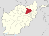 | |
|---|---|---|
| Landforms | ||
| Districts |  | |
|---|---|---|
| Populated places | ||
| Landforms | ||
| Other | ||
Coordinates: 35°19′18″N69°1′32″E / 35.32167°N 69.02556°E
| | This Parwan Province, Afghanistan location article is a stub. You can help Wikipedia by expanding it. |