
Elizabeth is an outer northern suburb of the Adelaide metropolitan area, South Australia, 24 km north of the Adelaide city centre. It is located in the City of Playford. At the 2016 census, Elizabeth had a population of 1,024.

Para Hills is a residential suburb of Adelaide, South Australia. There is a light aircraft airport close to its boundary, and numerous sporting facilities, abundant parks and schools and two medium-sized shopping centres. Most of the suburb is in the City of Salisbury while some is in the City of Tea Tree Gully.

Gulfview Heights is a small suburb of Adelaide, South Australia and is within the City of Salisbury and City of Tea Tree Gully local government area. It is adjacent to Wynn Vale, Salisbury East and Para Hills.
Edinburgh is an outer northern suburb of Adelaide, South Australia in the City of Salisbury. The suburb was created in 1997, on land straddling Penfield and Salisbury, that was compulsorily acquired by the Commonwealth Government in 1940 in order to manufacture munitions for the war effort during World War II, and later used for a number of defence-related establishments.

The Shire of Victoria Plains is a local government area in the Wheatbelt region of Western Australia, about 160 kilometres (100 mi) north of the state capital, Perth. It covers an area of 2,569 square kilometres (992 sq mi), and its seat of government is the town of Calingiri.

Dry Creek is a mostly industrial suburb north of Adelaide, containing significant wetlands. A substantial area was devoted to salt crystallisation pans until 2014, with plans to redevelop the site for housing.

Nathan is a suburb in the City of Brisbane, Queensland, Australia. In the 2021 census, it had a population of 1,085.
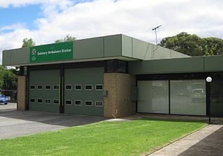
Salisbury East is a suburb of Adelaide, South Australia, located 20 kilometres north of the Adelaide CBD. The residential part of the suburb is in the local government area (LGA) of the City of Salisbury, however the eastern part of the Cobbler Creek Recreation Park is in the boundaries of the City of Tea Tree Gully.

Valley View is a suburb of Adelaide, South Australia. It spans three separate local government areas. They are the City of Salisbury, the City of Port Adelaide Enfield, and the City of Tea Tree Gully. The suburb's boundaries are defined by the intersection of Walkleys, Grand Junction and North East Roads in the south, and Wright and Kelly Roads in the north and east.

Coopers Plains is a southern suburb in the City of Brisbane, Queensland, Australia. In the 2016 census, Coopers Plains had a population of 5,483 people.

Salisbury is a southern suburb in the City of Brisbane, Queensland, Australia. In the 2016 census, Salisbury had a population of 6,290 people.

Parafield Gardens is a suburb of Adelaide, South Australia. The suburb is largely residential, with a pocket of industrial land in the southwest corner. There are two small shopping centres in the area, one on Salisbury Highway, and another on Sheperdson Road.

Burton is a small residential suburb approximately 21 kilometres north of the CBD of Adelaide, South Australia. It is located five km north-west of Salisbury in the flat terrain of the Adelaide Plains. The suburb contains two wetland reserves, including Kaurna Park.
Salisbury Heights is a suburb located in the City of Salisbury, Adelaide, South Australia. The upper section of Salisbury Heights was originally established as Castieu Estate in the 1970s by a private consortium. The blocks of land in this area were typically much larger than surrounding suburbs with half acre blocks compared to the usual quarter acre block. In April 2017, the Salisbury Heights section of Tea Tree Gully Council was renamed and amalgamated with nearby Greenwith.
Globe Derby Park is a suburb of Adelaide, South Australia. It is located in the City of Salisbury.
Brahma Lodge is a northern suburb of Adelaide, South Australia. It is located in the City of Salisbury.
Salisbury South is a suburb located in the City of Salisbury, Adelaide, South Australia. It is bounded by Frost Road, Main North Road, Kings Road and Cross Keys Road. It is predominantly industrial in character and includes factories for brandnames such as Bickford's and R. M. Williams.
Salisbury Park is a northern suburb of Adelaide, located in the City of Salisbury, South Australia. It is on the south bank of the Little Para River, bounded by Main North Road and Saints Road.
Salisbury Downs is a suburb located in the City of Salisbury, Adelaide, South Australia. The suburb is bordered by Kings Road, the Little Para River, Burton Road, Spains Road and the Gawler railway line.
Direk is a suburb located in the City of Salisbury, Adelaide, South Australia. It is bounded by Heaslip Road, Diment Road, Bolivar Road and the Adelaide-Port Augusta railway line.
