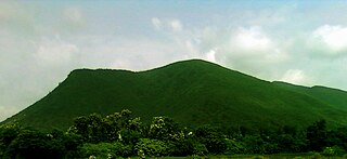
Vizianagaram is a city and the headquarters of the Vizianagaram district in the Indian state of Andhra Pradesh. It is located in the Eastern Ghats, about 24 km (15 mi) west of the Bay of Bengal and 40 km (25 mi) north-northeast of Visakhapatnam. The city has a population of 228,025 and was established as the capital of the Vizianagaram estate by Raja Vijayaram Raj from the Pusapati dynasty. The rulers had a notable role in the history of the region in the 18th century and were patrons of education and arts.

Vizianagaram district is one of the six districts in the Uttarandhra region of the Indian state of Andhra Pradesh with its headquarters located at Vizianagaram. The district was once the part of ancient Kalinga.Saripilli Dibbilingeswara temple, Jayathi Mallikarjuna Temple are the finest examples of ancient Eastern Ganga Dynasty built monuments in the district. The district is bounded on the east by the district of Srikakulam, north by Parvathipuram Manyam south by Visakhapatnam, Anakapalli, southeast by the Bay of Bengal, and west by Alluri Sitharama Raju district. It was formed on 1 June 1979, with some parts carved from the neighbouring districts of Srikakulam and Visakhapatnam. The district is named after the princely state of Vizianagaram. In 2011, it was the least populous district in Andhra Pradesh.

Bobbili is a town in Vizianagaram district of the Indian state of Andhra Pradesh.
Jatara is a town and a nagar palika parishad in Tikamgarh district in the Indian state of Madhya Pradesh.

Kothavalasa is a Suburb in Visakhapatnam city but present in Vizianagaram district of the Indian state of Andhra Pradesh. It is located in Kothavalasa mandal of Vizianagaram revenue division. It is located 30 km from the city of Visakhapatanam
Titilagarh is a town and Municipality in Balangir district in the Indian state of Odisha.

Nelli-marla is a census town in Vizianagaram district of the Indian state of Andhra Pradesh. It is in Nellimarla mandal of Vizianagaram revenue division.

The River Nagavali also known as Langulya is one of the main rivers of Southern Odisha and North Andhra States in India, between Rushikulya and Godavari basins.
Rama-bhadra-puram is a village and Ramabhadrapuram mandal headquarters in Vizianagaram district of Andhra Pradesh, India.
Mentada is a village in Vizianagaram district of the Indian state of Andhra Pradesh, India.

Bhogapuram is a village in Vizianagaram district of the Indian state of Andhra Pradesh. It is located in Bhogapuram mandal of Vizianagaram revenue division.

Srungavarapukota popularly known by its abbreviated form S.Kota is a neighbourhood in the district of Vizianagaram, India. S.Kota is located on Visakhapatnam – Araku road. The town was upgraded from gram panchayat to Nagar Panchayat in the year 2011.
Vepada is a village in Vizianagaram district of the Indian state of Andhra Pradesh, India.
Merakamudidam is a village in Vizianagaram district of the Indian state of Andhra Pradesh, India.
Garugu-billi is a village in Parvathipuram Manyam district of the Indian state of Andhra Pradesh, India.
Uttaravalli or Uttaravilli is a village in Merakamudidam mandal, Vizianagaram district of Andhra Pradesh, India.
Andra is a village and panchayat in Mentada mandal, Vizianagaram district of Andhra Pradesh, India.
Mondemkhallu is a village panchayat in Kurupam mandal of Vizianagaram district in Andhra Pradesh, India.
Makkuva mandal is one of the 34 mandals in Parvathipuram Manyam district of the Indian state of Andhra Pradesh. It is administration under Parvathipuram revenue division and headquartered at Makkuva. The mandal is bounded by Salur mandal on South & West, Parvathipuram mandal on North, Seethanagaram mandal on east and Bobbili mandal on south east. A portion of it also borders the Narayanapatna block of the Koraput district of Odisha on north west.


