San Fidel, New Mexico

Last updated

San Fidel, New Mexico
2013, Doug and HIs Beloved San Fidel Sign - panoramio.jpg
USA New Mexico location map.svg
Red pog.svg
San
Fidel
Coordinates: 35°06′56″N107°35′53″W / 35.11556°N 107.59806°W / 35.11556; -107.59806
Country United States
State New Mexico
County Cibola
Area
[1]
  Total4.21 sq mi (10.90 km2)
  Land4.21 sq mi (10.90 km2)
  Water0.00 sq mi (0.00 km2)
Elevation
[2]
6,296 ft (1,919 m)
Population
 (2020) [3]
  Total124
  Density29.47/sq mi (11.38/km2)
Time zone UTC-7 (Mountain (MST))
  Summer (DST) UTC-6 (MDT)
ZIP code
87049
Area code 505
GNIS feature ID2584205 [2]

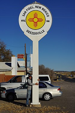
San Fidel is a census-designated place in Cibola County, New Mexico, United States. Its population was 138 as of the 2010 census. San Fidel has a post office with ZIP code 87049, which opened on December 24, 1910. [4] [5] New Mexico State Road 124, the original Route 66, also known as the "Old Road," passes through the community.

The Acoma Curio Shop, which is listed on the National Register of Historic Places, is located in San Fidel. [6]

Historical population
CensusPop.Note
2020 124
U.S. Decennial Census [7] [3]

Related Research Articles

<span class="mw-page-title-main">Adams Run, South Carolina</span> Census-designated place in South Carolina, United States

Adams Run is an unincorporated community and census-designated place (CDP) in Charleston County, South Carolina, United States. It was first listed as a CDP in the 2020 census with a population of 421.

<span class="mw-page-title-main">Conchas Dam, New Mexico</span> Census-designated place in New Mexico, United States

Conchas Dam is a census-designated place in San Miguel County, New Mexico, United States. As of the 2010 census, its population was 186.

Faywood is a census-designated place in Grant County, New Mexico, United States. Its population was 33 as of the 2010 census. Faywood has a post office with ZIP code 88034. It is located 3 miles (4.8 km) north of US 180 on NM 61.

<span class="mw-page-title-main">Hachita, New Mexico</span> Census-designated place in Grant County, New Mexico, United States

Hachita is a census-designated place in Grant County, New Mexico, United States. Its population was 49 as of the 2010 census. Hachita has a post office with ZIP code 88040. New Mexico State Road 9, New Mexico State Road 81, and New Mexico State Road 146 pass through the community. Hachita should not be confused with Old Hachita, which is a ghost town several miles west of town.

Hanover is a census-designated place in Grant County, New Mexico, United States. Its population was 167 as of the 2010 census. Hanover has a post office with ZIP code 88041. New Mexico State Road 152 and New Mexico State Road 356 pass through the community. The town was named after the local Hanover Mines. Sofio Henkel, one of the original settlers, came from Hanover, Germany, in 1841 and mined until 1843, when he was driven away by Apaches.

Mimbres is a census-designated place in Grant County, New Mexico, United States. Its population was 667 as of the 2010 census. Mimbres has a post office with ZIP code 88049. New Mexico State Road 35 passes through the community. The post office was established in 1886. It was named after the Mimbres River.

<span class="mw-page-title-main">San Antonito, Bernalillo County, New Mexico</span> Census-designated place in New Mexico, United States

San Antonito is a census-designated place in Bernalillo County, New Mexico, United States. Its population was 985 as of the 2010 census.

McIntosh is a census-designated place in Torrance County, New Mexico, United States. Its population was 1,484 as of the 2010 census. McIntosh has a post office with ZIP code 87032, which opened on August 28, 1906. New Mexico State Road 41 passes through the community.

Youngsville is a census-designated place in Rio Arriba County, New Mexico, United States. Its population was 56 as of the 2010 census. Youngsville has a post office with ZIP code 87064. New Mexico State Road 96 passes through the community.

Gallina is a census-designated place in Rio Arriba County, New Mexico, United States. Its population was 286 as of the 2010 census. Gallina has a post office with ZIP code 87017. New Mexico State Road 96 passes through the community.

Canjilon is a census-designated place in Rio Arriba County, New Mexico, United States. Its population was 256 as of the 2010 census. Canjilon has a post office with ZIP code 87515. The community is located along New Mexico State Road 115. Canjilon was first settled in 1870, and by 1880, 35 families lived here.

<span class="mw-page-title-main">Newkirk, New Mexico</span> Census-designated place in New Mexico, United States

Newkirk is a village in Guadalupe County, New Mexico, United States. The community is located at the junction of Interstate 40 and New Mexico State Road 129; historic U.S. Route 66 also passes through the community. Its population was 7 as of the 2010 census. Newkirk has a post office serving ZIP Code 88431, and a service station. It is part of the Newkirk Census Designated Place (CDP).

Blanco is a census-designated place in San Juan County, New Mexico, United States. Its population was 388 as of the 2010 census. Blanco has a post office with ZIP code 87412, which opened on March 6, 1901. U.S. Route 64 passes through the community.

La Plata is a census-designated place in San Juan County, New Mexico, United States. Its population was 612 as of the 2010 census. La Plata has a post office with ZIP code 87418. The community is located at the junction of state roads 170 and 574.

<span class="mw-page-title-main">Whites City, New Mexico</span> Census-designated place in New Mexico, United States

Whites City also spelled White's City, is a census-designated place and unincorporated community in Eddy County, New Mexico, United States. Whites City has a post office with ZIP code 88268.

Nogal is a census-designated place and unincorporated community in Lincoln County, New Mexico, United States. Its population was 96 as of the 2010 census. Nogal has a post office with ZIP code 88341, which opened on November 9, 1880.

<span class="mw-page-title-main">South Mills, North Carolina</span> Census-designated place in North Carolina, United States

South Mills is an unincorporated community and census-designated place (CDP) in Camden County, North Carolina, United States. Its population was 454 as of the 2010 census. South Mills has a post office with ZIP code 27976, which opened on March 2, 1840. The community is located near U.S. Route 17, and U.S. Route 17 Business and North Carolina Highway 343, and future Interstate 87 pass through the community.

<span class="mw-page-title-main">Costilla, New Mexico</span> Census-designated place in New Mexico, United States

Costilla is a census-designated place in Taos County, New Mexico, United States. Its population was 205 as of the 2010 census. Costilla has a post office with ZIP code 87524. State roads 196 and 522 intersect in the community.

<span class="mw-page-title-main">San Cristobal, New Mexico</span> Census-designated place in New Mexico, United States

San Cristobal is a census-designated place in Taos County, New Mexico. Its population was 273 as of the 2010 census. San Cristobal has a post office with ZIP code 87564, which opened on February 16, 1932.

Hunt is a hamlet and census-designated place (CDP) in Livingston County, New York, United States. Its population was 78 as of the 2010 census. Hunt has a post office with ZIP code 14846.

References

  1. "ArcGIS REST Services Directory". United States Census Bureau. Retrieved October 12, 2022.
  2. 1 2 U.S. Geological Survey Geographic Names Information System: San Fidel, New Mexico
  3. 1 2 "Census Population API". United States Census Bureau. Retrieved October 12, 2022.
  4. United States Postal Service (2012). "USPS - Look Up a ZIP Code" . Retrieved February 15, 2012.
  5. "Postmaster Finder - Post Offices by ZIP Code". United States Postal Service . Retrieved August 10, 2013.
  6. "National Register Information System". National Register of Historic Places . National Park Service. July 9, 2010.
  7. "Census of Population and Housing". Census.gov. Retrieved June 4, 2016.

Commons-logo.svg Media related to San Fidel, New Mexico at Wikimedia Commons