
Acomita Lake is a census-designated place (CDP) in Cibola County, New Mexico, United States. The population was 339 at the 2020 census.

Encinal is a census-designated place (CDP) in Cibola County, New Mexico, United States. It is the smallest of the six villages of the Laguna Pueblo and sits at the base of Mount Taylor. The population was 210 at the 2010 census.

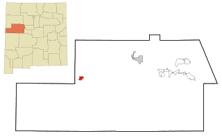
Paraje is a census-designated place (CDP) in Cibola County, New Mexico, United States. As of the 2010 census, the CDP population was 777.
Pinehill or Pine Hill is a census-designated place in Cibola County, New Mexico, United States. It is located on the Ramah Navajo Indian Reservation. The population was 88 at the 2010 census. The location of the CDP in 2010 had become the location of the Mountain View CDP as of the 2020 census, while a new CDP named "Pinehill" was listed 8 miles (13 km) further south, at a point 4 miles (6 km) southeast of Candy Kitchen.

Skyline-Ganipa is a census-designated place (CDP) in Cibola County, New Mexico, United States. The population was 1,224 at the 2010 census.

Datil is a census-designated place in Catron County, New Mexico, United States. As of the 2010 census it had a population of 54. Located at the intersection of U.S. Route 60 and New Mexico State Road 12, Datil is on the edge of the Cibola National Forest. The Very Large Array is also nearby.
Mountain View is a census-designated place (CDP) in Cibola County, New Mexico, United States. It is located on the Ramah Navajo Indian Reservation. In 2010 the location was listed as the Pinehill census-designated place. It was first listed as the Mountain View CDP prior to the 2020 census.

Fence Lake is a census-designated place located in southwestern Cibola County, New Mexico, United States. Designated in 1980 by the United States Census Bureau, Fence Lake had a population of 42 as of the 2010 census. The area is largely ranchland, and there are few businesses there. It was named after a small village which is contained within its boundaries.
Bluewater Village is a census-designated place in Cibola County, New Mexico, United States. Its population in 2010 was 628.
San Rafael is a census-designated place (CDP) in Cibola County, New Mexico, United States. As of the 2010 census it had a population of 933. Also known as "Bikyaya" or "El Gallo", it lies at an elevation of 6,470 feet (1,970 m) above sea level and is located in north-central Cibola County at. New Mexico State Road 53 passes through the community, leading north 3 miles (5 km) to Interstate 40 and 5 miles (8 km) to the center of Grants, the county seat.
Ponderosa Pine is a census-designated place (CDP) in Bernalillo County, New Mexico, United States. The population was 1,195 at the 2010 census. It is part of the Albuquerque Metropolitan Statistical Area.
Las Tusas is a census-designated place (CDP) in Cibola County, New Mexico, United States. At the 2010 census the CDP was known as Bluewater Acres and had a population of 206.
McCartys Village is a census-designated place (CDP) in Cibola County, New Mexico, consisting of the unincorporated community known as McCartys. The population was 48 at the time of the 2010 census. It is part of the Acoma Pueblo.
Moquino is a census-designated place (CDP) in Cibola County, New Mexico, United States. The population was 37 at the 2010 census.
South Acomita Village is a census designated place (CDP) in Cibola County, New Mexico, United States. The population was 105 at the 2010 census.
Broadview is a census-designated place (CDP) in Cibola County, New Mexico, United States. It was first listed as a CDP prior to the 2020 census.
Golden Acres is a census-designated place (CDP) in Cibola County, New Mexico, United States. It was first listed as a CDP prior to the 2020 census.
Lobo Canyon is a census-designated place (CDP) in Cibola County, New Mexico, United States. It was first listed as a CDP prior to the 2020 census.
Mount Taylor is a census-designated place (CDP) in Cibola County, New Mexico, United States. It was first listed as a CDP prior to the 2020 census.
Bluewater is a census-designated place (CDP) in McKinley County, New Mexico, United States. It was first listed as a CDP prior to the 2020 census.

