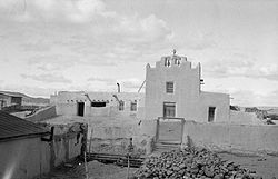
Laguna, New Mexico

Last updated
Laguna, New Mexico
Laguna Mission.jpg
Laguna Mission, 1934. Photo: Historic American Buildings Survey
Cibola County New Mexico Incorporated and Unincorporated areas Laguna Highlighted.svg
Location of Laguna, New Mexico
USA New Mexico location map.svg
Red pog.svg
Laguna
Location in the United States
Usa edcp location map.svg
Red pog.svg
Laguna
Laguna (the United States)
Coordinates: 35°2′50″N107°24′11″W / 35.04722°N 107.40306°W / 35.04722; -107.40306
Country Flag of the United States.svg  United States
State Flag of New Mexico.svg  New Mexico
County Cibola
Area
[1]
  Total9.56 sq mi (24.75 km2)
  Land9.55 sq mi (24.74 km2)
  Water0.00 sq mi (0.01 km2)
Elevation
5,807 ft (1,770 m)
Population
 (2020) [2]
  Total1,282
  Density134.20/sq mi (51.82/km2)
Time zone UTC-7 (Mountain (MST))
  Summer (DST) UTC-6 (MDT)
ZIP code
87026
Area code 505
FIPS code 35-37070
GNIS feature ID0928750

Laguna is a census-designated place (CDP) on the Laguna Pueblo in Cibola County, New Mexico, United States. The population was 1,241 at the 2010 census. [3] It is located approximately 47 miles west of Albuquerque.

Contents

Laguna was founded in 1699, making it the most recent of the New Mexican pueblos. The people of Laguna Pueblo speak Western Keresan. Laguna is home to an annual feast to Saint Joseph.

History

The San Jose de la Laguna Mission and Convento, built starting in 1699, is in Laguna. It is extremely well-preserved, and has been listed on the National Register of Historic Places since 1973.

Anton Docher, the "Padre of Isleta", served as a priest in Laguna during his long period in Isleta. [4]

Geography

Laguna is located in eastern Cibola County at 35°2′50″N107°24′11″W / 35.04722°N 107.40306°W / 35.04722; -107.40306 (35.047195, -107.403024). [5] It is bordered to the west by Paraje, to the southeast by Mesita, and to the south by Interstate 40, which provides access from Exit 114. Old U.S. Route 66 passes through the community.

According to the United States Census Bureau, the CDP has a total area of 10.9 square miles (28.3 km2), all land. [3] The CDP includes the original settlement of Laguna as well as New Laguna, about 2.5 miles (4.0 km) to the west on old Highway 66.

Demographics

Historical population
CensusPop.Note
2020 1,282
U.S. Decennial Census [6] [2]
Old Pueblo Council meeting house, built c.1874. 1934 photo Laguna Meetinghouse.jpg
Old Pueblo Council meeting house, built c.1874. 1934 photo

As of the census [7] of 2000, there were 423 people, 136 households, and 108 families residing in the CDP. The population density was 164.2 inhabitants per square mile (63.4/km2). There were 172 housing units at an average density of 66.8 per square mile (25.8/km2). The racial makeup of the CDP was 2.36% White, 96.45% Native American, 0.24% from other races, and 0.47% from two or more races. Hispanic or Latino of any race were 3.07% of the population.

There were 136 households, out of which 31.6% had children under the age of 18 living with them, 47.8% were married couples living together, 25.0% had a female householder with no husband present, and 19.9% were non-families. 17.6% of all households were made up of individuals, and 6.6% had someone living alone who was 65 years of age or older. The average household size was 3.11 and the average family size was 3.44.

In the CDP, the population was spread out, with 27.0% under the age of 18, 8.0% from 18 to 24, 28.6% from 25 to 44, 22.0% from 45 to 64, and 14.4% who were 65 years of age or older. The median age was 38 years. For every 100 females, there were 90.5 males. For every 100 females age 18 and over, there were 89.6 males.

The median income for a household in the CDP was $19,250, and the median income for a family was $19,750. Males had a median income of $19,000 versus $17,188 for females. The per capita income for the CDP was $10,980. About 28.6% of families and 27.1% of the population were below the poverty line, including 25.4% of those under age 18 and 30.9% of those age 65 or over.

Education

All public schools in the county are operated by Grants/Cibola County Schools.

Cubero Elementary School and Laguna Acoma Middle-High School serve the area.

There is a tribal elementary school, affiliated with the Bureau of Indian Education (BIE), called Laguna Elementary School. [8]

See also

Related Research Articles

<span class="mw-page-title-main">Sandoval County, New Mexico</span> County in New Mexico, United States

Sandoval County is located in the U.S. state of New Mexico. As of the 2020 census, the population was 148,834, making it the fourth-most populous county in New Mexico. The county seat is Bernalillo.

<span class="mw-page-title-main">Cibola County, New Mexico</span> County in New Mexico, United States

Cibola County is a county in the U.S. state of New Mexico. As of the 2010 census, the population was 27,213. Its county seat is Grants. It is New Mexico's youngest county, and the third youngest county in the United States, created on June 19, 1981, from the westernmost four-fifths of the formerly much larger Valencia County.

<span class="mw-page-title-main">Bernalillo County, New Mexico</span> County in New Mexico, United States

Bernalillo County is the most populous county in the U.S. state of New Mexico. As of the 2020 census, the population was 676,444. The county seat, Albuquerque, is the most populous city in New Mexico.

<span class="mw-page-title-main">Blue Diamond, Nevada</span> Census-designated place in Clark County, Nevada, United States

Blue Diamond is a census-designated place (CDP) in Clark County, Nevada, United States. The population was 268 at the 2020 census.

<span class="mw-page-title-main">Isleta Village Proper, New Mexico</span> Census-designated place in New Mexico, United States

Isleta Village Proper is a census-designated place (CDP) in Bernalillo County, New Mexico, United States. The population was 491 at the 2010 census. It is part of the Albuquerque Metropolitan Statistical Area.

<span class="mw-page-title-main">Acomita Lake, New Mexico</span> Census-designated place in New Mexico, United States

Acomita Lake is a census-designated place (CDP) in Cibola County, New Mexico, United States. The population was 339 at the 2020 census.

<span class="mw-page-title-main">Encinal, New Mexico</span> Census-designated place in New Mexico, United States

Encinal is a census-designated place (CDP) in Cibola County, New Mexico, United States. It is the smallest of the six villages of the Laguna Pueblo and sits at the base of Mount Taylor. The population was 210 at the 2010 census. The feast day for Encinal is September 8.

<span class="mw-page-title-main">Mesita, New Mexico</span> Census-designated place in New Mexico, United States

Mesita is a census-designated place (CDP) in Cibola County, New Mexico, United States. The population was 804 at the 2010 census.

<span class="mw-page-title-main">North Acomita Village, New Mexico</span> Census-designated place in New Mexico, United States

North Acomita Village is a census-designated place (CDP) in Cibola County, New Mexico, United States. The population was 303 at the 2010 census.

<span class="mw-page-title-main">Paguate, New Mexico</span> Census-designated place in New Mexico, United States

Paguate is a census-designated place (CDP) in Cibola County, New Mexico, United States. The population was 421 at the 2010 census.

<span class="mw-page-title-main">Paraje, New Mexico</span> Census-designated place in New Mexico, United States

Paraje is a census-designated place (CDP) in Cibola County, New Mexico, United States. As of the 2010 census, the CDP population was 777.

<span class="mw-page-title-main">Pinehill, New Mexico</span> Census-designated place in New Mexico, United States

Pinehill or Pine Hill is a census-designated place in Cibola County, New Mexico, United States. It is located on the Ramah Navajo Indian Reservation. The population was 88 at the 2010 census. The location of the CDP in 2010 had become the location of the Mountain View CDP as of the 2020 census, while a new CDP named "Pinehill" was listed 8 miles (13 km) further south, at a point 4 miles (6 km) southeast of Candy Kitchen.

<span class="mw-page-title-main">Seama, New Mexico</span> Census-designated place in New Mexico, United States

Seama is a census-designated place (CDP) in Cibola County, New Mexico, United States. The population was 465 at the 2010 census.

<span class="mw-page-title-main">Skyline-Ganipa, New Mexico</span> Census-designated place in New Mexico, United States

Skyline-Ganipa is a census-designated place (CDP) in Cibola County, New Mexico, United States. The population was 1,224 at the 2010 census.

<span class="mw-page-title-main">Pueblo Pintado, New Mexico</span> CDP in New Mexico, United States

Pueblo Pintado is a census-designated place (CDP) in McKinley County, New Mexico, United States. The population was 247 at the 2000 census.

<span class="mw-page-title-main">Ramah, New Mexico</span> CDP in New Mexico, United States

Ramah is a census-designated place (CDP) in McKinley County, New Mexico. The population was 407 at the time of 2000 census and 370 at the 2010 United States Census.

<span class="mw-page-title-main">Zuni Pueblo, New Mexico</span> Census-designated place in New Mexico, United States

Zuni Pueblo is a census-designated place (CDP) in McKinley County, New Mexico, United States. The population was 6,302 as of the 2010 Census. It is inhabited largely by members of the Zuni people (A:shiwi).

<span class="mw-page-title-main">San Felipe Pueblo, New Mexico</span> CDP in New Mexico, United States

San Felipe Pueblo is a census-designated place (CDP) in Sandoval County, New Mexico, United States, and is located 10 miles (16 km) north of Bernalillo. As of the 2000 census, the CDP population was 2,080. It is part of the Albuquerque Metropolitan Statistical Area.

<span class="mw-page-title-main">Zia Pueblo, New Mexico</span> CDP in New Mexico, United States

Zia Pueblo is a census-designated place (CDP) in Sandoval County, New Mexico, United States. The population was 646 at the 2000 census, with 310 males and 336 females. The pueblo after which the CDP is named is included within the CDP; it is listed on the National Register of Historic Places.

<span class="mw-page-title-main">Peralta, New Mexico</span> Town in New Mexico, United States

Peralta is a town in Valencia County, New Mexico, United States. Prior to its incorporation on July 1, 2007, it was a census-designated place (CDP). The population was 3,660 as of the 2010 census. Peralta is part of the Albuquerque metropolitan area.

References

  1. "ArcGIS REST Services Directory". United States Census Bureau. Retrieved October 12, 2022.
  2. 1 2 "Census Population API". United States Census Bureau. Retrieved Oct 12, 2022.
  3. 1 2 "Geographic Identifiers: 2010 Demographic Profile Data (G001): Laguna CDP, New Mexico". U.S. Census Bureau, American Factfinder. Archived from the original on February 12, 2020. Retrieved October 20, 2014.
  4. Keleher and Chant. The Padre of Isleta. Sunstone Press, 2009,chap.4- p. 30.36.
  5. "US Gazetteer files: 2010, 2000, and 1990". United States Census Bureau. 2011-02-12. Retrieved 2011-04-23.
  6. "Census of Population and Housing". Census.gov. Retrieved June 4, 2016.
  7. "U.S. Census website". United States Census Bureau . Retrieved 2008-01-31.
  8. "Laguna Elementary School". Bureau of Indian Education . Retrieved 2023-03-17.