San José del Rincón

Last updated
San José del Rincón
Municipality
ArchMichoacanMexico.JPG
Arch on the Angangueo–San José del Rincón highway at the Michoacán–Mexico state border
Bandera de San Jose del Rincon, Mexico.png
Flag
SAN JOSE DEL RINCON.svg
Seal
Mexico States blank map.svg
Red pog.svg
San José del Rincón
Location in Mexico
Coordinates: 19°39′38″N100°09′09″W / 19.66056°N 100.15250°W / 19.66056; -100.15250 Coordinates: 19°39′38″N100°09′09″W / 19.66056°N 100.15250°W / 19.66056; -100.15250 [1]
CountryFlag of Mexico.svg  Mexico
State Flag of Mexico (state).svg Mexico
Established 2002
Seat San José del Rincón Centro
Government [2]
  President Jesús Rolando Rangel Espinosa
Area [3]
  Total 489 km2 (189 sq mi)
Elevation [1] (of seat) 2,747 m (9,012 ft)
Population (2010 Census) [3]
  Total 91,345
  Estimate (2015 Intercensal Survey) [4] 93,878
  Density 190/km2 (480/sq mi)
  Seat 1,638
Time zone UTC-6 (Central)
  Summer (DST) UTC-5 (Central)
Postal code of seat 50660
Area code 712
Demonym Montero
Website Official website

San José del Rincón is a municipality in the State of Mexico. Its inhabitants are referred to as monteros. [5]

Municipalities are the second-level administrative divisions of Mexico, where the first-level administrative division is the state. As of the establishment of two new municipalities in Chiapas in September 2017, there are 2,448 municipalities in Mexico, not including the 16 delegaciones of Mexico City. The internal political organization and their responsibilities are outlined in the 115th article of the 1917 Constitution and detailed in the constitutions of the states to which they belong.

State of Mexico State of Mexico

The State of Mexico is one of the 32 federal entities of Mexico. It is the most populous, as well as the most densely populated state. It is divided into 125 municipalities and its capital city is Toluca de Lerdo.

Contents

Geography

San José del Rincón is located in the western part of the State of Mexico on its border with Michoacán. From north to south, it borders the municipalities of El Oro, San Felipe del Progreso, Villa Victoria and Villa de Allende in the State of Mexico, and the municipalities of Tlalpujahua, Senguío, Angangueo, Ocampo and Zitácuaro in Michoacán. The municipality covers an area of 489 square kilometres (189 sq mi). [3] The highest point in the municipality is the Cerro de Cabrero in the south, at 3,260 metres (10,700 ft) above sea level. [6]

Michoacán State of Mexico

Michoacán, formally Michoacán de Ocampo, officially the Free and Sovereign State of Michoacán de Ocampo, is one of the 31 states which, with the Federal District, comprise the 32 Federal Entities of Mexico. The State is divided into 113 municipalities and its capital city is Morelia. The city was named after José María Morelos, one of the main heroes of the Mexican War of Independence.

El Oro de Hidalgo Town & Municipality in State of Mexico, Mexico

The name El Oro de Hidalgo, is not from Nahuatl, like most other municipality names in the state, but from Spanish, and simply means "the gold." It has subsequently been given an alternative Nahuatl name of "Teocuitlatl," meaning "sacred excrement," referring to gold. Its seal, in the form of an Aztec glyph, contains elements referring to gold and to caves, of which there are many in the municipality. The municipality is located in the northwest of the State of Mexico, 96 km from the state capital of Toluca, and is bounded by the municipalities of Temascalcingo to the north, Jocotitlán to the east, San Felipe del Progreso and San José del Rincón to the south, and by the state of Michoacán to the west. As of 2005, the municipal seat with the formal name of El Oro de Hidalgo had a population of 5,797, and the municipality of El Oro had a population of 31,847. While it made its name as a major gold and silver mining town from the 17th to the early 20th centuries, the mines have since been tapped out and the town is turning to tourism for economic development.

San Felipe del Progreso Place in Mexico State, Mexico

San Felipe del Progreso is a town and municipality in the northwest of the State of Mexico. It is in the western part of the state, 59 km from the state capital of Toluca and 72 km southwest of Atlacomulco. In colonial times, the village was founded as "San Felipe" or "San Felipe Ixtlahuaca". Later it was called "San Felipe el Grande" and "San Felipe del Obraje". In the second half of the 19th century, it received its current name of "San Felipe del Progreso."

The northern part of the municipality lies within the Lerma River basin, while the southern part lies in the Cutzamala River sub-basin of the Balsas River system, and is drained by the Arroyo Grande [6] which flows southeast into Villa Victoria Reservoir, which is part of Mexico City's water supply.

Lerma River river in Mexico

The Lerma River is Mexico's second longest river. It is a 750 km-long (470 mi) river in west-central Mexico that begins in Mexican Plateau at an altitude over 3,000 metres (9,843 ft) above sea level, and ends where it empties into Lake Chapala, Mexico's largest lake, near Guadalajara, Jalisco. Lake Chapala is the starting point of Río Grande de Santiago, which some treat as a continuation of the Lerma River. In combination, the two are often called the Lerma Santiago River. The Lerma River is notorious for its pollution, but the water quality has demonstrated considerable improvement in recent years due mostly to government environmental programs and through massive upgrading projects of sanitation works.

The Cutzamala River is a river of Mexico.

Balsas River river in Mexico

The Balsas River is a major river of south-central Mexico.

Forests cover 30.7% of San José del Rincón and are mostly located in the mountainous western part of the municipality, [2] where the predominant trees are oyamel and pine. [5] These forests are protected as part of the Monarch Butterfly Biosphere Reserve. [6] The rest of the land in the municipality is mainly used for agriculture and livestock grazing. Soils in the municipality are mostly andosols with isolated areas of planosols in the northeast and cambisols in the east. [6]

Monarch Butterfly Biosphere Reserve biosphere reserve

The Monarch Butterfly Biosphere Reserve is a World Heritage Site containing most of the over-wintering sites of the eastern population of the monarch butterfly. The reserve is located in the Trans-Mexican Volcanic Belt pine-oak forests ecoregion on the border of Michoacán and State of Mexico, 100 km, northwest of Mexico City. Millions of butterflies arrive in the reserve annually. Butterflies only inhabit a fraction of the 56,000 hectares of the reserve from October–March. The biosphere’s mission is to protect the butterfly species and its habitat.

Andosol soil type

Andosols are soils found in volcanic areas formed in volcanic tephra. In some cases can Andosols also be found outside active volcanic areas. Andosols cover an estimated 1–2% of earth's ice-free land surface. Andosols are a Reference Soil Group of the World Reference Base for Soil Resources (WRB). They are closely related to other types of soils such as Vitrosols, Vitrandosols, Vitrons and Pumice Soils that are used in different soil classification systems.

Planosol soil type

A Planosol in the World Reference Base for Soil Resources is a soil with a light-coloured, coarse-textured, surface horizon that shows signs of periodic water stagnation and abruptly overlies a dense, slowly permeable subsoil with significantly more clay than the surface horizon. In the US Soil Classification of 1938 used the name Planosols, whereas its successor, the USDA soil taxonomy, includes most Planosols in the Great Groups Albaqualfs, Albaquults and Argialbolls.

The climate is temperate sub-humid with rainy summers. Average temperatures range between 12 and 18 degrees Celsius. Frost can occur between December and March; February and March bring winds and dust. More than 100 mm of rain falls in each of the months from June to September. [6]

History

The municipality of San José del Rincón was created by government decree on 2 October 2001, [5] which went into force on 1 January 2002. [2] Its territory previously comprised the western part of the municipality of San Felipe del Progreso. [2]

Administration

Municipal elections are held every three years. The current President of the municipality is Jesús Rolando Rangel Espinosa of the PRI. [2]

Demographics

In the 2010 Mexican Census, the municipality of San José del Rincón [5] recorded a population of 91,345 inhabitants living in 17,707 households. [3] Its annual growth rate of 2.7% was the highest in the State of Mexico. [7] [8] It recorded a population of 93,878 inhabitants in the 2015 Intercensal Survey. [4]

There are 137 localities in the municipality, [6] three of which are classified as urban:

In the 2015 Intercensal Survey, 89.67% of people in the municipality identified themselves as indigenous. [4] In the 2010 Census, 11,191 people or 12% of the population in San José del Rincón reported speaking an indigenous language, of which 10,916 spoke Mazahua. [1]

Economy

San José del Rincón is one of the poorest municipalities in the State of Mexico. [7] [8] Its main economic activities are agriculture, animal husbandry, commerce and handicrafts. [6]

Related Research Articles

Municipalities of Campeche Wikimedia list article

Campeche is a state in Southeast Mexico that is divided into eleven municipalities. According to the 2015 Mexican Intercensal Survey, Campeche is the third least populous state with 899,931 inhabitants and the 17th largest by land area spanning 57,693.59 square kilometres (22,275.62 sq mi).

Municipalities of Chiapas Wikimedia list article

Chiapas is a state in Southwest Mexico. According to the 2015 Mexican Intercensal Survey, it is the state that has the seventh largest population with 5,217,908 inhabitants and the 10th largest by land area spanning 73,560.47 square kilometres (28,401.86 sq mi). Chiapas is officially divided into 124 municipalities, although the establishment of municipal authorities in Belisario Domínguez has been suspended since 2015 pending the resolution of a territorial dispute between Chiapas and the neighbouring state of Oaxaca. A 125th municipality called Honduras de la Sierra, consisting of six ejidos currently part of Siltepec, will be incorporated on October 1, 2018.

Municipalities of Colima Wikimedia list article

Colima is a state in West Mexico that is divided into ten municipalities. According to the 2015 Mexican Intercensal Survey, it is the state that has the smallest population with 711,235 inhabitants and is the fifth smallest by land area spanning 5,801.75 square kilometres (2,240.07 sq mi).

Mazahua people ethnic group

The Mazahuas are an indigenous people of Mexico, primarily inhabiting the northwestern portion of the State of Mexico and small parts of Michoacán and Querétaro. The largest concentration of Mazahua is found in the municipalities of San Felipe del Progreso and San José del Rincón of the State of Mexico. There is also a significant presence in the Federal District, Toluca and the Guadalajara area owing to recent migration. According to the 2010 Mexican census, there are 116,240 speakers of the language in the State of Mexico, accounting for 53% of all indigenous language speakers in the state.

La Huacana Municipality Municipality in Michoacán, Mexico

La Huacana Municipality is a municipality in the south-central part of the Mexican state of Michoacán. It has a population of 32,757. Its municipal seat is the city of the same name.

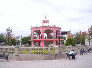
Villa Donato Guerra is the municipal seat of the municipality called Donato Guerra in the State of Mexico, Mexico. The area is also known as Malacatepec and La Asunción Malacatepec. (Villa) Donato Guerra is located in the western part of the State of Mexico. In the region that is identified with Valle de Bravo. The town was named in 1880 in honor of Donato Guerra, a distinguished soldier of the War of La Reforma. It is located around 77 kilometers from Toluca which is the capital of the state, on Federal Highway number 35 Mexico City - Zitácuaro.

Ixtlahuaca de Rayón is a city and municipality north of Toluca in the northwest part of the State of Mexico, in Mexico. The distance between Mexico City and Ixtlahuaca is 32 km. The name Ixthahuaca comes from Náhuatl and means plains without trees. The city and municipality were officially established by decree on November 14, 1816 by the Congress of the State of Mexico.

Jilotepec de Abasolo Town & Municipality in State of Mexico, Mexico

Jilotepec de Molina Enríquez and Jilotepec de Abasolo are a town and a municipality located northwest zone of the State of Mexico, in Mexico. However, both entities are interchangeably referred to as "Jilotepec". This name comes from Náhuatl, meaning "hill of corncobs". It is located in hilly and forested terrain an hour from Mexico City, Toluca, 40 minutes from San Juan del Río, 30 minutes from Tula and 20 from Tepeji. The Mexico City–Querétaro and the new Transoceanic Freeways converge within its territory that unite the coasts of Mexico from Veracruz to Michoacán.

Progreso Municipality, Yucatán Municipality in Yucatán, Mexico

Progreso Municipality is one of the 106 municipalities in the Mexican state of Yucatán containing (270.10 km2) of land and located roughly 25 km north of the city of Mérida.

Huehuetla, Puebla Municipality in Puebla, Mexico

Huehuetla is a rural municipality in Puebla, Mexico.

Tlaxco Municipality, Tlaxcala Municipality in Tlaxcala, Mexico

Tlaxco is a municipality in Tlaxcala, Mexico.

Río Grande Municipality, Zacatecas Municipality in Zacatecas, Mexico

Río Grande is a municipality in the Mexican state of Zacatecas.

Zinapécuaro Municipality in Michoacán, Mexico

Zinapécuaro is a municipality in the Mexican state of Michoacán, located 50 kilometres (31 mi) northeast of the state capital Morelia.

Tomatlán, Veracruz Municipality in Veracruz, Mexico

Tomatlán is a municipality in the Mexican state of Veracruz, located 58 kilometres (36 mi) south of the state capital of Xalapa.

Xoxocotla, Veracruz Municipality in Veracruz, Mexico

Xoxocotla is a municipality in the Mexican state of Veracruz, located 103 kilometres (64 mi) south of the state capital Xalapa.

Carácuaro Municipality in Michoacán, Mexico

Carácuaro is a municipality in the Mexican state of Michoacán, located 77 kilometres (48 mi) south of the state capital of Morelia.

Churintzio Municipality in Michoacán, Mexico

Churintzio is a municipality in the Mexican state of Michoacán, located 104 kilometres (65 mi) northwest of the state capital of Morelia.

Cojumatlán de Régules Municipality in Michoacán, Mexico

Cojumatlán de Régules is a municipality in the Mexican state of Michoacán, located 180 kilometres (110 mi) west of the state capital of Morelia.

Contepec Municipality in Michoacán, Mexico

Contepec is a municipality in the Mexican state of Michoacán, located 110 kilometres (68 mi) east of the state capital of Morelia.

References

  1. 1 2 3 "Sistema Nacional de Información Municipal" (in Spanish). SEGOB. 2010. Retrieved 4 November 2017.
  2. 1 2 3 4 5 "San José del Rincón". Enciclopedia de los Municipios y Delegaciones de México (in Spanish). INAFED . Retrieved 4 November 2017.
  3. 1 2 3 4 5 "San José del Rincón: Datos generales". Cédulas de información municipal (in Spanish). SEDESOL. 2013. Retrieved 4 November 2017.
  4. 1 2 3 "Panorama sociodemográfico de Estado de México 2015" (PDF). INEGI. 2016. p. 169. Retrieved 4 November 2017.
  5. 1 2 3 4 "San José del Rincón". Municipal Government of San José del Rincón. Retrieved 4 November 2017.
  6. 1 2 3 4 5 6 7 "Antecedents del Municipio" (PDF). Municipal Government of San José del Rincón. 2017. Retrieved 4 November 2017.
  7. 1 2 "San José del Rincón: el municipio más pobre y el que más se reproduce". MVT. 7 December 2010. Retrieved 4 November 2017.
  8. 1 2 Olvera, Dulce; Flores, Linaloe R. (10 June 2017). "El mexiquense rico le dio la espalda al PRI, y el PRI sacó votos a los distritos marginados". Sin Embargo. Retrieved 4 November 2017.