San Luis | |
|---|---|
| Municipality of San Luis | |
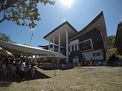 Municipal Hall | |
 Flag | |
| Motto: "Sinag San Luis." | |
 Map of Agusan del Sur with San Luis highlighted | |
OpenStreetMap  | |
 San Luis Location within the Philippines | |
| Coordinates: 8°30′N125°44′E / 8.5°N 125.74°E | |
| Country | Philippines |
| Region | Caraga |
| Province | Agusan del Sur |
| District | 1st district |
| Barangays | 25 (see Barangays) |
| Government | |
| • Type | Sangguniang Bayan |
| • Mayor | Ronaldo Y. Corvera |
| • Vice Mayor | Ely B. Yecyec |
| • Representative | Alfelito M. Bascug |
| • Electorate | 21,125 voters (2025) |
| Area | |
• Total | 950.5 km2 (367.0 sq mi) |
| Elevation | 342 m (1,122 ft) |
| Highest elevation | 1,880 m (6,170 ft) |
| Lowest elevation | 9 m (30 ft) |
| Population (2020 census) [3] | |
• Total | 35,196 |
| • Density | 37/km2 (96/sq mi) |
| • Households | 7,836 |
| Economy | |
| • Income class | 1st municipal income class |
| • Poverty incidence | 47.97 |
| • Revenue | ₱ 425.3 million (2022) |
| • Assets | ₱ 620.1 million (2022) |
| • Expenditure | ₱ 377.5 million (2022) |
| • Liabilities | ₱ 283 million (2022) |
| Service provider | |
| • Electricity | Agusan del Sur Electric Cooperative (ASELCO) |
| Time zone | UTC+8 (PST) |
| ZIP code | 8511 |
| PSGC | |
| IDD : area code | +63 (0)85 |
| Native languages | Agusan Butuanon Higaonon Tagalog language |
San Luis, officially the Municipality of San Luis (Cebuano : Lungsod sa San Luis; Tagalog : Bayan ng San Luis), is a municipality in the province of Agusan del Sur, Philippines. According to the 2020 census, it has a population of 35,196 people. [3]
Contents
San Luis was created into a municipality on June 15, 1968, when the barrios of San Luis, Santa Inez, Nuevo Trabajo, Cualision and Baylo were separated from the municipality of Esperanza and constituted into the new town, through Republic Act 5262. [5] Since the 1970s, the town's economy has been largely based on logging industries. [6]