Veruela

Last updated
Veruela
Municipality of Veruela
Veruela Municipal Hall.jpg
Municipal hall
Flag of Veruela, Agusan del Sur.png
Ph locator agusan del sur veruela.png
Map of Agusan del Sur with Veruela highlighted
OpenStreetMap
Veruela
Philippines location map (square).svg
Red pog.svg
Veruela
Location within the Philippines
Coordinates: 8°04′N125°58′E / 8.07°N 125.96°E / 8.07; 125.96
Country Philippines
Region Caraga
Province Agusan del Sur
District 2nd district
Barangays 20 (see Barangays)
Government
[1]
  Type Sangguniang Bayan
   Mayor Myrna S. Mondejar
   Vice Mayor Edgar P. Brigole
   Representative Adolph Edward G. Plaza
   Electorate 22,414 voters (2022)
Area
[2]
  Total385.45 km2 (148.82 sq mi)
Elevation
39 m (128 ft)
Highest elevation
169 m (554 ft)
Lowest elevation
19 m (62 ft)
Population
 (2020 census) [3]
  Total39,708
  Density100/km2 (270/sq mi)
   Households
9,637
Economy
   Income class 2nd municipal income class
   Poverty incidence
39.86
% (2018) [4]
   Revenue 203.1 million (2020)
   Assets 415.4 million (2020)
   Expenditure 166.1 million (2020)
   Liabilities 175.3 million (2020)
Service provider
  ElectricityAgusan del Sur Electric Cooperative (ASELCO)
Time zone UTC+8 (PST)
ZIP code
8509
PSGC
IDD : area code +63(0)85
Native languages Agusan
Butuanon
Cebuano
Higaonon
Tagalog
Website www.veruela.gov.ph

Veruela, officially the Municipality of Veruela (Cebuano : Lungsod sa Veruela; Tagalog : Bayan ng Veruela), is a 2nd class municipality in the province of Agusan del Sur, Philippines. According to the 2020 census, it has a population of 39,708 people. [3]

Contents

History

Veruela is considered the oldest town of upper Agusan del Sur. It was believed the name "Veruela" was derived from the word "virus", as the entire area was suffering from smallpox and cholera in the late 18th century when the Spanish missionaries encountered the tribe. From then on, the name Veruela existed out of the Spanish word La Verus. [5]

The Manobo tribes later moved to Manning, also known as Linongsuran along the Agusan River. In 1916 however, a great earthquake destroyed the settlement leaving no trace of it, forcing the survivors to evacuate and reorganize themselves into another place, now the barangay poblacion of the municipality. [5]

In the 18th century, the Muslim tribes in Davao invaded the Manobos in Agusan. The Manobos fought against the Muslims. The first known leader of the inhabitants was Eladio Manguyod, a strong and influential datu of the Manobo tribe, who led his people to victory after a hard-fought battle that drove the Muslims out of Agusan. It was also during those times when the tribe was converted into Christianity. The inhabitants owed their victories to Datu Manguyod as well as their patron, Saint John. [5]

Veruela became a municipality through Executive Order No. 147 proclaimed by President Diosdado Macapagal on March 31, 1965 [6] during the term of Congressman Guillermo Sanchez, who once also served as mayor of the town. Since its formal creation as a municipality, Veruela had undergone a series of eight different administrations.

The municipality of Veruela has a silent dispute with the nearby province of Compostela Valley regarding the boundary between the two in Barangay Del Monte. The local governments are trying to solve the issue amicably.[ citation needed ]

Geography

Veruela is located at 8°04′N125°58′E / 8.07°N 125.96°E / 8.07; 125.96 .

According to the Philippine Statistics Authority, the municipality has a land area of 385.45 square kilometres (148.82 sq mi) [7] constituting

Climate

Climate data for Veruela, Agusan del Sur
MonthJanFebMarAprMayJunJulAugSepOctNovDecYear
Mean daily maximum °C (°F)27
(81)
27
(81)
27
(81)
29
(84)
29
(84)
29
(84)
30
(86)
30
(86)
30
(86)
30
(86)
29
(84)
28
(82)
29
(84)
Mean daily minimum °C (°F)22
(72)
22
(72)
22
(72)
23
(73)
23
(73)
23
(73)
23
(73)
23
(73)
23
(73)
23
(73)
23
(73)
22
(72)
23
(73)
Average precipitation mm (inches)105
(4.1)
80
(3.1)
58
(2.3)
39
(1.5)
62
(2.4)
75
(3.0)
69
(2.7)
62
(2.4)
59
(2.3)
71
(2.8)
69
(2.7)
69
(2.7)
818
(32)
Average rainy days15.815.414.813.819.722.522.922.722.023.018.115.0225.7
Source: Meteoblue [8]

Barangays

Veruela is politically subdivided into 20 barangays. [9] Each barangay consists of puroks while some have sitios.

PSGC Barangay Population ±% p.a.
2020 [3] 2010 [10]
160313013 Anitap 1.5% 595 560 0.61%
160313014 Bacay II 2.7% 1,085 994 0.88%
160313001 Binongan 4.4% 1,735 1,477 1.62%
160313015 Caigangan 2.6% 1,029 726 3.55%
160313016 Candiis 1.6% 655 553 1.71%
160313002 Del Monte 6.0% 2,375 2,260 0.50%
160313003 Don Mateo 3.7% 1,452 1,269 1.36%
160313017 Katipunan 2.4% 958 922 0.38%
160313004 La Fortuna 16.2% 6,418 6,045 0.60%
160313005 Limot 2.5% 973 1,104 −1.25%
160313006 Magsaysay 4.1% 1,628 1,563 0.41%
160313007 Masayan 4.3% 1,726 1,430 1.90%
160313008 Poblacion 14.8% 5,891 5,643 0.43%
160313009 Sampaguita 15.0% 5,950 5,581 0.64%
160313010 San Gabriel 6.5% 2,569 2,115 1.96%
160313018 Santa Cruz 2.7% 1,059 1,021 0.37%
160313011 Santa Emelia 3.7% 1,483 1,463 0.14%
160313019 Sawagan 2.8% 1,099 1,214 −0.99%
160313012 Sinobong 9.3% 3,706 3,206 1.46%
160313020 Sisimon 3.3% 1,320 1,311 0.07%
Total39,70840,457−0.19%

Demographics

Population census of Veruela
YearPop.±% p.a.
1903 2,623    
1918 1,522−3.56%
1939 1,381−0.46%
1948 1,528+1.13%
1960 2,914+5.53%
1970 6,626+8.55%
1975 9,915+8.42%
1980 13,991+7.13%
1990 20,129+3.71%
1995 35,706+11.34%
2000 36,222+0.31%
2007 36,862+0.24%
2010 40,457+3.44%
2015 43,706+1.48%
2020 39,708−1.87%
Source: Philippine Statistics Authority [11] [10] [12] [13]

In the 2020 census, Veruela had a population of 39,708. [3] The population density was 100 inhabitants per square kilometre (260/sq mi).

Economy

Related Research Articles

<span class="mw-page-title-main">Agusan del Sur</span> Province in Caraga, Philippines

Agusan del Sur, officially the Province of Agusan del Sur, is a province in Caraga region, Mindanao, Philippines. Its capital is the municipality of Prosperidad. It is bordered on the northwest by Agusan del Norte and Misamis Oriental; east by Surigao del Sur; southeast by Davao Oriental; mid-south by Davao de Oro; southwest by Davao del Norte and, mid-west by Bukidnon. It is the fourth largest province in the country in terms of area, with the size of 3,856 sq miles.

<span class="mw-page-title-main">Sibagat</span> Municipality in Agusan del Sur, Philippines

Sibagat, officially the Municipality of Sibagat, is a 1st class municipality in the province of Agusan del Sur, Philippines. According to the 2020 census, it has a population of 33,957 people.

<span class="mw-page-title-main">Trento, Agusan del Sur</span> Municipality in Agusan del Sur, Philippines

Trento, officially the Municipality of Trento, is a 1st class municipality in the province of Agusan del Sur, Philippines. According to the 2020 census, it has a population of 54,492 people.

<span class="mw-page-title-main">Bunawan</span> Municipality in Agusan del Sur, Philippines

Bunawan, officially the Municipality of Bunawan, is a 1st class municipality in the province of Agusan del Sur, Philippines. According to the 2020 census, it has a population of 47,512 people.

<span class="mw-page-title-main">Buenavista, Agusan del Norte</span> Municipality in Agusan del Norte, Philippines

Buenavista, officially the Municipality of Buenavista, is a 1st class municipality in the province of Agusan del Norte, Philippines. According to the 2020 census, it has a population of 68,892 people.

<span class="mw-page-title-main">Carmen, Agusan del Norte</span> Municipality in Agusan del Norte, Philippines

Carmen, officially the Municipality of Carmen, is a 4th class municipality in the province of Agusan del Norte, Philippines. According to the 2020 census, it has a population of 23,172 people.

<span class="mw-page-title-main">Jabonga</span> Municipality in Agusan del Norte, Philippines

Jabonga, officially the Municipality of Jabonga, is a 3rd class municipality in the province of Agusan del Norte, Philippines. According to the 2020 census, it has a population of 24,855 people.

<span class="mw-page-title-main">Kitcharao</span> Municipality in Agusan del Norte, Philippines

Kitcharao, officially the Municipality of Kitcharao, is a 4th class municipality in the province of Agusan del Norte, Philippines. According to the 2020 census, it has a population of 21,278 people.

<span class="mw-page-title-main">Remedios T. Romualdez</span> Municipality in Agusan del Norte, Philippines

Remedios T. Romualdez, officially the Municipality of Remedios T. Romualdez, is a 5th class municipality in the province of Agusan del Norte, Philippines. According to the 2020 census, it has a population of 17,155 people.

<span class="mw-page-title-main">Santiago, Agusan del Norte</span> Municipality in Agusan del Norte, Philippines

Santiago, officially the Municipality of Santiago, is a 4th class municipality in the province of Agusan del Norte, Philippines. According to the 2020 census, it has a population of 28,657 people.

<span class="mw-page-title-main">Tubay</span> Municipality in Agusan del Norte, Philippines

Tubay, officially the Municipality of Tubay, is a 4th class municipality in the province of Agusan del Norte, Philippines. According to the 2020 census, it has a population of 25,785 people.

<span class="mw-page-title-main">Esperanza, Agusan del Sur</span> Municipality in Agusan del Sur, Philippines

Esperanza, officially the Municipality of Esperanza, is a 1st class municipality in the province of Agusan del Sur, Philippines. According to the 2020 census, it has a population of 59,353 people.

<span class="mw-page-title-main">La Paz, Agusan del Sur</span> Municipality in Agusan del Sur, Philippines

La Paz, officially the Municipality of La Paz, is a municipality in the province of Agusan del Sur in the Caraga of the Philippines. The population was 30,969 at the 2020 census. La Paz is the largest town in terms of land area in Agusan del Sur and the entire Mindanao.

<span class="mw-page-title-main">Loreto, Agusan del Sur</span> Municipality in Agusan del Sur, Philippines

Loreto, officially the Municipality of Loreto, is a 1st class municipality in the province of Agusan del Sur, Philippines. According to the 2020 census, it has a population of 43,880 people. Loreto is the largest Municipality in terms of land area in Mindanao.

<span class="mw-page-title-main">Prosperidad</span> Capital of Agusan del Sur, Philippines

Prosperidad, officially the Municipality of Prosperidad, is a 1st class municipality and capital of the province of Agusan del Sur, Philippines. According to the 2020 census, it has a population of 88,321 people.

<span class="mw-page-title-main">Rosario, Agusan del Sur</span> Municipality in Agusan del Sur, Philippines

Rosario, officially the Municipality of Rosario, is a 2nd class municipality in the province of Agusan del Sur, Philippines. According to the 2020 census, it has a population of 49,610 people.

<span class="mw-page-title-main">San Francisco, Agusan del Sur</span> Municipality in Agusan del Sur, Philippines

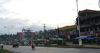
San Francisco, officially the Municipality of San Francisco, is a 1st class municipality in the province of Agusan del Sur, Philippines. According to the 2020 census, it has a population of 80,760 people.

<span class="mw-page-title-main">San Luis, Agusan del Sur</span> Municipality in Agusan del Sur, Philippines

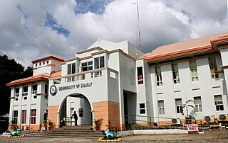
San Luis, officially the Municipality of San Luis, is a 1st class municipality in the province of Agusan del Sur, Philippines. According to the 2020 census, it has a population of 35,196 people.

<span class="mw-page-title-main">Santa Josefa</span> Municipality in Agusan del Sur, Philippines

Santa Josefa, officially the Municipality of Santa Josefa, is a 3rd class municipality in the province of Agusan del Sur, Philippines. According to the 2020 census, it has a population of 26,432 people.

<span class="mw-page-title-main">Talacogon</span> Municipality in Agusan del Sur, Philippines

Talacogon, officially the Municipality of Talacogon, is a 2nd class municipality in the province of Agusan del Sur, Philippines. According to the 2020 census, it has a population of 39,678 people.

References

  1. Municipality of Veruela | (DILG)
  2. "2015 Census of Population, Report No. 3 – Population, Land Area, and Population Density" (PDF). Philippine Statistics Authority. Quezon City, Philippines. August 2016. ISSN   0117-1453. Archived (PDF) from the original on May 25, 2021. Retrieved July 16, 2021.
  3. 1 2 3 4 Census of Population (2020). "Caraga". Total Population by Province, City, Municipality and Barangay. Philippine Statistics Authority . Retrieved 8 July 2021.
  4. "PSA Releases the 2018 Municipal and City Level Poverty Estimates". Philippine Statistics Authority. 15 December 2021. Retrieved 22 January 2022.
  5. 1 2 3 "Municipality of Veruela". Province of Agusan del Sur. Provincial Information Management Office (PIMO). Archived from the original on 9 May 2013. Retrieved 19 October 2016.
  6. "Executive Order No. 147; Declaring Certain Municipal Districts in the Province of Agusan as Municipalities". Official Gazette of the Republic of the Philippines. 31 March 1965. Retrieved 19 October 2016.
  7. "Province: Agusan del Sur". PSGC Interactive. Quezon City, Philippines: Philippine Statistics Authority . Retrieved 12 November 2016.
  8. "Veruela: Average Temperatures and Rainfall". Meteoblue. Retrieved 29 April 2020.
  9. "Municipal: Veruela". PSGC Interactive. Quezon City, Philippines: Philippine Statistics Authority . Retrieved 8 January 2016.
  10. 1 2 Census of Population and Housing (2010). "Caraga" (PDF). Total Population by Province, City, Municipality and Barangay. National Statistics Office . Retrieved 29 June 2016.
  11. Census of Population (2015). "Caraga". Total Population by Province, City, Municipality and Barangay. Philippine Statistics Authority . Retrieved 20 June 2016.
  12. Censuses of Population (1903–2007). "Caraga". Table 1. Population Enumerated in Various Censuses by Province/Highly Urbanized City: 1903 to 2007. National Statistics Office.{{cite encyclopedia}}: CS1 maint: numeric names: authors list (link)
  13. "Province of Agusan del Sur". Municipality Population Data. Local Water Utilities Administration Research Division. Retrieved 17 December 2016.
  14. "Poverty incidence (PI):". Philippine Statistics Authority. Retrieved December 28, 2020.
  15. "Estimation of Local Poverty in the Philippines" (PDF). Philippine Statistics Authority. 29 November 2005.
  16. "2003 City and Municipal Level Poverty Estimates" (PDF). Philippine Statistics Authority. 23 March 2009.
  17. "City and Municipal Level Poverty Estimates; 2006 and 2009" (PDF). Philippine Statistics Authority. 3 August 2012.
  18. "2012 Municipal and City Level Poverty Estimates" (PDF). Philippine Statistics Authority. 31 May 2016.
  19. "Municipal and City Level Small Area Poverty Estimates; 2009, 2012 and 2015". Philippine Statistics Authority. 10 July 2019.
  20. "PSA Releases the 2018 Municipal and City Level Poverty Estimates". Philippine Statistics Authority. 15 December 2021. Retrieved 22 January 2022.