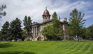
Cascade County is a county located in the U.S. state of Montana. As of the 2020 census, the population was 84,414, making it the fifth-most populous county in Montana. Its county seat is Great Falls.

Centerville is a city in and the county seat of Appanoose County, Iowa, United States. The population was 5,412 in the 2020 census, a decline from 5,924 in 2000. After the turn of the 20th century Centerville's coal mining industry attracted European immigrants from Sweden, Italy, Croatia, and Albania. Centerville is also home of the largest town square in the state of Iowa.

Bearcreek is an incorporated town in Carbon County, Montana, United States. It is part of the Billings, Montana Metropolitan Statistical Area. The population was 91 at the 2020 census. Bearcreek uses the Mayor/Council form of government.
Fromberg is a town in Carbon County, Montana, United States. As of the 2020 census, the population of the town was 392.

Belt is a town in Cascade County, Montana, United States. The population was 510 according to the 2020 census. It is part of the Great Falls, Montana metropolitan area.
Belgrade is a city in Gallatin County, Montana, United States. The population was 10,460 at the 2020 census. Belgrade is part of the Bozeman, MT Micropolitan Statistical Area. It is the most populous city in Montana that is not a county seat.

Livingston, is a city and county seat of Park County, Montana, United States. It is in southwestern Montana, on the Yellowstone River, north of Yellowstone National Park. As of the 2020 census, the population of the city was 8,040.

Conrad is a city in and the county seat of Pondera County, Montana, United States. The population was 2,318 at the 2020 census. Each June, the Whoop Up Days, a town wide celebration that includes a parade and rodeo, takes place in Conrad.

Colstrip is a city in Rosebud County, Montana, United States. The population was 2,096 at the 2020 census.

Billings is the most populous city in the U.S. state of Montana, with a population of 117,116 as of the 2020 census. Located in the south-central portion of the state, it is the seat of Yellowstone County and the principal city of the Billings Metropolitan Area, which had a population of 184,167 in the 2020 census. With one of the largest trade areas in the United States, Billings is the trade and distribution center for much of Montana east of the Continental Divide. Billings is also the largest retail destination for much of the same area. The Billings Chamber of Commerce claims the area of commerce covers more than 125,000 square miles (320,000 km2). In 2009, it was estimated to serve over 500,000 people.

Libby is a city in northwestern Montana, United States and the county seat of Lincoln County. The population was 2,775 at the 2020 census.
Centerville is a city in Montgomery County, Ohio, United States. A core suburb of Metro Dayton, its population was 24,240 as of the 2020 census.

Centerville is a town in Hickman County, Tennessee, United States. The population was 3,489 as of the 2020 Census. It is the county seat and the only incorporated town in Hickman County. It is best known for being the hometown of American comedian Minnie Pearl.

Coulee City is a town in Grant County, Washington. The population was 549 at the 2020 census.
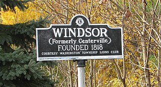
Windsor is a small historic unincorporated community and census-designated place (CDP) located within Robbinsville Township in Mercer County, in the U.S. state of New Jersey. The area is served as United States Postal Service ZIP Code 08561. As of the 2020 United States census, the CDP's population was 330, an increase of 104 (+46.0%) above the 226 counted at the 2010 census. The community, covering 570 acres (230 ha), was added to the National Register of Historic Places in 1992.
Geyser is a small, unincorporated rural village in Judith Basin County, Montana, United States, southeast of Great Falls along U.S. Route 87.
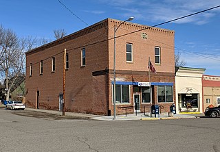
Stockett is a census-designated place and unincorporated community in Cascade County, Montana, United States. Its population was 169 as of the 2010 census. Stockett has a post office with ZIP code 59480.
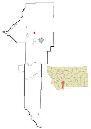
Centerville is a census-designated place (CDP) in Cascade County, Montana, United States. It is in the east-central part of the county, in the valley of Cottonwood Creek where it joins Sand Coulee Creek, a north-flowing tributary of the Missouri River. Centerville lies along Secondary Highway 227, 2.5 miles (4.0 km) north of Stockett and 2 miles (3 km) south of Tracy. It is 14 miles (23 km) southeast of Great Falls via Highway 227 and U.S. Route 87.
Big Stone Colony is a Hutterite community and census-designated place (CDP) in Cascade County, Montana, United States. It is in the east-central part of the county, bordered to the east by Sand Coulee and 11 miles (18 km) south of Great Falls.
Tracy is an unincorporated community and census-designated place (CDP) in Cascade County, Montana, United States. It is in the east-central part of the county, in the valley of Sand Coulee Creek, a north-flowing tributary of the Missouri River. Tracy is bordered to the west by the community of Sand Coulee, and it is 12 miles (19 km) southeast of Great Falls.


