Fort Shaw, Montana

Last updated

Fort Shaw, Montana
CDP
FortShawMT HistoricFortShaw 1.jpg
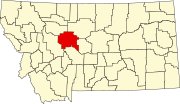
Cascade County Montana Incorporated and Unincorporated areas Fort Shaw Highlighted.svg
Location of Fort Shaw, Montana
Coordinates: 47°30′16″N111°48′41″W / 47.50444°N 111.81139°W / 47.50444; -111.81139
Country United States
State Montana
County Cascade
Area
[1]
  Total5.68 sq mi (14.71 km2)
  Land5.68 sq mi (14.71 km2)
  Water0.00 sq mi (0.00 km2)
Elevation
3,504 ft (1,068 m)
Population
 (2020)
  Total256
  Density45.07/sq mi (17.40/km2)
Time zone UTC-7 (Mountain (MST))
  Summer (DST) UTC-6 (MDT)
ZIP code
59443
Area code 406
FIPS code 30-28600
GNIS feature ID0771518

Fort Shaw is a census-designated place (CDP) in Cascade County, Montana, United States. The population was 280 at the 2010 census. [2] Named for a former United States military outpost, it is part of the Great Falls, Montana Metropolitan Statistical Area.

Contents

First called Camp Reynolds, Fort Shaw is named for Col. Robert G. Shaw of Boston, the first white officer to lead a unit of the United States Colored Troops in the American Civil War. The U.S. government established this fort on the Mullan Road in 1867. [3] A community developed around it.

Geography

Fort Shaw is located at 47°30′16″N111°48′41″W / 47.50444°N 111.81139°W / 47.50444; -111.81139 (47.504313, -111.811348). [4] It is situated on Montana Highway 200. The Sun River flows north of town.

According to the United States Census Bureau, the CDP has a total area of 5.6 square miles (15 km2), all land.

Demographics

Historical population
CensusPop.Note
2020 256
U.S. Decennial Census [5]

As of the census [6] of 2000, there were 274 people, 101 households, and 73 families residing in the CDP. The population density was 48.6 inhabitants per square mile (18.8/km2). There were 115 housing units at an average density of 20.4 per square mile (7.9/km2). The racial makeup of the CDP was 97.81% White, 0.73% Native American, and 1.46% from two or more races. Hispanic or Latino of any race were 1.46% of the population.

There were 101 households, out of which 34.7% had children under the age of 18 living with them, 59.4% were married couples living together, 7.9% had a female householder with no husband present, and 27.7% were non-families. 25.7% of all households were made up of individuals, and 12.9% had someone living alone who was 65 years of age or older. The average household size was 2.70 and the average family size was 3.32.

In the CDP, the population was spread out, with 29.6% under the age of 18, 6.2% from 18 to 24, 25.9% from 25 to 44, 25.5% from 45 to 64, and 12.8% who were 65 years of age or older. The median age was 38 years. For every 100 females, there were 101.5 males. For every 100 females age 18 and over, there were 105.3 males.

The median income for a household in the CDP was $36,250, and the median income for a family was $45,357. Males had a median income of $34,688 versus $16,250 for females. The per capita income for the CDP was $17,381. About 7.4% of families and 9.3% of the population were below the poverty line, including 14.5% of those under the age of eighteen and 6.3% of those 65 or over.

Education

Fort Shaw is part of the Sun River Valley School District. Fort Shaw Elementary School is located in town. Sun River Middle School and Simms High School are located in Simms. [7]

Related Research Articles

<span class="mw-page-title-main">Cascade County, Montana</span> County in Montana, United States

Cascade County is a county located in the U.S. state of Montana. As of the 2020 census, the population was 84,414, making it the fifth-most populous county in Montana. Its county seat is Great Falls.

<span class="mw-page-title-main">Mayo, Maryland</span> Census-designated place in Maryland, United States

Mayo is a census-designated place (CDP) in Anne Arundel County, Maryland, United States. The population was 8,298 in the 2010 census. The Mayo CDP of 2010 includes all of the area that used to be counted as the Selby-on-the-Bay CDP. The beach in Mayo used to be a popular weekend resort.

<span class="mw-page-title-main">Toston, Montana</span> Census-designated place in Montana, United States

Toston is a census-designated place (CDP) in Broadwater County, Montana, United States. The population was 108 at the 2010 census.

<span class="mw-page-title-main">Black Eagle, Montana</span> CDP in Montana, United States

Black Eagle is a census-designated place (CDP) in Cascade County, Montana, United States. The population was 904 at the 2010 census. It is a suburb of Great Falls.

<span class="mw-page-title-main">Simms, Montana</span> CDP in Montana, United States

Simms is a census-designated place (CDP) in Cascade County, Montana, United States. The population was 354 at the 2010 census. It is part of the Great Falls, Montana Metropolitan Statistical Area.

<span class="mw-page-title-main">Sun Prairie, Montana</span> CDP in Montana, United States

Sun Prairie is a census-designated place (CDP) in Cascade County, Montana, United States. The population was 1,630 at the 2010 census. It is part of the Great Falls Metropolitan Statistical Area and may have evolved as a remote suburb of Great Falls.

<span class="mw-page-title-main">Sun River, Montana</span> CDP in Montana, United States

Sun River is a census-designated place (CDP) in Cascade County, Montana, United States. The population was 124 at the 2010 census. It is part of the Great Falls, Montana Metropolitan Statistical Area.

<span class="mw-page-title-main">Ulm, Montana</span> CDP in Montana, United States

Ulm is a census-designated place (CDP) in Cascade County, Montana, United States. It was originally a large ranch owned by Indiana-born cattleman William Ulm. The population was 738 at the 2010 census. It is part of the Great Falls, Montana Metropolitan Statistical Area. The Zip Code is 59485.

<span class="mw-page-title-main">Carter, Montana</span> Census-designated place in Montana, United States

Carter is a census-designated place (CDP) in Chouteau County, Montana, United States. The population was 58 at the 2010 census.

<span class="mw-page-title-main">Loma, Montana</span> Census-designated place in Montana, United States

Loma is a census-designated place (CDP) in Chouteau County, Montana, United States. The population was 85 at the 2010 census.

<span class="mw-page-title-main">Four Corners, Montana</span> Census-designated place in Montana, United States

Four Corners is a census-designated place (CDP) in Gallatin County, Montana, United States. The population was 5,901 at the 2020 census, up from 3,146 in 2010. It is part of the Bozeman, MT Micropolitan Statistical Area.

<span class="mw-page-title-main">Willow Creek, Montana</span> Census-designated place in Gallatin County, Montana, United States.

Willow Creek is a census-designated place (CDP) in Gallatin County, Montana, United States. The population was 210 at the 2010 census. It is part of the Bozeman, MT Micropolitan Statistical Area.

<span class="mw-page-title-main">Augusta, Montana</span> Census-designated place in Montana, United States

Augusta is an unincorporated community and census-designated place (CDP) in Lewis and Clark County, Montana, United States. The population was 309 at the 2010 census and rose to 316 in the 2020 census. The most accepted version in the naming of this town is after Augusta Hogan, thought to be the first child born in this town, the daughter of J. D. Hogan, an early rancher.

<span class="mw-page-title-main">Helena Valley Southeast, Montana</span> Census-designated place in Montana, United States

Helena Valley Southeast is a census-designated place (CDP) in Lewis and Clark County, Montana, United States. The population was 8,227 at the 2010 census. It is part of the Helena Micropolitan Statistical Area.

<span class="mw-page-title-main">Harrison, Montana</span> Census-designated place in Montana, United States

Harrison is an unincorporated community and census-designated place (CDP) in Madison County, Montana, United States. The population was 105 at the 2020 census, down from 137 in 2010.

<span class="mw-page-title-main">Evaro, Montana</span> Census-designated place in Montana, United States

Evaro is a census-designated place (CDP) in Missoula County, Montana, United States, and part of the Missoula metropolitan area. It is located on the southernmost part of the Flathead Indian Reservation, approximately 20 miles (32 km) north of downtown Missoula via US Highway 93. As of the 2020 census, the population of the CDP was 373, up from 322 in 2010.

<span class="mw-page-title-main">Wye, Montana</span> Census-designated place in Montana, United States

Wye is an unincorporated community and census-designated place in Missoula County, Montana, United States. It is part of the Missoula metropolitan area. The population was 714 at the 2020 census, up from 511 in 2010. The community is named for the "y"-shaped DeSmet Junction where US 93 and MT 200 met former US 10.

<span class="mw-page-title-main">Fox Lake, Montana</span> CDP in Montana, United States

Fox Lake is a census-designated place (CDP) in Richland County, Montana, United States. The population was 158 at the 2010 census.

<span class="mw-page-title-main">Power, Montana</span> CDP in Montana, United States

Power is a census-designated place (CDP) in Teton County, Montana, United States. The population was 171 at the 2000 census. The town is named after Montana pioneer, Thomas Charles Power, who platted the townsite in 1910.

<span class="mw-page-title-main">Fort Kent (CDP), Maine</span> Census-designated place in Maine, United States

Fort Kent is a census-designated place (CDP) that comprises the main village in the town of Fort Kent in Aroostook County, Maine, United States. In 2010, Fort Kent's population was 2,488 of 4,097 for the entire town.

References

  1. "ArcGIS REST Services Directory". United States Census Bureau. Retrieved September 5, 2022.
  2. "Profile of General Population and Housing Characteristics: 2010 Demographic Profile Data (DP-1): Fort Shaw CDP, Montana". United States Census Bureau . Retrieved January 27, 2012.
  3. "Fort Shaw". Montana Place Names Companion. Montana Historical Society. Retrieved April 2, 2021.
  4. "US Gazetteer files: 2010, 2000, and 1990". United States Census Bureau. February 12, 2011. Retrieved April 23, 2011.
  5. "Census of Population and Housing". Census.gov. Retrieved June 4, 2016.
  6. "U.S. Census website". United States Census Bureau . Retrieved January 31, 2008.
  7. "Fort Shaw Elementary". Sun River Valley School District. Retrieved April 16, 2021.

Commons-logo.svg Media related to Fort Shaw, Montana at Wikimedia Commons