Sandhutton

Last updated • 1 min readFrom Wikipedia, The Free Encyclopedia

Sandhutton
Sandhutton, North Yorkshire, St Leonard's Church and War Memorial.jpg
St Leonard's Church with Sandhutton's War Memorial on the left
North Yorkshire UK location map (2023).svg
Red pog.svg
Sandhutton
Location within North Yorkshire
Population261 (2011 census) [1]
OS grid reference SE382820
Civil parish
  • Sandhutton
Unitary authority
Ceremonial county
Region
Country England
Sovereign state United Kingdom
Post town THIRSK
Postcode district YO7
Police North Yorkshire
Fire North Yorkshire
Ambulance Yorkshire
Website www.parish-council.com/sandhutton/
List of places
UK
England
Yorkshire
54°13′58″N1°24′54″W / 54.23271°N 1.41494°W / 54.23271; -1.41494

Sandhutton is a small village and civil parish in North Yorkshire, England. It lies about 3 miles (5 km) west of Thirsk on the A167. [2] It has been referred to as Hutton, Hutton (Sand), [3] and Sand Hutton. The name derives from Old English sand-hōh-tūn which translates as a sharply projecting piece of sandy ground with an enclosure, farmstead or village upon it. [4]

Contents

East of the village, on the road to Carlton Miniott, is the Sand Hutton Cross which is now a listed monument. The cross marked the point at which three parishes met and is designated due to the fact that it has survived despite intensive arable farming in the area. [5]

In 2017, a 45-acre (18 ha) solar farm was installed to the east of the village. The scheme involved the placing of 20,000 photovoltaic panels that would generate up to 5 MW and would have a life expectancy of 25 years. [6] [7]

Sandhutton is the location of Breckenbrough School, an independent special school. [8]

Transport

The village lies on the A167 road [9] which has a junction with the A61 road just south of the village at Busby Stoop. The Leeds and Thirsk Railway had a station called Topcliffe which was situated just south of the crossroads at Busby Stoop, however, this closed in 1959 [10] and the nearest railway station is Thirsk which is just over 2 miles (3 km) away. [2]

Related Research Articles

<span class="mw-page-title-main">Sowerby, North Yorkshire</span> Village and civil parish in North Yorkshire, England

Sowerby is a village, electoral ward and civil parish in North Yorkshire, England immediately south of the neighbouring market town of Thirsk. Although the boundary between the two parishes runs very close to Thirsk town centre, the village retains its own identity and has a separate Parish Council. The author James Herriot lived in the village.

<span class="mw-page-title-main">A19 road</span> Road in Northern England

The A19 is a major road in England running approximately parallel to and east of the A1 road. Although the two roads meet at the northern end of the A19, the two roads originally met at the southern end of the A19 in Doncaster, but the old route of the A1 was changed to the A638. From Sunderland northwards, the route was formerly the A108. In the past the route was known as the East of Snaith-York-Thirsk-Stockton-on-Tees-Sunderland Trunk Road. Most traffic joins the A19, heading for Teesside, from the A168 at Dishforth Interchange.
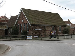
<span class="mw-page-title-main">Alne, North Yorkshire</span> Village and civil parish in North Yorkshire, England

Alne is a village and civil parish in the Hambleton District of North Yorkshire, England, about twelve miles north-west of York and four miles from Easingwold. The parish has a population of 711, increasing to 756 at the 2011 census.

<span class="mw-page-title-main">Asenby</span> Village and civil parish in North Yorkshire, England

Asenby is a village and civil parish in the Harrogate district of North Yorkshire, England, with a population of 285, increasing to 311 at the 2011 census. The village is about 5 miles (8 km) south-west of Thirsk and 7 miles (11 km) east of Ripon. It is 12 miles (19 km) south of the County Town of Northallerton on the south bank of the River Swale.

<span class="mw-page-title-main">Carlton Miniott</span> Village and civil parish in North Yorkshire, England

Carlton Miniott, formerly Carlton Islebeck, is a village and civil parish in the former Hambleton district of North Yorkshire, England, on the A61 road to the immediate west of Thirsk, 25 miles (40 km) north of York. According to the 2001 census it had a population of 926, increasing to 990 at the 2011 census.

<span class="mw-page-title-main">Raskelf</span> Village and civil parish in North Yorkshire, England

Raskelf is a village and civil parish in North Yorkshire, England. The electoral roll has a population of around 400 measured at 519 in the 2011 census.

<span class="mw-page-title-main">Hutton Sessay</span> Village and civil parish in North Yorkshire, England

Hutton Sessay is a village and civil parish in the former Hambleton district of North Yorkshire, England. In 2013 the population of the civil parish was estimated at 100. The village is situated just west of the A19 between Thirsk and Easingwold.

<span class="mw-page-title-main">Topcliffe, North Yorkshire</span> Village and civil parish in North Yorkshire, England

Topcliffe is a village and civil parish in North Yorkshire, England. The village is situated on the River Swale, on the A167 road and close to the A168. It is about 5 miles (8 km) south-west of Thirsk and 11 miles (18 km) south of the county town of Northallerton. It has a population of 1,489. An army barracks, with a Royal Air Force airfield enclosed within, is located to the north of the village.

<span class="mw-page-title-main">Pickhill</span> Village in North Yorkshire, England

Pickhill is a village in North Yorkshire, England, 6 miles (10 km) west of Thirsk. It is a part of the civil parish of Pickhill with Roxby.

<span class="mw-page-title-main">Killinghall</span> Village and civil parish in North Yorkshire, England

Killinghall is a village and civil parish in the Harrogate district of North Yorkshire, England. The civil parish population taken at the 2011 census was 4,132.

<span class="mw-page-title-main">Skipton-on-Swale</span> Village and civil parish in North Yorkshire, England

Skipton-on-Swale is a small village and civil parish in the former Hambleton district of North Yorkshire, England. The population at the 2011 Census was less than 100. Details are included in the civil parish of Catton, North Yorkshire. It lies on the A61 road, about 4 miles west of Thirsk on the east bank of the River Swale.

<span class="mw-page-title-main">Sessay</span> Village and civil parish in North Yorkshire, England

Sessay is a small, linear village and civil parish in North Yorkshire, England. It is situated approximately 4 miles (6 km) south-east from Thirsk, and 2 miles (3 km) west from the A19 road close to the East Coast Main Line.
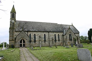
<span class="mw-page-title-main">Dalton, east North Yorkshire</span> Village and civil parish in North Yorkshire, England

Dalton is a village and civil parish in the former Hambleton District of North Yorkshire, England. It is about 4 miles (6.4 km) south of Thirsk and near the A168 road. It mainly consists of farmland as well as an industrial estate. It has a population of 518.

<span class="mw-page-title-main">A168 road</span> Road in North Yorkshire, England

The A168 is a major road in North Yorkshire, England. It runs from Northallerton to Wetherby, acting as a local access road for the A1(M).

<span class="mw-page-title-main">South Otterington</span> Village and civil parish in North Yorkshire, England

South Otterington is a village and civil parish in the former Hambleton district of North Yorkshire, England. It is located on the A167 road 5 miles (8 km) south of Northallerton and on the east bank of the River Wiske.

<span class="mw-page-title-main">Goldsborough, Harrogate</span> Village and civil parish in North Yorkshire, England

Goldsborough is a village and civil parish in North Yorkshire, England. It is situated near the River Nidd and one mile (1.6 km) east of Knaresborough. Goldsborough is recognised by the well-known stately home Goldsborough Hall and its other features including: Goldsborough Primary School, the Bay Horse Inn and the Goldsborough Cricket Grounds.

<span class="mw-page-title-main">RAF Skipton-on-Swale</span> Royal Air Force base in Yorkshire, England

Royal Air Force Skipton-on-Swale or more simply RAF Skipton-on-Swale is a former Royal Air Force satellite station operated by RAF Bomber Command during the Second World War. The station was located at Skipton-on-Swale 4 miles (6.4 km) west of Thirsk, North Yorkshire, England. The village of Sandhutton is located just to the east. RAF Skipton-on-Swale was a sub-station of RAF Leeming.

<span class="mw-page-title-main">Busby's stoop chair</span> Allegedly haunted chair

The Busby's stoop chair or the Dead Man's Chair is an oak chair that was supposedly cursed by the murderer Thomas Busby before his execution by hanging in 1702 in North Yorkshire, in the United Kingdom.

<span class="mw-page-title-main">Topcliffe railway station</span> Disused railway station in North Yorkshire, England

Topcliffe railway station served the village of Topcliffe, North Yorkshire, England from 1848 to 1959 on the Leeds and Thirsk Railway.

References

  1. UK Census (2011). "Local Area Report – Sandhutton Parish (1170216914)". Nomis. Office for National Statistics . Retrieved 21 May 2018.
  2. 1 2 "302" (Map). Northallerton & Thirsk. 1;25,000. Explorer. Ordnance Survey. 2015. ISBN   9780319245545.
  3. "History of Sand Hutton, in Hambleton and North Riding | Map and description". www.visionofbritain.org.uk. Archived from the original on 7 November 2017. Retrieved 1 November 2017.
  4. Ekwall, Eilert (1960). The concise Oxford dictionary of English place-names (4 ed.). Oxford: Clarendon Press. p. 259. ISBN   0-19-869103-3.
  5. Historic England. "Sand Hutton Cross (1011748)". National Heritage List for England . Retrieved 1 November 2017.
  6. Minting, Stuart (8 June 2015). "Renewable energy firms unveil plans for large solar farms". Darlington and Stockton Times. Archived from the original on 7 November 2017. Retrieved 1 November 2017.
  7. "Sandhutton Solar Farm Renewable energy scheme / Solar". www.renewables-map.co.uk. Archived from the original on 7 November 2017. Retrieved 1 November 2017.
  8. "Breckenbrough | Residential School for Boys with Special Needs". Breckenbrough School. Archived from the original on 25 January 2022. Retrieved 25 January 2022.
  9. "Sandhutton Parish Council | Home". www.parish-council.com. Archived from the original on 7 November 2017. Retrieved 1 November 2017.
  10. "Disused Stations:Topcliffe Station". www.disused-stations.org.uk. Archived from the original on 11 April 2013. Retrieved 1 November 2017.

Commons-logo.svg Media related to Sandhutton at Wikimedia Commons