Sandia Heights, New Mexico

Last updated

Sandia Heights, New Mexico
USA New Mexico location map.svg
Red pog.svg
Sandia Heights
Coordinates: 35°10′29″N106°29′18″W / 35.17472°N 106.48833°W / 35.17472; -106.48833
Country United States
State New Mexico
County Bernalillo
Area
[1]
  Total1.89 sq mi (4.88 km2)
  Land1.89 sq mi (4.88 km2)
  Water0.00 sq mi (0.00 km2)
Elevation
[2]
6,165 ft (1,879 m)
Population
 (2020) [3]
  Total3,273
  Density1,735.42/sq mi (670.06/km2)
Time zone UTC-7 (Mountain (MST))
  Summer (DST) UTC-6 (MDT)
ZIP code
87122
Area code 505
FIPS code 35-66765
GNIS feature ID2584202 [2]

Sandia Heights is a census-designated place (CDP) in Bernalillo County, New Mexico, United States. The population was 10,293 at the 2010 census. [4] It is part of the Albuquerque Metropolitan Statistical Area.

Contents

Geography

Sandia Heights is located in northern Bernalillo County at the western base of the Sandia Mountains. It is bordered to the south by the city of Albuquerque. The base station for the Sandia Peak Tramway is located just outside the northern edge of the CDP.

According to the United States Census Bureau, Sandia Heights has a total area of 1.9 square miles (5.0 km2), all land. [4]

Climate

Sandia Heights is categorized as being within the 7b USDA hardiness zone, meaning temperatures can get as low as 5 to 10 °F. [5]

Climate data for Sandia Heights (6,180 feet above sea level)
MonthJanFebMarAprMayJunJulAugSepOctNovDecYear
Record high °F (°C)67.0
(19.4)
70.0
(21.1)
79.0
(26.1)
85.0
(29.4)
96.0
(35.6)
101.0
(38.3)
100.0
(37.8)
98.0
(36.7)
93.0
(33.9)
86.0
(30.0)
75.0
(23.9)
67.0
(19.4)
101.0
(38.3)
Mean daily maximum °F (°C)43.0
(6.1)
48.0
(8.9)
56.0
(13.3)
64.0
(17.8)
74.0
(23.3)
83.0
(28.3)
85.0
(29.4)
83.0
(28.3)
77.0
(25.0)
66.0
(18.9)
53.0
(11.7)
43.0
(6.1)
64.6
(18.1)
Daily mean °F (°C)30.0
(−1.1)
34.5
(1.4)
41.0
(5.0)
48.0
(8.9)
57.5
(14.2)
66.0
(18.9)
69.5
(20.8)
68.5
(20.3)
61.5
(16.4)
50.5
(10.3)
39.0
(3.9)
30.0
(−1.1)
49.7
(9.8)
Mean daily minimum °F (°C)17.0
(−8.3)
21.0
(−6.1)
26.0
(−3.3)
32.0
(0.0)
41.0
(5.0)
49.0
(9.4)
54.0
(12.2)
54.0
(12.2)
46.0
(7.8)
35.0
(1.7)
25.0
(−3.9)
17.0
(−8.3)
34.8
(1.5)
Record low °F (°C)−30.0
(−34.4)
−27.0
(−32.8)
0.0
(−17.8)
7.0
(−13.9)
12.0
(−11.1)
28.0
(−2.2)
40.0
(4.4)
38.0
(3.3)
22.0
(−5.6)
3.0
(−16.1)
−18.0
(−27.8)
−18.0
(−27.8)
−30.0
(−34.4)
Average precipitation inches (mm)0.49
(12)
0.35
(8.9)
0.68
(17)
0.61
(15)
0.99
(25)
1.63
(41)
2.23
(57)
2.52
(64)
1.62
(41)
1.40
(36)
0.60
(15)
0.65
(17)
13.77
(348.9)
Source: Weather Channel [6]

Demographics

Historical population
CensusPop.Note
2020 3,273
U.S. Decennial Census [7] [3]

Education

It is zoned to Albuquerque Public Schools. [8]

Related Research Articles

<span class="mw-page-title-main">Bernalillo County, New Mexico</span> County in New Mexico, United States

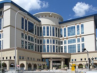
Bernalillo County is the most populous county in the U.S. state of New Mexico. As of the 2020 census, the population was 676,444. The county seat, Albuquerque, is the most populous city in New Mexico.

<span class="mw-page-title-main">Carnuel, New Mexico</span> Census-designated place in New Mexico, United States

Carnuel is a census-designated place (CDP) in Bernalillo County, New Mexico, United States. The population was 1,232 at the 2010 Census. It is part of the Albuquerque Metropolitan Statistical Area.

<span class="mw-page-title-main">Cedar Crest, New Mexico</span> Census-designated place in New Mexico, United States

Cedar Crest is a census-designated place (CDP) in Bernalillo County, New Mexico, United States. The population was 958 at the 2010 census. It is part of the Albuquerque Metropolitan Statistical Area.

<span class="mw-page-title-main">Chilili, New Mexico</span> Census-designated place in New Mexico, United States

Chilili is a census-designated place in Bernalillo County, New Mexico, United States. The population was 137 at the 2010 census. It is part of the Albuquerque Metropolitan Statistical Area.

<span class="mw-page-title-main">Isleta Village Proper, New Mexico</span> Census-designated place in New Mexico, United States

Isleta Village Proper is a census-designated place (CDP) in Bernalillo County, New Mexico, United States. The population was 491 at the 2010 census. It is part of the Albuquerque Metropolitan Statistical Area.

<span class="mw-page-title-main">South Valley, New Mexico</span> Census-designated place in New Mexico, United States

South Valley is a census-designated place (CDP) and unincorporated community in Bernalillo County, New Mexico, United States. The population was 38,338 at the 2020 Census. It is part of the Albuquerque Metropolitan Statistical Area. The U.S. Postal Service uses "Albuquerque" for all South Valley addresses.

<span class="mw-page-title-main">Pueblo of Sandia Village, New Mexico</span> Village in Sandoval County, New Mexico, US

Pueblo of Sandia Village is a census-designated place (CDP) in Sandoval County, New Mexico, United States. The population was 344 at the 2000 census. It is part of the Albuquerque Metropolitan Statistical Area.

<span class="mw-page-title-main">Edgewood, New Mexico</span> Town in New Mexico, United States

Edgewood is a town in Santa Fe County, New Mexico, United States. Through annexations, its town boundaries now extend into Bernalillo and Torrance counties. It is part of the Albuquerque–Santa Fe–Las Vegas combined statistical area.

<span class="mw-page-title-main">Quemado, New Mexico</span> Census-designated place in New Mexico, United States

Quemado is a census-designated place in Catron County, New Mexico, United States. As of the 2010 census it had a population of 228. Walter De Maria's 1977 art installation, The Lightning Field, is between Quemado and Pie Town, New Mexico.

Sandia Park is an affluenthttps://www.unitedstateszipcodes.org/rankings/zips-in-nm/median household income/ census-designated place in Bernalillo County, New Mexico, United States. Its population was 237 as of the 2010 census and 265 as of the 2020 census. Sandia Park has a post office with ZIP code 87047.

<span class="mw-page-title-main">Cedro, New Mexico</span> Census-designated place in New Mexico, United States

Cedro is a census-designated place (CDP) in Bernalillo County, New Mexico, United States. The population was 430 at the 2010 census. It is part of the Albuquerque Metropolitan Statistical Area.

Edith Enclave is a census-designated place (CDP) in Bernalillo County, New Mexico, United States. The population was 211 at the 2010 census. It is part of the Albuquerque Metropolitan Statistical Area.

Manzano Springs is a census-designated place (CDP) in Torrance and Bernalillo counties, New Mexico, United States. The population was 137 at the 2010 census. It is part of the Albuquerque Metropolitan Statistical Area.

Pajarito Mesa is a census-designated place in Bernalillo County, New Mexico, United States. At the 2010 census, the population was 579. It is part of the Albuquerque Metropolitan Statistical Area.

Paradise Hills is a census-designated place (CDP) in Bernalillo County, New Mexico, United States. The population was 4,256 at the 2010 census. It is part of the Albuquerque Metropolitan Statistical Area.

Ponderosa Pine is a census-designated place (CDP) in Bernalillo County, New Mexico, United States. The population was 1,195 at the 2010 census. It is part of the Albuquerque Metropolitan Statistical Area.

Sandia Knolls is a census-designated place (CDP) in Bernalillo County, New Mexico, United States. The population was 1,208 at the 2010 census. It is part of the Albuquerque Metropolitan Statistical Area.

Barton is a census-designated place (CDP) in Bernalillo and Santa Fe counties, New Mexico, United States. It was first listed as a CDP prior to the 2020 census.

Paa-Ko is a census-designated place (CDP) in Bernalillo County, New Mexico, United States, built around the Paa-Ko Ridge Golf Club. It was first listed as a CDP prior to the 2020 census.

La Madera is an unincorporated community and census-designated place (CDP) in Sandoval County, New Mexico, United States. It was first listed as a CDP prior to the 2020 census.

References

  1. "ArcGIS REST Services Directory". United States Census Bureau. Retrieved October 12, 2022.
  2. 1 2 U.S. Geological Survey Geographic Names Information System: Sandia Heights, New Mexico
  3. 1 2 "Census Population API". United States Census Bureau. Retrieved October 12, 2022.
  4. 1 2 "Geographic Identifiers: 2010 Demographic Profile Data (G001): Sandia Heights CDP, New Mexico". U.S. Census Bureau, American Factfinder. Archived from the original on February 12, 2020. Retrieved January 30, 2014.
  5. "USDA Plant Hardiness Zone Map". United States Department of Agriculture . Retrieved August 13, 2018.
  6. "Sandia Heights, NM Monthly Weather Forecast". Weather Channel . Retrieved August 13, 2018.
  7. "Census of Population and Housing". Census.gov. Retrieved June 4, 2016.
  8. "2020 CENSUS - SCHOOL DISTRICT REFERENCE MAP: Bernalillo County, NM" (PDF). U.S. Census Bureau . Retrieved July 20, 2021.