(now part of [[Murakami, Niigata|Murakami]])"},"leader_title":{"wt":"Mayor"},"leader_name":{"wt":""},"leader_title1":{"wt":"Vice Mayor"},"leader_name1":{"wt":""},"unit_pref":{"wt":"Metric"},"area_total_km2":{"wt":"283.91"},"population_total":{"wt":"6,942"},"population_as_of":{"wt":"2008"},"timezone1":{"wt":"[[Japan Standard Time|JST]]"},"utc_offset1":{"wt":"+09:00"},"postal_code_type":{"wt":""},"postal_code":{"wt":""},"blank_name_sec1":{"wt":"City hall address"},"blank_info_sec1":{"wt":""},"module":{"wt":"{{Infobox place symbols| embedded=yes\n | tree = [[Cryptomeria|Sugi]]\n | flower = \n | bird = \n | butterfly = \n | fish = \n}}"}},"i":0}}]}" id="mwAg">Former municipality in Hokuriku, Japan
Sanpoku 山北町 | |
---|---|
Former municipality | |
![]() Location of Sanpoku in Niigata Prefecture | |
Coordinates: 38°31′N139°32′E / 38.517°N 139.533°E | |
Country | Japan |
Region | Hokuriku |
Prefecture | Niigata Prefecture |
District | Iwafune District |
Merged | April 1, 2008 (now part of Murakami) |
Area | |
• Total | 283.91 km2 (109.62 sq mi) |
Population (2008) | |
• Total | 6,942 |
Time zone | UTC+09:00 (JST) |
Symbols | |
Tree | Sugi |
Sanpoku (山北町, Sampoku-machi) was a town located in Iwafune District, Niigata Prefecture, Japan.
As of 2005, the town had an estimated population of about 7,243 and a density of 25.95 persons per km2. The total area was 283.91 km2.
Sanpoku was an isolated town in the northernmost part of Niigata Prefecture, connected by the Uetsu Line (JR East) and National Route 7.
Neighboring municipalities were Tsuruoka in Yamagata Prefecture to the north, as well as Murakami and Asahi in Niigata to the south.
On April 1, 2008, Sanpoku, along with the town of Arakawa, and the villages of Asahi and Kamihayashi (all from Iwafune District), was merged into the expanded city of Murakami. [1] [2]
The official town tree was the Sugi and the official town flower was the Japanese Lily.
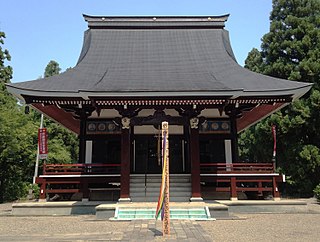
Murakami is a city located in Niigata Prefecture, Japan. As of 1 December 2020, the city had an estimated population of 58,300 in 22,594 households, and a population density of 50 persons per km². The total area of the city was 1,174.26 square kilometres (453.38 sq mi).
Asahi was a village located in Iwafune District, Niigata Prefecture, Japan. The village was named after the Asahi Mountains.
Yoita was a town located in Santō District, Niigata Prefecture, Japan.
Teradomari was a town located in Santō District, Niigata Prefecture, Japan.
Santō is a district located in Niigata Prefecture, Japan.
Yamakoshi was a village located in Koshi District, Niigata Prefecture, Japan.
Kawanishi was a town located in Nakauonuma District, Niigata Prefecture, Japan.
Nakasato was a village located in Nakauonuma District, Niigata Prefecture, Japan.
Nakauonuma is a district located in Niigata Prefecture, Japan.
Kariwa is a district located in Niigata Prefecture, Japan.
Yasuzuka was a town located in Higashikubiki District, Niigata Prefecture, Japan.
Uragawara was a village located in Higashikubiki District, Niigata Prefecture, Japan.
Ōshima was a village located in Higashikubiki District, Niigata Prefecture, Japan.
Matsunoyama was a town located in Higashikubiki District, Niigata Prefecture, Japan.
Myōkō was a village located in Nakakubiki District, Niigata Prefecture, Japan.
Arakawa was a town located in Iwafune District, Niigata Prefecture, Japan.
Kamihayashi was a village located in Iwafune District, Niigata Prefecture, Japan.
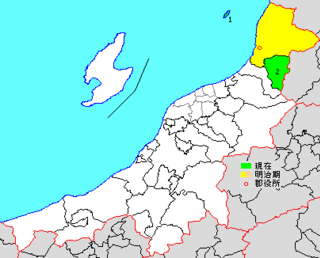
Awashimaura is a village located in Niigata Prefecture, Japan. As of 1 July 2019, the village had an estimated population of 353, and a population density of 36.1 persons per km2. The total area of the village is 9.78 square kilometres (3.78 sq mi).
Iwafune is a district located in Niigata Prefecture, Japan.
Murakami-shi, Arakawa-machi, Kamihayashi-mura, Asahi-mura and Sanpoku-machi were incorporated into a newly established Murakami-shi as of April 1, 2008.