
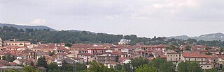
Trevignano Romano is a small town and comune in the Metropolitan City of Rome, Lazio, central Italy. With a population of about 5,000, it is located on the volcanic Lake Bracciano. It is about 47 kilometres (29 mi) away from Rome.

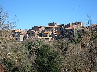
Acquasparta is a town and comune in the province of Terni. It is located on a hill above the Naia Valley and the river of the same name, facing the Monti Martani mountain range. It is one of I Borghi più belli d'Italia. It also sits between two hot springs, the Amerino and the Furapane.
Lioni is a town and comune in the province of Avellino, Campania, southern Italy.

Sant'Angelo dei Lombardi is a town and comune in the province of Avellino in the Campania region of southern Italy. It has been a historical spot of significance in mezzogiorno history.

Torella dei Lombardi is a town and comune in the province of Avellino, Campania, southern Italy.

Villa Sant'Angelo is a comune and town in the province of L'Aquila, in the Abruzzo region of Italy, which lies in the Aterno River valley near the convergence of the Sirente and the Gran Sasso mountain ranges. Many of the municipal functions are managed cooperatively with adjacent villages, comprising the Comunità Montana Amiternina.

Caggiano is a town and comune in the province of Salerno in the Campania region of south-western Italy.

Carpegna is a comune (municipality) in the Province of Pesaro e Urbino in the Italian region Marche, located about 100 kilometres (62 mi) west of Ancona and about 50 kilometres (31 mi) southwest of Pesaro.
Barbarano Romano is a comune (municipality) in the Province of Viterbo in the Italian region of Latium, located about 50 kilometres (31 mi) northwest of Rome and about 20 kilometres (12 mi) south of Viterbo.

Gradoli is a comune (municipality) in the Province of Viterbo in the Italian region of Latium, located about 100 kilometres (62 mi) northwest of Rome and about 35 kilometres (22 mi) northwest of Viterbo.

Borgo Velino is a comune (municipality) in the Province of Rieti in the region of Latium, Italy. It is located about 70 kilometres (43 mi) northeast of Rome and about 15 kilometres (9 mi) east of the town Rieti. It has an area of 17.3 square kilometres (6.7 sq mi), and as of 31 December 2010 it had a population of 1,004. Until 1927 Borgo Velino was part of the province of L'Aquila in Abruzzo. It is located near the site of a pre- or early-Roman Sabine village named Viario. Rare ruins of this ancient village, now occupied by a cultivated field, were found near a standing medieval tower. Borgo Velino is the birthplace of Giulio Pezzola, a notorious outlaw of the 17th century.

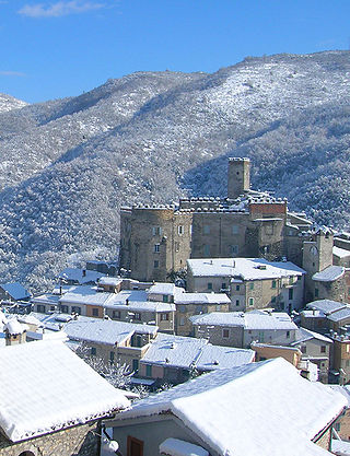
Castel Sant'Angelo is a comune (municipality) in the Province of Rieti in the Italian region of Lazio, located about 70 kilometres (43 mi) northeast of Rome and about 12 kilometres (7 mi) east of Rieti.
Campagnano di Roma is a comune (municipality) in the Metropolitan City of Rome in the Italian region of Latium, located about 30 kilometres northwest of Rome. It was first mentioned in 1076, having been carved out of the great estate assembled on the Roman pattern by Pope Adrian I, ca. 780, his Domusculta Capracorum. In medieval times, Campagnano di Roma was on the via Francigena. Here, Sigeric, Archbishop of Canterbury, sojourned on his return journey from Rome about 990.
Cineto Romano is a comune (municipality) in the Metropolitan City of Rome in the Italian region of Latium, located about 40 kilometres (25 mi) northeast of Rome. It was named Scarpe until 1882.

Mazzano Romano is a comune (municipality) in the Metropolitan City of Rome in the Italian region of Latium, located about 35 kilometres (22 mi) north of Rome.

Montelibretti is a town and comune (municipality) in the Metropolitan City of Rome in the Italian region of Lazio, located about 30 kilometres (19 mi) northeast of Rome on the slopes of Monti Sabini.

Rignano Flaminio is a comune (municipality) in the Metropolitan City of Rome in the Italian region of Latium, about 35 kilometres (22 mi) north of Rome. It is across the Via Flaminia.

Roviano is a comune (municipality) in the Metropolitan City of Rome in the Italian region of Latium, located about 45 kilometres (28 mi) northeast of Rome.

Vivaro Romano is a comune (municipality) in the Metropolitan City of Rome in the Italian region Lazio, located about 50 kilometres (31 mi) northeast of Rome.

Vallecorsa is a comune (municipality) in the Province of Frosinone in the Italian region Lazio, located about 90 kilometres (56 mi) southeast of Rome and about 20 kilometres (12 mi) south of Frosinone, in the Monti Ausoni area.


