John Forrest National Park is a national park in the Darling Scarp, 24 km (15 mi) east of Perth, Western Australia. Proclaimed as a national park in November 1900, it was the first national park in Western Australia and the second in Australia after Royal National Park.

Mundaring is a suburb located 34 km east of Perth, Western Australia on the Great Eastern Highway. The suburb is located within the Shire of Mundaring.
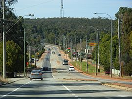
Mount Helena is an urban suburb on the outskirts of Perth, in Western Australia, 35 km from the city, in the Shire of Mundaring. Its population in 2016 was 3,185 people.

Darlington, Western Australia, is a locality in the Shire of Mundaring on the Darling Scarp, bisected by Nyaania Creek and north of the Helena River.

The Eastern Railway is the main railway route between Fremantle and Northam in Western Australia. It opened in stages between 1881 and 1893. The line continues east to Kalgoorlie as the Eastern Goldfields Railway.

Bellevue is an eastern suburb of Perth, Western Australia in the local government areas of the City of Swan and the Shire of Mundaring. It is at the foot of the slopes of Greenmount, a landmark on the Darling Scarp that is noted in the earliest of travel journals of the early Swan River Colony.

Greenmount is a locality and a geographical feature in the Shire of Mundaring, Western Australia, on the edge of the Darling Scarp. It is a vital point in the transport routes from the Swan Coastal Plain into the hinterland of Western Australia.

The Helena River is a tributary of the Swan River in Western Australia. The river rises in country east of Mount Dale and flows north-west to Mundaring Weir, where it is dammed. It then flows west until it reaches the Darling Scarp.

The Railway Reserves Heritage Trail – also on some maps as Rail Reserve Heritage Trail or Rail Reserves Historical Trail, and frequently referred to locally as the Bridle Trail or Bridle Track – is within the Shire of Mundaring in Western Australia.

Glen Forrest is a suburb within the Shire of Mundaring, south of John Forrest National Park, west of Mahogany Creek, east of Darlington, and north of the Helena River. Its northern boundary is determined by the Great Eastern Highway.

Chidlow is a small community in the Shire of Mundaring approximately 45 kilometres east of Perth, Western Australia.

Swan View is an eastern suburb of Perth, Western Australia. Its local government areas are the City of Swan and the Shire of Mundaring. It is 25 kilometres (16 mi) from Perth in the Perth Hills on the edge of the Darling Scarp, just to the west of the John Forrest National Park, east of Roe Highway and north of the Great Eastern Highway.
Wooroloo is a town on the outer fringe of the Perth metropolitan region, located off Great Eastern Highway in the eastern part of the Shire of Mundaring. At the 2006 census, Wooroloo had a population of 254.

Mahogany Creek is a suburb of Perth, the state capital of Western Australia. It is part of the Shire of Mundaring local government area.

Helena Valley is the name of a river valley and a locality in the foothills of the Darling Scarp in Perth, Western Australia.
The Lakes is an outer northeastern locality of Perth, the capital city of Western Australia, located within the Shire of Mundaring. It is located 51 kilometres (32 mi) east of the Perth CBD, at the junction of the Great Eastern Highway and the Great Southern Highway, and is the easternmost suburb within the Metropolitan Region Scheme. At the 2011 census, The Lakes had a population of 45.

Hovea is a suburb in the Shire of Mundaring in Perth, Western Australia.

Lake Leschenaultia, Western Australia is a former railway dam that is now a recreational lake in the Shire of Mundaring just north of the location of an important railway stopping place on the original Eastern Railway. The dam holds approximately 520 million litres of water.

The Mundaring and Hills Historical Society (MHHS) is a local history society for the Shire of Mundaring, based in Mundaring, Western Australia.

The Sawyers Valley Tavern was established in 1882 in Sawyers Valley, a hills suburb of Perth, Western Australia. It was originally called the Sawyers Valley Hotel before acquiring its current name.