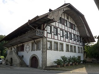
The former municipalities that now make up Schwarzenburg have a total combined area of 44.8km2 (17.30sqmi).[5]
Demographics
Schwarzenburg has a population (as of December 2020[update]) of 6,812.[6]As of 2011[update], 4.7% of the population are resident foreign nationals. Over the last year (2010–2011) the population has changed at a rate of 0.7%. Migration accounted for 0.8%, while births and deaths accounted for -0.2%.[7] Most of the population (as of 2000[update]) speaks German (96%) as their first language, French is the second most common (0.8%) and Italian is the third (0.4%).[7]
As of 2011[update], children and teenagers (0–19 years old) make up 21.1% of the population, while adults (20–64 years old) make up 60.8% and seniors (over 64 years old) make up 18.1%.[7]
As of 2010[update], the construction rate of new housing units was 3.9 new units per 1000 residents.[7] The vacancy rate for the municipality, in 2010[update], was 0.56%. In 2011, single family homes made up 44.9% of the total housing in the municipality.[8]
Historic population
The historical population is given in the following chart:[9]
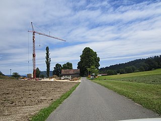
Transportation
Schwarzenburg is the terminal station of the Bern-Schwarzenburg-Bahn, which opened in 1907 and today forms part of the BLS AG. Lanzenhäusern also has a station.
As of 2011[update], Schwarzenburg had an unemployment rate of 1.24%. As of 2008[update], there were a total of 3,032 people employed in the municipality. Of these, there were 625 people employed in the primary economic sector and about 218 businesses involved in this sector. 1,088 people were employed in the secondary sector and there were 80 businesses in this sector. 1,319 people were employed in the tertiary sector, with 187 businesses in this sector.[7] Of the working population, 21.3% used public transportation to get to work, and 42.7% used a private car.[7]
In 2011 the average local and cantonal tax rate on a married resident, with two children, of Schwarzenburg making 150,000 CHF was 12.9%, while an unmarried resident's rate was 19%.[13] For comparison, the average rate for the entire canton in the same year, was 14.2% and 22.0%, while the nationwide average was 12.3% and 21.1% respectively.[14]
In 2011 a total of 3.5% of the population received direct financial assistance from the government.[15]
Religion
In 2000 about 79.6% of the population belonged to a Protestant church, 8.6% were Roman Catholic and 5.5% had no religious affiliation.[7] Schwarzenburg, along with Thun, is the area where most of the Amish and ethnic Mennonites in the United States trace their ancestry from.
Climate
Between 1981 and 2010 Schwarzenburg had an average of 136.7 days of rain or snow per year and on average received 1,296mm (51.0in) of precipitation. The wettest month was May during which time Schwarzenburg received an average of 154mm (6.1in) of rain or snow. During this month there was precipitation for an average of 14.2 days. The driest month of the year was February with an average of 67mm (2.6in) of precipitation over 10.3 days.[16]
Education
In Schwarzenburg about 55.9% of the population have completed non-mandatory upper secondary education, and 18.2% have completed additional higher education (either university or a Fachhochschule).[7] Schwarzenburg is home to the Schul- und Gemeindebibliothek (municipal library of Schwarzenburg). The library has (as of 2008[update]) 20,690 books or other media, and loaned out 94,725 items in the same year. It was open a total of 230 days with average of 20.5 hours per week during that year.[17]
Related Research Articles
Belp is a municipality in the Bern-Mittelland administrative district in the canton of Bern in Switzerland. It is close to Bern's Belp Airport. The municipality of Belpberg merged on 1 January 2012 into the municipality of Belp.
Saules is a municipality in the Jura bernois administrative district in the canton of Bern in Switzerland. It is located in the French-speaking Bernese Jura.
Rebévilier is a municipality in the Jura bernois administrative district in the canton of Bern in Switzerland. It is located in the French-speaking Bernese Jura.
Zweisimmen is a municipality in the Obersimmental-Saanen administrative district in the canton of Bern in Switzerland.
Amsoldingen is a municipality in the Thun administrative district in the canton of Bern in Switzerland.
Guggisberg is a municipality in the Bern-Mittelland administrative district in the Swiss canton of Bern.
Rüschegg is a municipality in the Bern-Mittelland administrative district in the canton of Bern in Switzerland. It is also a Swiss Reformed Church parish.
Wahlern is a former municipality of the canton of Bern in Switzerland and seat of the Bern-Mittelland administrative district. On 1 January 2011, the former municipalities of Wahlern and Albligen merged in the new municipality of Schwarzenburg.
Bühl bei Aarberg is a municipality in the Seeland administrative district in the canton of Bern in Switzerland.
Merzligen is a municipality in the Seeland administrative district in the canton of Bern in Switzerland.
Burgistein is a municipality in the administrative district of Thun in the canton of Bern in Switzerland.
Gelterfingen is a former municipality in the Bern-Mittelland administrative district in the canton of Bern in Switzerland. On 1 January 2018 the former municipalities of Gelterfingen, Mühledorf and Noflen merged into the municipality of Kirchdorf.
Gurzelen is a municipality in the administrative district of Thun in the canton of Bern in Switzerland.
Jaberg is a municipality in the Bern-Mittelland administrative district in the canton of Bern in Switzerland.
Kaufdorf is a municipality in the Bern-Mittelland administrative district in the canton of Bern in Switzerland.
Niedermuhlern is a municipality in the Bern-Mittelland administrative district in the canton of Bern in Switzerland.
Rüeggisberg is a municipality in the Bern-Mittelland administrative district in the canton of Bern in Switzerland.
Uttigen is a municipality in the administrative district of Thun in the canton of Bern in Switzerland. On 1 January 2014 the former municipality of Kienersrüti merged into the municipality of Uttigen.
Unterlangenegg or Unter Langenegg is a municipality in the administrative district of Thun in the canton of Bern in Switzerland.
Wachseldorn is a municipality in the administrative district of Thun in the canton of Bern in Switzerland.
References
Wikimedia Commons has media related to Schwarzenburg.
↑ "Norm Values Tables, 1981-2010" (in German, French, and Italian). Federal Office of Meteorology and Climatology - MeteoSwiss. Archived from the original on 14 May 2013. Retrieved 22 January 2013., the Schwarzenburg weather station elevation is 806 meters above sea level.
This page is based on this Wikipedia article Text is available under the CC BY-SA 4.0 license; additional terms may apply. Images, videos and audio are available under their respective licenses.