
Vizianagaram district is one of the six districts in the Uttarandhra region of the Indian state of Andhra Pradesh with its headquarters located at Vizianagaram. The district was once the part of ancient Kalinga.Saripilli Dibbilingeswara temple, Jayathi Mallikarjuna Temple are the finest examples of ancient Eastern Ganga Dynasty built monuments in the district. The district is bounded on the east by the district of Srikakulam, north by Parvathipuram Manyam south by Visakhapatnam, Anakapalli, southeast by the Bay of Bengal, and west by Alluri Sitharama Raju district. It was formed on 1 June 1979, with some parts carved from the neighbouring districts of Srikakulam and Visakhapatnam. The district is named after the princely state of Vizianagaram. In 2011, it was the least populous district in Andhra Pradesh.

Srikakulam district is one of the twenty-six districts of the Indian state of Andhra Pradesh, located in the Uttarandhra region of the state, with its headquarters located at Srikakulam. It is one of the six districts, located in the extreme northeastern direction of the state. It was formerly known as Chicacole, and was under Ganjam district till 1936 April 1, then merged under Vizagapatam district. Srikakulam district forms the core area of Kalinga where most of its historical capitals like Kalinganagari, pithunda, Dantapuram are located.

Parvathipuram is a municipality located at Parvathipuram Manyam district of Indian state of Andhra Pradesh. It is the administrative headquarters of Parvathipuram Manyam district and headquarters of Parvathipuram revenue division and Parvathipuram mandal. This revenue division shares a border with various districts in Odisha.
Salur or Saluru is a municipal town and mandal headquarters in Parvathipuram Manyam district, of the Indian state of Andhra Pradesh.

Baliji-peta or Baligi-peta is a village in Parvathipuram Manyam district of the Indian state of Andhra Pradesh.

Kurupam is a village in Parvathipuram Manyam district of the Indian state of Andhra Pradesh.
Kankipadu is a suburb of Vijayawada and a in Krishna District of the Indian state of Andhra Pradesh. It is also the mandal headquarters of Kankipadu mandal in Vuyyuru revenue division.
Makkuva is a village in Parvathipuram Manyam district of the Indian state of Andhra Pradesh.
Komarada is a village in Parvathipuram Manyam district of the Indian state of Andhra Pradesh.
Garugu-billi is a village in Parvathipuram Manyam district of the Indian state of Andhra Pradesh, India.
Jiyyammavalasa is a village in Parvathipuram Manyam district of the Indian state of Andhra Pradesh.
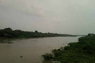
Bhamini is a village and Mandal in Parvathipuram Manyam district, Andhra Pradesh. It is located in Palakonda Revenue Division. The River Vamsadhara flows through border of Bhamini mandal and Orissa.

Hiramandalam is a census town in Srikakulam district of the Indian state of Andhra Pradesh. It is also the mandal headquarters of Hiramandalam mandal in Palakonda revenue division. BRR Project Located at Hiramandalam town. It is located 49 km towards North from District headquarters Srikakulam.

Palakonda is a town in Parvathipuram Manyam district of the Indian state of Andhra Pradesh. It is a nagar panchayat and the mandal headquarters of Palakonda mandal in Palakonda revenue division
Veeraghattam is an Indian town in Parvathipuram Manyam district of Andhra Pradesh. It is located in Veeraghattam mandal of Palakonda revenue division.
Battili is a town in Bhamini Mandal of Parvathipuram Manyam district in Andhra Pradesh, India.

Parvathipuram is a Scheduled Caste reserved constituency in Parvathipuram Manyam district of Andhra Pradesh that elects representatives to the Andhra Pradesh Legislative Assembly in India. It is one of the seven assembly segments of the Araku Lok Sabha constituency.
Makkuva mandal is one of the 34 mandals in Parvathipuram Manyam district of the Indian state of Andhra Pradesh. It is administration under Parvathipuram revenue division and headquartered at Makkuva. The mandal is bounded by Salur mandal on South & West, Parvathipuram mandal on North, Seethanagaram mandal on east and Bobbili mandal on south east. A portion of it also borders the Narayanapatna block of the Koraput district of Odisha on north west.

Parvathipuram revenue division is an administrative division in the Parvathipuram Manyam district of the Indian state of Andhra Pradesh. It is one of the two revenue divisions in the district with eight mandals under its administration. The divisional headquarters are located at Parvathipuram.

Parvathipuram Manyam district is a district in the Indian state of Andhra Pradesh. With Parvathipuram as its administrative headquarters, it became functional from 4th April 2022. The district was formed from Parvathipuram revenue division from Vizianagaram district and part of Palakonda revenue division of Srikakulam district. The district was once part of ancient Kalinga. The famous Kamalingeswara swamy temple was built in the regin of King Rajaraja Deva of Eastern Ganga Dynasty of Odisha in 11th century CE.
