Gumla district is one of the twenty-four districts of Jharkhand state, India, and Gumla town is the administrative headquarters of this district.
Ghaghra block is a CD block that forms an administrative division in the Gumla subdivision of Gumla district, in the Indian state of Jharkhand.

Navratangarh (Doisagarh) was one of the capitals of the Nagvanshi dynasty, who ruled parts of what is now the state of Jharkhand, India. It is located in Sisai block of Gumla district. It is said that king Durjan Shah shifted his capital from Khukhragarh to Navratangarh. He constructed the fort between 1636 and 1639. The palace was a five-storeyed structure with its "water-gate" and garh-khai (moat) arrangement. It has a kiaclmy (court), a treasury house and a prison-cell with its underground dungeon. It was declared national heritage in 2009.

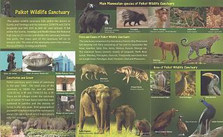
Palkot Wildlife Sanctuary is a wildlife sanctuary located near Palkot. It is spread over Gumla and Simdega districts of Jharkhand in India. The sanctuary cover total area of 182.83 km2 (70.59 sq mi).
Bishunpur is a village in the Bishunpur CD block in the Gumla subdivision of the Gumla district in the Indian state of Jharkhand.
Sisai is a village in the Sisai CD block in the Gumla subdivision of the Gumla district in the Indian state of Jharkhand.
Bharno is a village in the Bharno CD block in the Gumla subdivision of the Gumla district in the Indian state of Jharkhand.
Kamdara is a village in the Kamdara CD block in the Basia subdivision of the Gumla district in the Indian state of Jharkhand.
Basia is a village in the Basia CD block in the Basia subdivision of the Gumla district in the Indian state of Jharkhand.
Chainpur is a village in the Chainpur CD block in the Chainpur subdivision of the Gumla district in the Indian state of Jharkhand.
Dumri is a village in the Dumri CD block in the Chainpur subdivision of the Gumla district in the Indian state of Jharkhand.
Jari is a village in the Albert Ekka (Jari) CD block in the Chainpur subdivision of the Gumla district in the Indian state of Jharkhand.
Raidih is a village in the Raidih CD block in the Gumla subdivision of the Gumla district in the Indian state of Jharkhand.
Jalim is a village/ Bauxite mining site in the Bishunpur CD block in the Bishnupur subdivision of the Gumla district in the Indian state of Jharkhand.
Gurdari is a village/ Bauxite mining centre in the Bishunpur CD block in the Gumla subdivision of the Gumla district in the Indian state of Jharkhand.
Nagfeni is a village in the Sisai CD block in the Gumla subdivision of the Gumla district in the Indian state of Jharkhand.
Marda is a village in the Raidih CD block in the Gumla subdivision of the Gumla district in the Indian state of Jharkhand.
Toto is a census town in the Gumla CD block in the Gumla subdivision of the Gumla district in the Indian state of Jharkhand.
Chainpur subdivision is an administrative subdivision of the Gumla district in the South Chotanagpur division in the state of Jharkhand, India.
Basia subdivision is an administrative subdivision of the Gumla district in the South Chotanagpur division in the state of Jharkhand, India.


