Bagansky District is an administrative and municipal district (raion), one of the thirty in Novosibirsk Oblast, Russia. It is located in the southwest of the oblast. The area of the district is 3,367.73 square kilometers (1,300.29 sq mi). Its administrative center is the rural locality of Bagan. Population: 16,627 ; 18,457 (2002 Census); 18,922 (1989 Census). The population of Bagan accounts for 33.1% of the district's total population.

Barabinsky District is an administrative and municipal district (raion), one of the thirty in Novosibirsk Oblast, Russia. It is located in the western central part of the oblast. The area of the district is 5,400 square kilometers (2,100 sq mi). Its administrative center is the town of Barabinsk. Population: 14,169 ; 17,126 (2002 Census); 18,279 (1989 Census).
Cherepanovsky District is an administrative and municipal district (raion), one of the thirty in Novosibirsk Oblast, Russia. It is located in the southeast of the oblast. The area of the district is 2,908 square kilometers (1,123 sq mi). Its administrative center is the town of Cherepanovo. Population: 47,842 ; 50,959 (2002 Census); 53,418 (1989 Census). The population of Cherepanovo accounts for 41.4% of the district's total population.
Chistoozyorny District is an administrative and municipal district (raion), one of the thirty in Novosibirsk Oblast, Russia. It is located in the southwest of the oblast. The area of the district is 5,690 square kilometers (2,200 sq mi). Its administrative center is the urban locality of Chistoozyornoye. Population: 19,603 ; 22,444 (2002 Census); 24,126 (1989 Census). The population of Chistoozyornoye accounts for 32.8% of the district's total population.

Iskitimsky District is an administrative and municipal district (raion), one of the thirty in Novosibirsk Oblast, Russia. It is located in the east of the oblast. The area of the district is 4,384 square kilometers (1,693 sq mi). Its administrative center is the town of Iskitim. Population: 62,816 ; 66,420 (2002 Census); 67,733 (1989 Census).
Karasuksky District is an administrative and municipal district (raion), one of the thirty in Novosibirsk Oblast, Russia. It is located in the southwest of the oblast. The area of the district is 4,321 square kilometers (1,668 sq mi). Its administrative center is the town of Karasuk. Population: 46,262 ; 48,548 (2002 Census); 50,374 (1989 Census). The population of Karasuk accounts for 61.8% of the district's total population.

Krasnozyorsky District is an administrative and municipal district (raion), one of the thirty in Novosibirsk Oblast, Russia. It is located in the south of the oblast. The area of the district is 5,330 square kilometers (2,060 sq mi). Its administrative center is the urban locality of Krasnozyorskoye. Population: 32,491 ; 38,836 (2002 Census); 40,312 (1989 Census). The population of Krasnozyorskoye accounts for 29.3% of the district's total population.
Kupinsky District is an administrative and municipal district (raion), one of the thirty in Novosibirsk Oblast, Russia. It is located in the southwest of the oblast. The area of the district is 5,809 square kilometers (2,243 sq mi). Its administrative center is the town of Kupino. Population: 31,199 ; 37,451 (2002 Census); 40,440 (1989 Census). The population of Kupino accounts for 47.7% of the district's total population.
Kuybyshevsky District is an administrative and municipal district (raion), one of the thirty in Novosibirsk Oblast, Russia. It is located in the center of the oblast. The area of the district is 8,823.3 square kilometers (3,406.7 sq mi). Its administrative center is the town of Kuybyshev. Population: 15,466 ; 19,386 (2002 Census); 21,758 (1989 Census).
Kyshtovsky District is an administrative and municipal district (raion), one of the thirty in Novosibirsk Oblast, Russia. It is located in the northwest of the oblast. The area of the district is 11,101 square kilometers (4,286 sq mi). Its administrative center is the rural locality of Kyshtovka. Population: 12,399 ; 16,427 (2002 Census); 19,081 (1989 Census). The population of Kyshtovka accounts for 42.6% of the district's total population.
Maslyaninsky District is an administrative and municipal district (raion), one of the thirty in Novosibirsk Oblast, Russia. It is located in the east of the oblast. The area of the district is 3,453 square kilometers (1,333 sq mi). Its administrative center is the urban locality of Maslyanino. Population: 24,438 ; 27,196 (2002 Census); 26,421 (1989 Census). The population of Maslyanino accounts for 53.6% of the district's total population.

Moshkovsky District is an administrative and municipal district (raion), one of the thirty in Novosibirsk Oblast, Russia. It is located in the northeast of the oblast. The area of the district is 2,591 square kilometers (1,000 sq mi). Its administrative center is the urban locality of Moshkovo. Population: 39,192 ; 41,281 (2002 Census); 41,879 (1989 Census). The population of Moshkovo accounts for 26.1% of the district's total population.

Novosibirsky District is an administrative and municipal district (raion), one of the thirty in Novosibirsk Oblast, Russia. It is located in the east of the oblast. The area of the district is 2,900 square kilometers (1,100 sq mi). Its administrative center is the city of Novosibirsk. Population: 127,891 ; 113,047 (2002 Census); 130,300 (1989 Census).
Suzunsky District is an administrative and municipal district (raion), one of the thirty in Novosibirsk Oblast, Russia. It is located in the southeast of the oblast. The area of the district is 4,746 square kilometers (1,832 sq mi). Its administrative center is the urban locality of Suzun. Population: 32,592 ; 34,917 (2002 Census); 35,677 (1989 Census). The population of Suzun accounts for 47.1% of the district's total population.

Tatarsky District is an administrative and municipal district (raion), one of the thirty in Novosibirsk Oblast, Russia. It is located in the west of the oblast. The area of the district is 4,870 square kilometers (1,880 sq mi). Its administrative center is the town of Tatarsk. Population: 15,875 ; 19,297 (2002 Census); 20,718 (1989 Census).
Toguchinsky District is an administrative and municipal district (raion), one of the thirty in Novosibirsk Oblast, Russia. It is located in the east of the oblast. The area of the district is 3,925 square kilometers (1,515 sq mi). Its administrative center is the town of Toguchin. Population: 60,303 ; 65,515 (2002 Census); 66,912 (1989 Census). The population of Toguchin accounts for 36.3% of the district's total population.

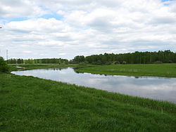
Ubinsky District is an administrative and municipal district (raion), one of the thirty in Novosibirsk Oblast, Russia. It is located in the center of the oblast. The area of the district is 13,760 square kilometers (5,310 sq mi). Its administrative center is the rural locality of Ubinskoye. Population: 16,297 ; 19,300 (2002 Census); 21,107 (1989 Census). The population of Ubinskoye accounts for 35.8% of the district's total population. The district's name comes from Lake Ubinskoye, which is mostly located inside the district.
Ust-Tarksky District is an administrative and municipal district (raion), one of the thirty in Novosibirsk Oblast, Russia. It is located in the west of the oblast. The area of the district is 4,061 square kilometers (1,568 sq mi). Its administrative center is the rural locality of Ust-Tarka. Population: 12,307 ; 14,670 (2002 Census); 15,405 (1989 Census). The population of Ust-Tarka accounts for 31.0% of the district's total population.
Vengerovsky District is an administrative and municipal district (raion), one of the thirty in Novosibirsk Oblast, Russia. It is located in the west of the oblast. The area of the district is 6,382.71 square kilometers (2,464.38 sq mi). Its administrative center is the rural locality of Vengerovo. As of the 2010 Census, the total population of the district was 20,446, with the population of Vengerovo accounting for 34.4% of that number.

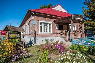
Kochenyovo is an urban-type settlement and the administrative center of Kochenyovsky District, Novosibirsk Oblast, Russia. Population: 16,374 (2010 Census); 16,510 (2002 Census); 15,048 (1989 Census).