Fujikawa-shuku was the thirty-seventh of the fifty-three stations of the Tōkaidō. It is located in the present-day city of Okazaki, in Aichi Prefecture, Japan. It was approximately 9 kilometres (5.6 mi) from Akasaka-juku, the preceding post station. Another accepted reading for this post town is "Fujikawa-juku."

Seki-juku was the forty-seventh of the fifty-three stations of the Tōkaidō. It is located in former Ise Province in what is now part of the city of Kameyama, Mie Prefecture, Japan.

Akasaka-juku was the thirty-sixth of the fifty-three stations of the Tōkaidō. It is located in present-day Toyokawa, Aichi Prefecture, Japan. It was only 1.7 kilometres (1.1 mi) from Goyu-juku, the preceding post station.

Kuwana-juku was the forty-second of the fifty-three stations of the Tōkaidō. It is located in former Ise Province in what is now part of the city of Kuwana, in Mie Prefecture, Japan. It was located on the western shores of the Ibi River and is considered to be the easternmost point of the Kansai dialect. It is 28 km from the preceding post station of Miya-juku.

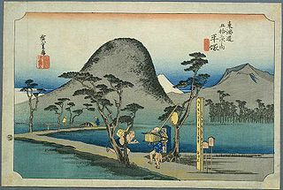
Kanaya-juku was the twenty-fourth of the fifty-three stations of the Tōkaidō. It is located in what is now part of Shimada, Shizuoka Prefecture, Japan. During the Edo period, it was the easternmost post station of Tōtōmi Province.

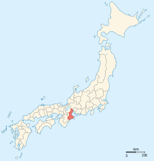
Fukuroi-juku was the twenty-seventh of the fifty-three stations of the Tōkaidō, making it the center of the route. It is located in what is now the center of the city of Fukuroi, Shizuoka Prefecture, Japan.

Fujisawa-shuku was the sixth of the fifty-three stations of the Tōkaidō. It is located in the present-day city of Fujisawa, Kanagawa Prefecture, Japan.

Sakashita-juku was the forty-eighth of the fifty-three stations (shukuba) of the Tōkaidō. It is located in former Ise Province in what is now part of the city of Kameyama, Mie Prefecture, Japan.

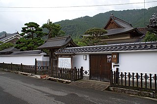
Goyu-shuku was the thirty-fifth of the fifty-three stations of the Tōkaidō. It is located in Goyu-chō in the city of Toyokawa, Aichi Prefecture, Japan. A pine tree colonnade, one of the few remnants from the Edo period post town, is a well-known tourist spot. It was approximately 10.4 kilometres (6.5 mi) from Yoshida-juku, the preceding post station.

Ishiyakushi-juku was the forty-fourth of the fifty-three stations of the Tōkaidō. It is located in former Ise Province in what is now part of the city of Suzuka, Mie Prefecture, Japan. It received its name from the nearby Buddhist temple, Ishiyakushi-ji.
Hiratsuka-juku was the seventh of the fifty-three stations (shukuba) of the Tōkaidō. It is located in the present-day city of Hiratsuka, Kanagawa Prefecture, Japan.

Okitsu-juku was the seventeenth of the fifty-three stations of the Tōkaidō. It is located in what is now part of the Shimizu-ku area of Shizuoka, Shizuoka Prefecture, Japan.
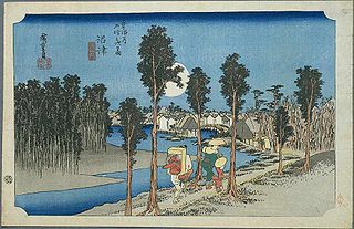
Numazu-juku was the twelfth of the fifty-three stations of the Tōkaidō. It is located in the present-day city of Numazu, Shizuoka Prefecture, Japan.

Ejiri-juku was the eighteenth of the fifty-three stations of the Tōkaidō. It is one of four former post stations located in what is now part of the Shimizu-ku area of Shizuoka, Shizuoka Prefecture, Japan. It was 3.4 kilometers from Okitsu-juku, the preceding post station.

Miya-juku was the forty-first of the fifty-three stations of the Tōkaidō. It is located in former Owari Province in what is now part of the Atsuta-ku section of the city of Nagoya, in Aichi Prefecture, Japan. It was six km from Narumi-juku, the preceding post station.

Futagawa-juku was the thirty-third of the fifty-three stations of the Tōkaidō. It is located in what is now the city of Toyohashi, Aichi Prefecture, Japan. It was the eastern most post station in Mikawa Province.

Maisaka-juku was the thirtieth of the fifty-three stations of the Tōkaidō. It is located in the western portion of Hamamatsu in Shizuoka Prefecture, Japan. During the Edo period, the area was part of Tōtōmi Province. The kanji for the post station were originally written 舞坂 (Maisaka).

Yoshida-juku was the thirty-fourth of the fifty-three stations of the Tōkaidō. It is located in the center of what is now the city of Toyohashi, Aichi Prefecture, Japan. It was 287 kilometres (178 mi) from the start of the route in Edo's Nihonbashi and 6.1 kilometres (3.8 mi) from Futagawa-juku to the east and 10.5 kilometres (6.5 mi) from Goyu-shuku to the west.

Narumi-juku was the fortieth of the fifty-three stations of the Tōkaidō. It is located in former Owari Province in what is now part of the Midori-ku section of the city of Nagoya, in Aichi Prefecture, Japan.

Kameyama-juku was the forty-sixth of the fifty-three stations (shukuba) of the Tōkaidō. It is located in former Ise Province in what is now part of the city of Kameyama, Mie Prefecture, Japan.