Yoshiwara-juku

Last updated
Yoshiwara-juku in the 1830s, as depicted by Hiroshige in the Hoeido edition of The Fifty-three Stations of the Tokaido (1831-1834) Tokaido14 Yoshiwara.jpg
Yoshiwara-juku in the 1830s, as depicted by Hiroshige in the Hōeidō edition of The Fifty-three Stations of the Tōkaidō (1831–1834)

Yoshiwara-juku(吉原宿,Yoshiwara-juku) was the fourteenth of the fifty-three stations of the Tōkaidō. It is located in the present-day city of Fuji, Shizuoka Prefecture, Japan.

53 Stations of the Tōkaidō Wikimedia list article

The 53 Stations of the Tōkaidō are the rest areas along the Tōkaidō, which was a coastal route that ran from Nihonbashi in Edo to Sanjō Ōhashi in Kyoto.

Tōkaidō (road) road of premodern Japan. sometimes mean region (see Q1196306)

The Tōkaidō road (東海道), which roughly means "eastern sea route," was the most important of the Five Routes of the Edo period in Japan, connecting Kyoto to Edo. Unlike the inland and less heavily travelled Nakasendō, the Tōkaidō travelled along the sea coast of eastern Honshū, hence the route's name.

Fuji, Shizuoka Special city in Chūbu, Japan

Fuji is a city in eastern Shizuoka Prefecture, Japan. Fuji is the third largest city in terms of population in Shizuoka Prefecture, trailing Hamamatsu and Shizuoka.

Contents

The Yoshiwara-juku Festival is held each year in October and November in Fuji, showing visitors the area's history. [1]

History

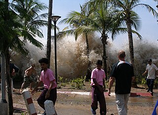
The Yoshiwara-juku was originally located near the present-day Yoshiwara Station, on the modern Tōkaidō Main Line railway, but after a very destructive tsunami in 1639, was rebuilt further inland, on what is now the Yodahara section of present-day Fuji. In 1680, the area was again devastated by a large tsunami, and the post town was again relocated and moved to its current place. Although most of the route of the Tōkaidō in Sagami and Suruga Provinces was along the seashore as the name "East Sea Route" implied, at Hara-juku travelers walked away from the sea. Also, up until this point on the journey, Mount Fuji could always be seen to the right of the travelers coming from Edo. However, as they traveled inland, they could see Mount Fuji to their left, and the view came to be called "Fuji to the Left"(左富士,Hidari Fuji).

Yoshiwara Station railway station in Fuji, Shizuoka prefecture, Japan

Yoshiwara Station is an interchange railway station in Fuji, Shizuoka Prefecture, Japan. The station is 141.3 rail kilometers from Tokyo Station. Yoshiwara is on the Tōkaidō Main Line of Central Japan Railway Company and is a terminal station for the Gakunan Railway Line of the Gakunan Electric Train and a freight terminal of the Japan Freight Railway Company.

Tōkaidō Main Line railway line in Japan

The Tōkaidō Main Line is a major Japanese railway line of the Japan Railways Group network, connecting Tokyo and Kōbe stations. It is 515.4 km (320.3 mi) long, not counting its many freight feeder lines around the major cities. The high-speed Tōkaidō Shinkansen largely parallels the line.

<i>Tsunami</i> Series of water waves caused by the displacement of a large volume of a body of water

A tsunami, also known as a seismic sea wave, is a series of waves in a water body caused by the displacement of a large volume of water, generally in an ocean or a large lake. Earthquakes, volcanic eruptions and other underwater explosions (including detonations, landslides, glacier calvings, meteorite impacts and other disturbances above or below water all have the potential to generate a tsunami. Unlike normal ocean waves, which are generated by wind, or tides, which are generated by the gravitational pull of the Moon and the Sun, a tsunami is generated by the displacement of water.

During the Edo period, there was a long colonnade of pine trees lining the route along this point. This is depicted in the classic ukiyo-e print by Andō Hiroshige (Hōeidō edition) from 1831–1834 which shows a groom leading a horse with women travelers down a narrow path lined with pine trees with Mount Fuji to the left.

Edo period period of Japanese history

The Edo period or Tokugawa period (徳川時代) is the period between 1603 and 1868 in the history of Japan, when Japanese society was under the rule of the Tokugawa shogunate and the country's 300 regional daimyō. The period was characterized by economic growth, strict social order, isolationist foreign policies, a stable population, "no more wars", and popular enjoyment of arts and culture. The shogunate was officially established in Edo on March 24, 1603, by Tokugawa Ieyasu. The period came to an end with the Meiji Restoration on May 3, 1868, after the fall of Edo.

Ukiyo-e A genre of Japanese art which flourished from the 17th through 19th centuries

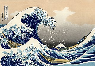
Ukiyo-e is a genre of Japanese art which flourished from the 17th through 19th centuries. Its artists produced woodblock prints and paintings of such subjects as female beauties; kabuki actors and sumo wrestlers; scenes from history and folk tales; travel scenes and landscapes; flora and fauna; and erotica.

Neighboring post towns

Tōkaidō
Hara-juku - Yoshiwara-juku - Kanbara-juku

Further reading

International Standard Book Number Unique numeric book identifier

The International Standard Book Number (ISBN) is a numeric commercial book identifier which is intended to be unique. Publishers purchase ISBNs from an affiliate of the International ISBN Agency.

Related Research Articles

Hiroshige Japanese ukiyo-e woodblock print artist

Utagawa Hiroshige, also Andō Hiroshige, was a Japanese ukiyo-e artist, considered the last great master of that tradition.

Mishima-shuku

Mishima-shuku was the eleventh of the fifty-three stations of the Tōkaidō during Edo period Japan. It is located in the present-day city of Mishima, in Shizuoka Prefecture.

Fujikawa-shuku

Fujikawa-shuku was the thirty-seventh of the fifty-three stations of the Tōkaidō. It is located in the present-day city of Okazaki, in Aichi Prefecture, Japan. It was approximately 9 kilometres (5.6 mi) from Akasaka-juku, the preceding post station. Another accepted reading for this post town is "Fujikawa-juku."
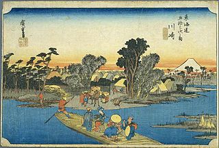
Kawasaki-juku Second of 53 stations of the Tōkaidō road, in Kawasaki, Japan

Kawasaki-juku was the second of the fifty-three stations of the Tōkaidō. It is located in Kawasaki-ku in the present-day city of Kawasaki, Kanagawa Prefecture, Japan.

Hodogaya-juku

Hodogaya-juku was the fourth of the fifty-three stations of the Tōkaidō. It is located in Hodogaya-ku in the present-day city of Yokohama, Kanagawa Prefecture, Japan. Occasionally, it is also written as 保土ヶ谷宿.

Kuwana-juku

Kuwana-juku was the forty-second of the fifty-three stations of the Tōkaidō. It is located in former Ise Province in what is now part of the city of Kuwana, in Mie Prefecture, Japan. It was located on the western shores of the Ibi River and is considered to be the easternmost point of the Kansai dialect. It is 28 km from the preceding post station of Miya-juku.

Shirasuka-juku

Shirasuka-juku was the thirty-second of the fifty-three stations of the Tōkaidō. It is located in Kosai, Shizuoka Prefecture, Japan. During the Edo period, it was the westernmost post station of Tōtōmi Province.

Mitsuke-juku

Mitsuke-juku was the twenty-eighth of the fifty-three stations of the Tōkaidō. It is located in what is now the central part of the city of Iwata, Shizuoka Prefecture, Japan. The post station received its name, which means "with a view," because it was the first place from which Mount Fuji could be seen by travelers coming from Kyoto.

Yui-shuku

Yui-shuku was the sixteenth of the fifty-three stations of the Tōkaidō. It is located in the Shimizu-ku area of Shizuoka, Shizuoka Prefecture, Japan. It is one of four former post stations located in Shimizu-ku.

Kanbara-juku

Kanbara-juku was the fifteenth of the fifty-three stations of the Tōkaidō. It is located in what is now part of the Shimizu-ku ward of Shizuoka, Shizuoka Prefecture, Japan. It is one of four former post stations located in Shimizu-ku.
Hiratsuka-juku

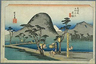
Hiratsuka-juku was the seventh of the fifty-three stations (shukuba) of the Tōkaidō. It is located in the present-day city of Hiratsuka, Kanagawa Prefecture, Japan.

Ōiso-juku

Ōiso-juku was the eighth of the fifty-three stations (shukuba) of the Tōkaidō. It is located in the present-day town of Ōiso, located in Naka District, Kanagawa Prefecture, Japan.
Numazu-juku

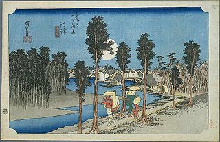
Numazu-juku was the twelfth of the fifty-three stations of the Tōkaidō. It is located in the present-day city of Numazu, Shizuoka Prefecture, Japan.
Hara-juku (Tōkaidō) one of the stations (shukuba) of the Tōkaidō

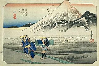
Hara-juku was the thirteenth of the fifty-three stations of the Tōkaidō. It is located in the present-day city of Numazu, Shizuoka Prefecture, Japan.

Miya-juku

Miya-juku was the forty-first of the fifty-three stations of the Tōkaidō. It is located in former Owari Province in what is now part of the Atsuta-ku section of the city of Nagoya, in Aichi Prefecture, Japan. It was six km from Narumi-juku, the preceding post station.

Kakegawa-juku

Kakegawa-juku was the twenty-sixth of the fifty-three stations of the Tōkaidō. It is located in what is now the city of Kakegawa, Shizuoka Prefecture, Japan.

Chiryū-juku

Chiryū-juku was the thirty-ninth of the fifty-three stations of the Tōkaidō. It is located in the present-day city of Chiryū in Aichi Prefecture, Japan. It was the westernmost post town in Mikawa Province, and was 330 kilometres (210 mi) from Nihonbashi, the start of the Tōkaidō, so it took approximately 10 days to for average travellers to reach.

Maisaka-juku

Maisaka-juku was the thirtieth of the fifty-three stations of the Tōkaidō. It is located in the western portion of Hamamatsu in Shizuoka Prefecture, Japan. During the Edo period, the area was part of Tōtōmi Province. The kanji for the post station were originally written 舞坂 (Maisaka).

Arai-juku

Arai-juku was the thirty-first of the fifty-three stations of the Tōkaidō. It is located in the city of Kosai, Shizuoka Prefecture, Japan. During the Edo period, it was located in Tōtōmi Province. The kanji for the post station were originally also written as 荒江 and 荒井 (Arai).

References

Commons-logo.svg Media related to Yoshiwara-juku at Wikimedia Commons

  1. Tōkaidō: Yoshiwara-juku. NPO Tōkaidō Yoshiwara-juku. Accessed November 24, 2007.

Coordinates: 35°09′45″N138°41′16″E / 35.16250°N 138.68778°E / 35.16250; 138.68778