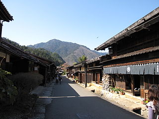
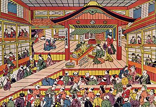
Kawasaki-juku(川崎宿 Kawasaki-shuku) was the second of the fifty-three stations of the Tōkaidō. It is located in Kawasaki-ku in the present-day city of Kawasaki, Kanagawa Prefecture, Japan.
The 53 Stations of the Tōkaidō are the rest areas along the Tōkaidō, which was a coastal route that ran from Nihonbashi in Edo to Sanjō Ōhashi in Kyoto.
The Tōkaidō road (東海道), which roughly means "eastern sea route," was the most important of the Five Routes of the Edo period in Japan, connecting Kyoto to Edo. Unlike the inland and less heavily travelled Nakasendō, the Tōkaidō travelled along the sea coast of eastern Honshū, hence the route's name.
Kawasaki-ku (川崎区) is one of the seven wards of the city of Kawasaki in Kanagawa Prefecture, Japan. As of 2010, the ward had an estimated population of 216,826 and a density of 5,530 persons per km². The total area was 39.21 square kilometres (15.14 sq mi). Kawasaki-ku has the home to the second largest Koreatown in Japan.
Kawasaki-juku was established as a post station in 1623, by the local magistrate Hasegawa Nagatsuna. [1] It was the last post station to be built along the Tōkaidō. It was located near Heiken-ji, a famous Buddhist temple, so it was often used by travelers coming to pray.
Shukuba (宿場) were post stations during the Edo period in Japan, generally located on one of the Edo Five Routes or one of its sub-routes. They were also called shuku-eki (宿駅). These post stations were places where travelers could rest on their journey around the nation. They were created based on policies for the transportation of goods by horseback that were developed during the Nara and Heian periods.
Kawasaki Daishi (川崎大師) is the popular name of Heiken-ji, a Buddhist temple in Kawasaki, Japan. Founded in 1128, it is the headquarters of the Chizan sect of Shingon Buddhism. Kawasaki Daishi is a popular temple for hatsumōde. In 2006, 2.72 million people engaged in hatsumōde here, the third largest figure in Japan and the largest in Kanagawa Prefecture. In 2016, the temple made preparations to receive 3 million visitors over the same period. Keihin Electric Express Railway, the oldest railroad company in the Kantō region of Japan, commenced service in January 1899 to carry passengers to Kawasaki Daishi from Tokyo.
A Buddhist temple is the place of worship for Buddhists, the followers of Buddhism. They include the structures called vihara, chaitya stupa, wat and pagoda in different regions and languages. Temples in Buddhism represent the pure land or pure environment of a Buddha. Traditional Buddhist temples are designed to inspire inner and outer peace. Its structure and architecture varies from region to region. Usually, the temple consists not only of its buildings, but also the surrounding environment. The Buddhist temples are designed to symbolize 5 elements: Fire, Air, Earth, Water, and Wisdom.
The classic ukiyo-e print by Andō Hiroshige (Hōeidō edition) from 1831–1834 depicts travelers in a ferry-boat crossing the Tama River, and passengers waiting on the further bank. Mount Fuji is depicted in the far distance.
Ukiyo-e is a genre of Japanese art which flourished from the 17th through 19th centuries. Its artists produced woodblock prints and paintings of such subjects as female beauties; kabuki actors and sumo wrestlers; scenes from history and folk tales; travel scenes and landscapes; flora and fauna; and erotica. The term ukiyo-e (浮世絵) translates as "picture[s] of the floating world".
The Tama River is a major river in Yamanashi, Kanagawa and Tokyo Prefectures on Honshū, Japan. It is officially classified as a Class 1 river by the Japanese government. Its total length is 138 kilometres (86 mi), and the total of the river's basin area spans 1,240 square kilometres (480 sq mi).
Mount Fuji, located on Honshū, is the highest volcano in Japan at 3,776.24 m (12,389 ft), 2nd-highest peak of an island (volcanic) in Asia, and 7th-highest peak of an island in the world. It is a dormant stratovolcano that last erupted in 1707–1708. Mount Fuji lies about 100 kilometers (60 mi) south-west of Tokyo, and can be seen from there on a clear day. Mount Fuji's exceptionally symmetrical cone, which is snow-capped for about 5 months a year, is a well-known symbol of Japan and it is frequently depicted in art and photographs, as well as visited by sightseers and climbers.
Mishima-shuku was the eleventh of the fifty-three stations of the Tōkaidō during Edo period Japan. It is located in the present-day city of Mishima, in Shizuoka Prefecture.
Seki-juku was the forty-seventh of the fifty-three stations of the Tōkaidō. It is located in former Ise Province in what is now part of the city of Kameyama, Mie Prefecture, Japan.
Hodogaya-juku was the fourth of the fifty-three stations of the Tōkaidō. It is located in Hodogaya-ku in the present-day city of Yokohama, Kanagawa Prefecture, Japan. Occasionally, it is also written as 保土ヶ谷宿.
Kuwana-juku was the forty-second of the fifty-three stations of the Tōkaidō. It is located in former Ise Province in what is now part of the city of Kuwana, in Mie Prefecture, Japan. It was located on the western shores of the Ibi River and is considered to be the easternmost point of the Kansai dialect. It is 28 km from the preceding post station of Miya-juku.
Shirasuka-juku was the thirty-second of the fifty-three stations of the Tōkaidō. It is located in Kosai, Shizuoka Prefecture, Japan. During the Edo period, it was the westernmost post station of Tōtōmi Province.
Fukuroi-juku was the twenty-seventh of the fifty-three stations of the Tōkaidō, making it the center of the route. It is located in what is now the center of the city of Fukuroi, Shizuoka Prefecture, Japan.
Mitsuke-juku was the twenty-eighth of the fifty-three stations of the Tōkaidō. It is located in what is now the central part of the city of Iwata, Shizuoka Prefecture, Japan. The post station received its name, which means "with a view," because it was the first place from which Mount Fuji could be seen by travelers coming from Kyoto.
Hamamatsu-juku was the twenty-ninth of the fifty-three stations (shukuba) of the Tōkaidō. It is located in what is now Hamamatsu's Naka-ku in Shizuoka Prefecture, Japan.
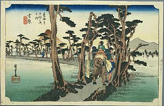
Yoshiwara-juku was the fourteenth of the fifty-three stations of the Tōkaidō. It is located in the present-day city of Fuji, Shizuoka Prefecture, Japan.
Totsuka-juku was the fifth of the fifty-three stations (shukuba) of the Tōkaidō. It was the eastern-most post station in Sagami Province. It is now located in Totsuka-ku in the present-day city of Yokohama, Kanagawa Prefecture, Japan.
Fujisawa-shuku was the sixth of the fifty-three stations of the Tōkaidō. It is located in the present-day city of Fujisawa, Kanagawa Prefecture, Japan.
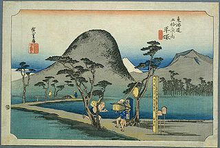
Hiratsuka-juku was the seventh of the fifty-three stations (shukuba) of the Tōkaidō. It is located in the present-day city of Hiratsuka, Kanagawa Prefecture, Japan.
Ōiso-juku was the eighth of the fifty-three stations (shukuba) of the Tōkaidō. It is located in the present-day town of Ōiso, located in Naka District, Kanagawa Prefecture, Japan.
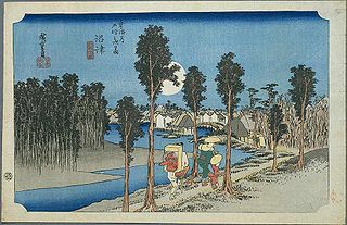
Numazu-juku was the twelfth of the fifty-three stations of the Tōkaidō. It is located in the present-day city of Numazu, Shizuoka Prefecture, Japan.
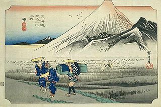
Hara-juku was the thirteenth of the fifty-three stations of the Tōkaidō. It is located in the present-day city of Numazu, Shizuoka Prefecture, Japan.
Kakegawa-juku was the twenty-sixth of the fifty-three stations of the Tōkaidō. It is located in what is now the city of Kakegawa, Shizuoka Prefecture, Japan.
Maisaka-juku was the thirtieth of the fifty-three stations of the Tōkaidō. It is located in the western portion of Hamamatsu in Shizuoka Prefecture, Japan. During the Edo period, the area was part of Tōtōmi Province. The kanji for the post station were originally written 舞坂 (Maisaka).
Arai-juku was the thirty-first of the fifty-three stations of the Tōkaidō. It is located in the city of Kosai, Shizuoka Prefecture, Japan. During the Edo period, it was located in Tōtōmi Province. The kanji for the post station were originally also written as 荒江 and 荒井 (Arai).
Yoshida-juku was the thirty-fourth of the fifty-three stations of the Tōkaidō. It is located in the center of what is now the city of Toyohashi, Aichi Prefecture, Japan. It was 287 kilometres (178 mi) from the start of the route in Edo's Nihonbashi and 6.1 kilometres (3.8 mi) from Futagawa-juku to the east and 10.5 kilometres (6.5 mi) from Goyu-shuku to the west.
Kameyama-juku was the forty-sixth of the fifty-three stations (shukuba) of the Tōkaidō. It is located in former Ise Province in what is now part of the city of Kameyama, Mie Prefecture, Japan.
Wikimedia Commons has media related to Kawasaki-juku . |
The International Standard Book Number (ISBN) is a numeric commercial book identifier which is intended to be unique. Publishers purchase ISBNs from an affiliate of the International ISBN Agency.