Miya-juku

Last updated
Miya-juku in the 1830s, as depicted by Hiroshige in the Hoeido edition of The Fifty-three Stations of the Tokaido (1831-1834) Tokaido41 Miya.jpg
Miya-juku in the 1830s, as depicted by Hiroshige in the Hōeidō edition of The Fifty-three Stations of the Tōkaidō (1831–1834)

Miya-juku(宮宿,Miya-juku) was the forty-first of the fifty-three stations of the Tōkaidō. It is located in former Owari Province in what is now part of the Atsuta-ku section of the city of Nagoya, in Aichi Prefecture, Japan. It was six km from Narumi-juku, the preceding post station. [1]

53 Stations of the Tōkaidō Wikimedia list article

The 53 Stations of the Tōkaidō are the rest areas along the Tōkaidō, which was a coastal route that ran from Nihonbashi in Edo to Sanjō Ōhashi in Kyoto.

Tōkaidō (road) road of premodern Japan. sometimes mean region (see Q1196306)

The Tōkaidō road (東海道), which roughly means "eastern sea route," was the most important of the Five Routes of the Edo period in Japan, connecting Kyoto to Edo. Unlike the inland and less heavily travelled Nakasendō, the Tōkaidō travelled along the sea coast of eastern Honshū, hence the route's name.

Owari Province historical province of Japan

Owari Province was a province of Japan in the area that today forms the western half of Aichi Prefecture, including the modern city of Nagoya. The province was created in 646. Owari bordered on Mikawa, Mino, and Ise Provinces. Owari and Mino provinces were separated by the Sakai River, which means "border river." The province's abbreviated name was Bishū (尾州).

Contents

History

In addition to being a post station on the Tōkaidō, Miya-juku was also part of the Minoji (a minor route which runs to Tarui-juku on the Nakasendō) and the Saya Kaidō. As a result, it had the most hatago of any post station along the Tōkaidō, with two honjin , one wakihonjin and 248 lesser inns.

The Minoji was a 60 km (37 mi) highway in Japan during the Edo period. It was a secondary route, ranked below the Edo Five Routes in importance, and connected Miya-juku on the Tōkaidō with Tarui-juku on the Nakasendō.

Tarui-juku

Tarui-juku was the fifty-seventh of the sixty-nine stations of the Nakasendō. It is located in the present-day town of Tarui, Fuwa District, Gifu Prefecture, Japan.

Nakasendō

The Nakasendō, also called the Kisokaidō (木曾街道), was one of the five routes of the Edo period, and one of the two that connected Edo to Kyoto in Japan. There were 69 stations (staging-posts) between Edo and Kyoto, crossing through Musashi, Kōzuke, Shinano, Mino and Ōmi provinces. In addition to Tokyo and Kyoto, the Nakasendō runs through the modern-day prefectures of Saitama, Gunma, Nagano, Gifu and Shiga, with a total distance of about 534 km (332 mi).

The classic ukiyo-e print by Andō Hiroshige (Hōeidō edition) from 1831 to 1834 depicts two gangs of men dragging a portable shrine cart (not shown) past a huge torii gate. The torii gate is the symbol of a Shinto shrine, and the name of "Miya" also means a "Shinto shrine". The shrine in question is the famous Atsuta Shrine, one of the most famous in Japan and a popular pilgrimage destination in the Edo period. [2] The area is now part of downtown Nagoya metropolis.

Ukiyo-e A genre of Japanese art which flourished from the 17th through 19th centuries

Ukiyo-e is a genre of Japanese art which flourished from the 17th through 19th centuries. Its artists produced woodblock prints and paintings of such subjects as female beauties; kabuki actors and sumo wrestlers; scenes from history and folk tales; travel scenes and landscapes; flora and fauna; and erotica. The term ukiyo-e (浮世絵) translates as "picture[s] of the floating world".

<i>Torii</i> traditional Japanese gate

A torii is a traditional Japanese gate most commonly found at the entrance of or within a Shinto shrine, where it symbolically marks the transition from the mundane to the sacred.

Shinto shrine Japanese shrine of the Shinto religion

A Shinto shrine is a structure whose main purpose is to house ("enshrine") one or more kami. Its most important building is used for the safekeeping of sacred objects, and not for worship. Although only one word ("shrine") is used in English, in Japanese, Shinto shrines may carry any one of many different, non-equivalent names like gongen, -gū, jinja, jingū, mori, myōjin, -sha, taisha, ubusuna or yashiro.

Neighboring post towns

Tōkaidō
Narumi-juku - Miya-juku - Kuwana-juku
Saya Kaidō
Miya-juku(starting location) - Iwazuka-juku
Minoji
Miya-juku(starting location) - Nagoya-juku

Further reading

International Standard Book Number Unique numeric book identifier

The International Standard Book Number (ISBN) is a numeric commercial book identifier which is intended to be unique. Publishers purchase ISBNs from an affiliate of the International ISBN Agency.

Related Research Articles

Inazawa, Aichi City in Chūbu, Japan

Inazawa is a city located in Aichi Prefecture, Japan.

Mishima-shuku

Mishima-shuku was the eleventh of the fifty-three stations of the Tōkaidō during Edo period Japan. It is located in the present-day city of Mishima, in Shizuoka Prefecture.

Seki-juku (Tōkaidō)

Seki-juku was the forty-seventh of the fifty-three stations of the Tōkaidō. It is located in former Ise Province in what is now part of the city of Kameyama, Mie Prefecture, Japan.

Yokkaichi-juku

Yokkaichi-juku was the forty-third of the fifty-three stations of the Tōkaidō. It is located in former Ise Province in what is now part of the city of Yokkaichi, in Mie Prefecture, Japan. It was 12.8 km from Kuwana-juku, the preceding post town.

Akasaka-juku (Tōkaidō)

Akasaka-juku was the thirty-sixth of the fifty-three stations of the Tōkaidō. It is located in present-day Toyokawa, Aichi Prefecture, Japan. It was only 1.7 kilometres (1.1 mi) from Goyu-juku, the preceding post station.

Kuwana-juku

Kuwana-juku was the forty-second of the fifty-three stations of the Tōkaidō. It is located in former Ise Province in what is now part of the city of Kuwana, in Mie Prefecture, Japan. It was located on the western shores of the Ibi River and is considered to be the easternmost point of the Kansai dialect. It is 28 km from the preceding post station of Miya-juku.

Mitsuke-juku

Mitsuke-juku was the twenty-eighth of the fifty-three stations of the Tōkaidō. It is located in what is now the central part of the city of Iwata, Shizuoka Prefecture, Japan. The post station received its name, which means "with a view," because it was the first place from which Mount Fuji could be seen by travelers coming from Kyoto.

Totsuka-juku

Totsuka-juku was the fifth of the fifty-three stations (shukuba) of the Tōkaidō. It was the eastern-most post station in Sagami Province. It is now located in Totsuka-ku in the present-day city of Yokohama, Kanagawa Prefecture, Japan.

Fujisawa-shuku

Fujisawa-shuku was the sixth of the fifty-three stations of the Tōkaidō. It is located in the present-day city of Fujisawa, Kanagawa Prefecture, Japan.

Okazaki-shuku

Okazaki-shuku was the thirty-eighth of the fifty-three stations of the Tōkaidō. It is located in the present-day city of Okazaki, in Aichi Prefecture, Japan.

Goyu-shuku

Goyu-shuku was the thirty-fifth of the fifty-three stations of the Tōkaidō. It is located in Goyu-chō in the city of Toyokawa, Aichi Prefecture, Japan. A pine tree colonnade, one of the few remnants from the Edo period post town, is a well-known tourist spot. It was approximately 10.4 kilometres (6.5 mi) from Yoshida-juku, the preceding post station.

Ishiyakushi-juku

Ishiyakushi-juku was the forty-fourth of the fifty-three stations of the Tōkaidō. It is located in former Ise Province in what is now part of the city of Suzuka, Mie Prefecture, Japan. It received its name from the nearby Buddhist temple, Ishiyakushi-ji.

Kanbara-juku

Kanbara-juku was the fifteenth of the fifty-three stations of the Tōkaidō. It is located in what is now part of the Shimizu-ku ward of Shizuoka, Shizuoka Prefecture, Japan. It is one of four former post stations located in Shimizu-ku.
Numazu-juku

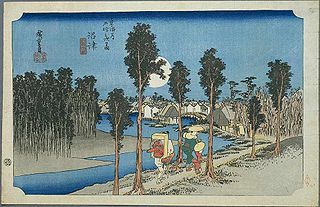
Numazu-juku was the twelfth of the fifty-three stations of the Tōkaidō. It is located in the present-day city of Numazu, Shizuoka Prefecture, Japan.

Fujieda-juku

Fujieda-juku was the twenty-second of the fifty-three stations of the Tōkaidō. It is located in what is now part of the city of Fujieda, Shizuoka Prefecture, Japan.

Chiryū-juku

Chiryū-juku was the thirty-ninth of the fifty-three stations of the Tōkaidō. It is located in the present-day city of Chiryū in Aichi Prefecture, Japan. It was the westernmost post town in Mikawa Province, and was 330 kilometres (210 mi) from Nihonbashi, the start of the Tōkaidō, so it took approximately 10 days to for average travellers to reach.

Yoshida-juku

Yoshida-juku was the thirty-fourth of the fifty-three stations of the Tōkaidō. It is located in the center of what is now the city of Toyohashi, Aichi Prefecture, Japan. It was 287 kilometres (178 mi) from the start of the route in Edo's Nihonbashi and 6.1 kilometres (3.8 mi) from Futagawa-juku to the east and 10.5 kilometres (6.5 mi) from Goyu-shuku to the west.

Narumi-juku

Narumi-juku was the fortieth of the fifty-three stations of the Tōkaidō. It is located in former Owari Province in what is now part of the Midori-ku section of the city of Nagoya, in Aichi Prefecture, Japan.

References

Coordinates: 35°07′44″N136°54′51″E / 35.1289°N 136.9143°E / 35.1289; 136.9143

Geographic coordinate system Coordinate system

A geographic coordinate system is a coordinate system that enables every location on Earth to be specified by a set of numbers, letters or symbols. The coordinates are often chosen such that one of the numbers represents a vertical position and two or three of the numbers represent a horizontal position; alternatively, a geographic position may be expressed in a combined three-dimensional Cartesian vector. A common choice of coordinates is latitude, longitude and elevation. To specify a location on a plane requires a map projection.