
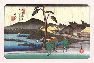
Magome-juku was the forty-third of the sixty-nine stations of the Nakasendō connecting Edo with Kyoto in Edo period Japan. It is located in former Mino Province in what is now part of the city of Nakatsugawa, Gifu Prefecture, Japan. It was also the last of eleven stations along the Kisoji, which was the precursor to a part of the Nakasendō, running through the Kiso Valley.

Kanō-juku was the fifty-third of the was the fifty-eighth of the sixty-nine stations of the Nakasendō connecting Edo with Kyoto in Edo period Japan. It is located in former Mino Province in what is now part of the city of Gifu, Gifu Prefecture, Japan.

Gōdo-juku was the fifty-fourth of the sixty-nine stations of the Nakasendō connecting Edo with Kyoto in Edo period Japan. It is located in former Mino Province in what is now part of the city of Gifu, Gifu Prefecture, Japan.

Unuma-juku was the fifty-second of the sixty-nine stations of the Nakasendō connecting Edo with Kyoto in Edo period Japan. It is located in former Mino Province in what is now part of the city of Kakamigahara, Gifu Prefecture, Japan.

Ōta-juku was the fifty-first of the sixty-nine stations of the Nakasendō connecting Edo with Kyoto in Edo period Japan. It is located in former Mino Province in what is now part of the city of Minokamo, Gifu Prefecture, Japan.

Ochiai-juku was the forty-fourth of the sixty-nine stations of the Nakasendō connecting Edo with Kyoto in Edo period Japan. It is located in former Mino Province in what is now part of the city of Nakatsugawa, Gifu Prefecture, Japan.
Nakatsugawa-juku was the forty-fifth of the sixty-nine stations of the Nakasendō connecting Edo with Kyoto in Edo period Japan. It is located in former Mino Province in what is now part of the city of Nakatsugawa, Gifu Prefecture, Japan.

Mieji-juku was the fifty-fifth of the sixty-nine stations of the Nakasendō connecting Edo with Kyoto in Edo period Japan. It is located in former Mino Province in what is now part of the city of Mizuho, Gifu Prefecture, Japan.

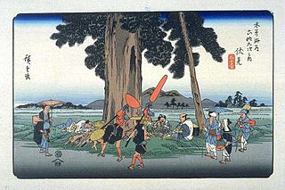
Ōi-juku was the forty-sixth of the sixty-nine stations of the Nakasendō connecting Edo with Kyoto in Edo period Japan. It is located in former Mino Province in what is now part of the city of Ena, Gifu Prefecture, Japan. From Ōi-juku to the next post town, Ōkute-juku, there are 13 hills to pass over. Travellers using the Shitakaidō (下街道) often used Ōi-juku, too, as they travelled on to Makiganetsui (槙ヶ根追) afterwards.

Ōkute-juku was the forty-seventh of the sixty-nine stations of the Nakasendō connecting Edo with Kyoto in Edo period Japan. It is located in former Mino Province in what is now part of the city of Mizunami, Gifu Prefecture, Japan. Alternative kanji for the post town are 大久手.

Hosokute-juku was the forty-eighth of the sixty-nine stations of the Nakasendō connecting Edo with Kyoto in Edo period Japan. It is located in former Mino Province in what is now part of the city of Mizunami, Gifu Prefecture, Japan.

Akasaka-juku was the fifty-sixth of the sixty-nine stations of the Nakasendō connecting Edo with Kyoto in Edo period Japan. It is located in former Mino Province in what is now Akasaka neighborhood of the city of Ōgaki, Gifu Prefecture, Japan.

Sekigahara-juku was the fifty-eighth of the sixty-nine stations of the Nakasendō connecting Edo with Kyoto in Edo period Japan. It is located in former Mino Province in what is now part of the town of Sekigahara, Fuwa District, Gifu Prefecture, Japan.
Fushimi-juku was the fiftieth of the sixty-nine stations of the Nakasendō connecting Edo with Kyoto in Edo period Japan. It is located in former Mino Province in what is now part of the town of Mitake, Kani District, Gifu Prefecture, Japan

.

Imasu-juku was the fifty-ninth of the sixty-nine stations of the Nakasendō connecting Edo with Kyoto in Edo period Japan. It is located in former Mino Province in what is now part of the town of Sekigahara, Fuwa District, Gifu Prefecture, Japan.
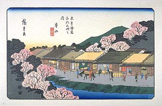
Moriyama-juku (守山宿) was the sixty-seventh of the sixty-nine stations of the Nakasendō highway connecting Edo with Kyoto in Edo period Japan. It was located in the present-day city of Moriyama, Shiga Prefecture, Japan.

Banba-juku was the sixty-second of the sixty-nine stations of the Nakasendō highway connecting Edo with Kyoto in Edo period Japan. It was located in the present-day city of Maibara, Shiga Prefecture, Japan.

Samegai-juku was the sixty-first of the sixty-nine stations of the Nakasendō highway connecting Edo with Kyoto in Edo period Japan. It was located in the present-day city of Maibara, Shiga Prefecture, Japan.

Musa-juku (武佐宿) was the sixty-sixth of the sixty-nine stations of the Nakasendō highway connecting Edo with Kyoto in Edo period Japan. It was located in the present-day city of Ōmihachiman, Shiga Prefecture, Japan. Other kanji used to write "Musa" included 牟佐 and 身狭, but 武佐 became the official kanji in the Edo period.


