Mochizuki-shuku

Last updated
Hiroshige's print of Mochizuki-shuku, part of The Sixty-nine Stations of the Kiso Kaido series Kisokaido25 Mochizuki.jpg
Hiroshige's print of Mochizuki-shuku, part of The Sixty-nine Stations of the Kiso Kaidō series

Mochizuki-shuku(望月宿,Mochizuki-shuku) was the twenty-fifth of the sixty-nine stations of the Nakasendō. It is located in the present-day city of Saku, in Nagano Prefecture, Japan.

69 Stations of the Nakasendō

The 69 Stations of the Nakasendō are the rest areas along the Nakasendō, which ran from Nihonbashi in Edo to Sanjō Ōhashi in Kyoto. The route stretched approximately 534 km (332 mi) and was an alternate trade route to the Tōkaidō.

Nakasendō

The Nakasendō, also called the Kisokaidō (木曾街道), was one of the five routes of the Edo period, and one of the two that connected Edo to Kyoto in Japan. There were 69 stations (staging-posts) between Edo and Kyoto, crossing through Musashi, Kōzuke, Shinano, Mino and Ōmi provinces. In addition to Tokyo and Kyoto, the Nakasendō runs through the modern-day prefectures of Saitama, Gunma, Nagano, Gifu and Shiga, with a total distance of about 534 km (332 mi).

Saku, Nagano City in Chūbu, Japan

Saku is a city located in Nagano Prefecture, Japan. As of 1 March 2019, the city had an estimated population of 99,131 in 41,522 households, and a population density of 230 persons per km². The total area of the city is 423.51 square kilometres (163.52 sq mi).

Contents

History

Located at the base of Mount Tateshina, Mochizuki has long been known for its horses. The area received its name, which roughly means "desirable moon," because it used to give horses to the Imperial Court and the shogunate on the day of the full moon on the fifteenth day of the eighth month, according to the old calendar. [1]

Mount Tateshina mountain in Nagano Prefecture, Japan

Mount Tateshina also Suwa Fuji is a complex volcano located on the border of the municipalities of Chino and Tateshina in Nagano Prefecture, Japan.

Chinese calendar Lunisolar calendar from China

The traditional China calendar, or Former Calendar, Traditional Calendar or Lunar Calendar, is a lunisolar calendar which reckons years, months and days according to astronomical phenomena. It is defined by GB/T 33661-2017, "Calculation and promulgation of the Chinese calendar", issued by the Standardisation Administration of China on 12 May 2017.

Mimakigahara was located to the northeast of the post town. During the Heian and Kamakura periods of Japan, Mimakigahara was an imperial pasture. [2]

Heian period last major division of classical Japanese history (794 to 1185), named after the capital city of Heian-kyō, or modern Kyōto

The Heian period is the last division of classical Japanese history, running from 794 to 1185. The period is named after the capital city of Heian-kyō, or modern Kyōto. It is the period in Japanese history when Buddhism, Taoism and other Chinese influences were at their height. The Heian period is also considered the peak of the Japanese imperial court and noted for its art, especially poetry and literature. Although the Imperial House of Japan had power on the surface, the real power was in the hands of the Fujiwara clan, a powerful aristocratic family who had intermarried with the imperial family. Many emperors actually had mothers from the Fujiwara family. Heian (平安) means "peace" in Japanese.

Kamakura period period of Japanese history

The Kamakura period is a period of Japanese history that marks the governance by the Kamakura shogunate, officially established in 1192 in Kamakura by the first shōgun, Minamoto no Yoritomo. The period is known for the emergence of the samurai, the warrior caste, and for the establishment of feudalism in Japan.

History of Japan aspect of history

The first human habitation in the Japanese archipelago has been traced to prehistoric times. The Jōmon period, named after its "cord-marked" pottery, was followed by the Yayoi in the first millennium BC when new technologies were introduced from continental Asia. During this period, the first known written reference to Japan was recorded in the Chinese Book of Han in the first century AD. Between the fourth century and the ninth century, Japan's many kingdoms and tribes gradually came to be unified under a centralized government, nominally controlled by the Emperor. This imperial dynasty continues to reign over Japan. In 794, a new imperial capital was established at Heian-kyō, marking the beginning of the Heian period, which lasted until 1185. The Heian period is considered a golden age of classical Japanese culture. Japanese religious life from this time and onwards was a mix of native Shinto practices and Buddhism.

Neighboring Post Towns

Nakasendō
Yawata-shuku - Mochizuki-shuku - Ashida-shuku
(Motai-shuku was an ai no shuku located between Mochizuki-shuku and Ashida-shuku.)

Related Research Articles

Shimosuwa-shuku

Shimosuwa-shuku was the twenty-ninth of the sixty-nine stations of the Nakasendō, as well as being the ending location of the Kōshū Kaidō. It is located in the present-day town of Shimosuwa, Suwa District, Nagano Prefecture, Japan.

Warabi-shuku

Warabi-shuku was the second of the sixty-nine stations of the Nakasendō highway connecting Edo with Kyoto during the Edo period. It was located in the present-day city of Warabi, Saitama Prefecture, Japan.

Wada-shuku

Wada-shuku was the twenty-eighth of the sixty-nine stations of the Nakasendō highway connecting Edo with Kyoto during the Edo period. It was located in the present-day town of Nagawa, in the Chiisagata District of Nagano Prefecture, Japan.

Nagakubo-shuku

Nagakubo-shuku was the twenty-seventh of the sixty-nine stations of the Nakasendō highway connecting Edo with Kyoto during the Edo period. It is located in the present-day town of Nagawa, in the Chiisagata District of Nagano Prefecture, Japan.

Ashida-shuku

Ashida-shuku was the twenty-sixth of the sixty-nine stations of the Nakasendō. It is located in the present-day town of Tateshina, in the Kitasaku District of Nagano Prefecture, Japan.

Yawata-shuku

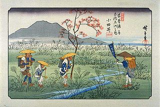
Yawata-shuku was the twenty-fourth of the sixty-nine stations of the Nakasendō. It is located in the present-day city of Saku, in Nagano Prefecture, Japan.

Shionada-shuku

Shionada-shuku was the twenty-third of the sixty-nine stations of the Nakasendō. It is located in the present-day city of Saku, in Nagano Prefecture, Japan.

Iwamurada-shuku

Iwamurada-shuku was the twenty-second of the sixty-nine stations of the Nakasendō. It is located in the present-day city of Saku, in Nagano Prefecture, Japan.

Otai-shuku

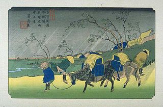
Otai-shuku was the twenty-first of the sixty-nine stations of the Nakasendō. It is located in the present-day town of Miyota, in the Kitasaku District of Nagano Prefecture, Japan.

Kumagai-shuku

Kumagai-shuku was the eighth of the sixty-nine stations of the Nakasendō highway connecting Edo with Kyoto during the Edo period. It was located in the present-day city of Kuamagaya, Saitama Prefecture, Japan.

Oiwake-shuku

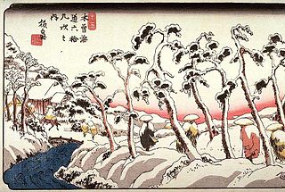
Oiwake-shuku was the twentieth of the sixty-nine stations of the Nakasendō. It is located in the present-day town of Karuizawa, in the Kitasaku District of Nagano Prefecture, Japan.

Kutsukake-shuku

Kutsukake-shuku was the nineteenth of the sixty-nine stations of the Nakasendō. It is located in the present-day town of Karuizawa, in the Kitasaku District of Nagano Prefecture, Japan.

Fukaya-shuku

Fukaya-shuku was the ninth of the sixty-nine stations of the Nakasendō highway connecting Edo with Kyoto during the Edo period It was located in the present-day city of Fukaya, Saitama Prefecture, Japan.

Okegawa-shuku

Okegawa-shuku was the sixth of the sixty-nine stations of the Nakasendō highway connecting Edo with Kyoto during the Edo period. It was located in the present-day city of Okegawa, Saitama Prefecture, Japan.

Kōnosu-shuku

Kōnosu-shuku was the seventh of the sixty-nine stations of the Nakasendō highway connecting Edo with Kyoto during the Edo period. It was located in the present-day city of Kōnosu, Saitama Prefecture, Japan.

Itahana-shuku

Itahana-shuku was the fourteenth of the sixty-nine stations of the Nakasendō. It is located in the present-day city of Annaka, Gunma Prefecture, Japan. Ruins of its honjin can be found at the Princess Kazunomiya Inn.

Matsuida-shuku

Matsuida-shuku was the sixteenth of the sixty-nine stations of the Nakasendō. It is located in the present-day city of Annaka, Gunma Prefecture, Japan, at the foot of Mount Myōgi.

Annaka-shuku

Annaka-shuku was the fifteenth of the sixty-nine stations of the Nakasendō. It is located in the present-day city of Annaka, Gunma Prefecture, Japan. Batō Kan'on lined the way to the post town.

Motai-shuku was a mid-station along the Nakasendō in Edo period Japan. It was in between the post stations of Mochizuki-shuku and Ashida-shuku. It is located in the present-day town of Saku, Nagano Prefecture, Japan.

References

  1. Shinshū no Kaidō Tabō, Nakasendō. Ministry of Land, Infrastructure and Transport, Kantō Region. Accessed July 3, 2007.
  2. Hiroshige - Kisokaido Archived 2007-10-29 at the Wayback Machine .. www.hiroshige.org.uk. Accessed October 24, 2007.

Coordinates: 36°15′57″N138°21′44″E / 36.2658°N 138.3622°E / 36.2658; 138.3622

Geographic coordinate system Coordinate system

A geographic coordinate system is a coordinate system that enables every location on Earth to be specified by a set of numbers, letters or symbols. The coordinates are often chosen such that one of the numbers represents a vertical position and two or three of the numbers represent a horizontal position; alternatively, a geographic position may be expressed in a combined three-dimensional Cartesian vector. A common choice of coordinates is latitude, longitude and elevation. To specify a location on a plane requires a map projection.