
Shimosuwa-shuku was the twenty-ninth of the sixty-nine stations of the Nakasendō, as well as being the ending location of the Kōshū Kaidō. It is located in the present-day town of Shimosuwa, Suwa District, Nagano Prefecture, Japan.

Wada-shuku was the twenty-eighth of the sixty-nine stations of the Nakasendō highway connecting Edo with Kyoto during the Edo period. It was located in the present-day town of Nagawa, in the Chiisagata District of Nagano Prefecture, Japan.

Ashida-shuku was the twenty-sixth of the sixty-nine stations of the Nakasendō. It is located in the present-day town of Tateshina, in the Kitasaku District of Nagano Prefecture, Japan.

Mochizuki-shuku was the twenty-fifth of the sixty-nine stations of the Nakasendō. It is located in the present-day city of Saku, in Nagano Prefecture, Japan.

Yawata-shuku was the twenty-fourth of the sixty-nine stations of the Nakasendō. It is located in the present-day city of Saku, in Nagano Prefecture, Japan.
Shionada-shuku was the twenty-third of the sixty-nine stations of the Nakasendō. It is located in the present-day city of Saku, in Nagano Prefecture, Japan.

Iwamurada-shuku was the twenty-second of the sixty-nine stations of the Nakasendō. It is located in the present-day city of Saku, in Nagano Prefecture, Japan.
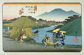
Otai-shuku was the twenty-first of the sixty-nine stations of the Nakasendō. It is located in the present-day town of Miyota, in the Kitasaku District of Nagano Prefecture, Japan.

Oiwake-shuku was the twentieth of the sixty-nine stations of the Nakasendō. It is located in the present-day town of Karuizawa, in the Kitasaku District of Nagano Prefecture, Japan.
Karuisawa-shuku was the eighteenth of the sixty-nine stations of the Nakasendō. It is located in the northern portion of the present-day town of Karuizawa, in the Kitasaku District of Nagano Prefecture, Japan. Karuisawa-shuku is 10 km (6.2 mi) from the preceding post station, Sakamoto-shuku, and 4 km (2.5 mi) from the following one, Kutsukake-shuku.
Kutsukake-shuku was the nineteenth of the sixty-nine stations of the Nakasendō. It is located in the present-day town of Karuizawa, in the Kitasaku District of Nagano Prefecture, Japan.

Okegawa-shuku was the sixth of the sixty-nine stations of the Nakasendō highway connecting Edo with Kyoto during the Edo period. It was located in the present-day city of Okegawa, Saitama Prefecture, Japan.

Shinmachi-shuku was the eleventh of the sixty-nine stations of the Nakasendō. It is located in the present-day city of Takasaki, Gunma Prefecture, Japan.

Kuragano-shuku was the twelfth of the sixty-nine stations of the Nakasendō. It is located in the present-day city of Takasaki, Gunma Prefecture, Japan.
Takasaki-shuku was the thirteenth of the sixty-nine stations of the Nakasendō. It is located in the present-day city of Takasaki, Gunma Prefecture, Japan.

Sakamoto-shuku was the seventeenth of the sixty-nine stations of the Nakasendō. It is located in the present-day city of Annaka, Gunma Prefecture, Japan.

Matsuida-shuku was the sixteenth of the sixty-nine stations of the Nakasendō. It is located in the present-day city of Annaka, Gunma Prefecture, Japan, at the foot of Mount Myōgi.

Annaka-shuku was the fifteenth of the sixty-nine stations of the Nakasendō. It is located in the present-day city of Annaka, Gunma Prefecture, Japan. Batō Kan'on lined the way to the post town.


